
Incident Information:
Facebook: www.facebook.com/brewerfire
Email: brewer.boxsprings.fireinfo@gmail.com
FIRE AT A GLANCE
Brewer Fire
Estimated Size: 32,707 acres
Containment: 5%
Cause: Lightning
Box Springs Fire
Estimated size: 15,203 acres
Containment: 0%
Cause: Lightning
Resources:
Hand Crews: 28
Engines: 42
Heavy Equipment: 15
Water Tenders: 17
Aviation: 6
Total Personnel: 881
County Evacuations:
Level 1-3 evacuations in place for the Brewer and Box Springs fires. Evacuations are determined by Crook and Jefferson County Sheriff’s Offices.
Road Closures:
For road closures, visit: https://www.tripcheck.com.
Incident Commanders:
Rich LaBelle, OSFM Red Incident Management Team
Tyler McCarty, ODF Complex Incident Management Team 3
PRINEVILLE, Ore. (July 23, 2026)- The Brewer and Box Springs fires continue to see growth, while progress was made on the north and west edges of each fire.
Yesterday’s Red-flag weather drove extreme fire behavior on both Brewer and Box Springs fires. Afternoon rains provided minimal relief against strong winds from the storm cell. High temperatures, low relative humidities, and strong winds continue providing challenges to suppression efforts.
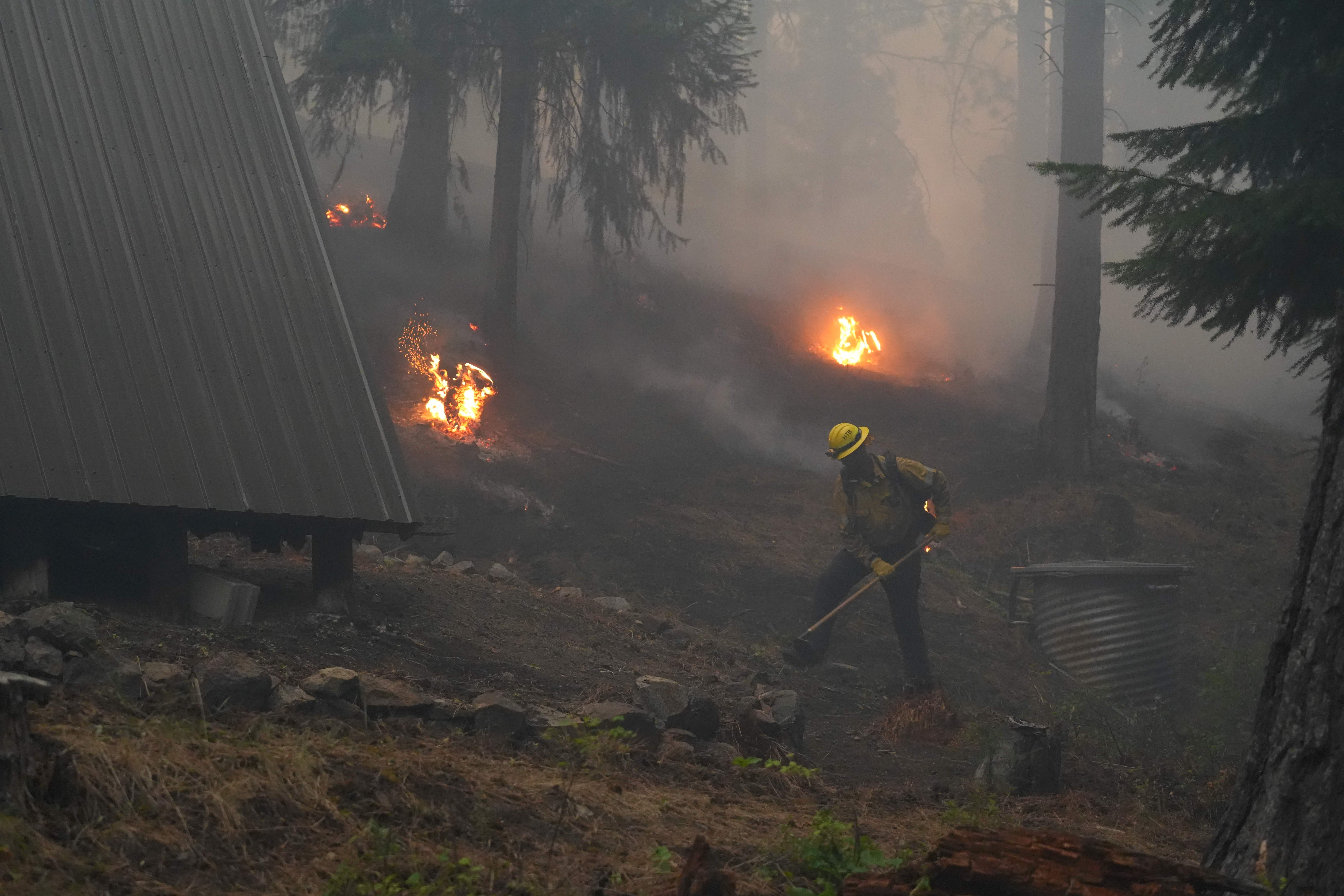
Last night, crews worked on maintaining and extending handline and dozer line on the southwest and southeast portions of the Brewer Fire. They addressed small spot fires in the Allen Creek drainage and built direct lines as close to the fires edge as possible. OSFM resources surged to homes near both Turner Creek and Grizzly Roads, tying handline around structures.
OSFM structural task forces remain engaged along the south end of the Brewer Fire, mopping up around structures where possible and going direct to protect homes. Today, three task forces will continue to work around Lofton Creek Rd, Sealy Springs Rd, and Grizzly Road to the west, plumbing in line and assisting wildland partners.
Today’s focus remains standing between the Brewer fire and outlying communities of Prineville. Additional personnel continue to arrive and join firefighting efforts.
The Box Springs Fire, to the west of the Rowe Creek Complex, saw increased activity near the Crosswhite fire. The two fires may soon merge. Due to continued growth on both fires, Incident Management Teams on the Rowe Complex are coordinating closely with Incident Management Teams (ODF CIMT 3 and OSFM Red Team) assigned to the Brewer and Box Spring fires.
Prineville Fires Community Meeting:
In partnership with ODF IMT 3, OSFM Red Team, California Team 1 and local officials, join us on Friday, July 24 at 6:00 p.m. at Carey Foster Hall at the Crook County Fairgrounds for a community briefing on the Prineville Fires. Incident and local officials will provide a 30-minute operational update for the Brewer, Box Springs, Coyote, Henry, Pilot, Conant & Crooked Fires followed by Q&A break-out session where you can talk directly with fire officials.
Evacuations:
Level 1, 2 and 3 evacuations are in effect for the Brewer and Box Springs fires. County sheriff’s offices issue evacuation orders. The most current evacuation information is available at:
Crook County: www.facebook.com/CrookCountySheriff
Jefferson County: www.facebook.com/JeffersonCountyORSheriff/
Smoke Impacts:
Smoke from the Brewer and Box Springs fires may be visible in Prineville and surrounding areas, reducing visibility and impacting air quality in nearby communities. Smoke conditions can change throughout the day as winds shift. Individuals sensitive to smoke should take appropriate precautions. For current air quality information and smoke forecasts, visit: https://fire.airnow.gov/.
Closures:
BLM has issued closures for lands in and near the fires. See below for current information:
BLM Closures and Restrictions: https://www.blm.gov/programs/fire/regional-info/oregon-washington/fire-restrictions
USFS has issued closures for lands in and near the fires. See below for current information:
USFS Closures and Restrictions: https://www.fs.usda.gov/r06/ochoco/alerts
If You Fly, We Can’t: Temporary Flight Restriction (TFR):
A “TFR” is in place for the fire area daily (24 hours) until further notice. Flying a drone near or around a wildfire is illegal and compromises the safety of both pilots and firefighters and interferes with firefighting efforts. If you fly, we can’t. All illegal drone use will be reported to law enforcement.
Air Quality Information:
Air quality updates: https://fire.airnow.gov/