August 4, 2021
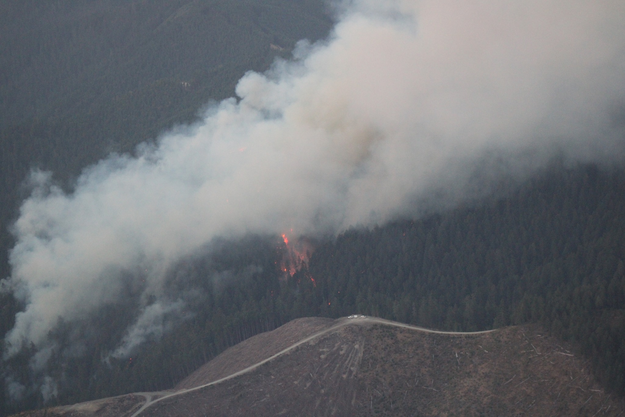
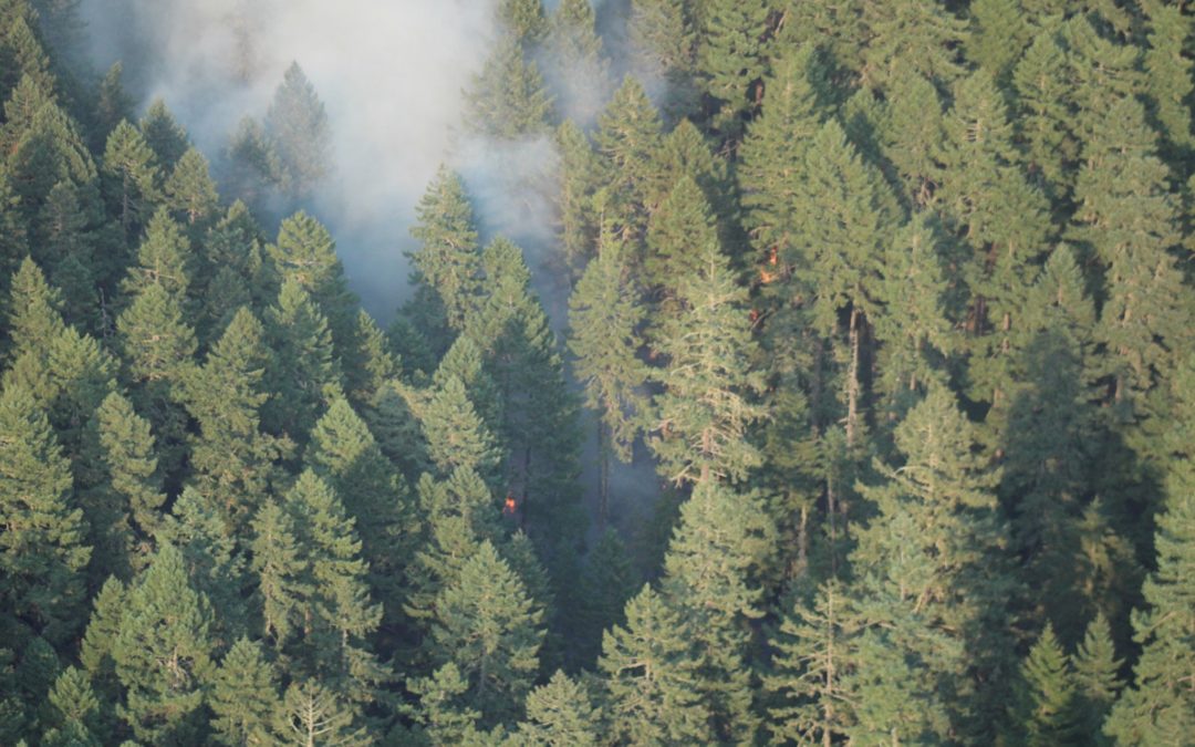
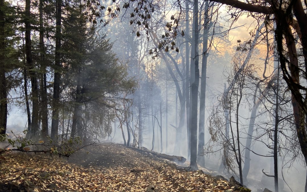
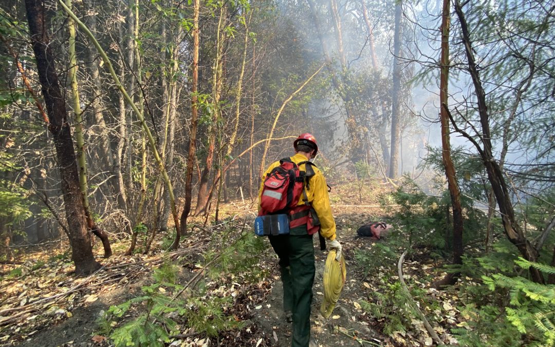
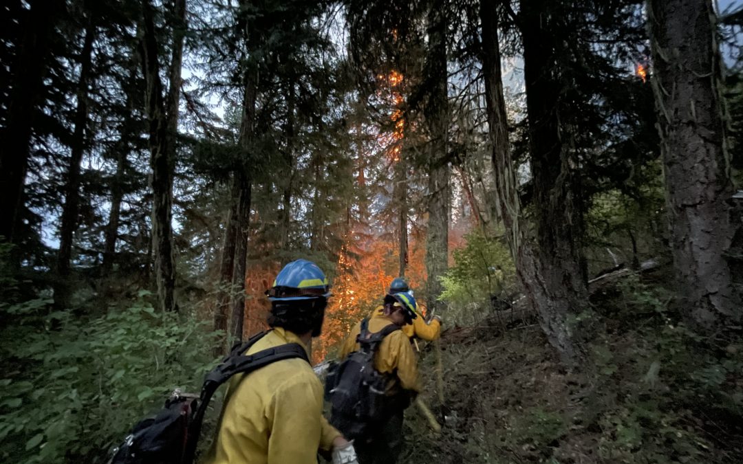
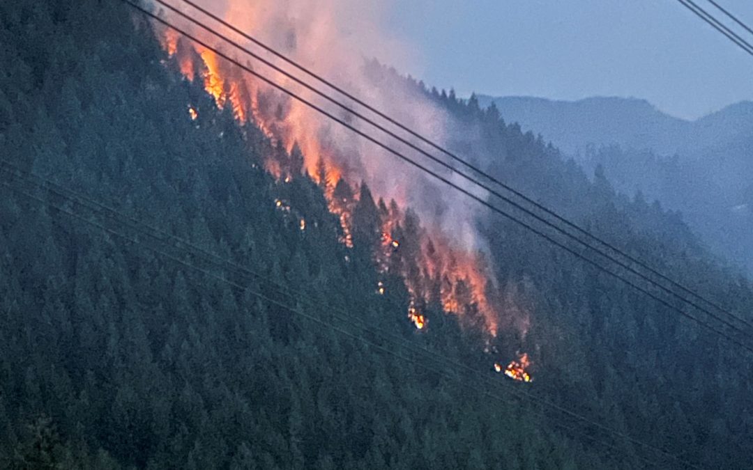
CANYONVILLE, Ore.— Crews on the Skyline Ridge Complex made steady progress on numerous small fires within the complex and are actively engaging the complex’s larger fires. The complex now contains 24 fires including four large fires—Poole Creek, O’Shea Creek, Ike Butte, and Sweat Creek.
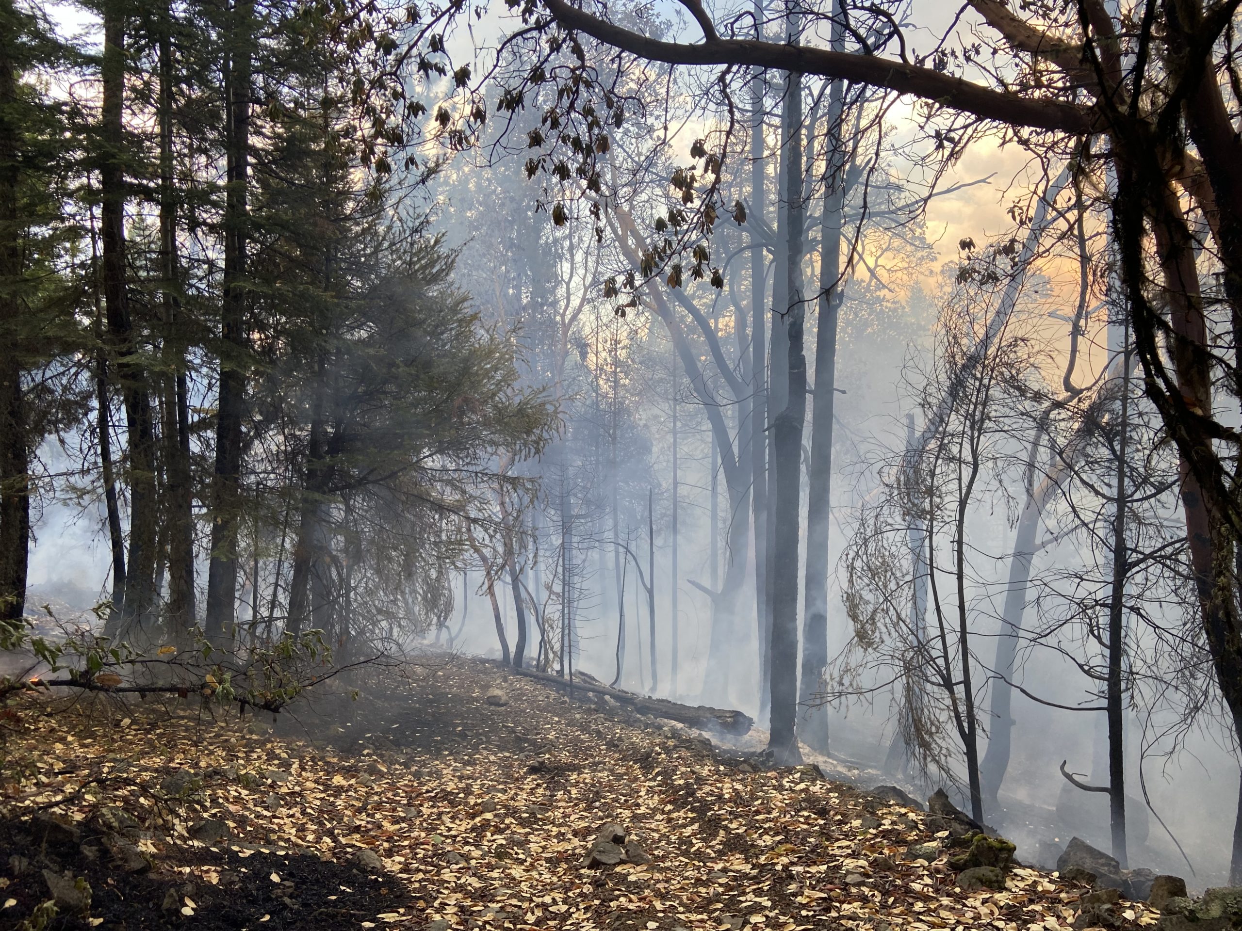
Overnight, firefighters on night shift held many of the small fires in the complex within their footprints. These fires will need additional work to strengthen control lines and mop up remaining hot spots.
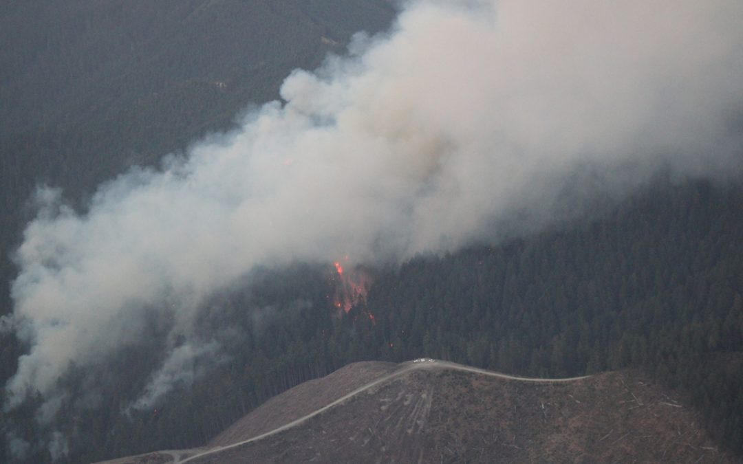
Fire managers are developing plans to suppress the largest fire in the complex, Poole Creek, with heavy equipment, crews and additional overhead. The Poole Creek Fire—estimated at several hundred acres and burning in steep, heavy timber—has emerged as high priority for the fire team.
Today’s weather forecast calls for hot, dry conditions with unstable air. The National Weather Service has declared a Red Flag Warning for this afternoon and evening.
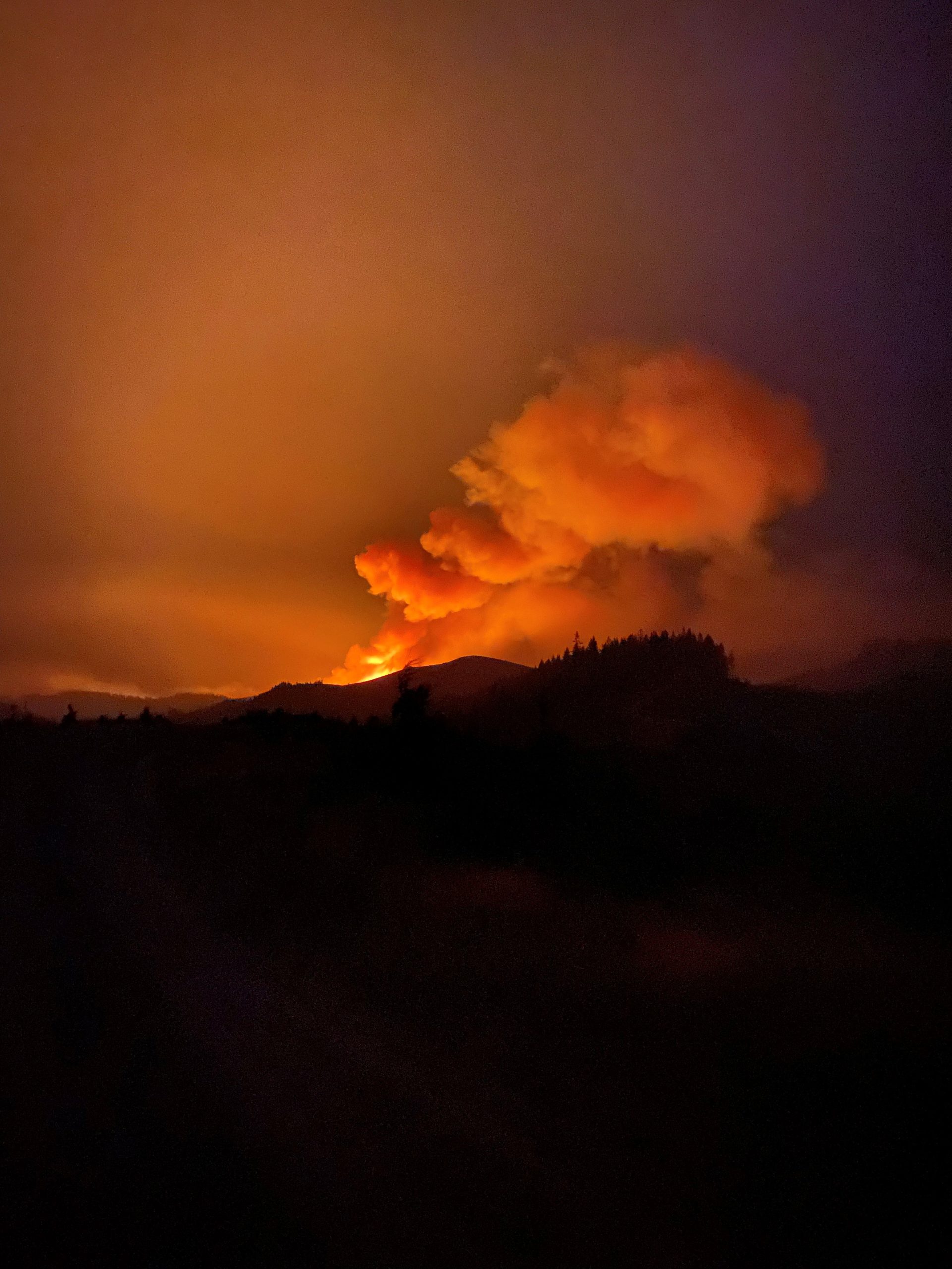
The fire’s Fire Behavior Analyst noted that the weather is going to drive increased fire behavior throughout the day.
“Today is going to be a fire day. Fuels are critically dry and we have unstable weather conditions. Crews should expect active fire behavior all day, including spotting (embers aloft) up to one-quarter of a mile,” said Brian Reel, Fire Behavior Analyst with ODF Incident Management Team 1.
Skyline Ridge Phone: 971-432-6250
Skyline Ridge Email: skylineridgecomplex.information@gmail.com
Skyline Ridge Facebook: https://www.facebook.com/skylineridgecomplex
Inciweb: https://inciweb.nwcg.gov/incident/7762/
Douglas County Evacuation Information: https://tinyurl.com/zv4paahr
August 3, 2021
CANYONVILLE, Ore.— On August 1, 2021 at 5:00 p.m. a lightning storm over southern Douglas County ignited dozens of confirmed wildfires. Collectively the fires have been dubbed the Skyline Ridge Complex. The fires range from less than an acre to over 600 acres and are burning on a mix of public and private forestland in southern Douglas County, east of Interstate 5. Firefighters from Douglas Forest Protective Association, Oregon Dept. of Forestry, Bureau of Land Management, and the US Forest Service have been aggressively attacking the blazes while providing for public and firefighter safety. The largest fires in the complex include Poole Creek (500-700 ac), O’Shea (100+ ac) and Ike’s Butte (40-60 ac).
Despite high temperatures and low humidity, crews are making progress—getting control lines built around the fires and working toward containment. The suppression strategy is to keep the small fires small and prevent them from turning into larger, more problematic incidents.
There are currently 19 large wildfires burning in the northwest. Progress on the Skyline Ridge Complex has been hampered by lack of resources. As more resources arrive over the next few days, crews will be tackling the larger fires within the complex.
Oregon Department of Forestry’s Incident Management Team 1 assumed command of the fire at 6:00 p.m. on August 3, 2021.
The Incident Management Team brings added capacity to manage firefighting efforts in multiple locations and the logistics of supporting the firefighters.
“We are happy to be here and lend the district some support,” said Joe Hessel, Incident Commander for ODF’s Incident Management Team 1. “Our goals are to keep these fires as small as possible while keeping everyone safe. Staying safe and healthy also means we’ll be following strict COVID-19 protocols,” said Hessel.
In addition to ODF’s Team taking command of the Skyline Complex, a separate incident management team (PNW Team 8) will be tackling the Devil’s Knob Complex which lies further to the east.
August 3, 2021
Round Top Fire, 10 miles northwest of Shady Cove, was reported at 23 acres.
JACKSON & JOSEPHINE COUNTIES, Ore. (August 3, 2021) – Several new fires were detected Tuesday across the Oregon Department of Forestry (ODF) Southwest Oregon District, including incidents outside the district in Douglas County that ODF is currently assisting on. Three fires on the Grants Pass unit were discovered, as well as three on the Medford; that brings the total number of fires since lightning storms began on Thursday to 66. There are 43 fires on the Medford unit side, referred to as the Applegate Complex. On the Grants Pass unit, the remaining 23 fires make up the Apple Foots Complex.
Of the 66 fires total, 35 were or currently are burning on Bureau of Land Management (BLM) land; ODF Southwest Oregon District provides fire protection to BLM land in Jackson and Josephine counties. The remaining 16 are on private, 10 on industry, 2 on U.S. Forest Service Umpqua National Forest land, and 3 on U.S. Forest Service Rogue River-Siskiyou National Forest land. Two of the BLM fires listed above are in the Douglas Forest Protective Association (DFPA) district in Douglas County.
ODF Southwest is assisting with DPFA and USFS Umpqua National Forest on several fires in the Railroad Gap area, ranging from 5 to 80 acres; firefighters are actively engaged on these incidents. Information on these specific fires can be found on https://www.facebook.com/skylineridgecomplex/.
On the ODF Southwest Oregon District, the top priority fires are:
- The Round Top Fire, located 10 miles northwest of Shady Cove. It is currently 23 acres, and now 100% lined, 0% contained but 100% plumbed, meaning they have hose secured around the fire and will have water easily accessible.
- The Buck Rock Fire, located 5 miles north of Trail. It’s currently 17 acres, 100% lined and 10% contained. Perimeter lines were strengthened Tuesday, after fire crossed over in a few areas overnight. Hazard trees in the area were removed to increase firefighter safety on the line. Overnight, firefighters will continue mop-up efforts.
A test of the Josephine County Emergency Management Nixle Notification System to Ring Doorbell users caused concern late Tuesday afternoon; there are currently no evacuation orders in effect in Jackson or Josephine counties. Evacuations are determined by Jackson and Josephine County Emergency Management and Sheriff’s Offices. To sign up for alerts in either county, visit http://www.rvem.org/.
Smoke from wildfires burning in Northern California remains in the air over Jackson and Josephine Counties. Information on general smoke reports can be found online at https://fire.airnow.gov/.
Additional information about fire season is also available online on our website, www.swofire.com, our Facebook page, @ODFSouthwest and our Twitter account, @swofire.
August 3, 2021
 JACKSON & JOSEPHINE COUNTIES, ORE. – An overnight flight of Oregon Department of Forestry’s (ODF) Multi-Mission Aircraft fixed-wing plane detected two new fires on the Southwest Oregon District, and confirmed a third that resources had already been dispatched to. Using a combination of infrared technology and night vision goggles, the plane can pick up heat sources and even give fire behavior reports.
From this flight, the Skyline Fire was confirmed in northwestern part of Jackson County; it’s estimated to be a quarter acre. In the same area, the Horse Mountain Fire was discovered. It’s estimated to be a quarter acre as well, and resources were dispatched to it first this Tuesday morning. The third fire, the Jack Creek Fire, is located on U.S. Forest Service Rogue River-Siskiyou National Forestland in the Applegate; ODF Southwest has sent an engine to assist on this incident. None of these fires are threatening homes.
The three largest fires on the district remain:
- The Buck Rock Fire, located 5 miles north of Trail.
- The Round Top Fire, located 10 miles northwest of Shady Cove.
- The North Fork Anderson Creek Fire, located on Anderson Butte near Talent.
Firefighters on all three of these fires continued to hold lines overnight, and in some cases, slightly increase containment. All three are burning on steep slopes in high elevations, creating challenges for crews to dig line. There are currently no homes threatened across the district. An update on acreage and containment will be available in our evening update.
Smoke from wildfires burning in Northern California remains in the air over Jackson and Josephine Counties. Information on general smoke reports can be found online at https://fire.airnow.gov/.
Additional information about fire season is also available online on our website, www.swofire.com, our Facebook page, @ODFSouthwest and our Twitter account, @swofire.

August 3, 2021
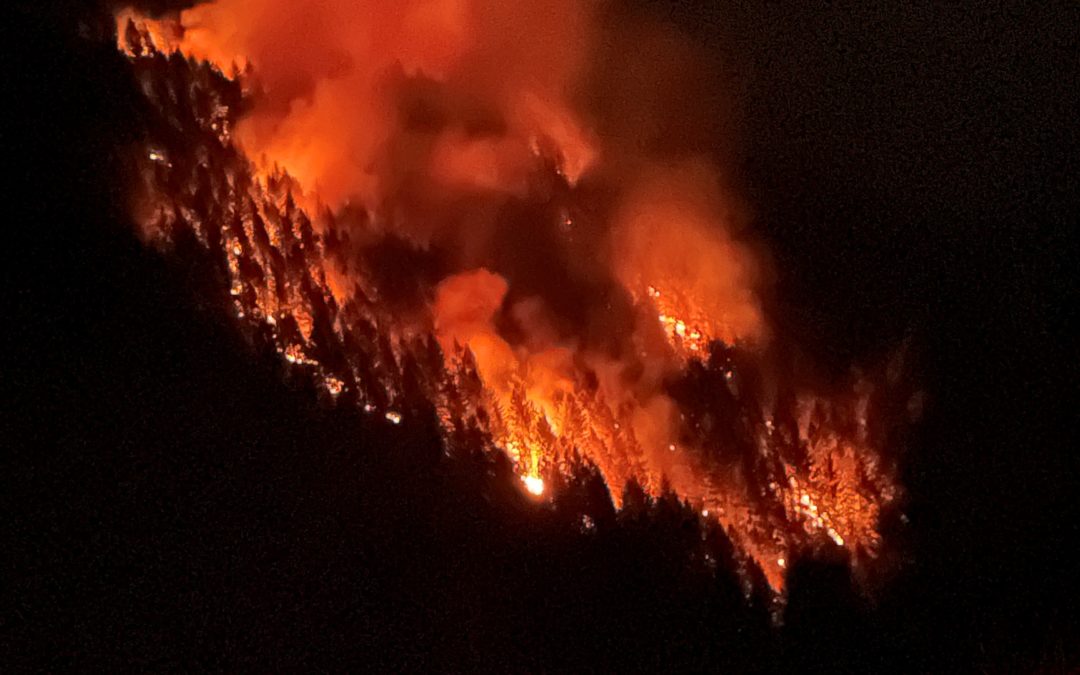
Fire activity increased on several incidents within the Skyline Ridge Complex Monday evening which resulted in active fire behavior well into the night. As of Tuesday morning, the combined size of the fires within the complex is estimated to be about 225 acres, with the majority of the burned area coming from the O’Shea Creek Fire, the Poole Creek Fire, and the Ike Butte Fire. Today, 115 firefighters and four helicopters will be engaged on the various fires within the complex with the objective of fully extinguish several small fires in addition to engaging on the larger incidents. Aviation and ground resources will also be on the lookout for additional fires from Sunday evenings lightning event.
Tuesday is also a day of transition for the Skyline Ridge Complex as an Incident Management Team from the Oregon Department of Forestry was ordered Monday morning by the Douglas Forest Protective Association to assist with suppression efforts. ODF Incident Management Team 1 arrived in Douglas County Monday evening and received an in briefing from the district. Members from the Incident Command Team are integrated into today’s operations and will assume command of the complex at 6:00 PM Tuesday evening.
An incident specific Facebook page and an InciWeb site have been created for the Skyline Ridge Complex and information for the fires will be posted at these locations:
Facebook: www.facebook.com/Skyline-Ridge-Complex-110696041255752
InciWeb: https://inciweb.nwcg.gov/incident/7762/
August 3, 2021
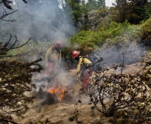
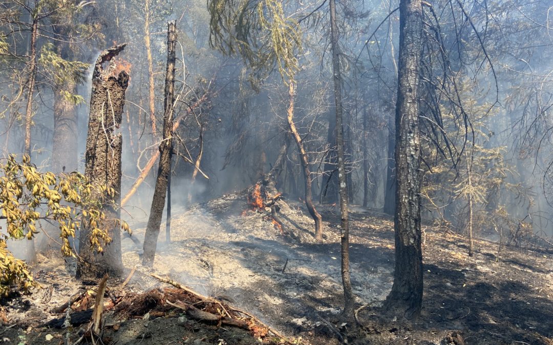
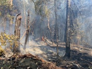
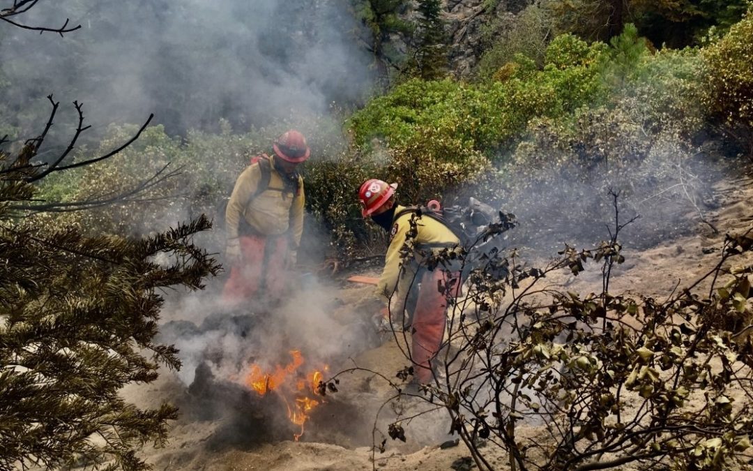
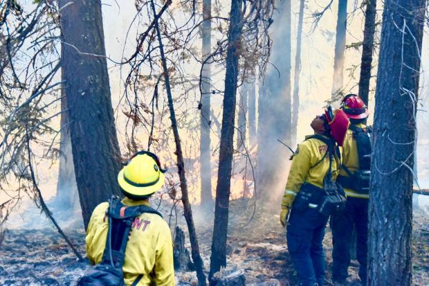
Crew members of the Puerto Rico Fire Crew mop up on the Bootleg Fire. Crews from across the nation are working on the fire which is currently the largest in the US.
Bootleg Fire Update, August 3, 2021
Location: 28 miles northeast of Klamath Falls, OR
Fireline total: 323 miles
Size: 413,762 acres, 647 square miles
51 miles active fire edge, 272 miles of contained line
Personnel: 1,617
Containment: 84%
(Klamath Falls, OR) – A Red Flag Warning is in effect for this afternoon and evening. A Fire Weather Watch is in effect for Wednesday. A Red Flag Warning means that critical fire weather conditions are either occurring now or will shortly. Specifically, these conditions include continued warm temperatures, low humidity, and strong winds. Combined, they promote the rapid spread of wildfire and extreme fire behavior that could become life threatening.
Out of an abundance of caution and at the recommendation of the Alaska Incident Management Team, Lake County expanded the Level 1 (Get Ready) evacuation boundary to include the area north of Summer Lake. The expanded area extends from Mile Post 73 on Highway 31 north to Picture Rock Pass and east of the highway to include the Ana Subdivision. A Level 2 (Be Set) evacuation remains in place from milepost 73 on Highway 31 south to Monument Rock. A Level 3 (GO NOW!) evacuation remains in place for all areas within and adjacent to the Bootleg Fire perimeter, including Yamsay Mountain, Thompson Reservoir, and the Sycan Marsh to the top of Winter Rim.
The Bootleg Fire containment continues to advance as firefighting crews mop up, improve fire line, and strengthen contingency lines. Crews are working tirelessly to ensure we are as prepared as we can be for the extreme fire weather forecast for the next couple days.
Just as firefighters have been preparing for the weather conditions, you should, too. Fire starts are not just from escaped embers and lightning but can also come from a trailer chain dragged on pavement, a hot catalytic converter in contact with dry grasses, or shooting firearms. “Any accidental or negligent release of sparks or heat can result in a fire that quickly gets out of control,” says Kristian Knutson, Fire Prevention Officer in Palmer, Alaska, and incident Public Information Officer. “Be sure to remove combustibles from around the outside of your home, such as firewood, fuel tanks, and gas grills. Keep shrubs and tree limbs away from your house and off the ground.” At this time of year, one less spark could mean one less wildfire.
Closures: An emergency closure order is in effect for the Bootleg Fire on the Fremont-Winema National Forest to protect public and firefighter safety. All travel or entry into the area is prohibited. The full closure order and map are available on the website under Alerts and Closures at https://www.fs.usda.gov/alerts/fremont-winema/alerts-notices
Red Cross Evacuation Shelters: For information or assistance: 1-800-Red-Cross (www.redcrossblog.org/disaster)
Smoke: A new complex of fires in Northern California sparked by thunderstorms started to put out a lot of smoke in the afternoon yesterday. Winds will likely carry that smoke into Oregon. Critical fire weather conditions later today could also increase fire behavior, putting more smoke into the air. Region wide, today should be generally moderate, though periods of Unhealthy for Sensitive Groups cannot be ruled out. See: fires.airfire.org/outlooks/southcentraloregon
Be aware of the smoke near you and learn about ways to mitigate smoke impacts. See the air quality near you at https://fire.airnow.gov and learn how to keep smoke out of your home at https://www.epa.gov/smoke-ready-toolbox-wildfires
Insurance Assistance: For additional information on submitting insurance claims after losing your home or property to a wildfire, please visit https://dfr.oregon.gov/insure/home/storm/Pages/wildfires.aspx or call the state’s team of consumer advocates at 888-877-4894 (toll-free).
Fire Information Public Phone: 541-482-1331 Fire Information Media Phone: 971-727-7255
Inciweb: inciweb.nwcg.gov/incident/7609/ Facebook: www.facebook.com/BootlegFireInfo
Twitter: twitter.com/BootlegFireInfo Hashtags: #BootlegFire #FireYear2021
Bootleg Fire Public Information
Email: 2021.bootleg@firenet.gov
Public Line:(541)482-1331
Media Line:(971)727-7255
August 3, 2021
JACKSON AND JOSEPHINE COUNTIES, Ore. – Firefighters across the Oregon Department of Forestry (ODF) Southwest Oregon District continued to hold fire lines and make progress on fires across the district yesterday. To date, 59 fires have been caused by lightning since Sunday night; of those, 11 fires are still active. The rest are extinguished and in patrol status.
The majority of these fires are located in high elevations on steep terrain, creating additional challenges and safety concerns for firefighters. These factors, along with multiple incidents across the district are slowing down typical containment times, however firefighters are continuing to make slow, steady progress on each incident; this is the best case scenario for as many incidents are active at the same time, with limited resources available.
The following fires are the largest and most active across the district:
- The Buck Rock Fire, located 5 miles north of Trail. It’s currently estimated to be 7 acres, 60% lined and 5% lined. Fire activity increased in the heat on Monday, and a spot fire was discovered up the hill of the main body of the fire. Through multiple helicopter water bucket drops, the spot fire was put out. Overnight, a 20-person hand crew, four engines and a water tender will remain on scene; these resources have a goal of lining the fire 100% by the morning shift change.
- The Round Top Fire, located 10 miles northwest of Shady Cove. This fire is putting off a large amount of smoke, however it’s only estimated to be between 15-17 acres, and 75% lined. Fire activity increased during the day; Large Air Tanker (LAT) 103 and two Single Engine Air Tankers (SEAT’s) were able to do several retardant drops to help secure temporary lines in order to allow firefighters to reinforce them. Overnight, four engines and a water tender will remain on scene. Additional resources will replace them in the morning.
- The North Fork Anderson Creek Fire, located on Anderson Butte near Talent. It’s estimated to be 2 acres. It’s currently 100% lined and 30% contained. Steep terrain is slowing firefighters down on this incident, however lines are holding. Overnight, two engines will continue mop-up work, with additional resources replacing them in the morning.
Smoke from wildfires burning in Northern California was heavily present in Jackson and Josephine Counties Monday. Dispatch centers across the area received multiple calls regarding the hazy air; general smoke information can be found online at https://fire.airnow.gov/.
While firefighters are making excellent progress on multiple incidents, additional fires from this storm may continue to be found in the coming days and weeks. Please report fires by calling 911.
Additional information about fire season is also available online on the SW Oregon District website, www.swofire.com, their Facebook page, @ODFSouthwest and their Twitter account, @swofire.
August 3, 2021
WALLOWA, Ore. – Due to the reduced complexity of the Elbow Creek Fire, Oregon Department of Forestry’s Type 1 Incident Management Team 3 will hand the fire over to a smaller Type 3 organization this morning (Tuesday, Aug. 3). The team would like to again thank the communities in the area for their kind hospitality and support during our stay.
The forward spread of the fire has been stopped for several days and stands at 22,960 acres and 95% contained.
The Type 3 organization will be working for the Umatilla and Wallowa-Whitman National Forests, the Vale District of the BLM and the Northeast Oregon District of the Oregon Department of Forestry.
The main responsibility of the new team will be to complete any remaining mop-up, patrol the perimeter, backhaul fire cache supply such as hose, pumps and portable water tanks, and continue suppression repair work.
The fire camp located at the Stampede Grounds in Elgin will be shut down. All personnel working the south end of the fire will be working out of the main fire camp located about three miles up Promise Road from Highway 82. A spike camp for crews working on the north end of the fire will be located on the 62 road at Fry Meadow Seed Orchard.
Resources working under the team will include eight 20-person crews, nine engines, four water tenders, four dozers and 2 excavators.
Information sources will remain in place for the Elbow Creek Fire, including Facebook and Inciweb. News updates about the fire will be provided as needed. Additional information can be obtained by calling (541) 805-2784 Monday through Friday 8 a.m. to 5 p.m.
August 2, 2021
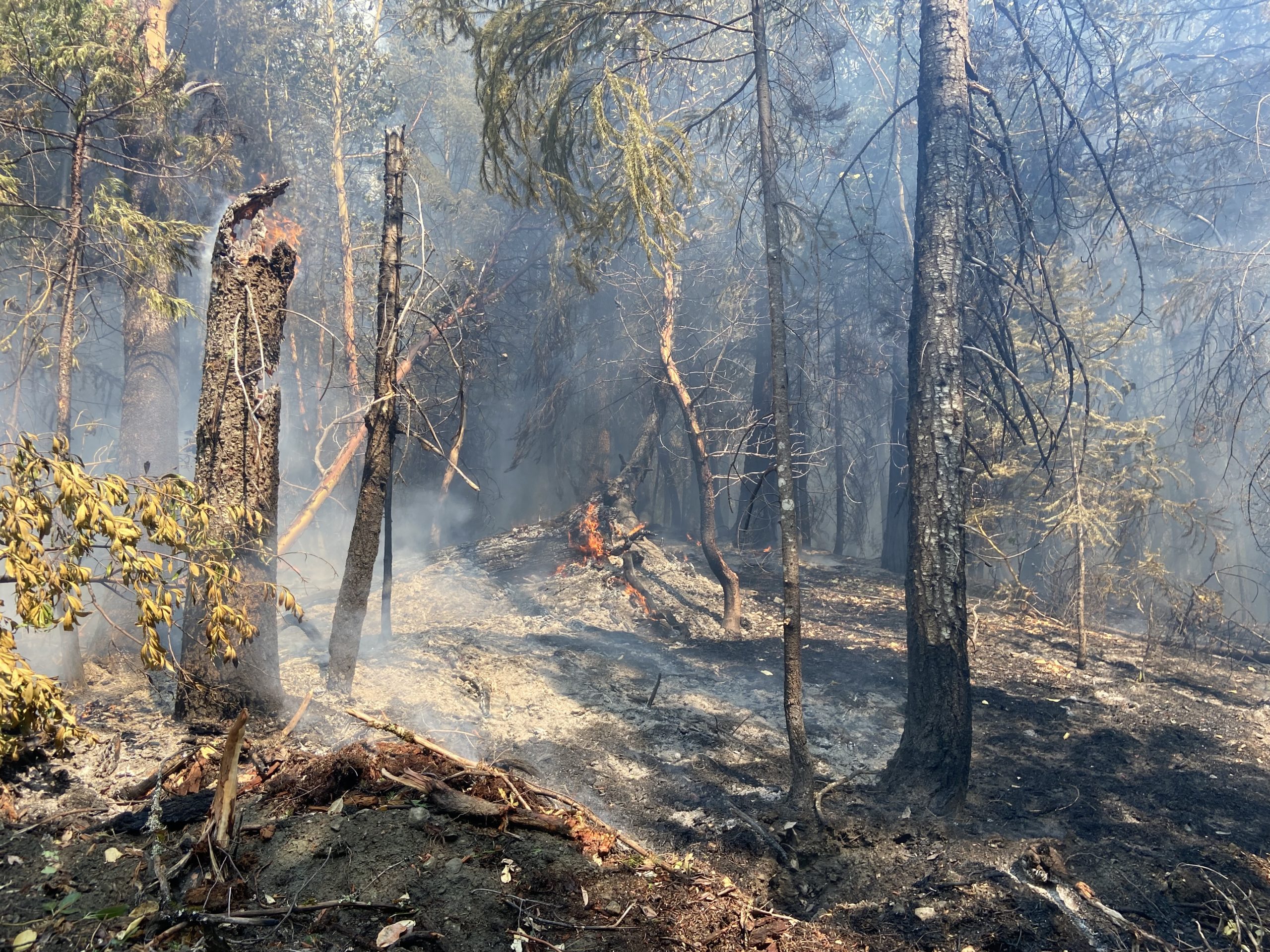
ROSEBURG, Ore. – Crews from the Douglas Forest Protective Association, rural fire departments, and industrial cooperators continue to work on the numerous lightning-related fires that ignited Sunday evening throughout the Douglas District. So far, approximately 20 fires have been located as of Monday afternoon with additional smoke reports expected in the coming days as temperatures increase. 12 of the known fires are currently staffed with boots on the ground firefighters. Additional resources are on order to assist with the remaining unstaffed fires. Four helicopters, two Single Engine Air Tankers (SEAT’s), and a fixed wing recon aircraft are currently working on the various fires. Warm and dry conditions are expected over the area for the next several days before a dry cold front is forecasted to move through the area. Cold fronts passing through fire areas are watchout situations for firefighters, as they are typically associated with low relative humidity readings and strong, gusty winds.
Below is the status of DFPA’s lightning-related fires:
- Cavitt Creek Area Fires: Three fires have been located southeast of Glide in the Cavitt Creek drainage, all of which have been contained. Crews are still engaged on these fires, mopping up hot sports and improving control lines.
- The remaining fires are in South Umpqua River corridor between Canyonville and Tiller, in addition to the Upper Cow Creek area, east of Azalea. The two largest fires in this area are the O’Shea Creek Fire and the Poole Creek Fire. The O’Shea Creek Fire is located three miles east of Canyonville and is currently estimated to be 20 acres in size. The Poole Creek Fire, located 8 miles west of Tiller, is estimated to be 10 acres in size. The remaining fires in this area range in size from a single struck tree to about two acres.
DFPA has ordered an Incident Management Team from the Oregon Department of Forestry (ODF IMT 1) to assist the district with suppression efforts of the fires in the South Umpqua River corridor and the Upper Cow Creek area. These fires will be referred to as the Skyline Ridge Complex. ODF IMT 1 is scheduled to meet with DFPA and cooperating agencies Monday evening for an in-briefing and is expected to take command of the fires Tuesday morning, Aug. 3.
# # #
August 2, 2021
JACKSON & JOSEPHINE COUNTIES, Ore. – An estimated 50 fires have been reported following thunderstorms that passed though the Oregon Department of Forestry (ODF) Southwest Oregon District on Sunday afternoon. Firefighters, dispatchers and detection specialists worked through the night to locate and extinguish fires. Approximately 50 fires were reported from Sunday afternoon into Monday morning; of those, 35 fires were confirmed as active. Of those 35, 20 have been put out, and 15 are in various stages of response; the majority are 100% lined and are currently in mop-up.
Private contract resources have been brought on to bolster firefighters, tree fallers and water tenders on active fires. This will also free up our district resources to respond to new fire starts as they are discovered throughout the day.
On the Medford unit, the two largest fires are both estimated to be 3.5 acres each. The North Fork Anderson Creek Fire, located on Anderson Butte outside of Talent is 100% lined and 5% contained. The Buck Rock Fire, located 5 miles north of Trail, is 30% lined and 5% contained. On the Grants Pass unit, the largest fire our resources responded to is the Bear Camp Road Fire; it’s estimated to be 4-5 acres. This fire is burning on U.S. Forest Service Rogue River-Siskiyou National Forest land, however, ODF responded as mutual aid due to close proximity to our protected area. The second largest incident in Josephine County is the Placer Road Fire located southwest of King Mountain at 1.5 acres. It is 100% lined and mopped up at this time. In the same area, the Oxyoke Fire near Hugo was extinguished as well; it was caught by ODF and Rural Metro Fire resources overnight at just over half an acre. This is the only fire that was burning near homes.
At this time, there are currently no homes threatened, despite the large amount of fires burning on the landscape. A reconnaissance flight was sent out at 8:30 a.m. to fly over current incidents and look for new reports of smoke; new fires will likely emerge throughout the day as temperatures heat up. Residents in areas where lightning struck should report any smoke by calling 911.
Fire season updates are available online on our website, www.swofire.com, our Facebook page, @ODFSouthwest and our Twitter account, @swofire.
August 2, 2021
Location: 28 miles northeast of Klamath Falls
Fireline total: 323 miles (51 miles active fire edge and 272 miles of contained line)
Size: 413,762 acres or 647 square miles
Personnel: 1,780
KLAMATH FALLS, Ore. – Crews on Sunday reported smokes from smoldering and torching fuels inside the burn area as they widened the fire line and soaked remaining heat and flames. Dozers continue to straighten the ragged edge of the fire line on the east side for improved containment. If a spot fire were to start, or if the existing fire jumped the line, contingency lines are in place to stop its progression. Due to the crews’ tremendous efforts over the past few days, the percent containment has increased and the miles of active fire edge have decreased significantly.
Because of the Bootleg Fire’s size and local conditions, it still holds a lot of heat. Even though progress has been made and fire advisors are confident in the containment measures, severe conditions remain for fire hazard. “Megafires” like this do not usually burn out until late fall or early winter when moisture increases and temperature decreases.
“For local residents, warm, dry, windy weather in this area is not a surprise,” said Tom Wright, Incident Meteorologist of the National Weather Service, Medford. “In fact, this is a common weather pattern, but it usually occurs in September—not the end of July and early August.” But this year is different. Several events led to the extremely dry conditions this year. Klamath and Lake counties are in an “exceptional” drought and have been in drought conditions for more than two years. Rainfall is at barely half the normal amount for the water year, and it is unlikely that the percentage will catch up, since the remainder of the year is the dry season. The record heat event in late June that included three consecutive days over 100 degrees Fahrenheit also had a major impact on drying trees, vegetation, and soil.
Today’s weather will include isolated afternoon showers and thunderstorms with scant amounts of rain. Over the next few days, temperatures will increase, humidity will decrease, and winds will pick up, creating critical fire weather conditions. Fuels around the fire are nearly 100% receptive to ignition if lightning strikes or an ember lands.
Evacuations: In Lake County, a Level 3 evacuation remains in place for all areas around the Bootleg Fire perimeter. The Level 3 extends to areas immediately adjacent to the fire line in all directions and includes Yamsay Mountain, Thompson Reservoir, and the Sycan Marsh to the top of Winter Rim. No evacuations are in place in Klamath County. Evacuations are dynamic; the best way to view the evacuation designation boundaries and details is on the interactive map available at tinyurl.com/bootlegevac
Red Cross Evacuation Shelters: For information or assistance: 1-800-Red-Cross (www.redcrossblog.org/disaster)
Insurance Assistance: For additional information on submitting insurance claims after losing your home or property to a wildfire, please visit https://dfr.oregon.gov/insure/home/storm/Pages/wildfires.aspx or call the state’s team of consumer advocates at 888-877-4894 (toll-free).
Closures: The Fremont-Winema National Forest is now open south of Oregon State Route 140. Closures remain in effect north of the highway to provide for public safety and the safety of firefighters. The full closure order and map are available at https://www.fs.usda.gov/alerts/fremont-winema/alerts-notices
Smoke: A change in weather patterns could start as early as tonight, as Tuesday could be a warmer, drier, and windier day than the past several. This could impact fire behavior in a way that will put more smoke into the air. Today will be generally good to moderate air quality day. This could change tonight as hazy conditions are expected. Smokier conditions close to the fire could bring back more periods when the air is Unhealthy for Sensitive Groups (USG) on Tuesday. See: fires.airfire.org/outlooks/southcentraloregon
Fire Information Public Phone: 541-482-1331 Fire Information Media Phone: 971-727-7255
Inciweb: inciweb.nwcg.gov/incident/7609/ Facebook: www.facebook.com/BootlegFireInfo
Twitter: twitter.com/BootlegFireInfo Hashtags: #BootlegFire #FireYear2021
Bootleg Fire Public Information
Email: 2021.bootleg@firenet.gov
Public Line:(541)482-1331
Media Line:(971)727-7255
August 2, 2021
WALLOWA, Ore. – Reports from the fireline informed that substantial showers occurred throughout the fire. Firefighters used this rainfall to their advantage, continuing mop-up operations and holding the fire in place. The fire remains stable at 22,960 acres and an increase in containment to 78 percent.
Today is the final operational shift for ODF’s Type 1 Incident Management Team 3, before the incoming Type 3 team assumes command tomorrow at 8:00 a.m. Today, the incoming team will shadow to help them better understand the current fire status and operations.
Mop-up will continue across the entire fire, with the Elbow Creek Drainage, Grossman Creek, and Sickfoot Creek being prioritized. Contingency work along the 62 and 6222 Roads will continue. Last night concluded all night operations.
Resources will continue to be “right sized” for the incident, with many crews timing out or being demobilized. To accommodate this down-sizing, the Elgin Camp will be broken down and a spike camp along the 62 Road will be set up instead.
Many hazards remain in the fire area, including fire weakened trees, stump holes, ash pits and many more. Additionally, heavy equipment, trucks and other firefighting apparatus remain active around the fire area. Staying off the roadways and out of the fire area allows these resources to continue to be effective. Thus, the Promise, Wallupa, and Troy Roads remain closed. To mitigate some of the listed hazards, the Umatilla National Forest remains closed as well.
Evacuation levels within Wallowa County remain unchanged for now. Additional information on evacuation levels is available on the Wallowa County Sheriff’s Office Facebook page (www.facebook.com/Wallowa-County-Sheriffs-Office-147212815486187).
Advisory: A virtual community meeting will take place over Facebook Live at 7:00 pm tonight. The Incident Management Team will provide a final update of the fire and share information on handing the fire over to a smaller Type 3 organization. Facebook Live Meeting Link: https://fb.me/e/4jEt5P5jL
August 2, 2021
ROSEBURG, Ore. – Thunderstorms moved across Douglas County Sunday evening, resulting in numerous strikes and several confirmed fires across the district, with most of the lightning activity occurring east of I-5. Aviation resources were unable to fly Sunday evening due to the active storm cells in the area but will be utilized first thing Monday morning to complete a district reconnaissance flight in addition to bucket work as needed. Additional resources, including hand crews, engines, water tenders, overhead personnel, and aviation resources have been ordered to assist with suppression efforts Monday morning. At this time, no structures are threatened by any of the known lightning fires.
Below is the status of each fire:
O’Shea Creek Fire: Located 3 miles east of Canyonville. Estimated to be 5 – 10 acres in size. Ground resources, including a bulldozer, are engaged on the incident, and will be working overnight to construct containment lines around the fire. Fire spread was reported to be slowing after nightfall.
Poole Creek Fire: Located 8 miles west of Tiller. Currently estimated to be 5 acres in size. Crews are engaged on the fire and will continue working on the incident overnight.
Hill Fire: Located 3 miles southeast of Canyonville. Currently 2 acres in size. Crews are engaged on the incident and will continue working on the fire overnight.
Sweat Creek Fire: Located 4 miles east of Canyonville. Currently 3/4 acre in size. Crews are engaged on the incident and have containment lines around half of the fire.
Buck Shot Fire: Located 9 miles southeast of Glide. The fire burned 1 acre. Crews have completed containment lines around the fire are mopping up hot spots.
Packard Creek Fire: Located 6 miles southeast of Canyonville. The fire burned a 1/4 acre. A bulldozer was used to open an old road that accessed the top of the fire. Crews have containment lines around half of the fire.
Turkey Creek Fire: Located 5 miles southeast of Canyonville. The fire burned 1/10th of an acre. Crews have completed containment lines around the fire.
Galesville Boat Ramp Fire: Located 8 miles southeast of Canyonville, between Upper Cow Creek Road and Galesville Reservoir. The fire burned 1/100th of an acre and has been contained.
# # #
August 1, 2021
CENTRAL OREGON – Fire crews made great progress Saturday on the Deep Creek and Johnson Ridge fires, increasing containment on both.
The Johnson Ridge Fire, located 9 miles northwest of Shaniko, Ore., started early Friday morning. It is 789 acres and is 90% contained. The fire will continue to be monitored today with crews and a water tender mopping up any hot spots found near the perimeter of the fire. Many resources from the Johnson Ridge Fire have been transferred to the Deep Creek Fire to help secure fire lines in anticipation of gusty winds this afternoon.
The Deep Creek fire started on Thursday afternoon and is located 21 miles north of Madras, Ore. It is approximately 1,221 acres in size with 23% containment. An error was stated in last evening’s update that the acreage was 2,010 acres, but that was the combined acreage of the two fires. Priority for firefighters on the fire is on the thickets of trees and brush closest to the fire’s edge.
Water tenders, engines, hand crews, dozers and a helicopter are all still assigned to the fires to ensure the fires stay within their footprints. On Monday the Type 3 Incident Management Team anticipates releasing some resources off the fires with the expectation of increased containment. However, the task forces of engines, hand crews and dozers will all remain here in Central Oregon, prepositioned and ready to help if the need arises.
The BLM Prineville District and Bakeoven/Shaniko Rural Fire Protection Association continued to work in unified command on the fires.
We ask communities of Central Oregon and visitors to continue to be vigilant about fire prevention. No campfires are allowed anywhere in Central Oregon and being aware of parking or driving on dry grass. The precipitation yesterday was helpful, but most areas received minimal moisture and even those areas with moderate amounts will dry very quickly! Central Oregon remains in extreme drought, leading to continued extreme fire danger
For current wildland fire information, the public can visit centraloregonfire.org or follow fire information on Twitter @CentralORfire.
# # #
August 1, 2021
Location: 28 miles NE of Klamath Falls Fireline total: 323 miles (83 miles active fire edge, 240 miles of contained line)
Size: 413,752 acres
Personnel: 1,878
KLAMATH FALLS, Ore. – Cloud cover and light rain over the last couple of days have moderated fire behavior. These favorable conditions have allowed crews on the ground, with continued air support, to make good progress on the fire line. The entire perimeter has been closed and crews are working to expand the width of the line, extinguish residual heat and flames, cut snags so they don’t roll downslope taking embers with them, and use bulldozers to straighten the ragged edge on the east side of the fire. Because there haven’t been more spot fires or breaches of the line, the Incident Management Team has been able to allocate necessary resources to focus on the active areas of the fire and strengthen the fire line.
Those efforts may be just in time. Today some isolated thunderstorms are possible, but they are more likely to bring gusty winds than rain. By Tuesday or Wednesday next week, warmer temperatures, low humidity, and gusty winds are likely to create conditions for rapid fire spread. This will be a test of the work that has been done so far to contain the fire.
“We’re not nervous about this weather,” said Karen Scholl, Operations Section Chief. “We want this test to happen to see how our line holds, while we have crews and contingencies in place. We believe we’re in a good position to be tested.”
Evacuations: In Lake County, a Level 3 evacuation remains in place for all areas around the Bootleg Fire perimeter. The Level 3 extends to areas immediately adjacent to the fire line in all directions and includes Yamsay Mountain, Thompson Reservoir, and the Sycan Marsh to the top of Winter Rim. No evacuations are in place in Klamath County. Evacuations are dynamic; the best way to view the evacuation designation boundaries and details is on the interactive map available at tinyurl.com/bootlegevac
Red Cross Evacuation Shelters: For information or assistance: 1-800-Red-Cross (www.redcrossblog.org/disaster)
Insurance Assistance: For additional information on submitting insurance claims after losing your home or property to a wildfire, please visit https://dfr.oregon.gov/insure/home/storm/Pages/wildfires.aspx or call the state’s team of consumer advocates at 888-877-4894 (toll-free).
Closures: The Fremont-Winema National Forest is now open south of Oregon State Route 140. Closures remain in effect north of the highway to provide for public safety and the safety of firefighters. The full closure order and map are available at https://www.fs.usda.gov/alerts/fremont-winema/alerts-notices
Smoke: Today should be a good day to enjoy the outdoors. Light winds should limit the spread of smoke. Overall, despite a lot of Moderate forecasts on the map, smoke levels will be on the lower end of that category. Hotter, drier, and windier conditions could start as early as Tuesday, which may have an impact on the fire’s behavior, consequently putting more smoke into the air. See: fires.airfire.org/outlooks/southcentraloregon
Bootleg Fire Public Information
Zone 1 Email: bootleg.fire.information@gmail.com
Zone 2 Email: 2021.bootleg@firenet.gov
Public Line:(541)482-1331
Media Line:(971)727-7255
August 1, 2021
WALLOWA, Ore. – The weather system expected to cross over the Elbow Creek Fire did arrive last night, but the predicted precipitation amounts did not. The fire area received 1/10 of an inch that was expected to receive up to ¾ inch. Some areas south of Wallowa received as much as one inch of rain. The Red Flag Warning, that was forecasted to be in effect through today, has been cancelled.
On the plus side, the fire’s spread has been stopped, remaining 22,960 acres. Containment has reached 71 percent.
While the moisture has moderated fire activity, that effect will be short-lived as weather is expected to be warmer and drier over the next few days.
With the fire growth essentially in check, work objectives around the entire fire will be similar from division to division – mop up and deepen the perimeter to mop up objectives. Special attention continues in the Elbow Creek Drainage and Sickfoot Creek. Work also continues on the north contingency line along the 62 road and the 6222 Road. Night operations have been suspended on the south end of the fire.
Personnel and fireline equipment continue to be “right sized” to the current fire situation, including the medical and COVID teams. Some resources are being released for rest while others are coming in to continue with the dirty and labor-intensive mop up process. Engines and crews arrived from Alaska late yesterday.
Evacuation levels within Wallowa County remain unchanged for now. Additional information on evacuation levels is available on the Wallowa County Sheriff’s Office Facebook page (www.facebook.com/Wallowa-County-Sheriffs-Office-147212815486187).
The Umatilla National Forest remains closed as well as several roads within the fire area.
Advisory: A virtual community meeting will take place over Facebook Live at 7 p.m. Monday evening. The Incident Management Team will provide a final update of the fire and share information on handing the fire over to a smaller Type 3 organization. Facebook Live Meeting Link: https://fb.me/e/4jEt5P5jL
July 31, 2021
JOHN DAY, Ore. – Firefighters from the Oregon Department of Forestry’s (ODF) John Day Unit responded to several lightning fires Friday and Friday night. These fires are holdover fires from thunderstorms which passed through on Thursday.
The National Weather Service has issued a red flag warning for much of central and eastern Oregon beginning this afternoon for abundant lightning in combination with critically dry fuels. These thunderstorms may come with rain, however the precipitation will not significantly reduce wildfire danger.
The 140-acre Cottonwood Creek Fire was reported mid-day Friday burning five miles south of Fossil. Resources from Wheeler County Fire and Rescue assisted ODF firefighters in initial attack of the incident. By late evening firefighters had completed construction of dozer line around the perimeter of the fire. Air tankers and helicopters were used to cool the fire and keep the fire within the fireline, allowing firefighters on the ground to strengthen the fireline and widen the “cold, black”. Throughout the night firefighters were challenged by embers from burning trees and hot rolling material igniting spot fires outside the line in steep terrain and heavy fuels. Firefighters successfully stopped these spot fires, minimizing fire growth.
Increasing wind and warm temperatures this afternoon has increased fire behavior within the perimeter. A Type 3 organization from ODF’s Central Oregon District, led by Incident Commander Chris Cook, is managing the fire today. Resources include five hand crews, 11 wildland engines, a dozer, and additional overhead. Local aircraft are available as needed to support the suppression efforts.
Five additional lightning fires within the John Day Unit were controlled at less than an acre. Resources from Burns District Bureau of Land Management, Umatilla National Forest, and Malheur National Forest were critical in stopping the spread of these fires. The cause of one new fire start from early this morning remains under investigation.
A Regulated-Use Closure is in effect for the Central Oregon District to reduce human caused fires. The closure restricts mowing of dried grass, cutting and grinding of metal, and chainsaw use between 10:00 a.m. and 8:00 p.m. as well as prohibiting campfires, cooking fires and warming fires. The full proclamation and restrictions are available at https://gisapps.odf.oregon.gov/firerestrictions/PFR.html. Industrial operations on forestland within the Central Oregon District also have restrictions in place. Details for these activities are found at https://gisapps.odf.oregon.gov/firerestrictions/IFPL.html.
Preventing human caused fires allows firefighters to focus suppression effort on fires started by lightning. These focused activities result in smaller fires with less damage to natural resources and communities and fewer impacts to air quality.
For additional information on ODF’s Central Oregon District, including contact information and unit offices, please visit www.ODFcentraloregon.com.
July 31, 2021
Location: 28 miles northeast of Klamath Falls Size: 413,562 acres
Personnel: 1,918 Containment: 56%
KLAMATH FALLS, Ore. – “At this point in the fire, we have to think about two things,” says Fire Behavior Analyst Chris Moore, “the fire we know about and the fire we don’t know.” The fire we know is the actively and recently burned portions of the Bootleg Fire. Much of the recent fire activity has been torching and burning pockets of fuel within the burn area. While the fire is not yet contained, a fire line has been constructed around the entire perimeter. Now crews are working to ensure that perimeter holds (is secured) to contain the fire. In some places, fire line is 100 to 150 feet wide from the unburned into the burned area. But some places may require as much as 300 feet to confidently expect the fire to remain contained.
Along the south, west, and east perimeters, crews are patrolling and extinguishing residual fire and heat (mopping up) where the fire is less active. The goal is to extend the line wide enough into the burned area to make fire escape unlikely based on the potential fire behavior, fuels, and terrain.
In the more active northwest and northeast corners of the fire, crews are working to strengthen and expand the fire line. Contingency lines, or fire breaks, further out from the perimeter, are also being constructed. The “fire we don’t know” is the potential for ember-sparked spot fires from these active areas or new fires sparked by lightning strikes that could occur.
Critical fire weather is forecast in the Bootleg Fire area over the weekend. Current drought conditions combined with low relative humidity, strong surface wind, and unstable air may cause more active fire behavior. In these places where the fire line is not secured, there is a potential for wind to carry embers and spark spot fires. The terrain in the northwest could encourage rapid spread of the fire and make it more difficult to control. Likewise, in the northeast corner, spot fires could continue to press up against Winter Rim and ultimately threaten structures along Summer Lake and Highway 31. Although Lake County evacuation designations have lifted, residents in this area should remain vigilant to changing fire behavior and should “Be Set” to evacuate if necessary.
A Red Flag Warning for lightning over dry fuels is in effect for Saturday afternoon and evening. Winds are expected to be light, but strong gusts and erratic winds could be associated with thunderstorms. More information is available at https://inciweb.nwcg.gov/incident/article/7609/62198/
Evacuations: Evacuations are dynamic. Klamath County has dropped all evacuation notices; however, the Fremont-Winema National Forest remains closed north of Oregon Route 140. The Lake County Sheriff’s Office and Emergency Management removed all residences in Lake County outside of the fire’s perimeter from a Level 3 evacuation. County leadership and fire teams ask that Lake County residents remain vigilant to potential wildfire hazards. In particular, areas along Highway 31 north of Monument Rock and south of the community of Summer Lake should “Be Set” to evacuate if necessary. The best way to view the evacuation designation boundaries and details is on the interactive map available at tinyurl.com/bootlegevac
Red Cross Evacuation Shelters: For information or assistance: 1-800-Red-Cross (www.redcrossblog.org/disaster)
Insurance Assistance: For additional information on submitting insurance claims after losing your home or property to a wildfire, please visit https://dfr.oregon.gov/insure/home/storm/Pages/wildfires.aspx or call the state’s team of consumer advocates at 888-877-4894 (toll-free).
Closures: The Fremont-Winema National Forest is now open south of Oregon State Route 140. Closures remain in effect north of the highway to provide for public safety and the safety of firefighters. The full closure order and map are available at https://www.fs.usda.gov/alerts/fremont-winema/alerts-notices
Smoke: Overall, today will be a generally good to moderate air quality day. Wind flow could bring in smoke from some of the neighboring fires (Jack, Dixie, and others). Models show that smoke from the Jack Fire could affect parts of Crater Late later today into tonight. Smoke from the Bootleg Fire could affect some of the eastern locations in this region, including Paisley and Silver Lake. These effects are likely to continue into tomorrow morning. See: fires.airfire.org/outlooks/southcentraloregon
Fire Information Public Phone: 541-482-1331 Fire Information Media Phone: 971-727-7255
Inciweb: inciweb.nwcg.gov/incident/7609/ Facebook: www.facebook.com/BootlegFireInfo
Twitter: twitter.com/BootlegFireInfo Hashtags: #BootlegFire #FireYear2021
July 31, 2021
WALLOWA, ORE. – The Elbow Creek Fire showed no growth over the last 24 hours and now stands at 22,960 acres. Containment has reached 64 percent.
The fire did flare up within containment lines yesterday as extreme heat, single-digit humidity and light winds increased fire behavior in unburned fuels. Because the fire activity was well within containment lines, firefighters had little concern. Just to be sure, however, two helicopters worked in unison to keep the fire in place.
As mop-up operations continue, so too does the contingency work on the north side of the fire, with crews improving roads and removing roadside vegetation in the event a backup fire break be needed.
A Red Flag Warning has been issued for this afternoon through Sunday. Thunderstorms are expected to develop over the area with erratic winds and chances for abundant lightning. There is also a high probability of heavy rainfall that could bring between ¼ and ¾ of an inch of rain.
Evacuation levels within Wallowa County remain unchanged for now. Additional information on evacuation levels is available on the Wallowa County Sheriff’s Office Facebook page (www.facebook.com/Wallowa-County-Sheriffs-Office-147212815486187).
The Umatilla National Forest remains closed as well as several roads within the fire area.
# # #
July 31, 2021
JACKSON AND JOSEPHINE COUNTIES, Ore. – Following two consecutive days of thunderstorms in the Rogue Valley, Oregon Department of Forestry (ODF) Southwest Oregon District (SWO) has responded to 14 fires across the district that are believed to be lightning-caused. The majority of these fires are already extinguished; only two remain active, however, both are in the latter stages of mop-up.
Thunderstorm cells from both Thursday and Friday took a very similar path up from northern California into the Applegate Valley. Almost immediately after the storms crossed into Oregon, the ODF Southwest Detection Center began discovering smoke in these areas. These fires became the Applegate Complex, consisting of 9 separate incidents. The largest of these fires is the Squires Peak Fire located near Woodrat Mountain southeast of Ruch at 3 and a half acres. At the time of this release, it is 100% lined and 70% contained. The other 8 fires were between 1/10th and 1/100th of an acre and are completely extinguished.
Further northwest, the Apple Foots Complex ranges from southwest Grants Pass to the Selma area; it consists of 5 fires. All are extinguished aside from the Marble Mountain Fire, located 10 miles southwest of Grants Pass. It’s 1/10th of an acre in size, 100% lined and nearly contained.
All of these fires, while small, are in extremely rough terrain in high elevations. Firefighters will remain on scene of the Squires Peak and Marble Mountain Fires until they are 100% contained, which is estimated to be reached by the end of Saturday. Several reconnaissance missions have been conducted by district aircraft; no new fires have been located from these flyovers, or by our Detection Center Specialists.
Additional thunderstorms are expected in our region; our firefighters, dispatchers and detection specialists will continue to be vigilant in locating, dispatching and responding to fires. ODF believes in an aggressive initial attack strategy with the goal of keeping fires as small as possible and putting them out as quickly as possible. This strategy has yielded excellent results over the past two days, and throughout this fire season on the Southwest Oregon District.
As a reminder to the communities we serve, Extreme Fire Danger is still in effect, despite the rain our area received in these storms. The 14 fires that have been found are proof that fuels are still prime to burn. Please continue to follow public use regulations in an effort to decrease the likelihood of human-caused fires; this greatly helps local fire crews to focus on the multiple incidents at hand, and additional lightning-caused holdover fires that will pop up in the coming weeks from these storms.
Additional information about fire season and current regulations is available online on our website, www.swofire.com, our Facebook page, @ODFSouthwest and our Twitter account, @swofire.