Location: 28 miles NE of Klamath Falls Fireline total: 323 miles (83 miles active fire edge, 240 miles of contained line)
Size: 413,752 acres
Personnel: 1,878
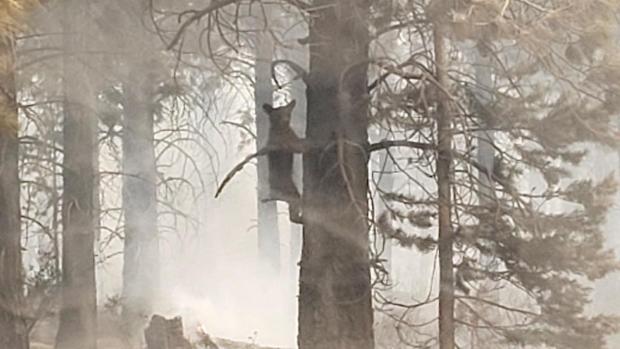
KLAMATH FALLS, Ore. – Cloud cover and light rain over the last couple of days have moderated fire behavior. These favorable conditions have allowed crews on the ground, with continued air support, to make good progress on the fire line. The entire perimeter has been closed and crews are working to expand the width of the line, extinguish residual heat and flames, cut snags so they don’t roll downslope taking embers with them, and use bulldozers to straighten the ragged edge on the east side of the fire. Because there haven’t been more spot fires or breaches of the line, the Incident Management Team has been able to allocate necessary resources to focus on the active areas of the fire and strengthen the fire line.
Those efforts may be just in time. Today some isolated thunderstorms are possible, but they are more likely to bring gusty winds than rain. By Tuesday or Wednesday next week, warmer temperatures, low humidity, and gusty winds are likely to create conditions for rapid fire spread. This will be a test of the work that has been done so far to contain the fire.
“We’re not nervous about this weather,” said Karen Scholl, Operations Section Chief. “We want this test to happen to see how our line holds, while we have crews and contingencies in place. We believe we’re in a good position to be tested.”
Evacuations: In Lake County, a Level 3 evacuation remains in place for all areas around the Bootleg Fire perimeter. The Level 3 extends to areas immediately adjacent to the fire line in all directions and includes Yamsay Mountain, Thompson Reservoir, and the Sycan Marsh to the top of Winter Rim. No evacuations are in place in Klamath County. Evacuations are dynamic; the best way to view the evacuation designation boundaries and details is on the interactive map available at tinyurl.com/bootlegevac
Red Cross Evacuation Shelters: For information or assistance: 1-800-Red-Cross (www.redcrossblog.org/disaster)
Insurance Assistance: For additional information on submitting insurance claims after losing your home or property to a wildfire, please visit https://dfr.oregon.gov/insure/home/storm/Pages/wildfires.aspx or call the state’s team of consumer advocates at 888-877-4894 (toll-free).
Closures: The Fremont-Winema National Forest is now open south of Oregon State Route 140. Closures remain in effect north of the highway to provide for public safety and the safety of firefighters. The full closure order and map are available at https://www.fs.usda.gov/alerts/fremont-winema/alerts-notices
Smoke: Today should be a good day to enjoy the outdoors. Light winds should limit the spread of smoke. Overall, despite a lot of Moderate forecasts on the map, smoke levels will be on the lower end of that category. Hotter, drier, and windier conditions could start as early as Tuesday, which may have an impact on the fire’s behavior, consequently putting more smoke into the air. See: fires.airfire.org/outlooks/southcentraloregon
Bootleg Fire Public Information
Zone 1 Email: bootleg.fire.information@gmail.com
Zone 2 Email: 2021.bootleg@firenet.gov
Public Line:(541)482-1331
Media Line:(971)727-7255

