
Incident Information:
Fire Information Line: 971-209-6990
Facebook: Facebook.com/ODFSouthwest
Email: imt1.fireinfo@odf.oregon.gov
Links: https://linktr.ee/odfteam1
InciWeb: https://inciweb.wildfire.gov/
FIRE AT A GLANCE
East Evans Creek Fire
Total Size: 15,705 acres
Containment: 17%
Cause: Vehicle into power pole
Evacuations
Evacuations have been issued in Jackson and Douglas counties.
More information is available online at: https://readyjacksonco.com/Emergency/emergency-information-hub-east-evans-creek-road-fire
Find your evacuation zone here: https://tinyurl.com/EastEvansCreekFireEvacMap
Fire Restrictions:
ODF: https://www.oregon.gov/odf/fire/pages/restrictions.aspx
BLM: https://www.blm.gov/programs/fire/regional-info/oregon-washington/fire-restrictions
All Resources:
Hand Crews: 72
Engines: 122
Heavy Equipment: 58
Water Tenders: 59
Aircraft: 14
Total Personnel: 2,343
Incident Commanders:
Dan Quinones, ODF Incident Management Team 1
Steve Bregman, Oregon State Fire Marshal Blue Team
SAMS VALLEY, Ore. – Overnight, firefighters on the East Evans Creek Fire took advantage of cooler, more stable conditions to strengthen containment features, expand mop-up, and reinforce control lines. Night crews used infrared (IR) technology to identify and flag remaining hot spots, allowing firefighters to continue extinguishing heat during daylight operations. Although fire activity moderated over the past 24 hours, firefighters remain vigilant as triple-digit temperatures, lower relative humidity, a lifting inversion, and the potential for isolated thunderstorms today could increase fire activity. A Fire Weather Watch is in effect for Wednesday, with potential for thunderstorms and abundant lightning capable of producing new fire starts before hot, dry, and breezy conditions return later this week.
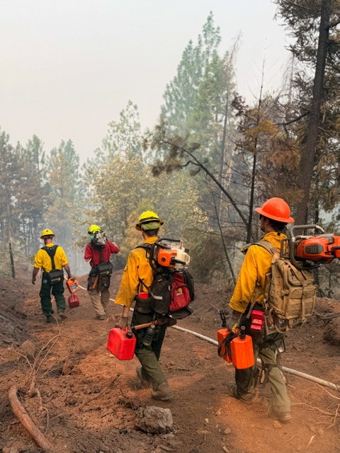
Across the fire, firefighters are steadily extending mop-up farther into the fire footprint. Mop-up is the process of locating, cooling, and extinguishing remaining heat to reduce the potential for rekindles and prevent fire from reaching or crossing established control lines. Structure protection crews continue supporting these efforts by focusing on mop-up around homes and reinforcing protection throughout nearby communities.
On the Board Mountain spot fire, firefighters will continue addressing remaining areas of unburned vegetation within the fire area to reduce available fuel and strengthen containment. Along the southern portion of the fire, crews will be assisted by felling personnel, who are removing fire-weakened and hazardous trees to improve firefighter safety and provide access for suppression operations. Due to steep, difficult terrain, helicopters and heavy equipment remain critical to suppression efforts. Structure protection crews continue supporting operations near homes in the Antioch, Jones Road, and Pomeroy areas.
On the Canyon Creek spot fire, firefighters continue extinguishing scattered pockets of heat where the fire burned unevenly, requiring methodical interior mop-up. Structure protection crews are extending mop-up in the Long Branch area outside Shady Cove, where fire previously encroached on homes, while proactive protection remains in place throughout the Shady Cove, Trail, and Dry Creek communities. In the Dry Creek and Shiloh areas, firefighters are advancing farther into the fire interior, conducting mop-up, removing hazardous trees, gridding for hidden heat, addressing heavy fuels, and using heavy equipment to improve access and support suppression operations.
On the spot fire northwest of Hull Mountain, firefighters continue pushing mop-up well into the fire’s interior, increasing the depth of extinguished fuels behind containment lines. In the Ramsey Canyon Road area, structure protection engines continue supplying water through high-pressure pump systems to firefighters extinguishing hot spots in steep, challenging terrain.
On the main fire, mop-up has progressed up to 150 feet into the fire footprint along the eastern edge and approximately 100 feet across much of the remaining perimeter. Around homes, structure protection crews have extended mop-up approximately 200 feet from structures. This progress reflects days of coordinated work to strengthen containment, increase the depth of extinguished fuels behind control lines, and reinforce protection around nearby communities.
The increased containment and reduced threats to structures have allowed several structure protection task forces and strike teams to return to their home agencies, enhancing statewide response capability while maintaining protection where it remains needed. In coordination with state and local partners, the incident continues strategically positioning both wildland and structure protection resources to support emerging initial attack and other priority incidents across southwest Oregon while maintaining the capability to respond to changing conditions on the East Evans Creek Fire.
Evacuations: There are evacuations in place in both Jackson and Douglas counties, issued by both counties’ Sheriff’s Offices and Emergency Management. Up-to-date evacuations are available here: https://readyjacksonco.com/Emergency/emergency-information-hub-east-evans-creek-road-fire
Find your evacuation zone here: https://tinyurl.com/EastEvansCreekFireEvacMap
Road/Land Closures: Traffic is closed to the public on East Evans Creek Road at Meadows Road. The BLM has issued a road closure for West Fork Evans Creek Road and Rock Creek Road. Please avoid the fire area to allow firefighters and heavy equipment to operate safely. Road closure information is available on https://tripcheck.com/
A closure order for BLM-administered lands near the East Evans Creek Fire is in place. Public entry, including hunting, hiking, and camping, is prohibited. More information about the closure, including a map, is available online at www.blm.gov/orwafire.
Smoke Impacts: Smoke from the East Evans Creek Fire may settle into valleys and other low-lying areas, reducing visibility and impacting air quality in nearby communities. Smoke conditions can change throughout the day as winds shift. Individuals sensitive to smoke should take appropriate precautions. For current air quality information and smoke forecasts, visit: https://fire.airnow.gov/.
Temporary Flight Restriction (TFR): A “TFR” is in place for the fire area daily (24 hours) until further notice. Complete information is available at https://tfr.faa.gov/tfr3/?page=detail_6_4915
Flying a drone near or around a wildfire is illegal, compromises the safety of both pilots and firefighters, and interferes with firefighting efforts.
Cause: The fire started on Friday, July 10th at 2:41 p.m. after a car crashed into a power pole, sparking dry vegetation in the area. The Jackson County Sheriff’s Office is currently investigating the cause of the crash.