ODF WILDFIRE NEWS
The official wildfire news blog for the Oregon Department of Forestry
LATEST NEWS
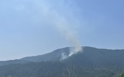
ODF’s SW Oregon District and federal, local partners stop 17 lightning-caused fires
JACKSON and JOSEPHINE COUNTIES, Ore. (July 22, 2024) – Firefighters are completing the last portions of mop-up operations on two of the 17 lightning-caused fires that were found on Oregon Department...

Lightning across Oregon reminds everyone to be informed and prepared
Salem, Ore – Starting this past Wednesday, July 17, and into Sunday, July 21, Oregon experienced two separate lightning events that resulted in over 2,000 strikes across the state, which primarily...
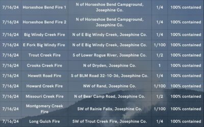
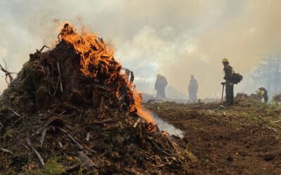
All new lightning-caused fires on land protected by ODF SW Oregon are now 100 percent lined
JACKSON AND JOSEPHINE COUNTIES, Ore. – Firefighters worked all day Sunday on four new lightning-caused fires across the Oregon Department of Forestry's Southwest Oregon District. As of 6 p.m., all...
Northeast Oregon District raises public use restrictions and additional restrictions for industrial operations
La Grande, OR—Fire managers are increasing the public use restrictions to Extreme (red), as well as implementing additional restrictions for industrial forest operations on lands protected by the...
Oregon receiving out of state help to fight numerous wildfires
SALEM, Ore. – The Oregon State Fire Marshal and the Oregon Department of Forestry are bringing in out-of-state firefighters and equipment to fight several wildfires impacting communities and...
Hot weather increases the fire danger level to high in northwest Oregon
NORTHWEST, Ore. — Due to the extreme high temperatures throughout the region, the fire managers will be increasing the fire danger level to High (yellow) for recreationists using the forests in the...
Fire danger level increases to high on ODF protected lands in Northeast Oregon District
LA GRANDE, Ore. — The fire danger level on lands protected by the Oregon Department of Forestry in Northeast Oregon will increase to “high” (yellow) on Monday, July 8, 2024, at 12:01 a.m. This...
All ODF Districts are now in fire season ahead of coming heat wave
SALEM, Ore. – As of today, July 3, all Oregon Department of Forestry (ODF) districts are in fire season. This means that to reduce the risk of human-caused wildfires, fire restrictions may be in...
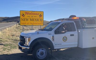
ODF sends 19 firefighters to New Mexico
SALEM, Ore. – This week the Oregon Department of Forestry (ODF) filled an order to send 19 firefighters to New Mexico to assist in fighting numerous, out of control wildfires. Many of the...
WILDLAND FIRE STATISTICS
ODF has been protecting Oregon’s forests for 110 years, and is the largest fire department in Oregon, protecting about 16 million acres of private and public forestland. The department emphasizes the importance of preventing human-caused fires, reducing wildfire risks through improved forest health and resiliency, and keeping those fires that do start as small as possible. This approach protects lives and property and limits fire-related impacts to communities.
These stats are for lands protected by ODF only. The Northwest Interagency Coordination Center shares updated statewide and regional stats daily.
As of September 29, 2025
ODF PROTECTED LAND
Fires and acres burned
Total fires = 1,091
Total acres = 23,796
10-year average fires and acres burned
Total fires = 920
Total acres = 136,590
ALL LANDS IN OREGON
Fires and acres burned
Total fires = 2,944*
Total acres = 340,091
* ODF Fires database & NWCC SIT reconcile.
10-year average fires and acres burned**
** Requires special requests to NWCC – not on normal daily reports.
Annual Fire Reports are available through the Northwest Interagency Coordination Center (NWCC).