July 25, 2018
SALEM, Ore. – Since
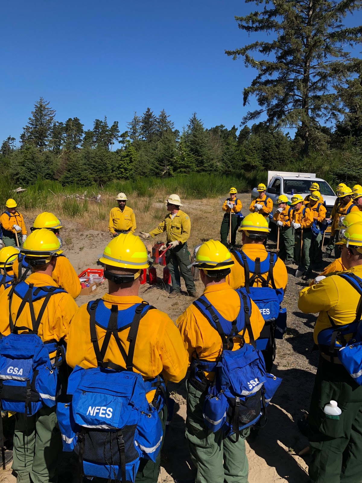
being activated by Gov. Brown earlier this month, the Oregon National Guard has been able to
send 80 members of the Guard to southern Oregon to help in support roles, such
as traffic control. Fifty Guard members are working on the Garner Complex (burning mostly in Josephine County) and
30 on the Hendrix Fire SW of Ashland. In addition, two Chinook helicopters from
the Guard and their pilots and ground crews are working on the Garner Complex.
One of the Guard’s Lakota helicopters is also making infrared mapping
flights over multiple Oregon fires.
More Guard members will receive firefighting
training in Salem the week of July 30- Aug. 3, increasing the number able to
serve on wildfires.
This year’s activation of the Guard comes weeks before last year’s activation, a reflection of how advanced the fire danger is this summer.
July 25, 2018
MORROW COUNTY, Ore. – Late
yesterday this fire in eastern Oregon’s Morrow County moved outside the fireline and pushed
into the Porter Creek drainage to the south. Evening downslope winds moved the
fire through the drainage to the southeast and across a ridge.
Very large
airtankers, single-engine airtankers and helicopters dropped water and
retardant on the fire to slow its growth and help firefighters
and equipment on the ground trying to suppress the fire. The fire’s movement
prompted evacuation and closure of the U.S. Forest Service campground at
Bull Prairie Lake. Northwest Team 8 is being briefed on the fire this
afternoon and will take command tomorrow morning.
Ignition
date: July
23, 2018
Acres
burned: 700
Cause: Under investigation
July 24, 2018
Oregon currently has more than a dozen active, large wildfires burning, the second most in the nation. Wildfires produce a lot of smoke, which can affect air quality over wide areas. This was especially noticeable last summer when the state was blanketed by smoke from numerous wildfires for weeks.
Oregonians concerned about air quality from wildfire smoke can check conditions at https://oregonsmoke.blogspot.com/ A map on the site displays the results of air monitoring stations, color coded to indicate the health impact from the readings. Levels range from good (green) to hazardous (dark red). Tuesday the map showed levels considered unhealthy or hazardous at a number of monitoring stations in Jackson, Klamath and Lake counties.
Additional information about general air quality can be found at this Oregon’s Department of Environmental Quality site https://www.oregon.gov/deq/aq/Pages/default.aspx

July 24, 2018
MERLIN, Ore. – The number of acres burned by fires in the Garner Complex increased by more than 2,000 since yesterday to reach 17,369 acres this morning. The number of personnel engaged on the fire has also grown, to 2,311 people, with 102 fire engines, 45 water tenders, 35 dozers, 18 aircraft and 76 hand crews.
Overnight, firefighters made progress on building and extending control lines. Today, firefighters will work to secure and hold those control lines by strengthening hand-built and dozer lines, placing water hoses, and continuing to mop up.
Weather permitting, firefighters expect to set fire between control lines and actively burning areas of the fire. This is done to stop the fire’s advance by consuming the fuel available to the fire.
The largest fire in the Complex is the Taylor Creek Fire, which is reported at 9,642 acres. That fire is burning on both private and BLM land as well as parts of the Rogue River-Siskiyou National Forest. As smoke conditions allow, air support will be dropping water and retardant on the south and west sides of the Taylor Creek, Pleasant Creek and Grave Creek fires. Firefighters have been successful in hold the Spencer Creek Fire within control lines. Mop-up on that fire continues.
 The Office of the Oregon State Fire Marshal has stated that no structures have been lost in the fire, but hundreds of primary residences as well as other structures are considered threatened. Structural crews are continuing to assess and create defensible spaces around homes and other structures on the Grave Creek and Taylor Creek fires. Level 3 evacuations have affected almost 400 people. Current evacuation information can be found by contacting the Joint Information Center in southern Oregon at 541-474-5305 between 8 a.m. and 8 p.m. A Red Cross shelter is set up for evacuees at Grants Pass High School at 830 N.E. 9th Street. The number for the shelter is 541-474-5710.
A public meeting about the fires is scheduled for today at 6 p.m. in Wimer at the Evans Valley Education and Community Center, 8205 East Evans Creek. A public meeting held yesterday at North Valley High School in Grants Pass was attended by some 300 people.
Weather forecasts call for continued hot and dry conditions. Smoke will gradually lift today, resulting in higher temperatures and lower humidity at the fire. As a result, firefighters will likely see elevated fire activity today.
July 24, 2018
MORROW COUNTY, Ore. – Firefighters made significant progress overnight building fireline around the
Wilson Prairie Fire, located in the southwest corner of Morrow County. The fire originated on lands protected by the
Oregon Department of Forestry (ODF) and spread onto the Umatilla National
Forest. The fire is estimated to be 120
acres, burning in grass, brush, and timber.
Yesterday firefighters were challenged with the fire spotting in pockets
of dead white fir. Overnight the fire
held inside the existing retardant lines used to “box in” the fire and check
the spread. There are currently no evacuations or closures in place around the
fire. The cause of the fire is under
investigation.
Today, additional resources are
arriving to relieve firefighting personnel who worked throughout the night to
stop the spread of the fire. Since the
fire was reported Monday afternoon, firefighters were able to use dozers to
build fireline around most of the fire.
Firefighters will work to complete the fireline, building handline in
steep, rocky ground where dozers were unable to work.
Resources assigned to the fire today include
two contract crews, two Oregon Department of Corrections crews, three dozers,
two water tenders, eight fire engines from ODF and three initial attack modules
from the Umatilla National Forest’s Heppner Ranger District. Work will also begin today mopping up fire
and heat adjacent to the fireline, strengthening these lines to reduce the risk
of fire moving outside the perimeter.
Aerial resources will support
the firefighting effort as needed. These
aerial assets include two Type 2 helicopters used to drop water and cool hot
spots. These helicopters are specially funded by Oregon’s legislature to reduce
impacts from large fires on landowners and Oregon’s natural resources including
water and air quality. A Type 1
helicopter will be arriving today to support the extended attack firefighting
for this fire. Single Engine Air Tankers
(SEATs) and large air tankers are available if the fire moves outside the
fireline.
Dry fuel conditions throughout
the region combined with continued hot and dry weather in the forecast have the
potential for rapid fire growth.
·
Regulated Closure is in effect for ODF’s Central
Oregon District. Specific restrictions, intended
to reduce human caused fires, can be found at www.ODFcentraloregon.com
-
Phase A of the Public
Use Restrictions (PURS) for the Umatilla National Forest is in effect. For more information regarding these and
other restrictions on the Umatilla National Forest visit www.bmidc.org.

July 23, 2018
ASHLAND, Ore. – Firefighters are taking advantage of favorable conditions to make progress on the Hendrix Fire 9 miles southwest of Ashland. The Oregon Department of Forestry is in Unified Command with the U.S. Forest Service on the fire. The 1,060-acre fire is burning in the Rogue River-Siskiyou National Forest and on about 180 acres of private land protected by ODF. The fire was started by lightning that passed through southern Oregon on July 15. It is currently 20 percent contained. Some 520 personnel are engaged on the fire.
On Sunday, helicopters
were hampered by poor visibility over the fire’s helibase. One of the Type 2 helicopters was loaned
to the Prospect Fire and was unable to return after its duties due to
challenging smoke conditions at the Prospect Fire’s helibase. Sharing resources continues to be a powerful tool
among all of the fire teams operating in southern Oregon and beyond.
Helicopters will continue to support firefighters on the ground, including
dropping water and conducting reconnaissance flights as needed and conditions
allow.
If conditions are
favorable, crews may continue small strategic firing operations on the
southwest portion of the fire. They will work to tie the main fire perimeter along the ridges down to hand lines
and dozer lines in more accessible terrain to help secure the area.
Firefighters continue
going direct, creating fireline along the fire’s perimeter on the east side of
the fire. On the north and northeast portions of the fire, firefighters are mopping up and extinguishing or
removing burning material near firelines to help secure the area. Good containment has been achieved on the northwest side of the fire.
Resources committed to the fire include:
- 22 fire engines
- 10 water tenders
- 5 assigned dozers and additional dozers on loan from cooperators
- 2 masticators for chipping brush
- 3 skidgens
- 5 helicopters
- 4 Hot Shot crews
- 13 hand crews
Drivers near the
intersection of Upper Applegate and Little Applegate should watch for
firefighters and fire vehicles in the area as the fire team sets up a vehicle wash
station there to help prevent weeds caught underneath brush trucks and other
apparatus from being carried from area to area. Efforts like this help prevent
the spread of invasive weeds like the yellow star thistle.
The forecast for
southern Oregon for the foreseeable future is continued hot temperatures and drying fuels. The temperatures at higher
elevations and peaks near the fire also continue to rise with an expected 90
degrees at 4,500 feet elevation by Wednesday. There is a chance of thunderstorms early this week. Fire crews will remain vigilant and are prepared to attack any
new fire starts if they occur.
Firefighters are
aggressively suppressing the fire where they can do so safely and effectively to protect and minimize
fire effects to residential structures, private
property, industrial timber lands, and natural and cultural resources. Public
and firefighter safety is the number one priority.
The lightning-caused Watershed Fire (9 acres), Bull Gap Fire (3.5 acres), and 288 Fire (a tenth of an acre) remain in
patrol status.
Evacuations and closures
Level 2 and Level 3
evacuations remain in place for residents near Hells Peak, southeast of Ruch. Details are available at http://jacksoncountyor.org/sheriff/. More info about evacuation levels and preparedness can be
found at http://www.rvem.org. Video from last night’s Hendrix Community Meeting at the Ruch Branch Library is available online at https://tinyurl.com/yczf47z9 . Additional community meetings will be held periodically.
The Rogue River-Siskiyou
National Forest Hendrix Fire Area Closure for the southern portion of the
Siskiyou Mountains Ranger District remains in effect. Detailed info and a
map of the area closure are available at https://www.fs.usda.gov/rogue-siskiyou. The closure has been revised to show Forest Road 20 as
being OPEN from the Upper Applegate Road to Jackson Gap. Forest Road 20 is
closed from Jackson Gap East to Ashland Watershed including access to
Dutchman Lookout.
The Pacific Crest Trail
is closed from where it meets National Forest Road No.40S01
(Observation Gap) to the Grouse Gap Shelter. Re-route information is available at https://www.pcta.org/discover-the-trail/closures/oregon/hendrix-fire-southern-oregon/.
High smoke levels can have hazardous
impact on health. People
with respiratory or heart disease, children, and the elderly should stay inside
and contact their healthcare providers if they become ill. Visit http://oregonsmoke.blogspot.com/
for more information.
Maps of the Hendrix Fire can be found at https://gacc.nifc.gov/nwcc/information/fire_info.aspx

July 23, 2018
MERLIN, Ore. – The Garner Complex grew in size over the weekend to 15,294 acres, with containment estimated at 14%. Personnel engaged on the fire has grown to 2,162.
Two public meetings are scheduled tonight and tomorrow for
the local communities most effected by fires in the Garner Complex.
- Monday, July 23 at 6 p.m, North Valley
High School, 6741 Monument Drive, Grant Pass
- Tuesday July 24 at 6 p.m. Evans Valley Education and
Community Center, 8205 East Evans Creek in Wimer
Today 50 Oregon National Guard personnel arrived to staff 10 traffic-control checkpoints. This helps the public avoid
entering active fire areas.
Construction of direct and indirect control lines continues on the Grave Creek
fires. Much of the fire is holding within the lines on the north and west
flanks, and hose-lays are in place in these areas. Crews worked down each side
of the fire tying in reopened roads, hand and dozer lines. Much of the focus on
the Grave Creek Fire was to create a fireDitch Fire and the Pleasant Creek Fire.
line across the southern edge to tie in
line between the
The Spencer Fires are
subdued with few visible smokes. On the Taylor Fire, because of challenging
fire behavior and topography, indirect control line is being built around much of the fire by a combination of hand crews and dozers. Some existing
roads and old firelines from previous fires will also be used. The smoke kept aircraft grounded most of Sunday.
Structure taskforces with the Oregon Office of the State Fire Marshal were busy today doing triage, assessment, and
protection of homes in the evacuation areas. Resources on the fire today are:
- 100 fire engines
- 38 water tenders
- 25 dozers
- 26 aircraft
- 70 hand crews
- 2,162 personnel
For most current evacuation information, please contact the Joint
Information Center at 541-474-5305 (8 a.m.—8 p.m.). A Red Cross Shelter is set up
at Grants Pass High School at 830 NE 9th Street in Grants Pass.
The number there is 541-474-5710.
July 23, 2018
The Garner Complex is the country’s number one fire. It has burned almost 8,000 acres and is threatening nearly 400 homes or other structures. The Oregon National Guard is helping provide roadblocks and security for evacuated areas. Oregon continues to have the second most large wildfires among all states with 11. Alaska has 15. Recent ODF wildfires Garner Complex – Southwest Oregon District Growth on this group of fires yesterday was about 1,600 acres. The Oregon State Fire Marshal’s team is in unified command with ODF and has been assessing risk and doing surface preparation around houses to help protect them. Air attack remains an important part of the strategy in the difficult terrain, including 4 very large air tankers. Evacuations orders have been issued for areas around this fire. Ignition date: July 15, 2018 Acres burned: 7,949 Containment: 10% Personnel: 1,834 Cause: Lightning ODF Incident Management Team 2 and OSFM Blue Team are in unified command of the Complex, which includes: • Pleasant Creek and Ditch Creek Fires – Crews continue building control lines by hand and using equipment. • Grave Creek Fires – These three fires have become one fire. Roads are being used along with dozer and hand lines at the northern edge of the fire. Indirect fire lines were constructed along the east and west sides. Retardant drops and water bucket drops were applied along the east edge to prevent spread any closer to structures and homes. • Spencer, King Mountain, and Swamp Fires – These fires have been lined, plumbed, and are in mop-up. • Taylor Fire – Crews continued work started by the local district and gathered information and identified access routes for fire suppression activities. Silver Creek Fire – North Cascade District Firefighters continue mopping up remaining hot spots on this fire in Silver Falls State Park. About 40 firefighters will continue working over the weekend to fully contain this fire. Report date: July 12, 2018 Acres burned: 27 Containment: 85% Personnel: 40 Cause: Lightning Hendrix Fire This roughly 1,000-acre fire, located 9 miles SE of Ashland, is under unified command between ODF and the U.S. Forest Service. It has burned about 180 ODF-protected acres. It is 15% contained. ODF 2018 FIRE STATISTICS Fires and acres burned (as of July 22, 2018) Total fires = 498 Total acres burned = 10,800 * * An estimate – does not include very recent fires 10-year average fires and acres burned (as of July 20, 2018): Total fires = 347 Total acres burned = 5,233 About this update: This update provides information chiefly about fires 10 acres or larger on land protected by the Oregon Department of Forestry. ODF provides fire protection on 16.2 million acres of private and state-owned forestland, and Bureau of Land Management forestlands west of the Cascades. ODF works closely with federal and local firefighting agencies to prevent and suppress fires.
July 21, 2018
Oregon continues to have the second most large wildfires among all states with 11. Alaska has 15. One of these is the Garner Complex which burned about 2,300 acres yesterday, making it a 6,400-acre group of fires. To support the firefighting effort at the Garner Complex, Governor Kate Brown invoked the Emergency Conflagration Act, which authorizes the Oregon State Fire Marshal to send more firefighters from around the state to help the local firefighters protect life, safety and property. Oregon’s largest wildfire is the Substation Fire southeast of The Dalles, which grew from 70,000 acres to 80,000 acres yesterday. It remains the number one fire in the nation, a designation that helps make it a priority to receive available national resources. Recent ODF wildfires Garner Complex – Southwest Oregon District Growth on this group of fires yesterday was about 2,300 acres. Governor Brown invoked the Emergency Conflagration Act, authorizing the Oregon State Fire Marshal to mobilize resources to help the local firefighting efforts. The Taylor fire was added to this complex last night. Air attack remains an important part of the strategy in the difficult terrain. Evacuations orders have been issued on this fire. Ignition date: July 15, 2018 Acres burned: 6,382 Containment: 8% Personnel: 1,355 Cause: Lightning ODF Incident Management Team 2 is in command of the Complex, which includes: Pleasant Creek Fire – Burning 15 miles north of Rogue River. Is holding within the control lines, and crews are mopping up. Grave Creek Fires – 17 miles north of Rogue River continued actively burning yesterday. Crews are building contingency lines today and considering burning back towards the fire to strengthen the lines. Spencer Creek Fires – Three fires 12 miles south of Grants Pass. Crews continue securing the containment lines around Spencer Creek Fires. Taylor Fire – This fire tripled in size overnight. Today aircraft will be used to slow the fire’s spread and crews will fight the fire where possible. Silver Creek Fire – North Cascade District Firefighters continue mopping up remaining hot spots on this fire in Silver Falls State Park. About 40 firefighters will continue working over the weekend to fully contain this fire. Report date: July 12, 2018 Acres burned: 27 Containment: 85% Personnel: 40 Cause: Lightning Fire restrictions increase in many districts For photos and more information on Oregon wildfires and wildfire readiness, visit ODF’s wildfire blog at: http://wildfireoregondeptofforestry.blogspot.com/. ODF 2018 FIRE STATISTICS Fires and acres burned (as of July 21, 2018) Total fires = 494 Total acres burned = 9,170 * * An estimate – does not include very recent fires 10-year average fires and acres burned (as of July 20, 2018) Total fires = 347 Total acres burned = 5,233 About this update This update provides information chiefly about fires 10 acres or larger on land protected by the Oregon Department of Forestry. ODF provides fire protection on 16.2 million acres of private and state-owned forestland, and Bureau of Land Management forestlands west of the Cascades. ODF works closely with federal and local firefighting agencies to prevent and suppress fires.

July 20, 2018
MERLIN, Ore. – There were almost 600 acres of growth Thursday on the Garner Complex, bringing the total number of acres burned to 1,700 this morning. Dry conditions, low overnight humidity and daytime highs still in the 90s are not helping firefighters.
The Grave No. 3 Fire was reported at 800 acres and continued to grow overnight. The Section 14 Fire was at 160 acres and active overnight. Smoke and ash from both of these fires is blowing south into the community of Wimer, northeast of Grants Pass. The Jackson County Sheriff’s Office issued a Level 2 (Be set) evacuation notice for seven homes on Graves Creek Road, north of Ditch Creek.
The Pleasant Fire stands at 400 acres. A new hot spot fire was found and crews began work to contain it. Crews will be opening additional roads to the fire for easier access. They will also continue to secure control lines on the north side of the fire. Level 2 and Level 3 evacuation notices are in place for different stretches of Pleasant Creek Road.
One of the fires that grew significantly yesterday was the Ditch Fire. It grew from 5 acres to 60. Crews are working to line this fire and secure it.
To the south, the Spencer Fire No. 3 is fully lined, plumbed and will be in mop up today.
Canadian airtankers have arrived in southern Oregon but have been kept on the ground in Medford due to smoky conditions. Once conditions improve, they will begin assisting the wildfire.
Altogether some 16 aircraft are assigned to the fire, including nine helicopters. Those helicopters are continuing to drop water on the fires.
Left: Aircraft are playing an important role in helping suppress fires in the Garner Complex in southern Oregon. A total of 16 aircraft are currently engaged on the Complex.
July 20, 2018
SILVER FALLS STATE PARK, Ore. – Approximately 70 personnel remain on this fire and are continuing to mop-up remaining hot spots. Through the weekend about 40 personnel will be on scene to continue the work.
Containment is listed as 85% on the 27-acre fire, and no growth in size is anticipated. Light smoke may be visible from the area but significant fire activity is not anticipated. There are no impacts to regular operations in Silver Falls State Park; waterfall areas are accessible during normal Park hours. Park managers are evaluating current trail closures. Any changes will be announced.
Managers plan to leave equipment staged at the site of the fire should it be needed to suppress hot spots. If necessary, air resources are also available.
July 20, 2018
MERLIN, Ore. – Over 900 personnel are engaged on the dozen wildfires making up the Garner Complex in Josephine County, including Canadian airtankers and their crews expected to arrive today. Also on order from the Oregon National Guard are two Chinook helicopters.
This morning there were 15 helicopters assigned to the fire. Helicopters are important because they can be the most effective way to reach fires located in very steep and hard-to-access areas. This keeps the number of firefighters who must get into the steepest areas to a minimum.
Also working on the fire today were 31 hand crews, 10 fire engines, 8 water tenders and 7 dozers.
Firefighters are expecting active fire behavior overnight, with critically low humidity. Temperatures Thursday were over 90 in and around Merlin on Thursday. The forecast calls for rising temperatures on Sunday, possibly reaching triple digits by Monday.
The Garner Complex is made up of the Spencer Creek Fires, the Grave Creek Fires and the Pleasant Creek Fire. In addition to the Oregon Department of Forestry’s Incident Management Team 2, cooperators on the fire include the Bureau of Land Management, and Rogue Valley Fire Chiefs Association.
Updates can be found on the @ODFSouthwest Facebook page as well as on Inciweb at inciweb.nwcg.gov
July 18, 2018
SALEM, Ore. — Governor Kate Brown today declared a statewide
wildfire emergency, which activates Operation Plan Smokey to make Oregon National Guard
(ONG) troops and resources available to the Oregon Department of Forestry
(ODF). At the request of ODF, aviation assets will be made available to
wildfire crews in Oregon. Oregon National Guard ground troops have not yet been requested but are
now available if wildfire conditions worsen.
“The wildfire season has escalated in Oregon much earlier normal, and
crews are working around the clock to keep homes and resources safe,”
Gov. Kate Brown said. “Given drought conditions and hotter than usual
temperatures, Oregonians should be prepared for an intense wildfire season this
year. I’m committed to making state resources available to ensure crews have
the resources they need, and I also urge the public to be mindful of fire
restrictions and use caution this summer to help keep Oregon green.”
Operation Plan Smokey is an agreement between the ONG and the ODF that allows
guard resources to be deployed to assist in wildfire management and
suppression. Additionally, the emergency declaration allows Office of Emergency
Management to coordinate with other states for assets if needed in the
future.
# # #
July 18, 2018
SILVER FALLS STATE PARK, Ore. – This lightning-caused fire in dense forest is now reported to be 65 percent contained. About 115 personnel remained to work on the 27-acre fire Wednesday. Overnight, crews used an infrared camera to look for hot spots within the fire’s perimeter in a remote part of Silver Falls State Park. This revealed good progress on extinguishing remaining heat.
Most of the snags that posed a threat to firefighter safety have now been removed, although some large hazard trees remain. Smoke can still be seen rising from some of these fire-damaged trees.
Visitors to Silver Falls State Park will find pleasant conditions. Light smoke may be visible at times, but heavy smoke is unlikely. Other fires burning in the region may be responsible for increased haze in the area. While some closures remain in the Park, the Ranches have reopened. No scheduled events are being interrupted. The Park’s landmark waterfalls remain fully accessible to visitors during normal Park hours.

July 18, 2018
MERLIN, Ore. – The Garner Complex, made up of 12 fires in Josephine County, grew in the past 24 hours by about 700 acres. It’s size was estimated this morning at 960 acres. More than 540 personnel are engaged on the fires, including ODF’s Incident Management Team 2. The team is directing operations from the Incident Command Post at the BLM Sprague Seed Orchard in Merlin, Ore.
Ground and aerial resources are being used to fight the fires, which were caused by lightning. This morning there were nine fire engines, two water tenders, seven dozers, eight helicopters and 18 hand crews assigned to the fire. With dozens of wildfires in southern Oregon and five other incident management teams from different agencies deployed in the region, finding fire crews, air support and equipment is a challenge.
The team managing the fires plan to fully contain the smaller fires in the complex, construct firelines around the larger ones and keep looking for any new fires in the area.
Among the fires in the complex are the Grave Creek Fires, Spencer Creek Fires and Pleasant Creek Fire.
For more information about the Garner Complex fires, go online to https://inciweb.nwcg.gov/incident/5935/
July 17, 2018
ODF’s Incident Management Team 2 was dispatched overnight to take command of a series of fires in Josephine County at the request of the Southwest Oregon District. The district is dealing with 68 reported wildfires that have occurred since a lightning storm passed through the area Sunday.
The Team will be operating out of an incident command post in the community of Merlin, north of Grants Pass. Led by Incident Commander Chris Cline, the team is responsible for fires within the Garner Complex, including:
Grave Creek Fires
Four fires are in this group. The fires are about 17 miles north of the town of Rogue River in the vicinity of Upper Grave Creek Road several miles east of Wolf Creek and visible from the community of Wimer. No structures are threatened. The total area of the fires is estimated at 115 acres. The fire with the most potential to spread today is Grave Creek Fire No. 3. Getting control of this fire is the top priority for firefighters. Aerial and ground resources are continuing to aggressively attack these fires as they work lengthen current control lines along the flanks. Winds along ridgelines will test those control lines today.
Pleasant Creek Fire
Located 15 miles north of Rogue River, this fire is estimated at 60 acres. Ground resources are working to build lines around the fire today while aircraft work to cool off the leading edge of the fire to stop further spread. No structures are threatened.
Spencer Creek Fires
This is a group of about three fires approximately 12 miles south of Grants Pass. The fires are highly visible from I-5 and Grants Pass, Applegate, Williams and the Illinois Valley. The combined size of the fires is estimated at 105 acres. Two of the fires were lined overnight. However, Spencer Creek Fire No. 3 is pushing firefighters to their limits. No structures are threatened.
The Southwest Oregon District is working to knock down and contain other fires in the area, including fires in the Wagner Creek Complex in Jackson County. Among these fires are:
Green Top Mountain
This fire 5 miles northeast of Eagle Point is holding at 125 acres. Firefighters completed control lines around the perimeter of the fire Monday night. Containment now stands at 45 percent. Ground-based firefighters and aircraft will continue to knock down interior heat today.
Sterling Creek
Located 7 miles south of Jacksonville, this fire is estimated at about 100 acres. The fire is 30 percent contained. Ground forces and aircraft will continue knocking down flames inside the perimeter of the fire today.
Trail Creek and Elk Creek Drainage
Multiple fires are burning in the area surrounding Cleveland Ridge, Elk Creek and the Trail Creek area, which is roughly 5.5 miles north to northwest of Shady Cove. There are about 10 confirmed fires on ODF-protected land within the drainage, the largest of which is estimated at 20 acres. Several fires within the drainage were lined on Monday, including an 18-acre fire. Several of the fires are one acre or less in size. Overall the fires are 50 percent contained. Crews will continue to attack any remaining active fires today. No structures are threatened.

July 17, 2018
|
Above: Smoke rises from the Silver Creek Fire. The heavily
forested location away from roads and trails has made
firefighters job more difficult. Despite that, firefighters
were able to completely encircle the fire. |
SILVER FALLS STATE PARK, Ore. – Firefighters continue making good progress on the Silver Creek Fire, with about 125 remaining to mop up over the next several days..
The fire, which is in a remote southeast part of Silver Falls State Park, is mapped at 27 acres. No further growth is expected. Firefighters have succeeded in building control lines completely around the fire, which is now 55 percent contained.
Investigators have officially determined the cause of the Silver Creek Fire was lightning, most likely from a storm that passed over the area on June 18. Known as a lightning holdover, the fire smoldered for several weeks before emerging during a windy period with high temperatures, low relative humidity and drier fuels on the ground.
While Howard Creek horse camp, the 214 Trailhead and several back-country trails remain closed, the Ranches have reopened and there are no interruptions to scheduled events. Waterfall areas remain accessible to visitors during normal park hours. Visitors may notice light smoke at times, but the fire is not anticipated to produce heavy smoke.
For the next several days crews will continue mopping up around the fire perimeter. This involves working from the fire’s edge into the fire’s interior, ensuring all heat has been extinguished. Mop-up is especially challenging on this fire because of thick brush, a heavy layer of duff and dangerous snags. Firefighters have been carefully removing large snags around the fire’s perimeter. Night crews have used infrared cameras to help identify hot spots. Fire managers anticipate maintaining current staffing levels for the next several days to continue this work and secure the fire area. No injuries or fatalities have been reported over the course of the fire.
Photos and videos from July 14-15 remain available online at
https://drive.google.com/open?id=19RlLpHp3XPlNq0d-H8ZBz7SqEvDUG3Yy.
July 16, 2018
MEDFORD, Ore. – Firefighters across Douglas, Jackson, Josephine, Klamath and Lake counties are battling dozens of wildfires in the wake of Sunday’s lightning storm across southern and south-central Oregon.
The outbreak has pushed the cumulative number of fires on lands protected by ODF to 429 so far this year, well above the 10-year average of 321. Total acres burned – an estimated 5,000 acres – are still in line with the 10-year average of 5,155 acres.
ODF’s Southwest Oregon District reported approximately 1,000 lightning strikes during the storm. About 55 new fires have been reported in that district, with planes continuing to scout for the tell-tale smoke of new ignitions.
The district has grouped the fires into two complexes:
Garner Complex in Josephine County
Spencer Creek # 3: Highly visible from Grants Pass and the Illinois Valley, this fire is 12 miles south of Grants Pass. Estimated at 10 acres, no structures are threatened by the fire which is being fought by both ground and aerial resources.
Swamp Creek: 16 miles north of the town of Rogue River. Estimated at 3 acres. Ground and aerial resources engaged. No structures are threatened.
Little Grayback: 8 miles east of Cave Junction. Estimated at 2 acres. Several ground resources engaged, securing the perimeter. Smoke will be present. No structures are threatened.
Wagner Creek Complex in Jackson County
Wagner Creek Area: ODF is not engaged with this wildfire because it is on U.S. Forest Service land in the Rogue River-Siskiyou National Forest. The fire is highly visible from I-5.
Green Top Mountain: 5 miles northeast of Eagle Point, this fire is estimated at 125 acres. This morning roughly 90% of the perimeter control line was complete and the fire was 5% contained.
Sterling Creek: Estimated at 100 acres, this fire is 7 miles south of Jacksonville but no structures are threatened. About 55% of the perimeter control line is complete and the fire is 5% contained. There was a roughly 4-acre spot fire this morning that has already been knocked down. Ground and aerial resources are engaged.
Trail Creek and Elk Creek drainages: Multiple fires are burning in the area surrounding Cleveland Ridge, Elk Creek and the Trail Creek area, which is roughly 5.5 miles north to northwest of Shady Cove. The largest fire in the area is estimated at 10 acres. Ground and aerial resources are engaged . No structures are threatened.
Douglas County Fires
The Douglas Forest Protective Association responded to five fires reported on Sunday in Douglas County. All but one were kept to less than an acre. The fifth – the Canyon Creek Fire four miles south of Canyonville – has proved more difficult to contain because of steep terrain and heavy fuels. About 30 firefighters a dozer and two helicopters worked on Sunday to install hose lays around the fire, and cool the perimeter, with work continuing Monday.
July 16, 2018
SILVER FALLS STATE PARK, Ore. – Oregon Department of Forestry firefighters assisted by local cooperators and a Type 1 helicopter made good progress on the Silver Creek Fire on Sunday despite temperatures that reached into the 90s. Firefighters have built trails around 75 percent of the fire. The fire is burning in dense forest in a remote part of Silver Falls State Park. Containment is now at 35 percent. About 125 personnel are engaged on the fire. There have been no reported injuries.

July 15, 2018
SILVER FALLS STATE PARK, Ore. – The Silver Creek Fire in Marion County is currently estimated at 27 acres and 25 percent contained. A good portion of the change in acreage over the last day is due to improved mapping and information from firefighters on the ground rather than fire growth.
The fire, which was first reported burning inside Silver Falls State Park July 12, is in the Howard Creek drainage. This is a remote, steep, timbered area over a mile from the park’s boundary. Initial acreage estimates were hampered by the dense canopy, extensive understory, and limited visibility due to smoke.
The area is especially challenging for firefighters due to steep slopes and the nature of a mature forest; thick undergrowth slows progress and snags pose a falling hazard. Firefighter and public safety remains priority for all involved. No injuries or facility damage have been reported.
The number of personnel engaged has risen to approximately 125.
Current aerial support includes two Type 2 helicopters and a Type 1 helicopter. Heavy airtankers and single-engine airtankers (SEATs) are on standby if needed.
Park facilities remain unchanged from earlier reports:
- the 214 Trailhead and several back-country trails, Howard Creek horse camp and Howard Creek day-use area, youth camp (Camp Silver Creek), and the Ranches are all closed. Howard Creek and the Ranches are closed to serve as incident command posts.
- All other areas of the park are currently operating normally, with no interruptions to scheduled events. Visitors are enjoying the Historic Silver Falls Day event (https://silverfallsstatepark.wordpress.com/category/historic-silver-falls-days/),
- The Silver Falls Lodge and Conference Center (http://silverfallslodge.com/) continues to serve customers, including a wedding reception.
Conditions can change quickly; watch for updates on https://bit.ly/2meFGMP.
Photos and videos taken at the fire Saturday, July 14 are online at https://drive.google.com/open?id=19RlLpHp3XPlNq0d-H8ZBz7SqEvDUG3Yy
###


