September 10, 2020
URGENT MESSAGE ON DONATIONS:
The Holiday Farm Fire and other wildfire incidents in the region are not able to accept donations.
We’re thankful for all the support and warm thoughts we have received from the community. Our firefighters currently have the support and resources they need. We are unable to take donations of any kind.
If you are looking for ways to assist in the effort, look to local disaster response organizations, such as American Red Cross. There are and will continue to be many displaced residents that will need assistance.
https://www.facebook.com/RedCrossCascades/
September 9, 2020
All ODF-managed forestland is currently closed to public entry and use, including the Santiam, Tillamook, Clatsop, Gilchrist and Sun Pass state forests.
This also includes ODF-managed forestlands in Lane, Douglas, Coos, Jackson, Josephine, Klamath, Polk, Lincoln, & Benton counties. The Tillamook and Clatsop closures are until at least Sunday, Sept. 13 at 11 p.m. All other closures are until further notice. Closure is necessary due to the current extreme fire conditions that are endangering life, forest resources, and property as well as very limited fire and emergency response resources.
September 8, 2020
FROM AN OSFM NEWS RELEASE – The invocation of the Conflagration Act by Gov. Brown has cleared the way for the Oregon State Fire Marshal to mobilize firefighters and equipment to assist local resources battling three wildfires in western Oregon.
The Office of State Marshal’s Green Incident Management Team has been mobilized to the Beachie Creek Fire and Lionshead fires and the OSFM’s Red Incident Management Team has been mobilized to the Holiday Farm Fire.
As of 8 a.m. this morning, four task forces from Marion, Benton, Linn, and Clatsop counties are deployed with the Green Team to support the Santiam Canyon communities being impacted by the Beachie Creek and Lionshead fires.
Two task forces from Polk and Yamhill counties are deployed with the Red Team.
Currently, evacuations have been ordered near both fires by local law enforcement.
In addition to its deployment of two IMTs, the OSFM has sent resources to Klamath County to support local firefighting resources who are responding to a fire near Collier State Park.
The predicted wind event has impacted much of the state. Multiple requests for structural firefighting resources have been made through the Oregon Fire Mutual Aid System.
All Oregonians should monitor communications coming from their local emergency response systems and communications from local law enforcement agencies, who are responsible for ordering evacuations.
The OSFM is asking residents to keep their fellow Oregonians and firefighters in their thoughts.
Additional updates for the incident may be accessed at:
• Wildfire Evacuation Readiness: www.oregon.gov/osp/programs/sfm/Pages/Wildland-Urban-Interface.aspx#evacuation
September 8, 2020
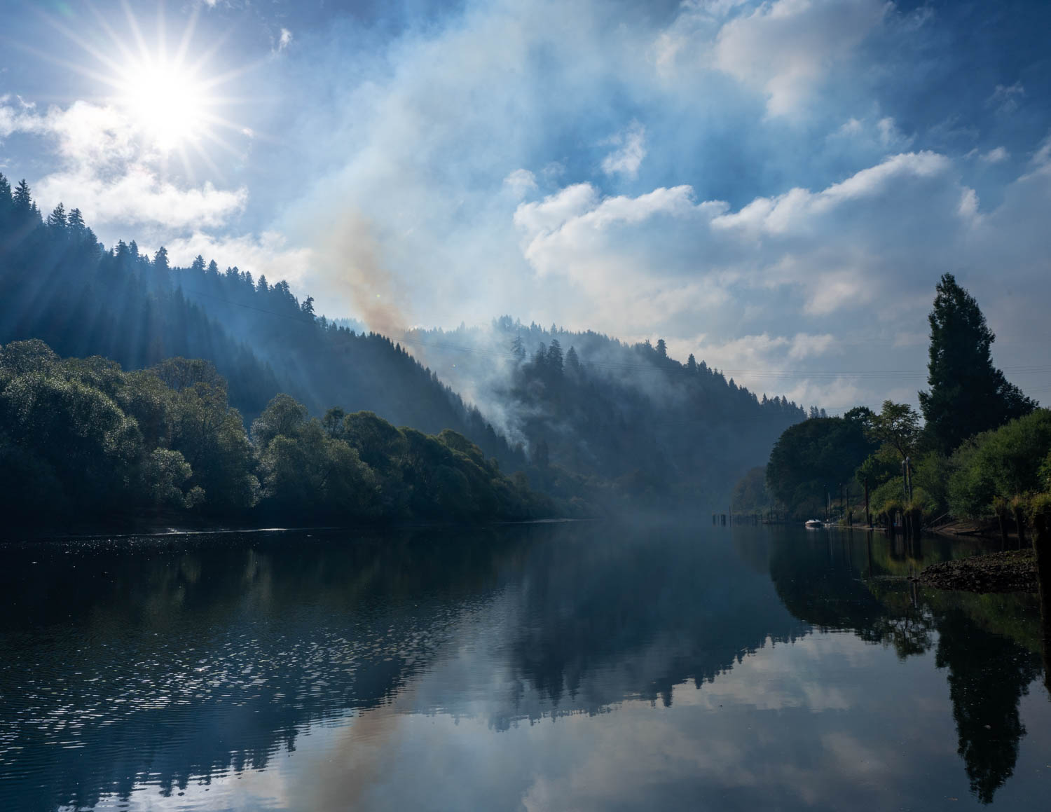
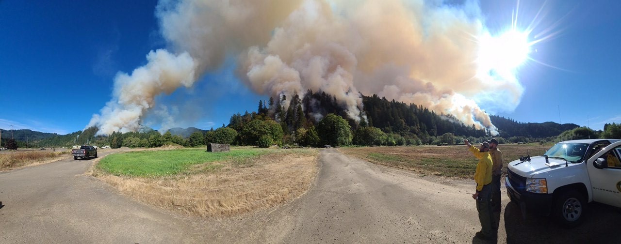
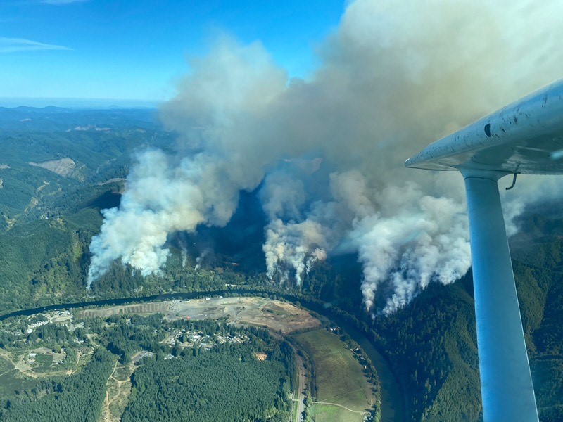
SALEM, ORE. — Governor Kate Brown approved an emergency conflagration declaration for the Beachie Creek, Lionshead, and Holiday Farm Fire. The Beachie Creek and Lionshead fires were active overnight in the Santiam Canyon in eastern Marion County. The Holiday Farm Fire is active in Lane County east of Springfield near McKenzie Bridge.
“Almost every year since becoming Governor, I’ve witnessed historic wildfire seasons,” said Governor Kate Brown. “This past weekend, we experienced significant wind that is fueling wildfires with devastating consequences across Oregon, on top of a dire pandemic. For people and families in the evacuation areas, please listen to local calls to evacuate as needed — these lifesaving measures can protect the lives of you and your loved ones, as well as our firefighters. In addition, I am asking all Oregonians to remain vigilant with any activity that could spark a wildfire during this historic wind event. We all need to do our part to help the many firefighters battling multiple fires across Oregon.”
In accordance with ORS 476.510 – 476.610, Governor Brown determined that a threat to a life, safety, and property exists due to fire, and the threat exceeds the firefighting capabilities of local firefighting personnel and equipment. The Governor’s declaration authorizes the Oregon Office of State Fire Marshal to mobilize resources to assist local resources battling the fire.
# # #
September 8, 2020
Governor’s news release from Sept. 8, 2020, 8:25 p.m.
(Salem, OR) — At 6:35 p.m., Governor Kate Brown approved an emergency conflagration declaration for the Alameda Fire in Jackson County, near the communities of Talent, Phoenix, and Medford. At the time of the declaration, homes and structures in the area were under level 3 mandatory evacuation orders.
“This situation is very dangerous,” said Governor Kate Brown. “Wind continues to fuel these wildfires, with devastating consequences across Oregon. People’s homes, lives and land are at risk. If you are in an evacuation area, please pay close attention and listen to local calls to evacuate as needed — this can save your life, your family and the lives of our firefighters.”
In accordance with ORS 476.510 – 476.610, Governor Brown determined that a threat to a life, safety, and property exists due to fire, and the threat exceeds the firefighting capabilities of local firefighting personnel and equipment. The Governor’s declaration authorizes the Oregon Office of State Fire Marshal to mobilize resources to assist local resources battling the fire.
September 6, 2020

SALEM, Ore. — With a Red Flag Warning in the forecast, state-managed forests in northwest Oregon will be in Extreme Fire Danger as of Monday morning. Campers are encouraged to leave during that time, and visitors should consider delaying their trip until fire danger moderates. Strong winds, high temperatures and dry conditions are predicted early in the week.
Starting Monday, visitors to state-managed forests in northwest Oregon can expect more public use restrictions, such as a ban on off-highway vehicle use, limited or no campfire opportunities, and more forest roads closed to vehicle traffic. This includes the Tillamook, Clatsop and Santiam state forests as well as smaller tracts of state forestland in Polk, Lincoln, Benton, and Columbia counties. Restrictions specific to a particular area can be found on the ODF website at https://www.oregon.gov/odf/fire/pages/restrictions.aspx.
The National Weather Service has issued a Red Flag Warning for northwest Oregon and southwest Washington starting 11 a.m. Monday through 8 p.m. Wednesday, indicating critical fire conditions. The NWS is predicting a strong east wind event starting Monday and continuing through at least Tuesday night. East winds and dry conditions in late summer historically have resulted in some of northwest Oregon’s largest wildfires. If possible, the Oregon Department of Forestry recommends that visitors delay their trip to state forests until these conditions subside, likely later in the week.
Precautions such as these can prevent most wildfires:
- Check current fire restrictions for the area before visiting: Restrictions on activities such as building campfires and riding off-highway vehicles are often in place in cases of extreme fire danger.
- Check your vehicle for dragging tow chains that can send sparks into roadside vegetation.
- Don’t park or idle on dry grass or brush – the hot exhaust system can set it smoldering in seconds.
- Smoke only in an enclosed vehicle. Properly dispose of cigarette butts.
- If you see smoke, call 911.
- Always have fire extinguishing tools on hand.

September 5, 2020
Fire officials with the Douglas Forest Protective Association say that two recent wildfires northwest of Winston that occurred alongside Lookingglass Road are suspicious in nature and may be related. The first fire occurred during the afternoon of Thursday, September 3rd and burned 1/2 acre of wildland fuels while the second fire burned a quarter acre of grass the following day.
DFPA is conducting a joint investigation with the Douglas County Sheriff’s Office and Oregon State Police to identify the responsible party. Anyone with information about either fire is asked to contact either DFPA or DCSO.
September 5, 2020

A helicopter cools a hotspot on the Sweet Creek MP2 fire.
MAPLETON, Ore.—Continued cool, overcast weather across the Sweet Creek Milepost 2 fire has helped crews push containment to 63%. Mop up operations have reached as much as 250 feet into the interior of the burn.
Crews continue using infrared thermal imaging cameras to identify hot spots as they work along the fire’s perimeter. Even with higher humidity and cooler temperatures, heavy fuels will produce smoke within the burn for some time. Rolling debris on the fire’s steep slopes continues to challenge mop up operations and create hazardous driving and working conditions for firefighters. To date, no injuries have been reported on the fire.
Today crews will continue mop up and begin to backhaul equipment from the line that is no longer needed. They will also begin rehabilitating some contingency line that is not needed to control the fire. Rehabilitation means taking corrective actions, such as installing water bars, to help reduce the likelihood of erosion and other impacts. Slowing and diverting water that may flow along fire lines is particularly important in an area that can receive as much as 100 inches of rain annually.
Favorable weather conditions are expected to continue for the next day or two, supporting continued progress across the burn. As containment increases more resources may be released from the fire, but aircraft and heavy equipment remain on standby should they be needed.
Labor Day weekend traffic along Highway 126 through the burn area has been moderate, but officials are still reminding travelers to allow extra time, drive slowly and be cautious of fire traffic. Parking on the highway shoulder is not permitted between mileposts 9 and 14.
Evacuation levels were lowered yesterday for residents impacted by the fire. Hadsall Creek Road is now at Level 2 (Set), Sweet Creek Road is at Level 1 (Ready) and Bernhardt Creek Road and Duncan Island Road are no longer under an evacuation order.
Sweet Creek Road and Hadsall Creek Road remain closed to all public traffic due to the potential for rolling debris and falling trees. The Siuslaw River also remains closed from the Highway 126 Bridge to Tiernan Landing. For more information on evacuations and closures please visit:
September 3, 2020
SALEM, Ore. – Labor Day weekend is a traditional time to head outdoors. The fire prevention organization Keep Oregon Green, the Oregon Department of Forestry, the Oregon State Fire Marshal, and local fire agencies statewide want Oregonians to be aware large fires in Oregon have started during this time, threatening communities and Oregon’s forests.
“The Oregon Department of Forestry and our private forest landowners, federal, tribal and local partners statewide have been working especially hard this summer to quickly catch fire starts, particularly in areas near where people live and work,” said ODF Chief of Fire Protection Doug Grafe. “So far we’ve had good success at keeping most fires small. But high to extreme fire danger continues into September, a time when we often see fire starts because of human activity.”
State Fire Marshal Jim Walker said, “Through the Labor Day weekend, we are expecting warming and drying conditions that create a potential for large and costly fires. We are asking all Oregonians to support their local fire service and all wildland firefighters by taking every precaution to prevent accidental fire starts that could easily escalate to a larger wildfire.”
Oregon’s forests have been overrun with crowds this summer. Some are discovering Oregon instead of traveling out-of-state during a pandemic. Others just want some fresh air and scenery after being cooped up at home with family or roommates.
When established campgrounds are full, people have resorted to camping in dispersed areas with no designated fire pits.
Keep Oregon Green President Kristin Babbs says that hundreds of abandoned campfires have been found still burning or smoldering at dispersed camping sites across the state.
“Campfires pose a major threat of new wildfires this time of year as it only takes one spark landing in dry grass to start a wildfire,” Babbs says.
Regardless of your weekend plans, Babbs says it is important to know the current fire restrictions in effect before leaving home. All public fire restrictions can be found online at https://gisapps.odf.oregon.gov/firerestrictions/PFR.html.
Many private or large landowners may have further restrictions or complete closures in place on their land due to the fire danger. Babbs recommends before you head to the great outdoors that you contact the owner of the land where you plan to recreate for any additional closure information.
# # #

September 2, 2020
Aerial view of the Humbug/280 Road Fire.
Firefighters from Coos Forest Protective Association and partner agencies were able to keep a fire on Humbug Mountain at about 4.6 acres with quick attack work on Tuesday, September 1.
The Humbug/280 Road Fire started Tuesday afternoon in a Bonneville Power Administration right-of-way. Ground resources included CFPA, U.S. Forest Service and local rural fire districts. Air support included two single-engine air tankers, one large airtanker, a Type II helicopter and a Type III helitack platform. The combined effort allowed firefighters to keep it from spreading, and ground crews are making progress in lining and plumbing the fire edge.
“It is critical to take this one out of play considering the weather we have ahead of us this week,” CFPA District Manager Mike Robison said, noting the extreme fire danger conditions in the area.
September 1, 2020
SALEM, Ore. – Oregon will face extremely hot weather for the next few weeks, including the coast. Wildfire managers and the fire-prevention organization Keep Oregon Green are concerned about this forecast. The return of high temperatures, low humidity and east winds can turbocharge even the smallest fire start. A smoldering campfire or an errant spark from a vehicle can become a raging blaze in minutes. And this at a time when firefighting resources are already strained in Oregon and nationally.
The last three weeks have been extremely challenging for wildland and structural firefighters. They have been working long hours in the heat for weeks at a time in an effort to contain the spread of the state’s current wildfires and keep communities safe. Many people across the state have had to evacuate or feared they might have to. And the threat isn’t over.
The threat of dry lightning in Oregon lessens after August. Human activity again becomes the chief cause of fires. So whether this September hot spell spawns new wildfires depends almost entirely on how Oregonians behave in the forest. Keep Oregon Green President Kristin Babbs says taking a few extra precautions while working or recreating in the forest can prevent most wildfires. Make a difference by following a few simple tips:
- Operate ATVs and other motorized vehicles only on established roads.
- Check your vehicle for dragging tow chains that can send sparks into roadside vegetation.
- Don’t park or idle on dry grass or brush – the hot exhaust system can set it smoldering in seconds.
- Check current fire restrictions for the area before building a campfire. Portable cooking stoves using liquefied or bottled fuels are allowed at any time of year. Or simplify your life by bringing prepared foods instead of trying to cook over a smoky fire.
- Smoke only in an enclosed vehicle. Properly dispose of cigarette butts.
- If you see smoke, call 9-1-1.
- Always have fire extinguishing tools on hand
September 1, 2020
Quick Facts
Estimated size: 513
Containment: 0%
Start date: August 30, 2020
Cause: Human
Personnel: 417
Structures threatened: 138
Structures damaged/destroyed: 0
MAPLETON, Ore.—Overnight, firefighters on the Sweet Creek Milepost 2 Fire completed hand line around the perimeter of all burned areas. The fire is now fully lined. They also continued putting in hose lays to bring water to the fire. Fire behavior was moderate, though the fire did grow outside the lines in two small areas. These were quickly controlled and new line has been established around them. The fire, estimated at 513 acres, is burning on private forestland near Mapleton in Lane County, Oregon. It remains 0% contained. ODF Team 1 took command of the fire yesterday at 6 pm.
Speaking at this morning’s briefing, Operations Section Chief Mike Carlson instructed crews, “today’s goals are to hold and continue to secure lines.”
Today crews will continue to secure lines by putting in hose lays to cool hot spots along the perimeter. They will also remain alert to any spots across the lines. Heavy equipment will be used to strengthen lines and open roads for access. Aircraft will make water drops to cool hot spots and be available to quickly address spot fires.
Today marks a change in the weather pattern across Oregon, with building high pressure expected to bring higher temperatures, lower relative humidity, and the potential for gusty winds. These conditions, combined with extremely dry fuels, will test fire lines over the next few days. Steep terrain also increases the likelihood of quick runs should spot fires emerge.
While containment remains 0%, it is expected to increase as crews strengthen existing lines and begin to mop up hot spots inside the fire perimeter.
Evacuations remain in place on Hadsall Creek (Level 3: GO!), Sweet Creek Rd (Level 2: Be Set!) and Bernhardt Creek Rd and Duncan Island Road (Level 1: Be Ready!). For more information on evacuations please visit: https://www.lanecounty.org/news/sweetcreekfires.
The Red Cross is providing accommodations for those affected by the fire. To make emergency arrangements call 888-680-1455.
The health and safety of local residents, visitors and fire crews is a critically important to our mission. Best management practices include proper distancing and minimizing our physical interactions within the community. To maintain these standards, the fire can no longer accept donations of food or other supplies from the community. We appreciate your generosity and understanding.
August 31, 2020
MAPLETON, Ore. – Firefighters today are continuing their fight to slow the spread of a wildfire in private forestland and a portion of BLM land about 1 mile southeast of Mapleton in western Lane County. The fire- estimated this afternoon at more than 500 acres – is in steep terrain on the south side of the Siuslaw River and is burning toward the south away from Mapleton.
Fire crews aided by six bulldozes, five water tenders, an excavator and a processor, are reinforcing control lines this morning that they dug yesterday. They are adding water hoses to the fire lines and working to extend those lines. However, containment remains officially at 0%.
Meanwhile, two helicopters are taking water from the Siuslaw River to drop on the fire. ODF fire officials are asking the pubic to avoid the area downstream from Mapleton in the Hadsall Creek Road section of the Siuslaw River where the helicopters are refilling their buckets. Fire officials are also asking the public to avoid the Hadsall Creek Road and Sweet Creek Road areas because of heavy firefighting traffic.
Lane County Sheriff has eight homes under a Level 3 (Go) evacuation order and 24 homes under a Level 2 (Get Set) evacuation order.
A number of local firefighting agencies have been assisting on the fire, including :
- Mapleton Fire Department
- Siuslaw Valley Fire and Rescue (Note: the Reedsport Volunteer Fire Department covered for SVFR so they could dispatch to the fire)
- Swisshome-Deadwood Rural Fire Protection District
Other agencies aiding in the fire include the Lance County Emergency Management, Lane County Road Department, Lane County Sheriff, Oregon Department of Transportation and USDA Forest Service wildland firefighters from the Siuslaw National Forest.
ODF Incident Management Team One led by Joe Hessel will take command of the fire at 6 p.m. tonight, freeing up local resources to focus again on initial attack on any new fires in coming days.
Cause of the fire is under investigation.
# # #
August 31, 2020
VENETA, Ore. – Oregon Department of Forestry firefighters are engaged this evening on what has been named the Sweet Creek Milepost 2 Fire about a mile from Mapleton in western Lane County. The fire was reported today about 2:30 p.m. as a number of separate fires but is now being managed as one wildfire. At least six aircraft and more than half a dozen fire engines have been attacking the fire since it was reported Sunday afternoon. Two helicopters, two airtankers and two single-engine airtankers were engaged on the fire into early evening. This evening the fire was reported burning uphill and away from Mapleton. It’s size was estimated at about 300 acres.
ODF’s Western Lane District based in Veneta has called for more resources, which will be arriving Monday. Included in that order is ODF’s Incident Management Team 1 led by Incident Commander Joe Hessel. They will take command of the fire tomorrow evening at 6 p.m. The team will oversee active administration of the fire so the local district can continue to focus on initial attack on new fires.
The Lane County Sheriff’s Office has issued Level 3 (Go immediately) evacuation orders for residents of Hadsell Creek Road, and a Level 2 (Get Set – Be ready to leave) evacuation orders for Sweet Creek Road residents. For the latest evacuation information please go to https://www.lanecounty.org/news/sweetcreekfires.
The cause of the fire is under investigation.
As more information is received new updates will be posted on ODF’s wildfire blog at https://odfwildfire.wpengine.com/
# # #
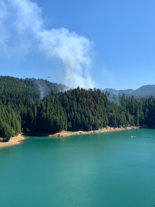
August 30, 2020
SWEET HOME, Ore. – Oregon Department of Forestry firefighters had to enlist boats Saturday, Aug. 29, to reach a wildfire burning on a roadless peninsula in Green Peter Lake northeast of here. The fire, which is estimated at about 15 acres, was reported about 5:30 p.m. yesterday. Multiple engines from ODF’s Sweet Home office responded. Upon reaching the lake they were quickly aided by private boaters who helped them ferry pumps, hoses and other equipment to the peninsula so they could engage on the fire. Boats from the Linn County Sheriff, Linn County Parks and Sweet Home Fire also assisted ODF firefighters in getting to and from the peninsula.
Two helicopters have been engaged since yesterday – one from a private industrial landowner and one on contract with the USDA Forest Service. The helicopters have been dropping water from the lake onto the fire. Just under 40 personnel are working on the fire today (Sunday, Aug. 30). In addition to ODF firefighters a hand crew from the Willamette National Forest, a USDA Forest Service Job Corps hand crew and a couple BLM resource advisors are helping with the fire.
The fire is burning in thickly forested, steep terrain on federal land managed by the Bureau of Land Management’s Northwest Oregon District, Cascades Field Office.
No evacuations are anticipated but the Whitcomb Creek County Park and its boat ramp are closed to the public as it is being used as a staging area for firefighting operations. Boaters are asked to use the Thistle Creek boat ramp instead and to avoid the Quartzville Arm of the lake so as not to interfere with the helicopters as they refill from that part of the lake. Quartzville Drive, also known as the Quartzville Back County Byway, remains opens.
The cause of the fire is under investigation.
# # #
August 28, 2020
SALEM, Ore. — At 6:20 a.m. today, Governor Kate Brown approved an emergency conflagration declaration for the White River Fire in Wasco County. That fire is threatening the community of Pine Grove. At the time of the declaration, 108 residences were under level 3 mandatory evacuation orders, with an additional 192 homes under level 2 and 1.
“This month, firefighting resources have been stretched to deal with 11 large wildfires,” said Governor Kate Brown. “I am asking all Oregonians to remain vigilant with any activity that could spark a wildfire. We all need to do our part to help the many firefighters who are on the frontlines by preventing human-caused wildfires during the COVID-19 pandemic. If you are heading outdoors this weekend, please follow all fire restrictions.”
In accordance with ORS 476.510 – 476.610, Governor Brown determined that a threat to a life, safety, and property exists due to fire, and the threat exceeds the firefighting capabilities of local firefighting personnel and equipment. The Governor’s declaration authorizes the Oregon Office of State Fire Marshal to mobilize resources to assist local resources battling the fire.
# # #

August 27, 2020

New infrared imaging equipment helps firefighters detect hot spots from the air at night.
JOHN DAY, Ore. – When a thunderstorm sparked hundreds of lightning-caused wildfires across eastern Oregon earlier this month, the Oregon Department of Forestry was ready. Just weeks before, the agency had finished equipping its Partenavia single-engine fire-spotting plane with an infrared camera and a night-vision system. Purchased with a grant from forest landowners through their Emergency Fire Cost Committee, the infrared camera’s superior ability to peer beneath smoke and tree canopies allowed ODF observers to pinpoint hot spots where embers or smoldering material might be hiding. And the new night-vision equipment permitted ODF for the first time to safely look for new fire starts at night,. The contrast between fire and cooler evening air temperatures makes night an ideal time to detect fires while they are still small.
The aircraft has flown close to 120 hours with the new equipment so far this summer, conducting detection and wildfire mapping missions in ODF’s three fire protection districts in eastern Oregon and in its Southwest Oregon District. Night flights earlier this week brought the total of previously unreported fire detections into double digits.
“The earlier a fire is detected, the earlier resources can be dispatched to deal with it. In turn, an early response increases the chances for keeping a wildfire small.,” said Neal Laugle, ODF’s Aviation Manager. Laugle, along with ODF Pilot Dan McCarron, helped ensure the equipment was installed in time for peak fire months this year. It’s a big leap from a century ago when the agency first took fire detection to the skies in 1919 using surplus airplanes from World War I.
In addition to finding places where lightning has started a wildfire, observers in the plane have used the equipment to map the 4,348-acre Green Ridge Fire, the 1,257-acre Laurel Fire and the 699-acre Steets Mountain Fire. All three fires are in rugged areas in eastern Oregon.
“Eric Larson and Cole Lindsay have been rotating as observers/sensor operators and they have been pivotal in the success of the program,” according to ODF State Aviation Coordinator Sarah Lathrop. “They bring fire background and GIS experience, which allows the crew to share critical fire size information with host districts, as well as imagery/videos and mapping for larger incidents. This critical information provides decision support to fire managers so they can more safely and effectively suppress wildfires.”
August 25, 2020
LA GRANDE, Ore. – Firefighters throughout the state have been busy following numerous lightning events this month. But battling lightning-caused wildifires isn’t the only headache firefighters are having to contend with. Human-caused fires are also still popping up as people spend their remaining summer days enjoying the outdoors.
“It’s startling how many human-caused fires we’re seeing right now,” Steve Meyer, ODF Protection Supervisor in Baker said. “Firefighting resources are spread pretty thin at this point in the summer. Now is the time we are really asking for cooperation in following the Public Use Restrictions, also known as Regulated Use Closure.”
Fire crews in the Baker Sub-Unit in eastern Oregon responded to a fire on Sunday morning that was clearly left from a gathering the night before.
“There were numerous signs of a get-together left at the scene. As with all our suspicious, human-caused fires, we are investigating this. Ultimately, the responsible parties can be held liable for the cost of the suppression effort if they are caught.” Meyer stated.
As hunting season and Labor Day approach, it is especially important for people to pay attention to restrictions designed to reduce fire risks. The nights may feel cooler, but the fuel conditions indicate that we are still deep in fire season. Many of the measurements that fire managers use to assess the risk of fire are pointing at dry fuels due to drought-like conditions.
Travelers through forestlands should be prepared for emergencies by having the following firefighting equipment with them: one shovel and one gallon of water or one 2 ½ pound or larger fire extinguisher.
Restrictions may vary depending on the land manager or management agency. You can find out the fire danger level wherever you’re headed in Oregon and what restrictions to reduce fire risk are in place by going to ODF’s fire restrictions map at https://gisapps.odf.oregon.gov/firerestrictions/PFR.html
August 20, 2020
SALEM, Ore. – ODF has deployed Incident Management Team 2 led by Chris Cline to manage two fires burning in ODF’s Central Oregon District. The Laurel Fire is 5 miles south of Spray. It’s cause is unknown at this time. The lightning-caused Steet Mountain Fire is 9 miles north of Monument. Both were reported yesterday, Aug. 19.
The Steet Mountain Fire was estimated at 450 acres in timber on ODF-protected land and is reported at 77% contained. The Team will inbrief at 2 p.m. this afternoon. Other ODF fires in the District will likely be added to create a Complex under Team 1 overall management.
The Laurel Fire is burning on Bureau of Land Management land but management of the fire will be coordinated by ODF Team 1 under a cooperative agreement. This morning the Laurel Fire was reported at approximately 1,000 acres actively burning in grass with 0% containment.
ODF IMT 1 has demobilized from the Mosier Creek Fire, which is well along in mop up. That fire is again being managed by ODF’s The Dalles Unit in the Central Oregon District.
August 18, 2020
Size as of IR flight: 985
Containment: 75%
Start date: August 12, 2020
Location: Wasco County
Cause: Under investigation
Personnel: 648
Structures threatened: 291
Structures damaged: 1
Structures destroyed: 36
Evacuations: Level 1 (Ready), Level 2 (Set).
Fire Info Page: https://www.facebook.com/mosiercreekfire2020/
MOSIER, Ore. – Yesterday afternoon ODF Incident Management Team 1, which is now in sole command of the Mosier Creek Fire, sent resources to help with a new fire reported south of Hood River near Odell, about 6 miles west of the Mosier Creek Fire. Five engines, one hand crew and four helicopters (Types 1, 2 and 3) along with a division supervisor were sent. The coordinated attack with local cooperators was a major success, stopping the new fire at 1.6 acres.
Today, firefighters will continue working on mopping-up on the Mosier Creek Fire. The Wasco County Sheriff has lifted Level 3 (Go!) evacuations entirely for this fire. However, the general public should avoid the area burned by the fire unless absolutely necessary as there will be ongoing firefighting traffic.
Some roads are restricted to local access only. Fire-weakened trees and burned roots covered by dust or ash might also still be hot enough to cause harm.
On Wednesday, ODF’s Incident Management Team 1 will transfer command of the Mosier Creek Fire back to The Dalles Unit of ODF’s Central Oregon District. Several local resources will continue to patrol and monitor the fire. People may see occasional smoke from the interior of the fire.
Having completed their structure protection work, the Oregon State Fire Marshal’s IMT and the remaining structural Task Forces demobilized yesterday and returned structure responsibilities to local fire authorities. Their final assessment: 8 residences were destroyed along with 28 other structures.
Across much of Oregon fire danger continues at its highest level. Temperatures well into the 90s and above have left brush, grass and trees parched. Dried leaves are falling, adding to combustible fuels on the ground.
Fire officials urge the public to exercise caution.