September 17, 2020
News Release from Clackamas Co. Sheriff’s Office
Posted on FlashAlert: September 17th, 2020 4:51 PM
UPDATE (Thursday, Sept. 17, 2020, 4 p.m.) — NEW EVACUATION-LEVEL REDUCTIONS
Effective immediately (Thursday, Sept. 17), the Clackamas County Sheriff’s Office — in collaboration with the Riverside Fire Incident Management Team SWA Team 1, Clackamas Fire District #1, Molalla Rural Fire Protection District #73, Colton Rural Fire Protection District #70, the Oregon Department of Forestry, the U.S. Forest Service, the Bureau of Land Management, and the Oregon Department of Transportation — is announcing additional reductions to evacuation levels.
Please refer to the Wildfire Evacuation Zones map to see if your area has been changed:
https://ccgis-mapservice.maps.arcgis.com/apps/webappviewer/index.html?id=fe0525732f1a4f679b75a5ccf1c84b30
Details on level changes:
- All areas west of State Highway 213, as well as additional areas surrounding Oregon City have been returned to “normal” status, with no evacuation level assigned.
- Areas between Molalla and Scotts Mills, and areas northwest of the Unger fire have been reduced to Level 1 “Ready” (green).
- An area northwest of Estacada has been reduced to Level 2 “Set” (yellow).
- Areas encompassing the Dowty Fire, Unger Fire, and Riverside Fire remain at Level 3 “Go” (red).
- The Mt. Hood National Forrest remains under a closure order.
The Sheriff’s Office and the Emergency Operations Center want to caution residents who are returning to their homes to be aware of the following:
- Stay out of Level 3 evacuation areas and respect road closures – Increased traffic in these areas creates additional safety concerns for firefighters and other first responders operating in these areas.
- Monitor your evacuation level area and be “Ready” or “Set” to evacuate if conditions change.
- Be on the lookout for downed powerlines, roadway debris or other hazards.
- Do NOT bring your livestock back to your home at this time.
- Report criminal damage or theft to your home by calling non-emergency dispatch at (503) 655-8211.
- Residents are encouraged to stay inside due to poor air quality. Details: https://www.oregon.gov/deq/aq/Pages/aqi.aspx
- Conserve water usage.
- Refer to Clackamas County’s resource page for additional information: https://www.clackamas.us/wildfires/returning-to-your-home
September 17, 2020
News Release from Oregon Dept. of Forestry
Posted on FlashAlert: September 17th, 2020 3:33 PM
OREGON CITY, Ore. – Personnel assigned to the Clackamas County Fires have been receiving word of individuals requesting or raising funds on social media outlets for Oregon Department of Forestry (ODF) firefighters working on various fires in the area. All wildland firefighter personnel assigned to the Clackamas County Fires (which include those based out of Molalla) are supported by an incident management team that provides food, shelter and necessary supplies for these firefighters.
The public is cautioned to avoid scams on social media from those requesting money supposedly to support firefighters working on the many wildfires in the county. Scammers will use certain geographic or information cues to lure in unsuspecting donors with good intentions.
Due to the complexity of the wildfire situation in Northwest Oregon, individual fires, outposts, and field units supporting assigned firefighter personnel cannot accept donations of food, money, or other supplies, as they do not have the capability to provide distribution of these goods to the firefighters. Instead, citizens should consider supporting their local volunteer fire departments, or donating to the non-profit Wildland Firefighter Foundation.
If folks are looking to help people recover from wildfires, they should consider reaching out to the local Red Cross unit for the impacted area.
All information on how to help in Clackamas County can be found at: https://www.clackamas.us/wildfires/help.
September 17, 2020
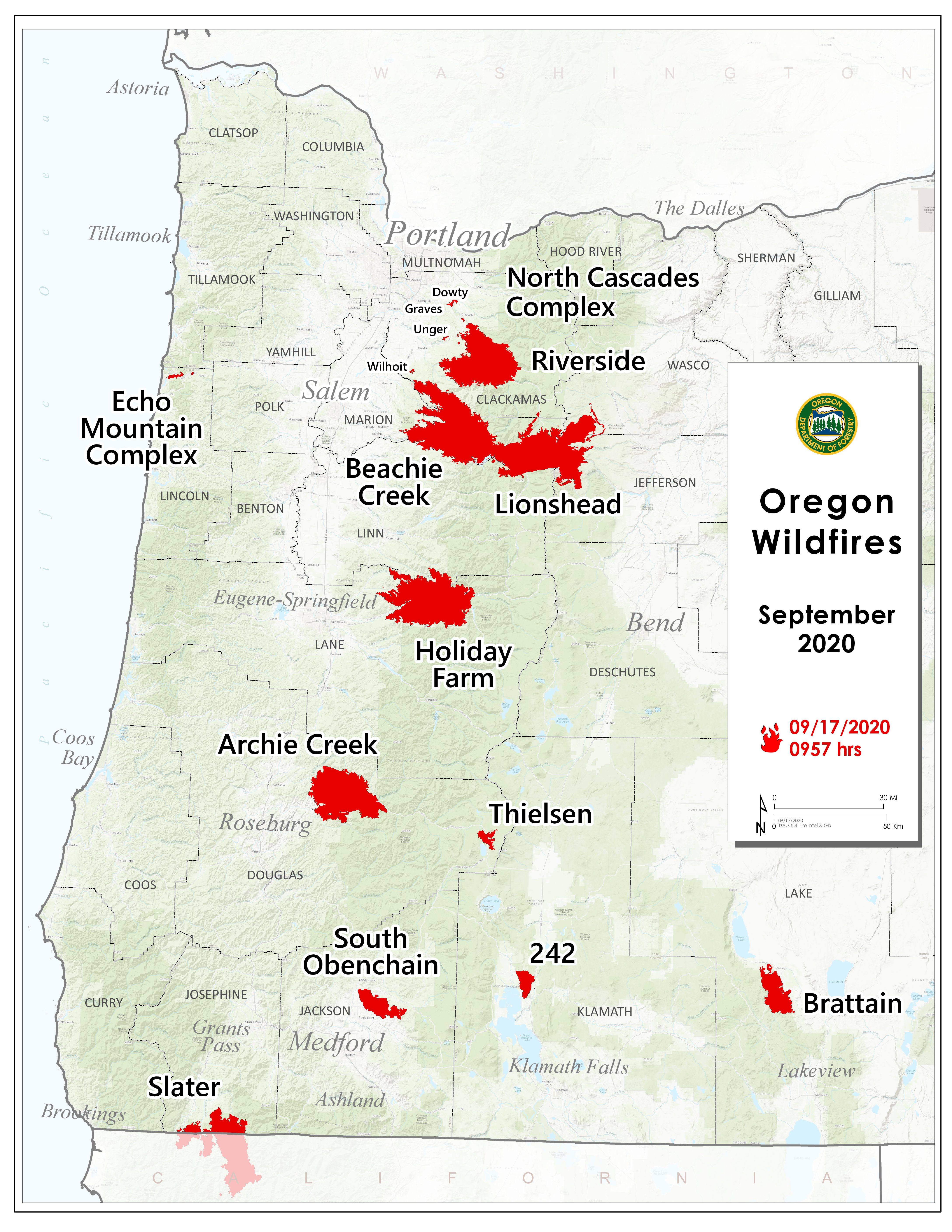
SALEM, Ore. – ODF’s fire map shows location and current size and containment level for 12 large fires currently burning in the state.
September 17, 2020
News release for Sept. 16, 2020 from Oregon Department of Fish and Wildlife
Read and watch the video.
September 17, 2020
SALEM, Ore. – ODF is closely monitoring 12 major fires in Oregon, (see table below for details). Fires are removed from the list when they are 100% lined and fire managers are confident in their progress toward containment. There are about 6,500 personnel assigned to these fires from across the nation and Canada. This doesn’t include the many government emergency response employees, landowners, forestland operators, and members of the community who are contributing to the fight in whatever way they can. About 1 million acres have burned in Oregon since the start of this year, which is nearly double the 10-year average of approximately 557,811.
| Fire name |
Acres burned (est.) |
Containment |
Location |
| Beachie Creek |
191,138 |
20% |
15 miles N of Detroit |
| Lionshead |
189,316 |
10% |
20 miles W of Warm Springs |
| Holiday Farm |
170,637 |
8% |
3 miles W of McKenzie Bridge |
| Riverside |
135,956 |
3% |
2 miles SE of Estacada |
| Archie Creek |
128,020 |
20% |
20 miles E of Glide |
| Brattain |
44,800 |
20% |
8 miles S of Paisley |
| Slater |
38,721 in Oregon |
10% |
SE of Cave Junction (also in No. California) |
| S. Obenchain |
32,814 |
25% |
5 miles E of Eagle Point |
| Two Four Two |
14,473 |
29% |
W/NW of Chiloquin |
| Thielsen |
8,645 |
1% |
E of Diamond Lake |
| Echo Mtn. Complex |
2,552 |
45% |
4 miles NE of Lincoln City |
| North Cascade Complex |
2,315 |
– |
Multiple locations in ODF’s North Cascade District |
Please note: The acres burned estimates above are based very limited information available. These numbers will change over the next several days, in some cases significantly. We will be taking every opportunity to map these fires. Fire maps are an important tool for both ongoing response operations and keeping people informed.
More information
September 17, 2020
News Release for Sept. 16, 2020 from FEMA Region 10
SALEM, Ore. – State and federal officials are encouraging Oregon residents affected by the wildfires and straight-line winds, which began on Sept. 7 and are continuing, to register for disaster assistance with FEMA as soon as possible.
FEMA’s Individual Assistance program for survivors has been made available in Clackamas, Douglas, Jackson, Klamath, Lane, Lincoln, Linn, and Marion counties.
Disaster assistance may include grants for temporary housing and home repairs, low-cost loans to cover uninsured property losses, and other programs to help individuals and business owners recover from the effects of the disaster.
If you have phone or Internet access, you may register by:
- Going online at DisasterAssistance.gov
- Downloading the FEMA app
- Calling 1-800-621-3362 (FEMA) or TTY 1-800-462-7585 for people with speech and hearing disabilities. If you use 711-Relay or Video Relay Services (VRS), call 1-800-621-3362. The toll-free telephone lines operate from 7 a.m. to 10 p.m. PDT, seven days a week.
- Going to DisasterAssistance.gov or via web-enabled phone or tablet at m.fema.gov.
Low-interest disaster loans from the U.S. Small Business Administration are available to homeowners, renters, and businesses. Call the SBA at 1-800-659-2955 or visit www.sba.gov/services/disasterassistance.
Public assistance for emergency work and the repair or replacement of disaster-damaged facilities has been made available to 20 counties (Benton, Clackamas, Columbia, Coos, Deschutes, Douglas, Jackson, Jefferson, Josephine, Klamath, Lake, Lane, Lincoln, Linn, Marion, Multnomah, Tillamook, Wasco, Washington, and Yamhill counties). All areas statewide are eligible to apply for Hazard Mitigation assistance.
September 16, 2020
News Release from Clackamas Co. Sheriff’s Office
Posted on FlashAlert: September 16th, 2020 1:25 PM
UPDATE (Wednesday, Sept. 16, 2020, 1 p.m.) — NEW EVACUATION LEVEL REDUCTIONS
Effective immediately (Wednesday, Sept. 16), the Clackamas County Sheriff’s Office — in collaboration with the Riverside Fire Incident Management Team SWA Team 1, the Office of the Oregon State Fire Marshal, the Oregon Department of Forestry, the U.S. Forest Service, the Bureau of Land Management, and the Oregon Department of Transportation — is announcing additional reductions to evacuation levels in many areas of the county.
Please refer to the Wildfire Evacuation Zones map to see if your area has been changed:
https://ccgis-mapservice.maps.arcgis.com/apps/webappviewer/index.html?id=fe0525732f1a4f679b75a5ccf1c84b30
Details on changes:
- The cities of Oregon City, Canby, and Sandy have been returned to “normal” status, with no evacuation level assigned.
- The city of Molalla is now at Level 1 “Ready” (green).
- The city of Estacada is now at Level 2 “Set” (yellow).
- Areas encompassing the Dowty Fire, Unger Fire, and Riverside Fire remain at Level 3 “Go” (red).
- The Mt. Hood National Forrest remains under a closure order.
The Sheriff’s Office and the Emergency Operations Center also want to caution residents who are returning to their homes to be aware of the following:
- Stay out of Level 3 evacuation areas and respect road closures – Increased traffic in these areas creates additional safety concerns for firefighters and other first responders operating in these areas.
- Monitor your evacuation level area and be “Ready” or “Set” to evacuate if conditions change.
- Be on the lookout for downed powerlines, roadway debris or other hazards.
- Do NOT bring your livestock back to your home at this time.
- Report criminal damage or theft to your home by calling non-emergency dispatch at 503-655-8211.
- Residents are encouraged to stay inside due to poor air quality: https://www.oregon.gov/deq/aq/Pages/aqi.aspx
- Conserve water usage.
- Refer to the Clackamas County EOC resource page for additional information: https://www.clackamas.us/wildfires/returning-to-your-home
September 16, 2020
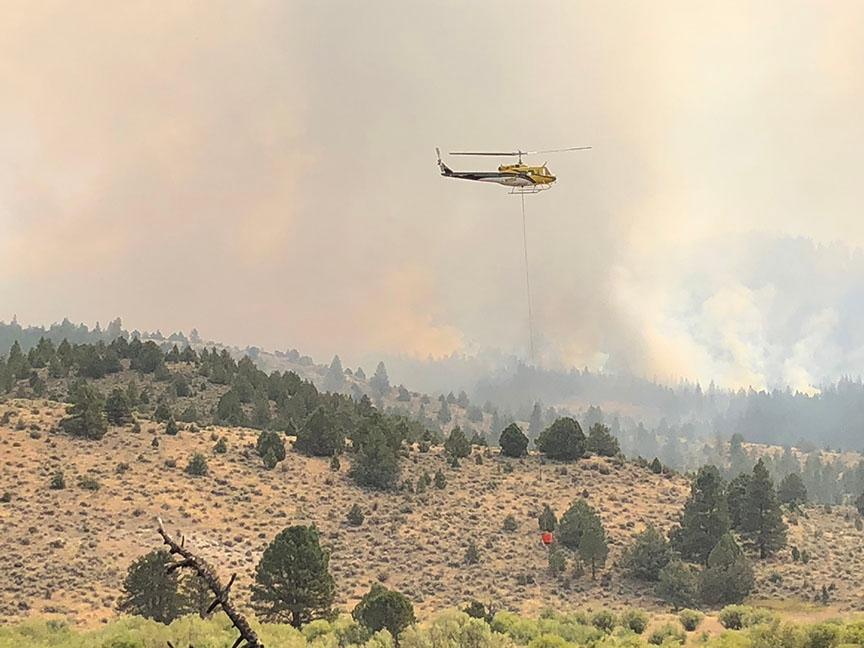
SALEM, Ore. – Oregon fire officials are expecting that as visibility improves, a large number of helicopters and planes will soon take flight and start engaging on the many wildfires in the state. They are appealing to drone enthusiasts to not fly their equipment while skies over Oregon are so busy.
“We’re looking to Oregonians statewide to help us make the most of these resources and ensure our people stay safe by keeping their personal drones on the ground. If you fly, we can’t,” said ODF’s Chief of Fire Protection Doug Grafe.
Grafe said two key ways firefighters use aviation assets is to actively fight fires using water and retardant drops and to provide an aerial view of the fires, especially hidden hot spots that need extinguishing.
“That aerial view informs our operational decisions and helps us provide accurate information about fire perimeters and activities to the public,” Grafe said.
State Fire Marshal Mariana Ruiz-Temple said:, “We appreciate the cooperation from drone hobbyists. By keeping their drones on the ground for the time being, we’ll be able to get our helicopters and planes safely in the air fighting fires.”
Poor visibility over the state from the heavy smoke has prevented firefighting aircraft from fully engaging on wildfires. With forecasts calling for clearer skies in coming days, fire officials say the public should expect to see many more planes and helicopters in and around wildfires, sources of water and airstrips.
# # #

September 16, 2020
SALEM, Ore – ODF is closely monitoring 12 major fires in Oregon. (see table below for details). Fires are removed from the list when they are 100% lined and fire managers are confident in their progress toward containment. There are more than 6,000 personnel assigned to these fires from across the nation and Canada. This doesn’t include the many of the government emergency response employees, landowners, forestland operators, and members of the community who are contributing to the fight in whatever way they can. About 1 million acres have burned in Oregon since the start of this year, which is nearly double the 10-year average of approximately 557,811.
| Fire name |
Acres burned (estimated) |
Containment |
Location |
| Beachie Creek |
190,911 |
20% |
15 miles N of Detroit |
| Lionshead |
183,744 |
10% |
20 miles W of Warm Springs |
| Holiday Farm |
167,422 |
8% |
3 miles W of McKenzie Bridge |
| Riverside |
135,956 |
3% |
2 miles SE of Estacada |
| Archie Creek |
125,498 |
20% |
20 miles E of Glide |
| Brattain |
34,155 |
15% |
8 miles S of Paisley |
| S. Obenchain |
32,513 |
25% |
5 miles E of Eagle Point |
| Slater |
30,998 in Oregon |
10% |
SE of Cave Junction (also in No. California) |
| Two Four Two |
14,536 |
21% |
W/NW of Chiloquin |
| Thielsen |
7,778 |
1% |
E of Diamond Lake |
| Echo Mtn. Complex |
2,552 |
40% |
4 miles NE of Lincoln City |
| North Cascade Complex |
2,315 |
– |
Multiple locations in ODF’s North Cascade District |
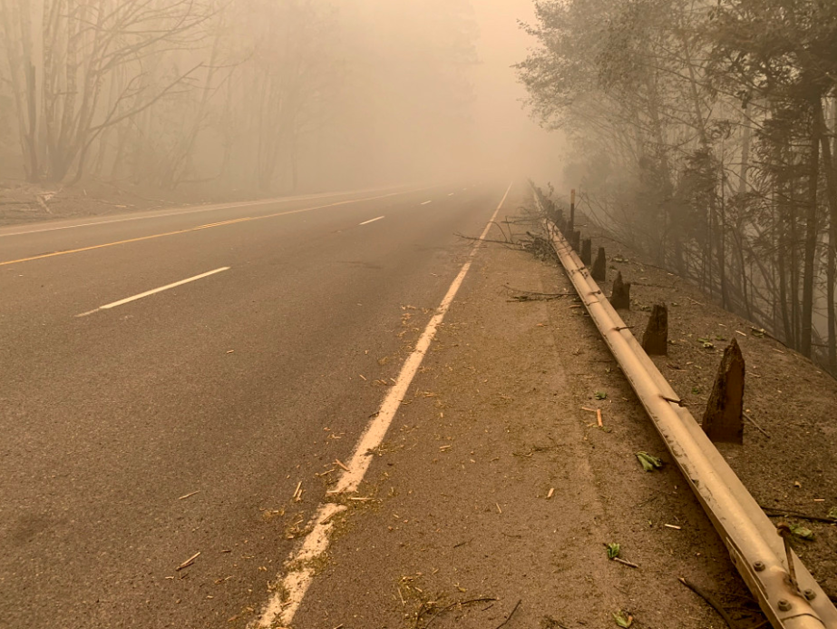
September 16, 2020

Fire damage on OR22 near Gates – Photo courtesy of ODOT
News release from ODOT – Sept. 16, 2020
Contact: Katherine Benenati, 503-871-0388
SALEM – Even with wildfires still burning, ODOT crews around the state have begun assessing damage on hundreds of miles of road, removing thousands of trees damaged by fire, and inspecting culverts, bridges, guardrail and pavement.
The work will continue location by location as conditions allow, but it will be some time before roads reopen – partially or fully – to traffic. Even when roads do reopen, ODOT crews will continue monitoring for hazards including landslides or loose rock in areas where wildfires have scarred the landscape.
New webpage shows recovery progress
A new webpage will track this progress showing information on what we’ve done and still need to do to reopen closed roads. The webpage also provides information on road and office closures, links to news releases, photos, videos and more.
“This is such a dynamic and constantly changing situation, we have to make sure these roads are cleared,” said Luci Moore, ODOT State Maintenance and Operations Engineer. “There are many concerns that we will address. It is likely to be some time before these roads open to full or even partial travel. Each will be determined individually based on the damages.”
Recovery work underway
ODOT has started removing hazard trees on OR 138 E, OR 126 McKenzie Highway and Oregon 22 North Santiam Highway. While ODOT is still assessing how many trees it will need to remove, estimates put the number of hazard trees along the OR 22 corridor alone in the hundreds of thousands.
Roads will remain closed until ODOT can remove debris from affected areas, inspect slopes for weakness, inspect bridges, pavement, culverts, signs, guardrail and other structures for damage, and make repairs. Rock scaling — to bring down materials that threaten roads — will be used where needed.
Even after roads are fully reopened, heavy rain will be a concern in fire-stricken areas and ODOT may have further work to do to stabilize hillsides or clear debris from falls. Slides and debris flows are a particular concern — especially after rains — in areas where fire stripped away vegetation, tree roots and underbrush, creating greater slide danger.
Know before you go
Partial openings that allow limited traffic while work continues will be common. Drivers can expect to see flaggers or pilot cars and should plan for frequent lane closures.
Drivers should check www.TripCheck.com for updates on closures.
For pictures of road damage around the state: https://www.flickr.com/photos/oregondot/albums/72157715891016418
For videos explaining the recovery challenges faced by ODOT crews: https://www.youtube.com/user/OregonDOT
September 15, 2020
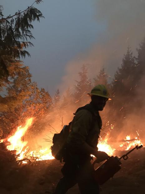
Firefighters continued to work in the Little River area with heavy machinery, engines and crews, working to construct and hold containment lines. Structure protection resources remain in place along Little River Road. On the far eastern portion of the fire, crews are allowing the fire to slowly back down the hillside to Panther Creek where roads have been prepped to hold the fire. Heading north from Highway 138E, firefighters are scouting and constructing both primary and secondary containment lines from the Canton Creek area into the Upper Rock Creek area. Containment lines from South Calapooya Creek down to Glide continue to hold with no reported issues.
Suppression efforts on the Archie Creek Fire were boosted today by an additional 125 personnel from the Oregon National Guard. These soldiers are being used to hold containment lines around the perimeter of the fire and mop-up hot spots near structures. Total personnel assigned to the incident is now 773 people.
Air resources were grounded again today due to safety concerns presented by the thick smoke. Four helicopters and two Single Engine Air Tankers remain available in the area for use when the smoke clears.
Highway 138E remains closed to all non-fire traffic from Milepost 21 through Milepost 83. Crews from the Oregon Department of Transportation, Douglas County Public Works Department, Pacific Power and their contractors continue to work along Highway 138E, Rock Creek Road and other county maintained roads within the footprint of the Archie Creek Fire.
The Archie Creek Fire has burned 125,498 acres and is 20% contained. The breakdown of acres by ownership include:
- 62,623 acres of Private lands
- 38,536 acres of BLM lands
- 24,300 acres of USFS lands
- 39 acres of State of Oregon lands
InciWeb: https://inciweb.nwcg.gov/incident/7176/
September 15, 2020
MOLALLA, Ore. – With the very large Riverside and Beachie Creek fires in ODF’s North Cascade District drawing lots of media attention in northwest Oregon, a few other fires in Clackamas County have received far less attention. Four fires are being managed as the North Cascade Complex. About 185 firefighters are working on the fires. Here’s today’s update on these fires:
· Dowty – 1,452 acres, 30% lined. Construction of fire line is continuing, with mop up underway and felling of hazardous snags.
· Wilhoit – 591 acres, 100% lined. Firefighters have mopped up from the fire line 50 feet into the fire’s interior with the goal of reaching 250 feet. They have also been felling trees made hazardous by the fire.
· Unger – 489 acres, 100% lined. Mop up has been completed at least 50 feet into the interior with the goal of reaching 250 feet. Fire personnel are also cutting down fire-damaged trees that pose a hazard.
· Graves – 44 acres, 100% lined. Mop up is continuing, moving from 50 feet inside the fire lines inward, with the goal of mopping up to 250 feet. Felling of hazardous trees is happening on this fire as well.
September 15, 2020
News Release from Oregon State Fire Marshal
Posted on FlashAlert: September 15th, 2020 10:27 AM
Gov. Kate Brown has declared a Conflagration to address changing conditions as the Brattain Fire threatens Paisley, in Lake County.
The Brattain Fire in Lake County is currently threatening lives, structures and property as it moves closer to Paisley. Forecasters yesterday had issued a Red Flag Warning for strong, gusty winds and low relative humidity.
The Office of State Marshal mobilized three task forces, who are at the incident today. Two task forces were sent from Oregon structural fire agencies and one task force was deployed from Idaho, following the state’s request for out-of-state resources through the state’s Emergency Management Assistance Compact (EMAC). Those resources joined existing local, state and federal resources currently at the incident.
Prior to last night’s declaration, Gov. Brown had made a statewide Conflagration Act declaration, and Oregon structural fire service resources from more than 100 agencies have been mobilized to 11 conflagrations statewide in a week.
For the past two days, weather systems have allowed some crews in Oregon’s fire service to begin pulling off of current deployments, while additional resources have arrived and are being mobilized from Utah, North Dakota, Minnesota, Washington and Idaho.
Calls for assistance from impacted fire districts continue to be managed through the Oregon Fire Mutual Aid System.
Additional updates for the incident may be accessed on the Oregon State Fire Marshal Facebook page: www.facebook.com/OregonStateFireMarshal/.
To learn more about wildfire evacuation readiness go to: www.oregon.gov/osp/programs/sfm/Pages/Wildland-Urban-Interface.aspx#evacuation.
September 14, 2020
News Release from Clackamas Co. Sheriff’s Office
Posted on FlashAlert: September 14th, 2020 2:34 PM
Update for Sept. 14, 2020, 2 p.m. — EVACUATION LEVELS REDUCED IN SOME AREAS
Effective immediately (Monday, Sept. 14), the Clackamas County Sheriff’s Office, in collaboration with the Riverside Fire Incident Management Team SWA Team 1, the Office of the Oregon State Fire Marshal, the Oregon Department of Forestry, the U.S. Forest Service, the Bureau of Land Management, and the Oregon Department of Transportation, is announcing additional reductions to evacuation levels in some areas.
Please refer to the Wildfire Evacuation Zones map for specific areas included:
https://ccgis-mapservice.maps.arcgis.com/apps/webappviewer/index.html?id=fe0525732f1a4f679b75a5ccf1c84b30
Details:
Level 2 “Set” (Yellow) to Level 1 “Ready” (Green):
- An area south of the cities of Oregon City and Canby, encompassing some portions of the Mulino and Monitor areas.
Level 3 “Go” (Red) to Level 2 “Set” (Yellow):
- An area east of Oregon City encompassing some portions of the Redland, Beavercreek and Highland areas.
- An area south of the city of Sandy, encompassing some portions of the Eagle Creek, Firwood, and Wildcat Mountain areas.
The Sheriff’s Office and the Emergency Operations Center want to caution returning residents to be aware of the following:
- Monitor your evacuation level area be “Ready” or “Set” to evacuate if conditions change.
- Be on the lookout for downed powerlines or other hazards.
- Do NOT bring your livestock back to your home at this time.
- Stay inside as much as possible during this period of poor air quality.
Air quality remains extremely poor due to wildfire smoke. Residents are encouraged to stay inside. Keep an eye on https://www.oregon.gov/deq/aq/Pages/aqi.aspx and other resources below for air-quality updates.
[END UPDATE]
EARLIER (Sept. 13, 2020, 7:05 p.m.) — CITY OF MOLALLA EVACUATION LEVEL REDUCED TO LEVEL 2
Effective immediately (Sunday, Sept. 13), the Clackamas County Sheriff’s Office is reducing the evacuation level from Level 3 (Red) to Level 2 (Yellow) for the City of Molalla and some areas north and southwest of Molalla.
Please refer to the Wildfire Evacuation Zones map for specific areas included.
This change in the evacuation level allows the residents of Molalla to return home. The Sheriff’s Office and the Emergency Operations Center want to caution returning residents to be aware of the following:
- You are still at a Level 2 evacuation. “Be Set” to evacuate if conditions change.
- Be on the lookout for downed powerlines or other hazards.
- Do NOT bring your livestock back to your home at this time.
- Keep bags packed and be ready to leave (Level 2, “Be Set”)
- Stay inside as much as possible during this period of poor air quality.
The Sheriff’s Office made the decision in collaboration with the Riverside Fire Incident Management Team SWA Team 1, the Office of the Oregon State Fire Marshal, the Oregon Department of Forestry, the U.S. Forest Service, the Bureau of Land Management, and the Oregon Department of Transportation.
Air quality remains extremely poor due to wildfire smoke. Residents are encouraged to stay inside. Keep an eye on https://www.oregon.gov/deq/aq/Pages/aqi.aspx and other resources below for air-quality updates.
[END UPDATE]
EARLIER (Sept. 13, 2020, 12:43 p.m.) — #CLACKAMASWILDFIRES UPDATE: URBAN AREAS REMOVED FROM LEVEL 1; INCLUDES WILSONVILLE, LAKE OSWEGO, WEST LINN, CLACKAMAS, HAPPY VALLEY, GLADSTONE, MILWAUKIE, TUALATIN
Effective immediately (Sunday, Sept. 13), the Clackamas County Sheriff’s Office is dropping the evacuation level from Level 1 to Normal for Wilsonville, Lake Oswego, West Linn, Clackamas, Happy Valley, Gladstone, Tualatin, Milwaukie, and some areas near Boring and Damascus.
The newly revised fire-evacuation map is here:
https://ccgis-mapservice.maps.arcgis.com/apps/webappviewer/index.html?id=fe0525732f1a4f679b75a5ccf1c84b30
IMPORTANT: There are NO reductions in Level 3 (“Go”) or Level 2 (“Set”) areas at this time.
The Sheriff’s Office made the decision in collaboration with the Riverside Fire Incident Management Team SWA Team 1, Office of the Oregon State Fire Marshal, Oregon Department of Forestry, the U.S. Forest Service, the Bureau of Land Management, and the Oregon Department of Transportation.
Air quality remains extremely poor due to wildfire smoke. Residents are encouraged to stay inside. Keep an eye on https://www.oregon.gov/deq/aq/Pages/aqi.aspx and other resources below for air-quality updates.
#ClackamasWildfires RESOURCE LINKS FOR CLACKAMAS COUNTY:
Official updates on the Riverside Fire:
https://inciweb.nwcg.gov/incident/7174/
Hotline: 541-638-0668
Clackamas County wildfire updates:
https://www.clackamas.us/wildfires
Hotline: 503-655-8224
Clackamas County wildfire evacuation map:
https://ccgis-mapservice.maps.arcgis.com/apps/webappviewer/index.html?id=fe0525732f1a4f679b75a5ccf1c84b30
Clackamas County Disaster Management encourages people to sign up for PublicAlerts — it allows county residents to opt-in to receive critical wildfire emergency messaging via email, phone call, and text. Sign up now at https://www.clackamas.us/dm/publicalerts
Wildfire resource from the State of Oregon — including a Fires & Hotspots Map, Air Quality Index info, a list of experts to follow, and more:
https://wildfire.oregon.gov
Air quality updates:
Curfew information from the Clackamas County Commissioners:
https://www.clackamas.us/news/2020-09-11/clackamas-county-establishes-curfew-during-wildfire-crisis-the-curfew-is-effective-immediately-between-10-pm-and-6-am
PublicAlerts “Wildfire 2020” resource page:
https://www.publicalerts.org/Hazards/Wildfire-2020
INFORMATION ON FIRE EVACUATION LEVELS:
Level 1: BE READY for potential evacuation. You should be aware of the danger that exists in the area, monitor emergency services websites and local media outlets for information. This is the time for preparation and precautionary movements of persons with special needs, mobile property and (under certain circumstances) pets and livestock. If conditions worsen, emergency services personnel may contact you via an emergency notification system.
Level 2: BE SET to evacuate. You must prepare to leave at a moment’s notice. This level indicates there is significant danger to your area, and residents should either voluntary relocate to a shelter or with family and friends outside of the affected area, or if choosing to remain, to be ready to evacuate at a moment’s notice. Residents MAY have time to gather necessary items, but doing so is at their own risk. This may be the only notice you receive. Emergency services cannot guarantee that they will be able to notify you if conditions rapidly deteriorate. Area media services will be asked to broadcast periodic updates.
Level 3: GO! Evacuate now! Leave immediately! Danger to your area is current or imminent, and you should evacuate immediately. If you choose to ignore this advisement, you must understand that emergency services may not be available to assist you further. DO NOT delay leaving to gather any belongings or make efforts to protect your home. This will be the last notice you receive.
September 14, 2020
News Release from Marion Co. Sheriff’s Office
Posted on FlashAlert: September 14th, 2020 2:43 PM
Important Evacuation Information *Reduction of Levels*
Current evacuation information for Marion County:
LEVEL 3 “GO”
- Detroit
- Idanha
- Breitenbush
- Lyons
- Mehama
- Mill City
- Gates
- North Fork Rd recreation area
LEVEL 2 “BE READY”
- Scott’s Mills
- Crooked Finger Rd and Moss Lane
LEVEL 1 “GET READY”
- Areas east of Meridian Rd, Davis Creek and Victor Point
To see current Marion County Evacuation Zones please visit: http://bit.ly/MCEvacZones
September 13, 2020
Update for Sept. 13, 2020, 7:05 p.m. from Clackamas County Sheriff’s Office
CITY OF MOLALLA EVACUATION LEVEL REDUCED TO LEVEL 2
Effective immediately (Sunday, Sept. 13), the Clackamas County Sheriff’s Office is reducing the evacuation level from Level 3 (Red) to Level 2 (Yellow) for the City of Molalla and some areas north and southwest of Molalla.
Please refer to the Wildfire Evacuation Zones map for specific areas included.
This change in the evacuation level allows the residents of Molalla to return home. The Sheriff’s Office and the Emergency Operations Center want to caution returning residents to be aware of the following:
- You are still at a Level 2 evacuation. “Be Set” to evacuate if conditions change.
- Be on the lookout for downed powerlines or other hazards.
- Do NOT bring your livestock back to your home at this time.
- Keep bags packed and be ready to leave (Level 2, “Be Set”)
- Stay inside as much as possible during this period of poor air quality.
The Sheriff’s Office made the decision in collaboration with the Riverside Fire Incident Management Team SWA Team 1, the Office of the Oregon State Fire Marshal, the Oregon Department of Forestry, the U.S. Forest Service, the Bureau of Land Management, and the Oregon Department of Transportation.
Air quality remains extremely poor due to wildfire smoke. Residents are encouraged to stay inside. Keep an eye on https://www.oregon.gov/deq/aq/Pages/aqi.aspx and other resources below for air-quality updates.
[END UPDATE]
EARLIER (Sept. 13, 2020, 12:43 p.m.) — #CLACKAMASWILDFIRES UPDATE: URBAN AREAS REMOVED FROM LEVEL 1; INCLUDES WILSONVILLE, LAKE OSWEGO, WEST LINN, CLACKAMAS, HAPPY VALLEY, GLADSTONE, MILWAUKIE, TUALATIN
Effective immediately (Sunday, Sept. 13), the Clackamas County Sheriff’s Office is dropping the evacuation level from Level 1 to Normal for Wilsonville, Lake Oswego, West Linn, Clackamas, Happy Valley, Gladstone, Tualatin, Milwaukie, and some areas near Boring and Damascus.
The newly revised fire-evacuation map is here:
https://ccgis-mapservice.maps.arcgis.com/apps/webappviewer/index.html?id=fe0525732f1a4f679b75a5ccf1c84b30
IMPORTANT: There are NO reductions in Level 3 (“Go”) or Level 2 (“Set”) areas at this time.
The Sheriff’s Office made the decision in collaboration with the Riverside Fire Incident Management Team SWA Team 1, Office of the Oregon State Fire Marshal, Oregon Department of Forestry, the U.S. Forest Service, the Bureau of Land Management, and the Oregon Department of Transportation.
Air quality remains extremely poor due to wildfire smoke. Residents are encouraged to stay inside. Keep an eye on https://www.oregon.gov/deq/aq/Pages/aqi.aspx and other resources below for air-quality updates.
#ClackamasWildfires RESOURCE LINKS FOR CLACKAMAS COUNTY:
Official updates on the Riverside Fire:
https://inciweb.nwcg.gov/incident/7174/
Hotline: 541-638-0668
Clackamas County wildfire updates:
https://www.clackamas.us/wildfires
Hotline: 503-655-8224
Clackamas County wildfire evacuation map:
https://ccgis-mapservice.maps.arcgis.com/apps/webappviewer/index.html?id=fe0525732f1a4f679b75a5ccf1c84b30
Clackamas County Disaster Management encourages people to sign up for PublicAlerts — it allows county residents to opt-in to receive critical wildfire emergency messaging via email, phone call, and text. Sign up now at https://www.clackamas.us/dm/publicalerts
Wildfire resource from the State of Oregon — including a Fires & Hotspots Map, Air Quality Index info, a list of experts to follow, and more:
https://wildfire.oregon.gov
Air quality updates:
Curfew information from the Clackamas County Commissioners:
https://www.clackamas.us/news/2020-09-11/clackamas-county-establishes-curfew-during-wildfire-crisis-the-curfew-is-effective-immediately-between-10-pm-and-6-am
PublicAlerts “Wildfire 2020” resource page:
https://www.publicalerts.org/Hazards/Wildfire-2020
INFORMATION ON FIRE EVACUATION LEVELS:
Level 1: BE READY for potential evacuation. You should be aware of the danger that exists in the area, monitor emergency services websites and local media outlets for information. This is the time for preparation and precautionary movements of persons with special needs, mobile property and (under certain circumstances) pets and livestock. If conditions worsen, emergency services personnel may contact you via an emergency notification system.
Level 2: BE SET to evacuate. You must prepare to leave at a moment’s notice. This level indicates there is significant danger to your area, and residents should either voluntary relocate to a shelter or with family and friends outside of the affected area, or if choosing to remain, to be ready to evacuate at a moment’s notice. Residents MAY have time to gather necessary items, but doing so is at their own risk. This may be the only notice you receive. Emergency services cannot guarantee that they will be able to notify you if conditions rapidly deteriorate. Area media services will be asked to broadcast periodic updates.
Level 3: GO! Evacuate now! Leave immediately! Danger to your area is current or imminent, and you should evacuate immediately. If you choose to ignore this advisement, you must understand that emergency services may not be available to assist you further. DO NOT delay leaving to gather any belongings or make efforts to protect your home. This will be the last notice you receive.
September 13, 2020
Update for Sept. 13, 2020, 3:30 p.m. from Marion County Sheriff’s Office
** Marion County Sheriff’s Office IMPORTANT Evacuation update **
As of 3:30 PM on September 13, 2020 the Marion County Sheriff’s Office is reducing the evacuation levels for the City of Scotts Mills and surrounding areas in Marion County. The reduction from level 3 to level 2 is being made following close consultation with Beachie Creek Fire management officials. Below are the following updated evacuation levels.
Current evacuation information for Marion County
LEVEL 3 “GO”
- Detroit
- Idanha
- Breitenbush
- Lyons
- Mehama
- Mill City
- Gates
- North Fork Rd recreation area
- Grade Road and Bridgecreek Road east of the Level 2 line
- Crooked Finger Road east of the level 2 line
LEVEL 2 “BE READY”
- Areas east of Meridian Rd, Davis Creek and Victor Point
- Scotts Mills
LEVEL 1 “GET READY”
- Stayton
- Sublimity
- Aumsville
- Silverton
- Mt. Angel
- Meridian Rd South to Cascade Hwy
- West of Davis Creek
- West of Victor Point south to the County line
To see current Marion County Evacuation Zones please visit: http://bit.ly/MCEvacZones
September 12, 2020
Updated Sept. 12, 2020, 2:30 p.m.
All ODF-managed lands are closed for public use. Public use closures of the Tillamook and Clatsop state forests, along with ODF-managed lands in Benton, Lincoln & Polk counties, have been extended past Sunday, Sept. 13, and remain closed until re-openings are announced publicly. All other ODF-managed lands remain closed until further notice.
September 10, 2020
(via Oregon Health Authority) During Oregon’s wildfires and safety evacuations, it is important to take precautions to avoid spreading COVID-19, particularly for those in isolation or quarantine due to a positive diagnosis or exposure to the virus.
The first priority in wildfire situations is responding to the evacuation and safety instructions of local and state fire officials – and heeding their warnings. Regardless of disease status, if you are asked or ordered to evacuate, you should do so.
If you or a household member are quarantining or isolating to prevent the spread of COVID-19, please take the following precautions:
- If ordered to evacuate, do so immediately. Follow all instructions from fire officials.
- If you have time, reach out to your local public health authority, who should have already been in contact with you about your isolation/quarantine. They may have solutions to help you continue to isolate/quarantine if you are evacuated.
- Should you be directed to a shelter or other evacuation space, please let officials know you are in isolation/quarantine so that they can take steps to keep you distanced from other evacuees.
- Wear a mask at all times when outside your home, or if you may come into contact with people who do not live with you.
- If you are an older adult or a person with disabilities, reach out to the Aging and Disabilities Resource Connection for information about resources 1-855-ORE-ADRC(1-855-673-2372).
- Practice physical distancing to the greatest extent possible, if you must travel outside your home for any reason, including evacuation.
- More information about wildfire safety and your health is available on healthoregon.org/wildfires.
- Additional resources can be found by calling 2-1-1.
September 10, 2020
Governor’s news release from Sept. 10, 2020, 10:41 a.m.
(Portland, OR) — Governor Kate Brown today issued Executive Order 20-42, declaring an abnormal market disruption as a result of the statewide wildfire emergency. This order is in response to reports of unusual increases in lodging rates for Oregonians who have evacuated fire areas and concern that the wildfire emergency may prevent ready availability of other essential consumer goods and services.
“During a statewide emergency, it is absolutely unacceptable to price gouge Oregonians who have already been hard hit and are facing devastating loss,” said Governor Brown. “This order empowers the Attorney General and the Oregon Department of Justice to investigate these instances and take appropriate action if businesses are found to be in violation.”
“As wildfires force thousands of Oregonians to abandon their homes, local businesses have stepped up to ensure that families can find essential goods and services at fair prices,” said Attorney General Ellen Rosenblum. “To any who would take advantage of neighbors in need, the Governor’s order on price gouging is a reminder that the Oregon Department of Justice will stop them in their tracks.”
Oregonians who believe they have been subjected to excessive prices for essential consumer goods and services due to this disruption can report these instances to the Oregon Department of Justice through their Consumer Protection hotline at 877-877-9392. Oregonians can also visit www.OregonConsumer.gov for more information. The Oregon Department of Justice has the authority to investigate unlawful trade practices.
This Executive Order is in addition to, and does not replace, Executive Order 20-06, which the Governor issued in March. EO 20-06 declared an abnormal market disruption due to the COVID-19 pandemic regarding essential consumer goods and services like hand sanitizer and toilet paper; it remains in effect.