June 22, 2021
Oregon Department of Forestry IMT 1, Joe Hessel, Incident Commander
Cutoff Fire email: Cutoff.Fire.Information@gmail.com
Cutoff Fire Information Line: 971-600-2579 (7 a.m. – 10 p.m.)
Facebook: Cutoff Fire
Evacuation Information
Inciweb
Fire Crews Continue to Make Progress on Cutoff Fire in Klamath County
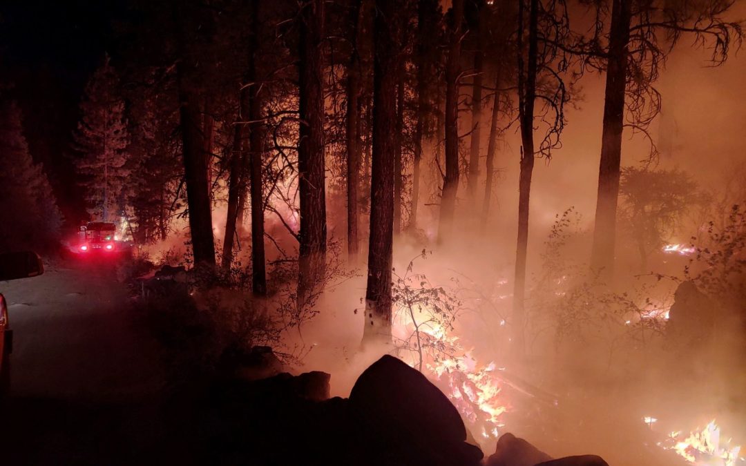
BONANZA, Ore. — Firefighters successfully battled a spot fire that grew to about 5 acres as winds swept the Cutoff Fire Tuesday afternoon. In addition to keeping the new spot fire from spreading, firefighters from the Cutoff Fire also attacked a new fire start elsewhere in Klamath County. They also widened their containment lines on the Cutoff Fire during the day to at least 50 feet around the perimeter and up to 100 feet in many places. Fire managers expect fire activity tonight to be mainly limited to the duff under juniper trees, stumps, and heavier fuels, such as downed trees.
The fire size has remained at 1,150 acres, although some unburned portions in the interior may still burn over the next day or two. Fire behavior is mainly smoldering and creeping, with gusty winds overnight affecting the spread and direction. The fire is burning on a mix of public and private forestland.
A damage assessment team looked over the fire-impacted area today. The team found that two residences and 20 outbuildings were destroyed, out of some 125 structures that were initially threatened by the fire.
Containment rose to 23%. That is expected to rise as fire managers gain confidence in the strength of their fire lines in the face of continuing dry weather, with much high temperatures expected heading into the weekend.
ODF’s Incident Management Team 1 has been managing the fire since Sunday night. Liaison Officer Larry Goff praised the work of local cooperating agencies. One example is the help Fire District 5 in Klamath County and the Bonanza Fire Department gave in providing a supplemental water supply when crews on the Cutoff Fire were running low. “This is typical of the tremendous support we’ve received from local agencies for our efforts here.”
June 22, 2021
Northwest Incident Management Team 8, Incident Commander Kevin Stock, assumed management of the S-503 Fire yesterday morning. The incident command post is located at the Wasco County Fairgrounds and a base camp is located off Ashby Rd also in Tygh Valley. A spike camp is located in Bear Springs Campground. The S-503 Fire is burning in timber and grasses on the Confederated Tribe of the Warm Springs Reservation and privately owned in-holdings protected by Oregon Department of Forestry. This fire is being managed as a full suppression fire.
General Updates: Cooler temperatures allowed firefighters to make significant progress towards containing the S-503 Fire. A containment line is now completely around the entire fire perimeter, but much work remains to secure the line. Improvements include patrolling and cooling hotspots, and constructing containment line directly along the fire’s edge in areas where unburned fuels remain between the previously constructed fire line. Firefighters remained diligent watching for spot fires popping up as dried fuels remained receptive to sparks. Heavy lift helicopters assisted firefighters with water drops cooling hotspots. Night shift will continue to patrol and improve lines. Additional ordered resources continue to arrive to assist with the suppression efforts. Resource from the S-503 Fire will remain available to assist the Confederated Tribe of the Warm Springs Reservation with any new fire starts.
Acreage: 6,046 (approximately 535 acres is private in-holdings protected by Oregon Department of Forestry); aerial infra-red imagery allows for the increase in accurate acreage interpretation
Containment: 20%
Fire Information: (541) 670-0812 (8:00 a.m. to 9:00 p.m.) or (541) 553-2004 (8:00 a.m. to 9:00 p.m.)
E-mail: 2021.S-503@firenet.gov
Information Websites:
Facebook page “CTWS – Fire Management”
Inciweb information on https://inciweb.nwcg.gov/incident/7559
Oregon Smoke Information – http://oregonsmoke.blogspot.com/
Weather: Tonight will be partly cloudy with cumulus buildups. Temperatures will range 57 – 60 degrees with maximum relative humidity of 76 – 79%. Winds will be west to southwest 7 – 14 mph with gusts to 16 mph decreasing after midnight.
Resources-316: 2 – type 1 hotshot crews, 5-type 2 initial attack crews, 1-heavy helicopter, 1-light helicopter,30-engines, 6-dozers, 9-water tender, and 71 overhead.
Closures and Evacuations: The Wasco County Sherriff’s Office has lowered all residences west of Kelly Springs Rd/Back Walters Rd from Level 3 evacuation to Level 2 – Get Set. Anything east of Kelly Springs to Reservation Rd, including Walters Corners and the community of Pine Grove, remain at Level 2 – Get Set.
Temporary Flight Restrictions: For the safety of the firefighters and aircraft fighting the S-503 Fire, a temporary flight restriction has been placed over the fire area. Please consult the “Notice to Airman” for specifics. Wildfires are a “No Drone Zone.”
June 22, 2021
La Grande, ORE. – Oregon Department of Forestry’s (ODF) Northeast Oregon District will implement Regulated-Use Closure Wednesday, June 23, 2021, at 12:01 a.m. These public use restrictions are intended to reduce human caused wildfires by limiting high risk activities. Lands affected by this closure include lands protected by ODF’s Northeast Oregon District in Malheur, Baker, Wallowa, Union, Morrow, Grant, and Umatilla counties. The following restrictions are included in the closure:
- Smoking is prohibited while traveling, except in vehicles on improved roads, in boats on the water or at a cleared area free of flammable vegetation.
- Open fires are prohibited, including campfires, charcoal fires, cooking fires and warming fires, except at designated locations. Designated locations within the Regulated Use Closure area are available at each ODF office. Designated locations within the Oregon State Parks system include but are not limited to: Emigrant Springs, Ukiah Dale, Catherine Creek, Hilgard Junction, Red Bridge, Wallowa Lake, Minam and Unity Lake.
- Portable cooking stoves using liquefied or bottled fuels are allowed. Open fires may be allowed by waiver through a written order, if, in the judgement of the forester, conditions so warrant.
- Non-Industrial use of chain saws is prohibited between the hours of 12:00 p.m. and 8:00 p.m. Chain saw use is permitted at all other hours, if the following fire fighting equipment is present with each operating saw: one axe, one shovel, and one 8 ounce or larger fire extinguisher. In addition, a fire watch is required at least one hour following the use of each saw.
- Possession of the following fire fighting equipment is required while traveling, except on state highways, county roads and driveways: one shovel and one gallon of water or one 2½ pound or larger fire extinguisher.
- Cutting, grinding and welding of metal is prohibited, between the hours of 12:00 p.m. and 8:00 p.m. Cutting, grinding and welding of metal is permitted at all other hours, if conducted in a cleared area and if a water supply is present.
- The mowing of dry, cured grass with power driven equipment is prohibited between the hours of 12:00 p.m. and 8:00 p.m., except for the commercial culture and harvest of agricultural crops.
- Any electric fence controller in use shall be: 1) Listed be a nationally recognized testing laboratory or be certified by the Department of Consumer and Business Services; and 2) Operated in compliance with manufacturer’s instructions.
- Use of fireworks is prohibited.
Additionally, during fire season debris burning is prohibited as is the use of exploding targets and tracer ammunition.
ODF’s Northeast Oregon District is in Fire Season. Restrictions can be found at http://bmidc.org/restrictions.shtml. Fire conditions are HIGH throughout the region. Please use caution to help prevent forest fires. Wildland fuels are unseasonably dry and firefighters are experiencing very active fire behavior.
Contact the Oregon Department of Forestry-Northeast Oregon Fire Prevention Information Line for more information on ODF’s Public Use Restrictions: (541) 975-3027
To report a fire, contact: Blue Mountain Interagency Dispatch (541) 963-7171 Or, call 9-1-1.
June 22, 2021
Oregon Department of Forestry IMT 1, Joe Hessel, Incident Commander
Cutoff Fire email: Cutoff.Fire.Information@gmail.com
Cutoff Fire Information Line: 971-600-2579 (7a.m. – 10 p.m.)
Facebook: Cutoff Fire
Evacuation Information
Inciweb
Fire lines hold despite high winds overnight
BONANZA, Ore.— High winds kept firefighters on the southern and western flanks of the Cutoff Fire busy overnight. Crews battled spot fires, strong winds and dry fuels to prevent additional fire spread. Their hard work paid off—the fire stayed within the existing control lines with no net gain in acres burned. Today, firefighters will concentrate on strengthening fire lines and cooling hot spots. At least three-quarters of the fire’s 1,150-acre perimeter has been lined. Containment has risen to 12 percent.
ODF Incident Management Team 1 will hold a community meeting on the fire today, June 22 at 7 p.m. The public is invited to join us at Bonanza Big Springs Park, 300 Main Street in Bonanza. A live stream will be available via Facebook Live. In the case of severe weather, please join us on the Facebook page for the virtual presentation at (https://www.facebook.com/CutoffFire2021).
Incident Commander Joe Hessel said, “Yesterday and last night were pivotal to keeping this fire in its footprint. Firefighters worked hard in extremely hot weather to keep winds from spreading the fire beyond our control lines.”
Evacuation levels were lowered Monday, allowing residents to return. However, hazards remain near the fire including possible down powerlines, fire-damaged trees, stump holes and other hazards. Roads in the fire area are limited to use by emergency vehicles and residents. Klamath County Sheriff’s Office is continuing patrols in the area.
A Level 2 (GET SET) evacuation remains in effect for the area east of Bly Mountain Cutoff Road, between Jaguar Lane/Racoon Lane and Spaniel Lane/ Crocodile Lane, west of Thrasher Drive. A Level 1 (GET READY) evacuation notice is in place for other areas. Damage assessment teams will be at the fire today evaluating structural impacts.
| Estimated Size: |
1,150 acres |
| Containment: |
12% |
| Start Date/Time: |
6/19/2021 at 1:29 p.m. |
| Anticipated Containment Date: |
6/29/2021 |
| Location: |
6 miles north of Bonanza |
| Cause: |
Under investigation |
| Personnel: |
341 |
| Assigned Resources
Hand Crews:
Engines:
Dozers:
Water Tenders:
Other Heavy Equipment: |
8
18
4
8
6 |
| Assigned Aircraft:
Structure Task Forces: |
9
0 |
| Injuries: |
0 |
| Structures Threatened: |
125 |
| Structures Damaged: |
Undetermined |
| Structures Destroyed: |
Undetermined |
| Evacuations: |
237 persons |
June 22, 2021
Northwest Incident Management Team 8, Incident Commander Kevin Stock, assumed management of the
S-503 Fire yesterday morning. The incident command post is located at the Wasco County Fairgrounds
and a base camp is located off Ashby Rd also in Tygh Valley. A spike camp is located in Bear
Springs Campground. This fire is being managed as a full suppression fire.
General Updates: The S-503 Fire continues to burn in timber and grasses on the Confederated Tribe
of the Warm Springs Reservation and privately owned in-holdings protected by Oregon Department of
Forestry. Firefighters are focused on securing areas of concern including structures, residences,
and values at risk. Night shift continued line construction on the southern portion of the fire
tying into a large meadow. In addition, resources secured line around two spot fires over the S-560
and S-570 Roads. Today, firefighters will continue to strengthen lines on the fire’s northern (one
mile south of Hwy 216) and eastern flanks (four miles west of Hwy 3), including securing the heel
of the fire in the northwestern corner of the fire perimeter. On the southern and western flanks
of the fire (approximately two miles east of Hwy 26), resources are constructing direct fire line
where feasible while securing and holding existing containment line. Predicted afternoon winds and
potential thunderstorms may test the eastern flank today. Initial attack activity is expected to
increase as lightning activity moves through the area. Northwest Incident Management Team 8 will
assist the Confederated Tribe of the Warm Springs Reservation with any new fire starts.
Acreage: 6,201 (approximately 535 acres is private in-holdings protected by Oregon Department of
Forestry)
Containment: 10%
Fire Information: (541) 670-0812 (8:00 a.m. to 9:00 p.m.) or (541) 553-2004 (8:00 a.m. to 9:00 p.m.)
E-mail: javin.dimmick@ctwsbnr.org
Information Websites:
• Facebook page “CTWS – Fire Management”
• Inciweb information on https://inciweb.nwcg.gov/incident/7559
• Oregon Smoke Information – http://oregonsmoke.blogspot.com/
Weather: Today, weather will be mostly cloudy with patchy smoke in the morning with afternoon
cumulus buildups. Temperatures will range 86 – 89 degrees with minimum relative humidity of 26-29%.
Winds will be west to southwest 4 – 8 mph increasing to 7-14 mph with gusts to 16 mph in the
afternoon.
Resources-251: 2 – type 1 hotshot crews, 5-type 2 initial attack crews, 1-heavy helicopter, 1-light
helicopter,16-engines, 4-dozers, 5-water tender, and 53 overhead.
Closures and Evacuations: The Wasco County Sherriff’s Office has lowered all residences west of
Kelly Springs Rd/Back Walters Rd from Level 3 evacuation to Level 2 – Get Set. Anything east of
Kelly Springs to Reservation Rd, including Walters Corners and the community of Pine Grove, remain
at Level 2 – Get Set.
Temporary Flight Restrictions: For the safety of the firefighters and aircraft fighting the S-503
Fire, a temporary flight restriction has been placed over the fire area. Please consult the “Notice
to Airman” for specifics. Wildfires are a “No
Drone Zone.”
June 21, 2021
Northwest Incident Management Team 8, Incident Commander, Kevin Stock
Northwest Incident Management Team 8, Incident Commander Kevin Stock, assumed management of the S-503 Fire this morning. The incident command post is located at the Wasco County Fairgrounds and a Base Camp is located off Ashby Rd also in Tygh Valley. A spike camp is located in Bear Springs Campground. This fire is being managed as a full suppression fire.
General Updates: The S-503 Fire continues to burn in timber and grasses on the Confederated Tribe of the Warm Springs Reservation. Firefighters are focused on securing areas of concern including structures and residences and values at risk. On the northwest and north flanks, firefighters are beginning mop-up cooling any smokes near the containment lines. On the east flank, a spot fire near Bald Peter has been boxed in with retardant and direct dozer line is being constructed to secure. On the southwest flank, there was a little growth and dozers are working to tie the containment lines together. Night shift will continue to work directly along the fire’s edge to secure and hold established containment lines.
Acreage: 6,201 (approximately 535 acres is private in-holdings protected by Oregon Department of Forestry)
Containment: 10%
Fire Information: (541) 670-0812 (8:00 am to 9:00 PM), (541) 553-2004 (8:00 am to 9:00 PM)
E-mail: javin.dimmick@ctwsbnr.org
Information Websites:
Weather: Tonight, weather will be partly cloudy with patchy smoke. Potential for evening thunder cloud build-up. Temperatures will range 62 – 65 degrees with maximum relative humidity of 69- 72%. Winds will be northwest 4 – 8 mph.
Resources-251: 2 – type 1 hotshot crews, 5-type 2 initial attack crew, 1- heavy helicopter, 16-engines, 4-dozers, 5-water tender, and 53 overhead.
Closures and Evacuations: The Wasco County Sherriff’s Office declares all residences West of Kelly Springs Rd/Back Walters Rd have been lowered from Level 3 evacuation to Level 2 – Get Set. Also, anything East of Kelly Springs to Reservation Rd including Walters Corners and the community of Pine Grove remain at Level 2 – Get Set.
Temporary Flight Restrictions: For the safety of the firefighters and aircraft fighting the S-503 Fire, a temporary flight restriction has been placed over the fire area. Please consult the Notice to Airman for specifics. Wildfires are a No Drone Zone.
June 21, 2021
Oregon Department of Forestry IMT 1, Joe Hessel, Incident Commander
Cutoff Fire email: Cutoff.Fire.Information@gmail.com
Cutoff Fire Information Line: 971-600-2579 (7a.m. – 10 p.m.)
Facebook: Cutoff Fire
Evacuation Information
Inciweb
Firefighters make good progress despite challenging weather conditions
Bonanza, ORE. — Despite the forecast for challenging winds the Cutoff Fire experienced no new growth and the fire stayed within its established footprint. On the northern portion of the fire, firefighters began mop-up operations and strengthened control lines. Several helicopters dropped water on the southern portion of the fire where winds and dry fuel conditions caused more active fire behavior.
This evening, night resources will continue to monitor for thunderstorms which are forecast to develop into the early morning hours. These passing storms could bring wetting rains and hail directly under the cells. Gusty and erratic winds are associated with thunderstorm activity. Crews are also prepared to respond if new starts materialize from the passing storms. The current Red Flag Warning expires at 12:00 a.m. on Wednesday, June 23.
At noon on June 21, 2021, Klamath County Emergency Management and Klamath County Sheriff’s Office, under recommendation of the Incident Commander for the Cutoff Fire, reduced the Evacuation Level 3 area (GO NOW) to Level 2 (GET SET). The current evacuation recommendations are:
East of Bly Mountain Cutoff Rd, North to Grizzly Ln, West of Hummingbird Dr, and Forest Service Rd 3812 South three miles past Keno Springs Rd.
East of Bly Mountain Cutoff Rd, North to Hwy 140 and Kingfisher Dr, West of Hummingbird Dr, South to Grizzly Ln.
While evacuation levels were reduced, there is still significant danger in the area. Residents should be aware of the possibility of down powerlines, damaged trees at risk of falling, and other dangers. Roads in the fire area remain closed to all but emergency vehicles and residents only. Firefighting equipment traffic will continue to be heavy in the fire area. Klamath County Sheriff’s Office will also continue patrols in the area.
ODF Incident Management Team 1 will be holding a public meeting tomorrow, June 22 at 7:00 p.m. Members of the community are invited to join us at Bonanza Big Springs Park, 300 Main Street. A live stream will be available via Facebook live. In the case of severe weather please join us on the Facebook page for a virtual presentation.
June 21, 2021
North River Road Fire 80% Contained
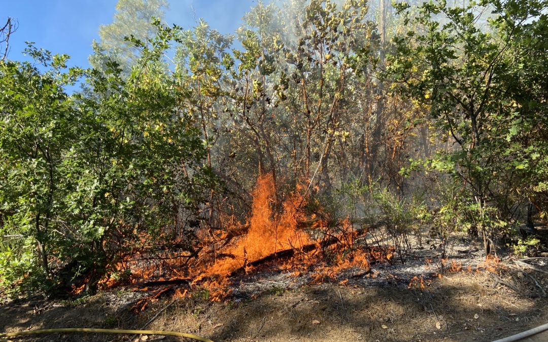
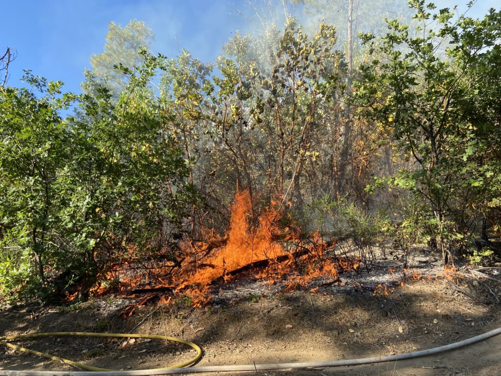
GOLD HILL, Ore. – Despite the heat, steep terrain and dense brush, crews on the North River Road Fire, located on Bureau of Land Management land along the 4300-block of North River Road between Gold Hill and Rogue River, are continuing to make significant progress on mop-up operations; the fire is 80% contained as of Monday evening. The entire fire is currently mopped up 100-feet into the interior, with some areas even more so. The fire lines are holding strong, and the fire remains 60 acres.
Due to the status of the fire, resources for the nightshift are being slightly decreased. One 20-person crew will be on scene overnight to continue mop-up efforts and monitor for hotspots. Two 20-person crews are scheduled for the Tuesday dayshift. Two helicopters, a type 2 and type 3, will also be available for bucket drops as needed.
With dangerous conditions, including triple-digit temperatures, safety on the fire line has been a major focus for crews since the fire first started late Saturday afternoon. Firefighters are encouraged to remain hydrated and take breaks as needed. Since the start of this incident, no injuries have been reported, and no heat exhaustion has occurred. Supervisors and crews will continue to monitor each other throughout the completion of this fire, given an excessive heat warning and fire weather watch have been issued for the region.
A level 1 (BE READY) evacuation order by the Jackson County Sheriff’s Office and Jackson County Emergency Management for the 1000-3000 blocks of Wards Creek Road and the surrounding areas has been lifted. The Mountain of the Rogue biking trails remain closed to the public, as firefighting activity is taking place on the trails. The Bureau of Land Management will reopen these trails when the agency deems that it is safe to do so.
The North River Road Fire was first reported on Saturday, June 19 at approximately 4:30 p.m. The cause remains under investigation. Multiple agencies responded alongside ODF, including Rogue River Fire District #1, Jackson County Fire District 3, Grants Pass Fire Rescue, Rural Metro Fire, Evans Valley Fire District #6, Medford Fire-Rescue, U.S. Forest Service Rogue River-Siskiyou National Forest, Bureau of Land Management, Jackson County Sheriff’s Office, Jackson County Roads Department and numerous contract crews; these partnerships are greatly appreciated by ODF.
This will be the final update on the North River Road Fire unless conditions significantly change. Fire updates are available online at www.swofire.com and Facebook, @ODFSouthwest.
June 21, 2021
Incident Commander: Kevin Stock
E-mail – javin.dimmick@ctwsbnr.org
Fire Information: 541-553-2004
Warm Springs, ORE. – This update is for the S-503 Fire burning on the Warm Springs Reservation. Northwest Incident Management Team 8, a local type 2 team with Incident Commander Kevin Stock assumed management of the S-503 Fire this morning at 0600. The Incident Command Post (IC) is being set up at the Tygh Valley Rodeo Grounds.
Current Status: The S-503 fire has grown to an estimated at 6200 acres and is officially 0% contained but this will be updated today. Resources of crews, engines, dozers, water tenders and aerial support arrived in force yesterday. Firefighters were able to hold the north flank. This was an area of concern as Pine Grove residences lay just to the northeast of the S-503 perimeter. Efforts were aided with lighter winds from the northeast as the footprint moved to the southwest at a slow pace. There was a spot fire to the southeast. The S-503 is roughly 2 miles east of HWY 26 and 7 miles northwest of Simnasho.
Today’s Operations: Safety of personnel and communication are the number one priority today as command of the fire operations is transferred. The values at risk are the private structures and other infrastructure in the Pine Grove area but also natural, archeological and cultural resources on the Warm Springs Reservation. Crews will work aggressively to hold the northwest anchor point and establish some new control line along both northeast and south west flanks.
Weather and Fire Behavior: Temperatures today in the lower 90’s and very low relative humidity. Winds are predicted to be light but shifting throughout the day from the northeast at 7 mph in morning and becoming northwest in the afternoon. The fire is burning is several drainages and ridges with mixed timber fuels and brush to west and southwest with a grass and shrub combination to the majority of the northeast flank. There is a low risk for spotting if the winds are light.
Closures and Evacuations: As of Sunday at 1200, All residences west of Kelly Springs Rd/Back Walters Rd have been lowered from level 3 to level 2 -Get Set There is a Level 2 GET READY: Anything else previously under level 1 EAST of Kelly Springs to Reservation Rd including Walters Corners and the community of Pine Grove. A Temporary Flight Restriction will be established over the S-503.Wildfires are a No Drone Zone.
For more information please call the Warm Springs Public Information Officer at 541-553-2004.
Also check out:
Confederated Tribes of Warm Springs at warmsprings-nsn.gov
June 21, 2021
National: Preparedness Level 3 (Fire activity in two or more geographic regions is requiring a major commitment of national resources)
|
# of fires |
Acres burned |
| Total to date |
28,926 |
1,097,061 |
Oregon: Preparedness Level 2 (Fire activity is increasing)
| Only ODF-protected lands (16 million acres) |
| |
# of fires |
Acres burned |
| 2021 year-to-date |
376 |
7,526 |
10-year avg. year-to-date
(2011 – 2020) |
200 |
1,699 |
| All lands in Oregon (Includes ODF-protected lands) |
| |
# of fires |
Acres burned |
| 2021 year-to-date |
541 |
15,044 |
Current large fires in Oregon: Includes all lands
| Name |
Date |
Total Acres |
ODF Acres |
Containment |
Location |
Cause |
Notes |
| Cutoff |
June 19, 2021 |
1,500 |
1,000 |
10% |
6 mi. N of Bonanza |
Unknown |
ODF Team 1 (Type 1 team) in command.
Extreme fire behavior. Evacuations and road closures.
Fire information |
| S-503 |
June 18, 2001 |
4,300 |
700 |
0% |
5 mi. SW of Pine Grove |
Unknown |
NW Team 8 (Type 2 team) in command.
Moderate fire behavior. Evacuations.
Fire information |
More information:
Thunderstorms are predicted to bring lightning to southern, south central, and eastern Oregon through Wednesday. The storms should bring enough precipitation to stay below the high-risk threshold for new significant fires; however, wind gusts could challenge control efforts on new and existing fires. Temperatures will cool a bit mid-week and then rise again Thursday into next weekend, with possible record high temperatures.
June 21, 2021
Crews Continue to Make Steady Progress on North River Road Fire
GOLD HILL, Ore. – Crews assigned to the North River Road Fire, located along the 4300-block of North River Road between Gold Hill and Rogue River, continued to make steady progress on mop-up operations overnight; the fire is now 65% contained. Lines along the perimeter are holding strong and the fire remains 60 acres, burning on Bureau of Land Management (BLM) lands.
Overnight, crews were able to mop up 50 feet into the interior of the fire along the entire perimeter. Three 20-person, two 10-person crews and three type-6 engines will continue that work today. A type two and type three helicopter will be available to the fire should bucket drops be necessary.
Jackson County Emergency Management and the Jackson County Sheriff’s Office issued a level 1 (BE READY) evacuation notice for the 1000-3000 blocks of Wards Creek Road in Rogue River and the surrounding area of the North River Road Fire. That evacuation notice remains in effect. North River Road is now open, however, the public is advised to used alternate routes if possible for the safety of firefighters working in the area. The BLM Mountain of the Rogue biking trails remain closed to the public for safety concerns and wildfire operations along the trails.
The cause of the fire remains under investigation. ODF would like to thank our partner agencies who have provided resources on this fire, including Rogue River Fire District #1, Jackson County Fire District 3, Grants Pass Fire Rescue, Rural Metro Fire, Evans Valley Fire District #6, Medford Fire-Rescue, U.S. Forest Service Rogue River-Siskiyou National Forest, Bureau of Land Management, Jackson County Sheriff’s Office and Jackson County Roads Department.
Fire updates are available online at www.swofire.com and Facebook, @ODFSouthwest.
June 21, 2021
Oregon Department of Forestry IMT 1, Joe Hessel, Incident Commander
Cutoff Fire email: Cutoff.Fire.Information@gmail.com
Cutoff Fire Information Line: 971-600-2579 (7a.m. – 10 p.m.)
Facebook: Cutoff Fire
Evacuation Information
Inciweb
Fire crews work spot fires as they prepare for shifting winds
BONANZA, Ore.—Firefighters were kept busy overnight suppressing a number of small fires started by drifting embers on the southern and eastern flanks of the Cutoff Fire, six miles north of Bonanza in Klamath County. Fire lines on the northern and western portions of the fire held overnight. Today, firefighters will begin mopping up those portions of the fire, cooling hot spots. Over half of the fire’s 1,150-acre perimeter has been lined. Containment remains at 10 percent.
The fire is burning on a mix of public and private forestland and threatens approximately 125 structures. Evacuations remain in effect today with a Level 3 (GO NOW) evacuation for the area east of Bly Mountain Cutoff Road, between Jaguar Lane/Racoon Lane and Spaniel Lane/ Crocodile Lane, west of Thrasher Drive. Those levels will be reviewed later today for possible change.
Firefighters will be challenged late today when winds are expected to pick up. A red-flag warning is in effect from 5 p.m. due to thunderstorms with associated shifting winds, with gusts possible up to 25 miles per hour. These conditions are expected to challenge control lines as the vegetation remains extremely dry, similar to mid-to-late July conditions. Thunderstorms are expected to be dry early, but may bring rain later in the evening.
A total of 250 personnel have been assigned to the fire, including ground crews, fire engines, bulldozers and other heavy equipment. About nine aircraft will continue attacking the fire today, including helicopters. Other available aircraft are single-engine air tankers and a very large air tanker. They will drop water and retardant to slow the fire’s spread and help firefighters tackle any small fires starting beyond the control lines.
A community meeting about the fire is planned for Tuesday night at 7 p.m. in Bonanza, which will be streamed live on the Cutoff Fire’s Facebook page (https://www.facebook.com/CutoffFire2021)
American Red Cross and the Klamath County Community Emergency Response Team (CERT) have set up shelter for evacuees at the Living Springs Fellowship Church (31897 Mission St, Bonanza, OR 97623). The shelter offers temporary housing, meals, first aid and a pet shelter.
ODF’s Incident Management Team 1 has been in command of the fire since Sunday night. Incident Commander Joe Hessel said the emphasis today is on safety due to the changing wind and thunderstorms. “We want to keep the fire from spreading today in that very dry vegetation, so firefighters will need to be very aware as winds move around and increase in speed.”
| Estimated Size: |
1,150 acres |
| Containment: |
10% |
| Start Date/Time: |
6/19/2021 at 1:29 p.m. |
| Anticipated Containment Date: |
6/29/2021 |
| Location: |
6 miles north of Bonanza |
| Cause: |
Under investigation |
| Personnel: |
250 |
| Assigned Resources
Hand Crews:
Engines:
Dozers:
Water Tenders:
Other Heavy Equipment: |
4
18
3
7
2 |
| Assigned Aircraft:
Structure Task Forces: |
9
0 |
| Critical Resources Needs:
Injuries: |
Type 1 and Type 2 Initial Attack crews, Type 6 engines
0 |
| Structures Threatened: |
125 |
| Structures Damaged: |
Undetermined |
| Structures Destroyed: |
Undetermined |
| Evacuations: |
501 persons |
June 20, 2021
Oregon Department of Forestry IMT 1, Joe Hessel, Incident Commander
Cutoff Fire email: Cutoff.Fire.Information@gmail.com
Cutoff Fire Information Line: 971-600-2579 (7a.m. – 10 p.m.)
Facebook: Cutoff Fire
Evacuation Information
Inciweb
BONANZA, Ore.—Firefighters on the ground used bulldozers, other heavy equipment, and hand tools to build containment lines around the Cutoff Fire near Bonanza. In the air, skies above the fire were busy with heavy air tankers, helicopters, and single engine air tankers (SEATS) dropping water and retardant to slow the fire’s spread.
Fire managers estimate that over half of the fire’s 1,500-acre perimeter has been lined. Containment sits at 10%, indicating that the control lines will need to be significantly strengthened before they will withstand forecasted hot, dry weather. The fire is burning on a mix of public and private forestland and threatens approximately 125 structures.
In consultation with the fire’s Incident Commander, Klamath County Emergency Management issued a Level 3 (GO NOW) evacuation for the area east of Bly Mountain Cutoff Road, between Jaguar Lane/Racoon Lane and Spaniel Lane/ Crocodile Lane, west of Thrasher Drive. Evacuation levels remain unchanged.
ODF’s Incident Management Team 1 took command of the fire at approximately 6:00 pm on Sunday, June 20, 2021. Incident Commander Joe Hessel praised the work of local agencies. “The local forces did an excellent job getting this fire knocked down quickly. They did a tremendous amount of work. Our job is to pick up where they left off and finish the job,” said Hessel.
The priorities for the coming days including improving protection around structures and strengthening control lines. The weather forecast calls for continued hot and dry weather with the potential for thunderstorms.
American Red Cross and the Klamath County Community Emergency Response Team (CERT) have set up shelter at the Living Springs Fellow Church (31897 Mission St, Bonanza, OR 97623). The shelter offers temporary housing, meals, first aid and a pet shelter.
June 20, 2021
Despite hot temperatures and windy conditions, North River Road Fire 50% contained
GOLD HILL, Ore. – Mop-up work on the North River Road Fire, located along the 4300-block of North River Road between Gold Hill and Rogue River, is progressing quickly; crews were able to contain 50% of the fire during dayshift operations. Hot temperatures and windy conditions caused multiple flare-up’s in the perimeter of the fire, however, helicopters assigned to the incident were able to effectively extinguish them, and the lines are holding strong. The fire is 60 acres burning on Bureau of Land Management (BLM) lands.
Two 20-person hand crews will be tasked with continuing the mop-up efforts overnight, along with one type-6 engine. Significant progress is expected with lower evening temperatures and higher relative humidity.
Jackson County Emergency Management and the Jackson County Sheriff’s Office issued a level 1 (BE READY) evacuation notice for the 1000-3000 blocks of Wards Creek Road in Rogue River and the surrounding area of the North River Road Fire. That evacuation notice remains in effect. North River Road is now open, however, the public is advised to used alternate routes if possible for the safety of firefighters working in the area. The BLM Mountain of the Rogue biking trails remain closed to the public for safety concerns and wildfire operations along the trails.
The cause of the fire remains under investigation. ODF would like to thank our partner agencies who have provided resources on this fire, including Rogue River Fire District #1, Jackson County Fire District 3, Grants Pass Fire Rescue, Rural Metro Fire, Evans Valley Fire District #6, Medford Fire-Rescue, U.S. Forest Service Rogue River-Siskiyou National Forest, Bureau of Land Management, Jackson County Sheriff’s Office and Jackson County Roads Department.
Fire updates are available online at www.swofire.com and Facebook, @ODFSouthwest.
June 20, 2021
BONANZA, Ore. – The Cutoff Fire continues to burn on Oregon Department of Forestry (ODF) protected land, Bureau of Land Management (BLM) Lakeview District and Fremont-Winema National Forest lands approximately 6 miles north of Bonanza.
The fire is estimated to be approximately 1,000 acres with no containment. It was reported Saturday afternoon around 1:30 p.m. The fire cause is still under investigation.
Firefighters worked overnight on structure protection and constructing dozer line, handline, and contingency lines. Today the focus will be continued structure protection and work towards containment.
An ODF Incident Management Team is expected to take command of the Cutoff Fire today at 1800.
Bly Mountain Cutoff Road, Jaguar Lane and Keno Springs Road are closed except for Emergency Vehicles and residents exiting the evacuation area. This closure is for firefighter and public safety. There will be increased fire traffic around the Bonanza area.
At this time approximately 125 structures are threatened. Residents in the area should monitor current evacuation status as this incident progresses.
Following is updated evacuation information, at the request of the Cutoff Fire Incident Commander, issued by Klamath County Emergency Management:
- Level 3 (GO NOW)
- East of Bly Mountain Cutoff Rd, North to Grizzly Ln, West of Hummingbird Dr, and South to Keno Springs Road.
- Level 2 (GET SET)
- East of Bly Mountain Cutoff Rd, North to Keno Springs Rd, West of Forest Service Rd 3812, South three miles.
- Level 1 (GET READY)
- East of Bly Mountain Cutoff Rd, North to Hwy 140 and Kingfisher Dr, West of Hummingbird Dr, South to Grizzly Ln.
Klamath County Sheriff’s Office Deputies and Search and Rescue Volunteers are in the process of evacuating affected residents.
For the latest evacuation information, visit https://www.facebook.com/KlamathCountyGov. To sign up for Klamath County alerts, visit http://alerts.klamathcounty.org
American Red Cross along with Klamath County Community Emergency Response Team (CERT) has set up shelter for evacuees at Living Springs Fellowship in Bonanza. 31897 Mission Street, Bonanza Oregon 97623.
The weather forecast for today and into this week is extremely hot. There is a fire weather watch for Monday afternoon through Monday evening for strong gusty winds with low relative humidity. The public is urged to use extreme caution with anything that can spark a wildfire.
South Central Oregon Fire Management Partnership provides comprehensive wildland fire services to more than eight million acres of land administered by the Bureau of Land Management Lakeview District; Fremont-Winema National Forest; Oregon Department of Forestry Klamath-Lake District; U.S. Fish and Wildlife Service’s Sheldon-Hart Mountain National Wildlife Refuge Complex; and Crater Lake National Park. The area encompasses federal, state, and private lands within south central Oregon and northwest Nevada.
June 20, 2021
North River Road Fire 100% lined, 5% contained following excellent overnight progress
GOLD HILL, Ore. – Overnight progress on the North River Road Fire, located along the 4300-block of North River Road between Gold Hill and Rogue River, proved to be extremely successful; firefighters were able to line 100% of the perimeter, and begin mop-up operations. The fire is currently 5% contained, however crews assigned to the incident today will continue to further mop-up efforts while holding the lines. Firefighters were able to GPS map the fire overnight as well, and determined it’s 60 acres in size. The majority of the fire is burning on Bureau of Land Management lands, including the Mountain of the Rogue biking trails; they are currently closed to the public for safety concerns and wildfire operations along the trails.
Additional resources arrived on scene Sunday morning for a change in shift at 8:00 a.m., including three 20-person crews and three contract engines. A type two and type three helicopter are assigned to the fire today and will be doing bucket drops on particularly difficult areas. Forecasted triple digit temperatures are posing a risk for increased fire activity and causing concern for firefighter safety; crews working on the fire today are being briefed on these challenges and will focus on holding lines, monitoring fire behavior and staying hydrated.
The North River Road Fire was first reported at approximately 4:30 p.m. on Saturday, June 19. Rogue River Fire District #1, Jackson County Fire District 3, Grants Pass Fire Rescue, Rural Metro Fire, Evans Valley Fire District #6, Medford Fire-Rescue, U.S. Forest Service Rogue River-Siskiyou National Forest, Bureau of Land Management, Jackson County Sheriff’s Office and Jackson County Roads Department responded alongside ODF.
Jackson County Emergency Management and the Jackson County Sheriff’s Office issued a level 1 (BE READY) evacuation notice for the 1000-3000 blocks of Wards Creek Road in Rogue River and the surrounding area of the North River Road Fire. That evacuation notice remains in effect. North River Road is now open, however, the public is advised to used alternate routes if possible for the safety of firefighters working in the area.
The cause is currently under investigation; as there were no reports of lightning, it has been determined to be human-caused. Fire updates are available online at www.swofire.com and Facebook, @ODFSouthwest.
June 20, 2021
Incident Commander: Shawn Jaca IC & Cason McCain ICT
E-mail – javin.dimmick@ctwsbnr.org
Fire Information: 541-553-2004
Warm Springs, ORE. – This update is for the S-503 Fire burning on the Warm Springs Reservation.
This fire is being managed for full suppression.
Current Status: Crews worked throughout the night as the S-503 fire has grown to an estimated 4300
acres and is 0% contained.
The location of the S-503 fire is moving to the southeast currently. It is located on the north-end
of the Confederated Tribes of Warm Springs Reservation. The perimeter of the fire is changing
rapidly. It is roughly 3 miles east of HWY 26 and 8 miles north of Simnasho.
Today’s Operations: The area of concern and values at risk are the private structures and other
infrastructure in the Pine Grove area to the northeast of the fire. Another area of concern is to
the southwest as winds are predicted to shift throughout the day.
Crews will work to hold the northwest anchor point and establish some new control line along both
northeast and south west flanks. Many more crews continue to arrive to fight the blaze as
additional aerial support has also been ordered. Additional engine crews as well as bulldozers and
operators have already arrived on scene. Incident command of the fire has been transitioned to a
type 3 team in coordination with Warm Springs Fire management.
Weather and Fire Behavior: Temperatures in the upper 80’s and very low relative humidity will
elevate fire weather concerns through Monday. Winds are predicted to be light but shifting
throughout the day from the northeast at 4 to 9 mph pushing the fire around heading toward the
southwest. There is also a predicted potential for thunderstorms through Tuesday.
Closures and Evacuations: There is a level 3 GO NOW evacuation in effect for a small portion of
Kelley Springs Rd to the northeast
of the fire. There is also a Level 2 GET READY: Anything else previously under level 1 EAST of
Kelly Springs to Reservation Rd including Walters Corners and the community of Pine Grove. A
Temporary Flight Restriction will be established over the S-503. Wildfires are a No Drone Zone.
For more information please call the Warm Springs Public Information Officer at 541-553-2004.
Also check out the CTWS – Fire Management Facebook page and standby for the updated maps and other
useful information on https://inciweb.nwcg.gov/
| Quick Facts |
| Approximate Size in Acres: |
Approx. 4,300 + ac. |
| Fire Containment: |
0% |
| Incident Commander |
Shawn Jaca, Cason McCain |
|
Resources on the fire: |
Crews: 9
Aircraft: 0
Engines: 14
Water Tenders: 3
Dozers: 6 |
| Total Personnel: |
Approx. 300 + |
| Jurisdiction: |
Confederated Tribes of Warm Springs |
| Oregon Smoke Blog |
| Facebook |
| Inciweb: Stay Tuned. |
June 19, 2021
GOLD HILL, Ore. – Oregon Department of Forestry (ODF) Southwest Oregon District firefighters are actively engaged on the North River Road Fire, located on the 4300-block of North River Road between Rogue River and Gold Hill. The fire, which was first reported at approximately 4:30 p.m. on Saturday, June 19, is estimated to be 40 acres in size. It is currently 20% lined; three 20-person hand crews will be working overnight with the goal of lining the entire perimeter.
Rogue River Fire District #1 was the first resource on scene of the North River Road Fire. At that time, it was estimated to be one acre and burning in steep terrain with dense brush. Windy conditions were pushing the fire up the slope, and it quickly grew to an estimated 3-5 acres. Multiple ODF engines, two bulldozers and multiple aircraft were ordered, including a type one and two type two helicopters and an air attack platform. Additional resources from Jackson County Fire District 3, Grants Pass Fire Rescue, Rural Metro Fire, Evans Valley Fire District #6, Medford Fire-Rescue, U.S. Forest Service Rogue River-Siskiyou National Forest, Bureau of Land Management, Jackson County Sheriff’s Office and Jackson County Roads Department responded.
North River Road Fire started June 19.
Within three hours, the fire had grown to be an estimated 40 acres. Jackson County Emergency Management issued a level 1 (BE READY) evacuation notice for the 1000-3000 blocks of Wards Creek Road in Rogue River and the surrounding area of the North River Road Fire. That evacuation notice remains in effect.
Investigators will be on scene to work on determining the cause of the fire. In the next week, the weather is continuing to warm up; temperatures are forecasted to be in the 100’s this week. Please use extreme caution, as fires can easily spread in these conditions. Fire updates are available online at www.swofire.com and Facebook, @ODFSouthwest.
June 18, 2021
Douglas Forest Protective Association
1758 N.E. Airport Road
Roseburg, Oregon 97470
www.dfpa.net
www.twitter.com/DouglasFPA
www.facebook.com/DouglasForestProtectiveAssociation
Fire danger increases on Sunday, June 20
Roseburg, ORE. – Warming and drying conditions have prompted the Douglas Forest Protective Association to increase the fire danger to Moderate within the Douglas District, effective Sunday, June 20th at 1:00 AM. The Industrial Fire Precaution Level will remain at IFPL I (one).
Under DFPA’s Public Use Restrictions, a moderate fire danger rating changes the shutdown times for several activities for the general public. During moderate fire danger, the following activities are prohibited between the hours of 1:00 PM and 8:00 PM:
- The cutting, trimming, or mowing of dried or cured grass. This restriction does not apply to the mowing of green lawns. The use of battery or electric string trimmers and the commercial culture and harvest of agricultural crops are exempt from this restriction.
- The cutting, grinding, or welding of metal for non-industrial purposes.
- The use of power saws for non-industrial purposes.
- Any non-industrial improvement or development taking place on private property that utilizes power driven machinery not specifically mentioned in the Public Use Restrictions.
All other restrictions listed under DFPA’s Public Use Restrictions remain in effect and are unchanged. A complete list of DFPA’s Public Use Restrictions can be found online at www.dfpa.net/public-fire-restrictions or by calling DFPA’s 24-hour information line at 541-672-0379. Residents are reminded that additional restrictions or closures may be in place through private industrial landowners or public land management agency on the lands they own or manage.
June 15, 2021
Ukiah, OR- Firefighters responded to the North Fork John Day River area for a report of a fire on June 14th. The Bone Canyon Fire is located 12 miles southwest of Ukiah. There are no evacuations, and no structures are threatened at this time. The fire is burning on steep slopes and rugged terrain in grass, brush, and timber. Fire managers estimate the fire to be 99 acres in size. The cause of the fire is lightning that passed through the area on June 13th. Lightning detection resources indicated one strike in the immediate area of the fire.
The terrain and strong, gusty winds associated with the passing cold front, hampered efforts by firefighters on the ground. Yesterday, four Single-Engine Airtankers (SEATs), one Type 3 helicopter, two Type 2 helicopters, and one air attack aircraft assisted ground resources with the fire. The SEATs and Type 3 helicopter are funded by Oregon’s legislature this year to support suppression of wildfires and limit impacts including private property damage, water quality, soil health, other natural resource concerns, and air quality issues for Oregon’s public.
Additional resources are responding today to assist Pendleton ODF firefighters. These include: two Interagency Hotshot crews, two Oregon Department of Corrections crews, one Oregon Youth Authority crew, one Umatilla National Forest crew, two Oregon Youth Authority engines, and one ODF engine. This will be the only update on this fire unless conditions change.
ODF’s Northeast Oregon District is in Fire Season. Restrictions can be found at http://bmidc.org/restrictions.shtml. Fire conditions are MODERATE throughout the region. Please use caution to help prevent forest fires. Fuel conditions in many areas are ripe for active fire behavior and fire growth.
Contact the Oregon Department of Forestry-Northeast Oregon Fire Prevention Information Line for more information on ODF’s Public Use Restrictions: (541) 975-3027
To report a fire, contact: Blue Mountain Interagency Dispatch (541) 963-7171 Or, call 9-1-1.
