July 18, 2021
Fire Information: 425-324-1267 (7 a.m. – 7 p.m.)
Email: darlenefireinfo@gmail.com
Inciweb: inciweb.nwcg.gov/incident/7665/
Facebook: www.facebook.com/deschutesnationalforest
Twitter: twitter.com/CentralORFire
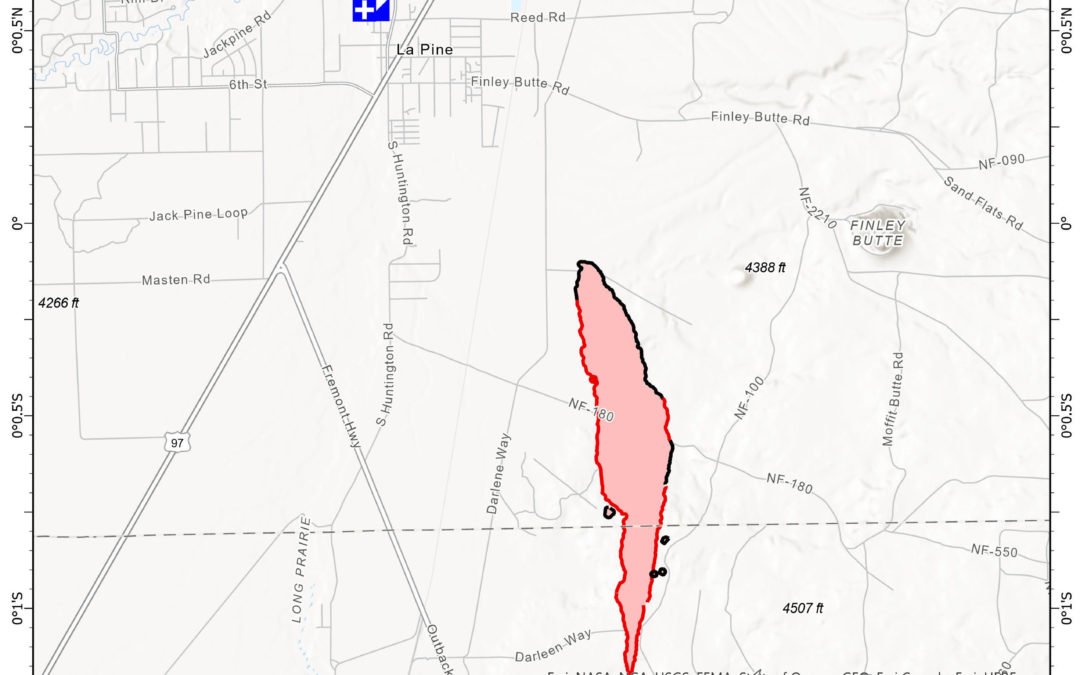
Acres: 686
Number of Personnel: 220
Percent Containment: 61%
Cause: Under Investigation
Date/Time Detected: July 13, 2021, 1:30 p.m.
Origin/Location: La Pine, Oregon
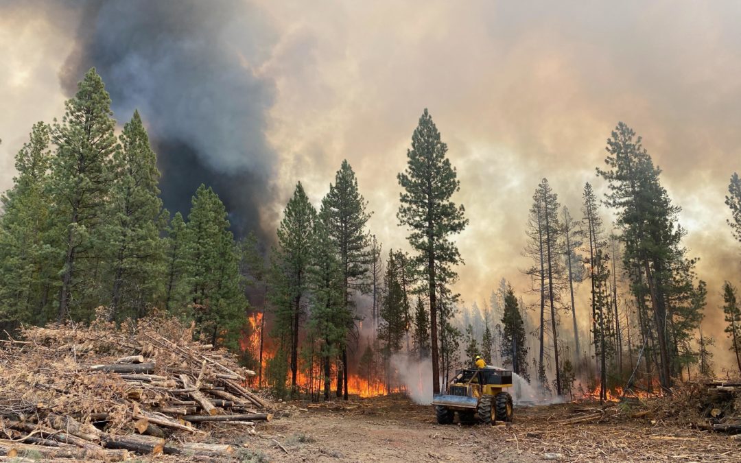
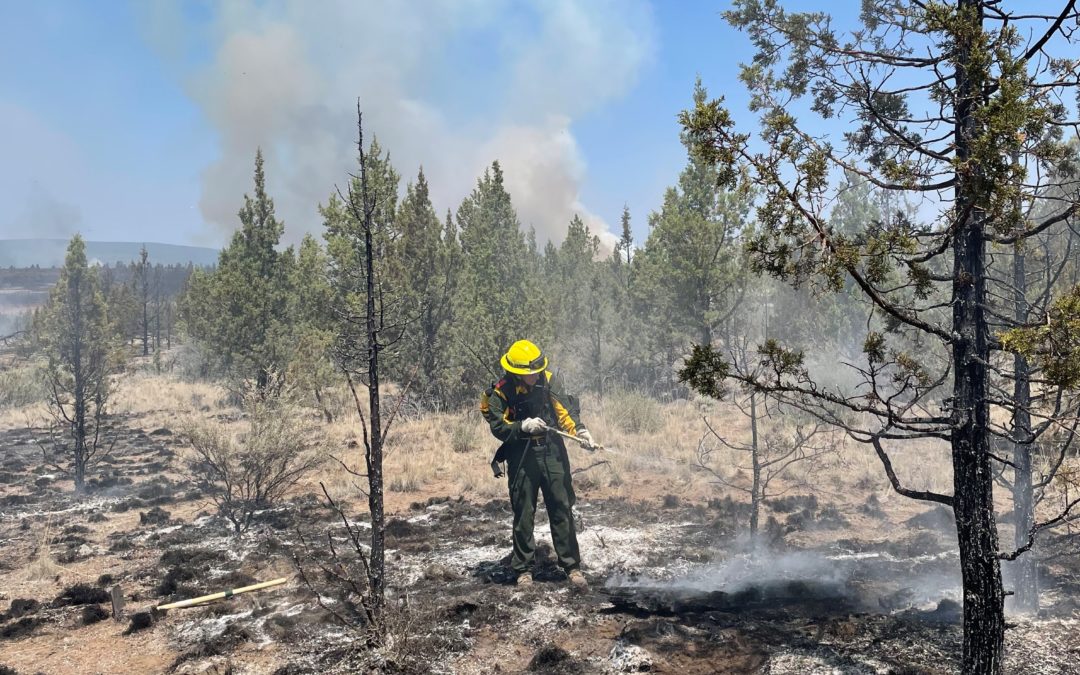
La Pine, ORE. – Containment on the Darlene Fire increased to 61% yesterday evening as fire crews
continued to secure lines around the perimeter. Today, fire activity is expected to remain low with some
smoldering and minimal creeping behavior. Crews will continue to strengthen containment lines and work
their way further into the interior of the fire perimeter, extinguishing any hot spots that they find.
Today’s weather is expected to be warmer and drier, with minimal impact on fire activity. Morning
southerly winds will turn westerly in the afternoon but should remain light with a few gusts reaching 10-
15mph. Relative humidity (RH) will decrease slightly, allowing moderate recoveries overnight.
Northwest Incident Management Team 6 will be transitioning with a local Type 4 Incident Management
Team at 0600 Monday July 19, 2021. All current fire communication including email, the phone line, and
InciWeb will cease at 0600 Monday. For more information about the Darlene Fire after the team
transition call the Central Oregon Fire Information Desk phone at (541) 316-7711 from 7am to 7pm or
visit www.centraloregonfire.org and follow on the Deschutes National Forest Facebook page.
Evacuations: https://www.deschutes.org/sheriff/page/emergency-information
All residences south of La Pine off of Darlene Way to the Deschutes/Klamath County Line including Old
Ice Cave Rd have been reduced from a Level 3 (Go Now) Evacuation Notice to a Level 2 (Get Set)
Evacuation notice.
Areas south of the Deschutes/Klamath County line including most of township 23 east of Hwy 97, Sun
Forest Estates, Split Rail, and Antelope Meadows, have been reduced from a Level 2 (Get Set)
Evacuation Notice to a Level 1 (Be Ready) Pre-Evacuation notice.
Closures and Fire Restrictions:
Bureau of Land Management/US Forest Service: All open fires are prohibited. All the units are at an
Industrial Fire Precaution Level 4 (IFPL 4). Commercial and private firewood cutting is no longer
permitted. Information is available at https://www.fs.usda.gov/alerts/deschutes/alerts-notices.
Oregon Department of Forestry: Central Oregon is in regulated closure www.odfcentraloregon.com.
Walker Range: Walker Range is also in Regulated Closure www.walkerrange.org.
July 18, 2021
A virtual community meeting will be held this evening on Facebook Live at 7 p.m. Evacuation orders remain in place with the most up to date map found on the Wallowa County Sheriff Facebook page.
Elbow Creek Fire Information: 541-805-2784 (7am – 9pm)
Email: ElbowCreek.information@gmail.com
Facebook: www.facebook.com/ElbowCreekFire
Inciweb: https://inciweb.nwcg.gov/incident/7672/
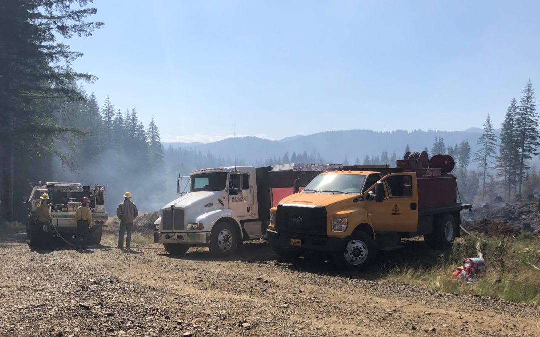
Wallowa, ORE. – Oregon Department of Forestry’s Incident Management Team 3, led by Incident Commander Link Smith, in conjunction with key members from Oregon State Fire Marshal’s Blue Team, have assumed command of the Elbow Creek Fire 31 miles southeast of Walla Walla. The arrival of the fire management organization brings in additional overhead capacity and firefighting resources.
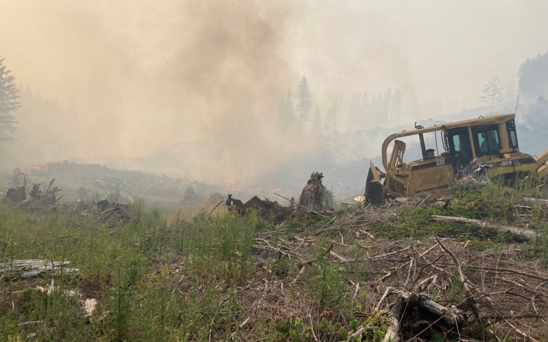
Progress was made yesterday on the northwest side of the fire with firefighting crews constructing line and stopping progression of the fire into the Elbow Creek Drainage. Dozer operations have assisted in cutting lines along the ridges on both the north and south ends of the fire. Burnout operations on the eastern portions of the fire were successfully performed last night.
Today, crews and equipment will pick up where the night shift left off and continue to connect containment lines in open areas. Additional taskforces will be joining crews today.
Fire potential remains high with warmer and drier conditions expected this afternoon. The topography of the area acts in funneling winds – accelerating rapid fire growth and erratic fire behavior. The weather outlook for the week brings the potential of thunderstorms starting Monday afternoon through Tuesday morning.
After receiving the team in-brief from local agencies, Incident Commander Link Smith noted, “this is going to be challenging, but we will give everything we have to protect the natural resources.” Oregon State Fire Marshal Chief Deputy Travis Medema echoed this commitment adding OSFM’s presence aids in, “protecting structures and further supporting the community.”
Closures: All Forest Service lands, roads, and trails within the Umatilla National Forest are closed. For more information visit the Umatilla National Forest website at www.fs.usda.gov/Internet/FSE_DOCUMENTS/fseprd931174.pdf
Additionally, the Grande Ronde River is closed.
July 18, 2021
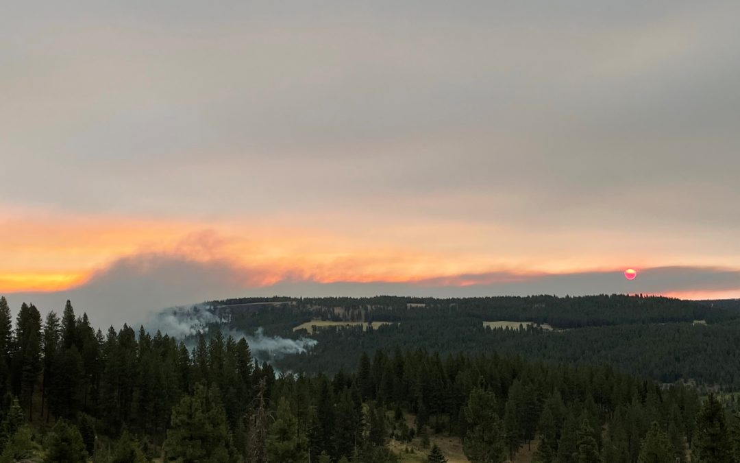
Klamath Falls, ORE. – Red Flag weather conditions played a significant role in fire behavior yesterday. The fire pushed over Sam’s Cabin Road and the 27 Road to the north. The fire continues to be held from Preacher Flats to Mitchell Monument, and is pushing further east, approaching the 28 road. Fire crews were able to insert dozer line and burnout to minimize the fire growth overnight. One of today’s priorities will be to attempt hold these areas to prevent further spread of the fire.
Other priorities include constructing direct fireline and building contingency lines north of the fire in the Sycan Marsh and along the 28 Road to the south. These contingency lines may be used as the fire continues to march towards the communities of Paisley, Summer Lake, and Silver Lake.
Structure protection groups today will be focused on homes along the 34 and 28 roads. Crews plan to work around Deadhorse Lake to begin preparation of advance of the fire. As work is completed, structural firefighters will continue their work further north on the southeastern corner of the fire. Additional evacuation levels have been implemented in Lake County.
The southwestern flank of the fire continues to hold and firefighters remain in patrol status to scout for areas of remaining heat. As evacuations relax along the south and southwest flanks and residents begin to return to their homes, it is imperative landowners use caution when returning. Firefighters have cleared many of the hazards, however there may be some lingering hot spots and fire weakened trees. Residents may also see smoke as fuels continue to burn within the fire perimeter. Please use an abundance of caution around these areas.
Evacuations: Evacuations are rapidly changing due to the nature of this wildfire. Please visit tinyurl.com/bootlegevac for an interactive map of evacuation level in Lake and Klamath Counties.
Closures: The Fremont-Winema National Forest is closed to the public in the fire area. Map and full order available at inciweb.nwcg.gov/incident/7609/.
Smoke: Smoke impacts will continue to be high in areas north, northeast, and east of the fire today and tomorrow, especially in the vicinity of Silver Lake, Summer Lake, and Paisley. Stronger SW winds today will help scour smoke earlier in the day around Lakeview, Klamath Falls and Sprague River Valley. Full report at: fires.airfire.org/outlooks/southcentraloregon.
Fire Information Public Phone: 541-482-1331
Fire Information Media Phone: 971-727-7255
Inciweb: inciweb.nwcg.gov/incident/7609/
Facebook: www.facebook.com/BootlegFireInfo
Twitter: twitter.com/BootlegFireInfo
Hashtags: #BootlegFire #FireYear2021
July 18, 2021
Sisters, ORE. – The Grandview fire acreage has been updated to 6,032 acres by using more accurate mapping information. Containment on the fire is now 43%.
The community meeting from last night can be viewed online in two places:
Temperatures over the fire will be in the lower 90’s and winds out of the NW at 5-8 mph. Today, crews will continue mopping up deeper into the fire to 100 feet and more. Snags are a concern around the perimeter of the fire and felling crews will work to remove them to reduce risk of hazard to the other crews and the public.
For up-to-date information on the Grandview Fire, please visit: https://inciweb.nwcg.gov/incident/7651/ or Centraloregonfire.org.
There are evacuation notices in place issued by the Jefferson County Sheriff’s Office and Deschutes County Sheriff’s Office. Please follow their guidance.
Jurisdictional agencies tied to the fire include Oregon Department of Forestry Central Oregon District and Ochoco National Forest, Crooked River National Grassland.
July 17, 2021
This video shot at the Bootleg Fire NE of Klamath Falls shows firefighters using heavy equipment to build a firebreak in hopes of stopping the fire’s spread. ODF’s Bryce Melville explains what’s involved. Watch at https://fb.watch/6OUrtveyyV/
July 17, 2021
FOREST GROVE, Ore. – Mechanical issues grounded two helicopters before they could assist at the Game Creek Hog Fire. Instead, ODF’s The Dalles Unit loaned two single-engine airtankers to the fire team engaged on the fire. Today, both planes are scooping water up from Hagg Lake and dropping it onto hot spots in the steep terrain of the Elk Creek drainage where the blaze is located. The fire remains entirely within the Tillamook State Forest.
Arrival of an additional hand crew has increased personnel engaged on the fire to about 100. The fire has so far been kept to about 135 acres of the 364,000-acre state forest.
The Tillamook State Forest remains open but visitors can expect smoke in the area. However, the Drift Creek and Idiot Creek forest roads and the Fear and Loaming mountain bike trail remain closed due to fire activity. Also closed is Rogers Camp trailhead, which is being used as a staging area for firefighters. Highway 6 and 26 to the coast remain open and unaffected by the fire, which is burning about two miles north of Highway 6. No evacuations are associated with this fire.
Cause of the fire is still under investigation.
# # #
July 17, 2021
LA PINE, Ore. – Evacuations decreased in all areas surrounding the Darlene Fire yesterday afternoon and
residents can now return to their homes and property. At 4:33 p.m. on Friday, July 16, the Deschutes County
Sheriff’s Office and Klamath County Sheriff’s Office, in coordination with fire managers, adjusted
evacuation levels as follows:
• All residences south of La Pine off of Darlene Way to the Deschutes/Klamath County Line including Old Ice
Cave Rd have been reduced from a Level 3 (Go Now) Evacuation Notice to a Level 2 (Get Set) Evacuation
notice.
• Areas south of the Deschutes/Klamath County line including most of township 23 east of Hwy 97, Sun
Forest Estates, Split Rail, and Antelope Meadows, have been reduced from a Level 2 (Get Set) Evacuation
Notice to a Level 1 (Be Ready) Pre-Evacuation notice.
Fire crews continued to work around the perimeter of the Darlene fire, extinguishing hot spots and
strengthening containment lines; containment increased from 5% to 35% and the fire remained at 686
acres. Containment is expected to increase Saturday, with low winds and favorable humidity levels
forecasted.
The Northwest Incident Management Team 6 hosted a community meeting with agency administrators
last night. Community members were able receive answers to questions and many expressed gratitude
for the firefighting efforts. Visit the Deschutes National Forest Facebook page for videos and summaries.
Evacuations: https://www.deschutes.org/sheriff/page/emergency-information
Closures and Fire Restrictions:
Bureau of Land Management/US Forest Service: All open fires are prohibited. All the units are at an
Industrial Fire Precaution Level 3 (IFPL 3). Commercial and private firewood cutting is no longer
permitted. These units will be moving to an IFPL 4 as of Saturday morning at 12:01 a.m. Information is
available at https://www.fs.usda.gov/alerts/deschutes/alerts-notices.
Oregon Department of Forestry: Central Oregon is in regulated closure www.odfcentraloregon.com.
Walker Range: Walker Range is also in Regulated Closure www.walkerrange.org.
# # #
July 17, 2021
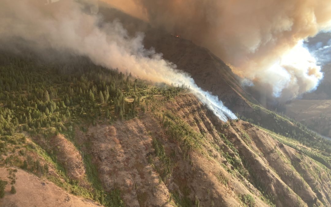
WALLOWA, Ore. – The Elbow Creek Fire continues to be pushed by erratic winds and hot temperatures, challenging firefighters as the fire burns primarily to the east and west, with some growth to the north. The fire is located in the Grande Ronde River drainage near Mud Springs, approximately 31 miles southeast of Walla Walla, Wash.
Helicopters and air tankers worked to slow the spread of the fire to the north and south yesterday, while crews aided in structure protection. Firefighters also worked the northwest side of the fire to keep the fire from spreading into Elbow Creek and progressing further through the Grande Ronde River drainage. Support from heavy airtankers aided in limiting the fire spread on the south on private ownership and firefighters were able to hold the fire last night north of Sickfoot Road. Based on infrared mapping, the fire is estimated to be 10,941 acres in size.
Today, suppression activities are focused on holding the fire in the Wildcat creek area on the east side and protecting structures at risk. Additionally, firefighters are establishing anchor points and scouting opportunities to build containment lines to the west side of the fire near Elbow Creek. Where terrain and fuels allow for crews to safely engage, firefighters continue working to build line construction and limit the fire spread on private ownership to the south, utilizing aircraft to slow fire spread.
The Elbow Creek Fire was reported on Thursday, July 15 and is burning on both sides of the Grande Ronde River and is on or threatening Umatilla National Forest lands, Wallowa-Whitman National Forest lands, Vale District Bureau of Land Management lands and Oregon Department of Forestry protected lands. The cause of the fire is under investigation.
Numerous resources are aiding in firefighting efforts, including landowners, private operators, and various
federal and state resources (hand crews, dozers, multiple engines, and water tenders). The fire is currently
being staffed by a Type 3 Northeast Oregon Interagency Management Team. The agencies will inbrief the
Oregon Department of Forestry Team 3 Type 1 Incident Management Team led by Link Smith today at 5 p.m.
at the Wallowa High School and the team is anticipated to take command of the fire tomorrow.
The conflagration request sent by Wallowa County Fire Defense Board Chief, Paul Karvoski, to the Governor’s
Office has been approved and additional resources are en route to support structure protection work with
suppression efforts. The Oregon State Fire Marshal’s Office is surging resources to assist the local fire
agencies.
Wallowa County has updated evacuation information. Additional information regarding evacuations is
available through the Wallowa County Sheriff’s Office at (541) 426-3131 or by monitoring the Wallowa
County Sheriff’s Office Facebook.
Closures are also in place surrounding the fire. Due to fire activity on both sides of the Grande Ronde River
corridor, the river is closed at Minam State Park. Any rafters that arrive into the fire area will be safely
evacuated in coordination with Wallowa County Search and Rescue. Due to extreme wildfire activity and the
concern for the safety of the public the entirety of the Umatilla National Forest has been temporarily closed.
Hot and dry conditions are expected to persist throughout the week. Fire officials want to remind everyone
that the current fire danger rating remains at EXTREME.
The latest fire information can be found by visiting the Blue Mountains Fire Information Blog
(http://bluemountainfireinfo.blogspot.com/).
# # #
July 17, 2021
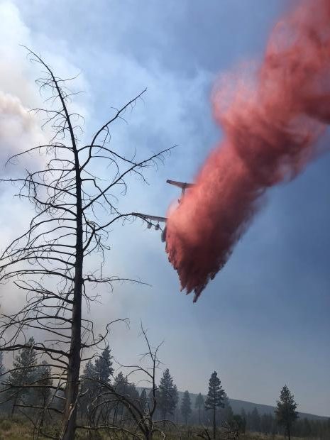
KLAMATH FALLS, Ore. – Smoke cleared early around the Bootleg Fire yesterday due to increased southwest winds, which allowed air operations to support the firefighting efforts on the ground. Firefighters utilized retardant drops and water bucket work along the northern flank and southeast corner of the fire. Crews are utilizing Sam’s Cabin Road and the 27 Road to stop fire growth to the north. Some 2,106 personnel are engaged on the fire, which is located 28 miles NE of Klamath Falls. .
The fire also remains very active on the southeastern corner towards Grouse Prairie. Crews will continue to conduct burnout operations on this southeast corner if conditions allow. Structure protection resources will protect and secure structures in this area as necessary.
“This fire is large and moving so fast, every day it progresses four to five miles,” said Incident Commander Joe Hassel, “One of the many challenges that our firefighters face every day is working in new country that can present new hazards all the time.”
The entire south and southwest portion of the fireline has been held in check for the last several days, leading to the significant increase in containment. Evacuation status has been reduced in most of the communities in Klamath County along that flank. Crews will be seen along this portion of the fire as they continue to patrol and hold the area.
New evacuation levels were implemented and increased yesterday in areas of Lake County east of the fire.
Community Meeting: There will be an in-person community meeting at the Paisley Community Center (705 Chewaucan Street, Paisley, OR 97636) Saturday, July 17, 2021 at 6:30 p.m.
Evacuations: Evacuations are rapidly changing due to the nature of this wildfire. Please visit tinyurl.com/bootlegevac for an interactive map of evacuation level in Lake and Klamath Counties.
Closures: The Fremont-Winema National Forest is closed to the public in the fire area. Map and full order available at inciweb.nwcg.gov/incident/7609/.
Smoke: Substantial smoke impacts likely in the vicinity of Paisley and Frenchglen and moderate impacts in the Lakeview area. Air quality will improve significantly in communities to the north, west, and south/southwest of the fire. Full report at: fires.airfire.org/outlooks/southcentraloregon.
Fire Information Public Phone: 541-482-1331
Fire Information Media Phone: 971-727-7255
Inciweb: inciweb.nwcg.gov/incident/7609/
Facebook: www.facebook.com/BootlegFireInfo
Twitter: twitter.com/BootlegFireInfo
Hashtags: #BootlegFire #FireYear2021
# # #
July 17, 2021
SISTERS, Ore. – There will be a virtual community meeting about the Grandview Fire tonight at 6:30pm. Fire managers will update the community on the progress being made on the fire, evacuations and answer any questions. You can view it two different ways: Microsoft Teams – https://bit.ly/GrandviewFire2021 Facebook – https://fb.me/e/PSHNNzSv
The Grandview fire is now mapped at 6,013 acres and 31% contained. This increase in acreage is due to more accurate mapping and not fire growth.
Due to the tremendous partnership between the Oregon State Fire Marshal’s office and Oregon Department of Forestry in maintaining the fire footprint and protecting homes and nearby communities, the Oregon State Fire Marshall Incident Management Team will be demobilizing today (Saturday). This will allow firefighting resources to return to their home agency and prepare for other fires burning throughout the state. It is still early in the fire season and the size and frequency of wildfires is concerning to fire officials. Our firefighters encourage Oregonians to please be fire safe, have an evacuation plan, and create defensible space around your home to keep you and your family safe this season.
Temperatures over the fire will be in the upper 80s to 90 and winds out of the NW at 4-8 miles per hour and gusts to 14 miles per hour, which may increase fire activity within the fire perimeter with some smoke showing. Crews today will begin mopping up deeper into the fire to 100 feet and more.
For up-to-date information on the Grandview Fire, please visit: https://inciweb.nwcg.gov/incident/7651/ or Centraloregonfire.org
There are evacuation notices in place issued by the Jefferson County Sheriff’s Office https://arcg.is/D9OPi and Deschutes County Sheriff’s Office https://tinyurl.com/DeschutesCOEvacMap Please follow their guidance.
Jurisdictional agencies tied to the fire include Oregon Department of Forestry Central Oregon District and Ochoco National Forest, Crooked River National Grassland.
# # #
July 16, 2021
PENDLETON, LA GRANDE, VALE, and BAKER CITY, Ore. – Firefighters battled winds and low humidity on the Elbow Creek Fire today, located in the Grande Ronde River drainage near Mud Springs, approximately 31 miles southeast of Walla Walla, Washington. The fire is burning on both sides of the Grande Ronde River and is on or threatening Umatilla National Forest lands, Wallowa-Whitman National Forest lands, Vale District Bureau of Land Management lands and Oregon Department of Forestry protected lands.
Winds and hot temperatures contributed to active fire behavior and growth today, as the Elbow Creek Fire burned to the northeast, south and west. With threats to nearby communities, helicopters and air tankers were utilized to slow the spread of the fire to the north and south while crews aided in structure protection. Erratic winds caused the fire to spot on the western edge and it has crossed Grossman Creek. Firefighters worked the northwest side of the fire to keep it from spreading into Elbow Creek and progressing further through the Grande Ronde River drainage. Heavy airtankers supported efforts to limit the fire spread on the south on private ownership and firefighters were able to hold the fire north of Sickfoot Road.
The Wallowa County Fire Defense Board Chief, Paul Karvoski, has sent a conflagration request to the Governor’s Office for additional resources to support structure protection work with suppression efforts. The Oregon State Fire Marshal’s Office is surging resources to assist the local fire agencies. Firefighters are actively working to stop the fire and will go back through to assess structure or property losses when the fire spread has been stopped.
The Elbow Creek Fire was reported on Thursday, July 15 and is now estimated to have burned 10,000 acres. The cause of the fire is under investigation.
Numerous resources are aiding in firefighting efforts, including landowners, private operators, and various federal and state resources (hand crews, dozers, multiple engines and water tenders). The fire is currently being staffed by a Type 3 Northeast Oregon Interagency Management Team. The Forest has ordered the Oregon Department of Forestry Team 3 Type 1 Incident Management Team and will inbrief the team on Saturday.
The Level 3 evacuation notice is still in effect for community members that live at Eden Bench and Troy, as well as along Wild Cat Road (also known as Wallupa Road), Powwatka Road and the 500/501 Road up to the 763 Road. A Level 3 means those within the evacuation area should leave immediately. A Level 1 evacuation notice is in effect for Roy Flat and the 603 road. Additional information regarding evacuations is available through the Wallowa County Sheriff’s Office at (541) 426-3131 or by monitoring the Wallowa County Sheriff’s Office Facebook.
Hot and dry conditions are expected to persist throughout the week. Fire officials want to remind everyone that the current fire danger rating remains at EXTREME.
Due to extreme wildfire activity and the concern for the safety of the public the entirety of the Umatilla National Forest has been temporarily closed. Additional information regarding this area closure is available at: https://bluemountainfireinfo.blogspot.com/2021/07/umatilla-national-forest-lands.html.
The latest fire information can be found by visiting the Blue Mountains Fire Information Blog
(http://bluemountainfireinfo.blogspot.com/).
# # #
July 16, 2021
Acres: 686 Number of Personnel: 201
Percent Containment: 5% Cause: Under Investigation
Date/Time Detected: July 13, 2021, 1:30 p.m. Origin/Location: La Pine, Oregon
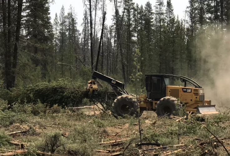
LA PINE, Ore. – On the Darlene Fire yesterday, crews laid more hose around the perimeter of the
fire and mopped up within the fire lines. They continue to secure the areas around structures as
well. Fire operations today will include strengthening the containment lines and watching for
any spot fires that could occur outside of the established lines.
Today’s temperatures are predicted to be in the low to mid 80s. Winds will be from the
southwest switching to northwest in the afternoon again. Relative Humidity (RH) is coming back
up with good recoveries at night, helping decrease fire behavior. Fuel moistures are still at
record lows, especially for July, and firefighters will continue to watch for any spot fires that
could ignite and spread rapidly.
Tonight, there will be a community meeting at the La Pine Park and Recreation District,
16405 1st St., at 6 p.m. The meeting will be streamed live on the Deschutes National
Forest’s Facebook page https://www.facebook.com/deschutesnationalforest.
Evacuations: https://www.deschutes.org/sheriff/page/emergency-information
Level 3: Go Now Residences on Darlene Way south of La Pine to the Deschutes/Klamath
County line, and along Old Ice Cave Road.
Level 2: Be Set Areas south of the Deschutes/Klamath County line including the Sun Forest
Estates, Split Rail subdivision and Antelope Meadows.
Closures and Fire Restrictions:
- Bureau of Land Management/US Forest Service: All open fires are prohibited. All the units are at an Industrial Fire Precaution Level 3 (IFPL 3). Commercial and private firewood cutting is no longer permitted. These units will be moving to an IFPL 4 as of Saturday morning at 12:01 a.m. Information is available at https://www.fs.usda.gov/alerts/deschutes/alerts-notices.
- Oregon Department of Forestry: ODF Central Oregon is in Regulated Closure. Information is available at www.odfcentraloregon.com.
- Walker Range: Walker Range is also in Regulated Closure www.walkerrange.org.
InciWeb (Incident Website): https://inciweb.nwcg.gov/incident/7665/
Facebook: https://www.facebook.com/deschutesnationalforest
Twitter: https://twitter.com/CentralORFire
# # #
July 16, 2021
PENDLETON, LA GRANDE, VALE, and BAKER CITY, Ore. – Firefighters continue battling the Elbow Creek Fire located in the Grande Ronde River drainage near Mud Springs, approximately 31 miles southeast of Walla Walla, Wash. The fire is burning on both sides of the Grande Ronde River and is on or threatening Umatilla National Forest lands, Wallowa-Whitman National Forest lands, Vale District Bureau of Land Management lands and Oregon Department of Forestry-protected lands.
The Elbow Creek Fire is now estimated to have burned 9,000 acres. The fire was reported on Thursday, July 15 and is burning in grass and timber. Winds and hot temperatures contributed to active fire behavior and growth yesterday, pushing the fire rapidly to the northeast. The movement of the fire prompted the Wallowa County Sheriff’s office to evacuate the communities of Eden Bench and Troy. Firefighters, aided by aerial resources, focused suppression efforts on protecting structures in the area and establishing containment lines to slow the spread of the fire. The cause of the fire is under investigation.
The fire continues to spread to the northeast. Today firefighters will focus on establishing access points to the fire and securing an anchor point where firefighters can build containment lines, utilizing aircraft to slow fire spread where needed. Resources on scene include hand crews, dozers, multiple engines and water tenders. Additional firefighting resources are arriving today, including resource support from the Lick Creek Fire, burning on the Pomeroy Ranger District. The Forest has ordered a Type 1 Oregon Department of Forestry Incident Management Team and will inbrief the team on Saturday.
The Level 3 evacuation notice is still in effect for community members that live at Eden Bench and Troy, as well as along Wild Cat Road, Powwatka Road and the 500/501 Road up to the 763 Road. A Level 3 means those within the evacuation area should leave immediately. Additional information regarding evacuations is available through the Wallowa County Sheriff’s Office at (541) 426-3131 or by monitoring the Wallowa County Sheriff’s Office Facebook.
Hot and dry conditions are expected to persist throughout the week. Fire officials want to remind everyone that the current fire danger rating remains at EXTREME.
Due to extreme wildfire activity and the concern for the safety of the public all of the Umatilla National Forest has been temporarily closed. Additional information regarding this area closure is available at: https://bluemountainfireinfo.blogspot.com/2021/07/umatilla-national-forest-lands.html.
The latest fire information can be found by visiting the Blue Mountains Fire Information Blog
(http://bluemountainfireinfo.blogspot.com/).
July 16, 2021
FOREST GROVE, Ore. – Steep terrain where the Game Hog Creek Fire is burning in the Tillamook State Forest has made it difficult for firefighters to deepen their control lines encircling the fire. Yesterday the fire pushed through those lines to burn three more acres.
A helicopter has been helping with air drops of water onto the fire. It will be joined by another helicopter today, with an additional helicopter also expected on Saturday. The water they drop will help cool hot spots so that embers in the interior of the fire have less chance of being blown across control lines.
About 80 ground crew remain engaged on the wildfire, which is entirely within the state forest in timber and slash. Their goal today is to extend control lines down to Elk Creek.
Cooler air from the ocean has moved over the fire today, which should aid firefighters.
The Tillamook State Forest remains open to visitors with the exception of Drift Creek and Idiot Creek forest roads and the Fear and Loaming mountain bike trail. These are closed due to fire activity in the area. Rogers Camp trailhead is being used as a staging area for firefighters and is also closed to the public. Highway 6 and 26 to the coast remain open and unaffected by the fire. No evacuations are associated with this fire.
Cause of the fire is still under investigation.
# # #
July 16, 2021
SISTERS, Ore. – A Red Flag Warning over the fire area expired at 11 p.m. last night with overnight temperatures dropping into the 40s and humidity recovering to reduce fire activity. The fire did not grow yesterday. It remains at 5,971 acres and is 20% contained.
Overnight crews used infrared equipment to identify hot spots near the fire lines that the day shift will extinguish. Crews also worked to improve roads around the fire to reduce dust and improve access.
Two Oregon National Guard helicopters will support ground crews today. This extra assistance will aid firefighters in keeping the Grandview Fire inside the established containment lines.
Temperatures will be lower over the fire with highs in the 80s and winds out of the northwest at 5-9 mph and gusts to 15 mph. These better weather conditions will allow crews to continue to build and strengthen containment lines by cutting back or removing fuel on the perimeter, extinguishing hot spots near the fire line and remove hazard trees. This will allow crews to start mopping up deeper into the fire perimeter.
Two task forces of structure fire engines and a structural hand crew will continue working around homes in the fire area. Due to great progress firefighters have made on the fire the Oregon State Fire Marshal’s Office will be demobilizing their remaining fire crews at the end of the day.
For up-to-date information on the Grandview Fire, please visit: https://inciweb.nwcg.gov/incident/7651/ or Centraloregonfire.org
There are evacuation notices in place issued by the Jefferson County Sheriff’s Office https://arcg.is/D9OPi and Deschutes County Sheriff’s Office https://deschutes.maps.arcgis.com/apps/PublicInformation/index.html?appid=f9de45337eb043fca432548f91d03ad6 Please follow their guidance.
Jurisdictional agencies tied to the fire include Oregon Department of Forestry Central Oregon District and Ochoco National Forest, Crooked River National Grassland.
###
July 15, 2021
CENTRAL OREGON – With no additional growth and minimal fire activity, crews on the Grandview Fire have been able to focus all efforts on mopping up the perimeter of fire to increase containment.
Since the fire began on Sunday, July 11, firefighters have been focused on suppressing the blaze, which remains at 5,971 acres. Crews have worked around the clock to hold and improve preliminary containment lines around the perimeter and today, were able to get a hose lay around the entire fire perimeter to begin or continue mop-up operations. Mop-up is the tedious process of ensuring that everything within 150 feet – 300 feet of the fire perimeter is cool to the touch so embers cannot escape and reignite the fire. Crews will work on this next phase of suppression until full containment is achieved.
A Red Flag Warning continues today until 11 p.m. Predicted low relative humidity and winds between 5-15 mph (gusts to 20 mph) out of the west could challenge containment lines on the fire’s eastern edge. Crews will continue to build and strengthen containment lines and monitor and rapidly respond to any spot fires that may emerge outside the lines.
The Forest Service has issued an area closure for the federally managed public lands in and around the Grandview Fire perimeter. For more information and to view a map of the closure, visit: https://www.centraloregonfire.org/2021/07/15/10254/
For up-to-date information on the Grandview Fire, please visit: https://inciweb.nwcg.gov/incident/7651/ or Centraloregonfire.org
There are evacuation notices in place issued by the Jefferson County Sheriff’s Office and Deschutes County Sheriff’s Office. Please follow their guidance.
Jurisdictional agencies tied to the fire include Oregon Department of Forestry Central Oregon District and Ochoco National Forest, Crooked River National Grassland.
# # #
July 15, 2021
FOREST GROVE, Ore. – The fire lines firefighters dug to control the Game Hog Creek Fire burning in the Tillamook State Forest have held. About 80 ground crew are engaged on the wildfire. They have been aided by helicopters assisting with air drops onto the fire, which is in a steep, inaccessible area of the forest.
More precise mapping shows the fire, which is about 22 miles northwest of Forest Grove, has burned a little over 130 acres.
Temperatures overnight are expected to drop somewhat, which will help retain moisture in the air. Cooler air off the ocean is expected to move inland over the fire on Friday, which should also aid firefighters.
Most of the Tillamook State Forest remains open to visitors with the exception of Drift Creek and Idiot Creek forest roads and the Fear and Loaming mountain bike trail due. These are closed due to fire activity in the area. Rogers Camp trailhead is being used as a staging area for firefighters and is also closed to the public. Highway 6 and 26 to the coast remain open and unaffected by the fire, which is entirely within the state forest.
Cause of the fire is still under investigation.
# # #

July 15, 2021
Location: 28 miles northeast of Klamath Falls, OR
Size: 227,234 acres
Containment: 7%
Personnel: 1,716
KLAMATH FALLS, Ore. – Firefighters reported another day of extreme fire behavior including torching, running, and frequent spotting ahead of the main fire including growth into the Gearhart Wilderness and north towards Lake Henry. The Log Fire, located 8 miles southwest of Summer Lake, continued to spread to the east driven by steady west winds and is now 4,830 acres. Large pyrocumulus clouds developed over the eastern portion of the fire during the afternoon and are possible again today. Throughout the night, crews continued working in the greater Fuego Mountain area as well as to the southeast along the 34 Road, improving existing containment lines.
“This fire is going to continue to grow – the extremely dry vegetation and weather are not in our favor,” said Joe Hessel, Incident Commander for ODF Team 1 Incident Management Team. “We are going to continue to prepare lines, protect structures, and move resources as we can around the fire’s edge.”
With continued west winds predicted, firefighters will continue to work to hold the fire to the 34 Road to prevent further eastern and southern spread. Heavy beetle killed timber and active fire behavior will present challenges in keeping the fire north and west of this road. Crews will continue to work on strengthening their existing line as well as scout for potential contingency lines. Structure protection groups are in place along the fire to help reduce risk to area homes.
Community Meeting: Please join us for a virtual community meeting Friday July 16, 2021 at 6:30pm at www.facebook.com/BootlegFireInfo.
Evacuations: Evacuations are rapidly changing due to the nature of this wildfire. Please visit tinyurl.com/bootlegevac for an interactive map of evacuation level in Lake and Klamath Counties.
Closures: The Fremont-Winema National Forest is closed to the public in the fire area. Map and full order available at inciweb.nwcg.gov/incident/7609/.
Smoke: Heavy smoke expected July 15, 2021 with widespread impacts to communities and State Route 140 in Oregon between Chiloquin and Bly. Full report at: fires.airfire.org/outlooks/southcentraloregon.
Fire Information Public Phone: 541-482-1331
Fire Information Media Phone: 971-727-7255
Inciweb: inciweb.nwcg.gov/incident/7609/
Facebook: www.facebook.com/BootlegFireInfo
Twitter: twitter.com/BootlegFireInfo
Hashtags: #BootlegFire #FireYear2021

July 15, 2021
SISTERS, Ore. — Firefighters successfully stopped three spot fires that jumped lines during the Red Flag Warning yesterday. As temperatures cooled and the humidity increased last night, firefighters strengthened the containment lines by beginning to cool the hot areas just inside the perimeter.
Retardant is dropped over the Grandview Fire in central Oregon. More aircraft are expected to arrive at the fire today to assist with control efforts.
The great work by last night’s crews will enable today’s crews to hold the perimeter of the Grandview Fire. The fire is estimated to be 5,971 acres and is 14% contained.
Two Oregon Air National Guard helicopters are arriving to support ground crews, joining four private contract helicopters already at the fire. This extra assistance will aid firefighters in keeping the Grandview Fire inside the established containment lines.
A Red Flag Warning continues today until 11 p.m. Predicted low relative humidity and winds between 5-15 mph (gusts to 20 mph) out of the west could challenge containment lines on the fire’s eastern edge. Crews will continue to build and strengthen containment lines and monitor and rapidly respond to any spot fires that may emerge outside the lines.
There are still homes and other structures at risk, and as the risk diminishes due to the great work by our firefighters. Fire managers are coordinating resources across multiple fires to best meet firefighting needs throughout Oregon. Due to progress made on the fire, some structural task forces will depart to aid other fires within the state today.
For up-to-date information on the Grandview Fire, please visit:
https://inciweb.nwcg.gov/incident/7651/ or Centraloregonfire.org
There are evacuation notices in place issued by the Jefferson County Sheriff’s Office and Deschutes County Sheriff’s Office. Please follow their guidance.
Jurisdictional agencies tied to the fire include Oregon Department of Forestry Central Oregon District and Ochoco National Forest, Crooked River National Grasslands.
July 15, 2021
OREGON CITY, Ore. – As part of its mutual-aid agreements with local fire departments, ODF personnel and firefighting equipment from the North Cascade District assisted in a fire between Oregon City and Canby yesterday afternoon. The fire near Highway 99 E caused evacuations and was widely reported on in the Portland-area media.