July 22, 2021
Fire Information: 541-805-2784 (7 a.m. – 9 p.m.)
Email: ElbowCreek.information@gmail.com
Facebook: www.facebook.com/ElbowCreekFire
Inciweb: inciweb.nwcg.gov/incident/7672/
Wallowa, ORE. – The Elbow Creek Fire, now at 19,993 acres, is moving up the ranks in priority across the region and orders for crews and other resources are being filled. Twelve new crews arrived yesterday evening and the fire now has resources from Washington, Texas, Arizona, New Mexico, Michigan, California, Oregon, and Idaho.
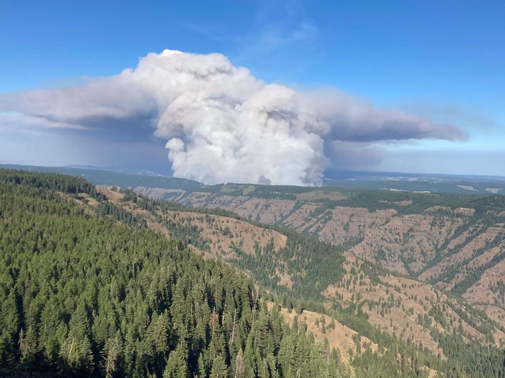
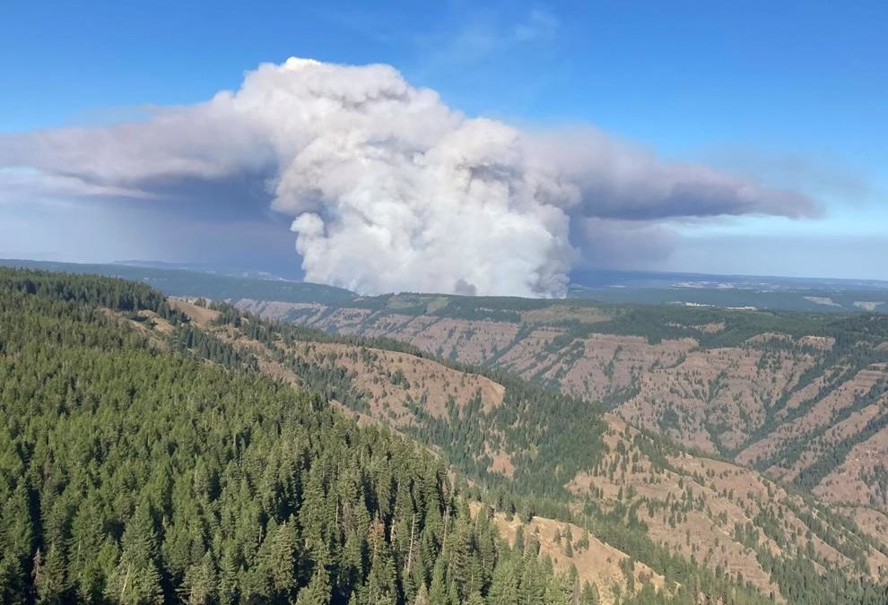
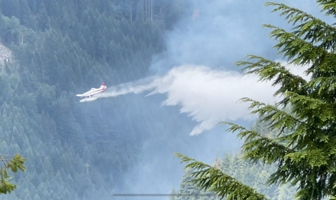
Smoke plume from the Elbow Creek Fire, July 16, 2021.
As additional personnel arrive more objectives are being met, giving firefighters the ability to plan ahead and make changes to suppression techniques.
The most active area of the fire remains in the Elbow Creek Drainage near the confluence of the Grande Ronde River. This particular area is central to the intersection of several canyons that produce erratic winds from all directions.
Steep slopes along Indian Ridge and Grossman Creek are challenging as firefighters continue to establish hand and dozer lines. Water dispensing helicopters and a retardant-dropping airtanker are being used to aid firefighters in slowing the fire in the Elbow Creek and Sickfoot Creek drainages. A mobile retardant base is now in place at the Bar B Ranch on the southeast side of the fire for faster aircraft turnaround. Looking ahead, the fire team is planning on opening up existing road systems and ridgetops with bulldozers and hand crews. This contingency planning will create backup containment lines should they be needed in the future.
With little to no activity in the northeast and eastern side of the fire, crews continue to mop up and widen containment lines. Firefighters were successful in yesterday’s burnout operation within Sickfoot Creek and today’s goal is to develop fire line around the area perimeter. Firefighters are having success on the south end of the fire, in the Deep Creek drainage, securing lines and transitioning to mop-up.
Weather conditions call for lower humidity with potential for unpredictable and erratic westerly winds. These conditions can cause swirling winds within the deep canyons leading to additional fire activity.
Incident management team members and others will once again share information about the fire this evening through Facebook Live and Zoom. Stay tuned for details.
July 22, 2021
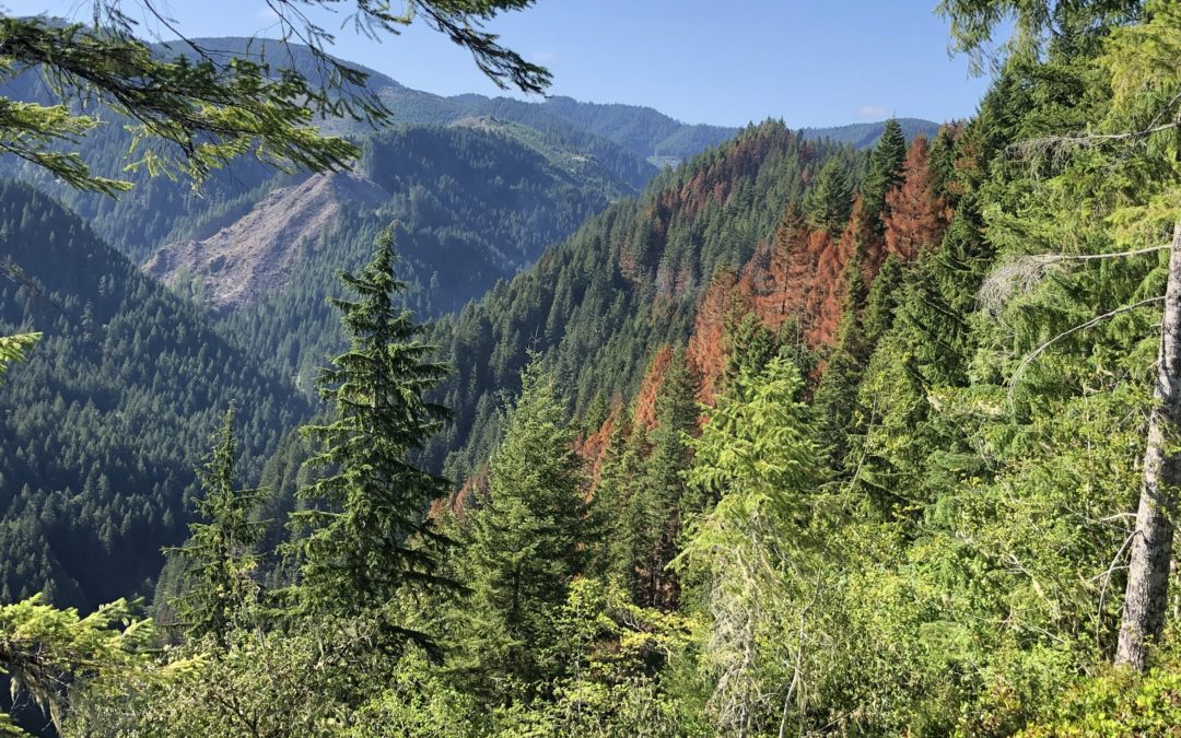
Central Oregon – The Grandview Fire burning northeast of Sisters on private lands protected by Oregon Department of Forestry and the Crooked River National Grassland is now 95% contained at 6,032 acres.
A Central Oregon Management Service Type 4 Incident Management Team under the command of Luke Garcia is now managing the Grandview Fire. Crews will continue to mop-up the fire perimeter until it is fully contained. This will be the last daily update until containment is reached.
The Grandview Fire was reported at 1:30 p.m., Sunday, July 11th, burning on lands protected by Oregon Department of Forestry and on the Crooked River National Grassland.
For up-to-date information on Central Oregon fires, visit www.centraloregonfire.org or www.twitter.com/CentralORFire
July 22, 2021
Bootleg Fire Public Information
Zone 1 Email: bootleg.fire.information@gmail.com
Zone 2 Email: 2021.bootleg@firenet.gov
Public Line: 541-482-1331
Media Line: 971-727-7255
Inciweb: inciweb.nwcg.gov/incident/7609/
Facebook: www.facebook.com/BootlegFireInfo
Twitter: twitter.com/BootlegFireInfo
Location: 28 miles northeast of Klamath Falls, OR
Size: 399,359 acres
Personnel: 2,359
Containment: 38%
Klamath Falls, ORE. – Higher humidity and reduced wind speeds yesterday and overnight allowed firefighters to construct and improve firelines. Today’s forecast will be favorable to continue those efforts in securing the existing fireline. A steady warming and drying trend will begin today and continue into the weekend which can affect fire activity in the upcoming days.
“Fire crews and support personnel have made significant progress in containing this fire in the last few days,” said Joe Prummer, Incident Commander trainee of Pacific Northwest Incident Management Team 2. “However, we still have a long road ahead of us to ensure the safety of the surrounding communities.”
The Oregon State Fire Marshall have transitioned to working with Zone 2 on the north and northeast sections of the fire. The fireline to Long Creek was improved with dozers and helicopter drops. Firefighters scouted the area from Long Creek to Coyote Creek to develop a plan to connect the fireline to the already completed line near The Nature Conservancy compound. Fire activity picked up in the Sycan Marsh but was quickly contained by dozers. Crews and equipment are going direct along the eastern fireline while also working to improve contingency lines between the fire and the communities near Summer Lake as well as provide structure protection for those homes. There was some slight growth to the northeast, however dozer crews were able to stop that progression and crews will work to hold that today.
In many areas of the fire, firefighters are working on patrolling and mopping areas along the line. This step is necessary to ensure that all heat that could threaten the security of the fire line has been extinguished. Resources continue to be shifted around the fire perimeter to meet resource needs across the fire area. As the need for night operations on the southern zone decreases, those resources will be moved to day shift or sent home for rest as they time out.
An additional responsibility of the firefighters on the Bootleg Fire is to provide initial attack response in the area adjacent to the fire. Any new starts have the potential to rapidly grow, given the extremely dry fuel conditions. Fire managers have identified resources that would respond immediately in the event that a new fire should start.
Evacuations: Klamath and Lake Counties have altered the evacuation zones, please make sure to check the new areas on the interactive map. Interactive map of evacuation levels in Lake and Klamath Counties at tinyurl.com/bootlegevac
Red Cross Evacuation Shelters: Open 24/7: Thrive Church – 235 South Laguna St. Klamath Falls, Oregon for information or assistance: 1-800-Red-Cross, FB @RedCrossCascades, (www.redcrossblog.org/disaster)
Closures: The Fremont-Winema National Forest is closed to the public in the fire area. Map and full order available at inciweb.nwcg.gov/incident/7609/.
Smoke: Afternoon smoke impacts will continue to be high in areas north, northeast, and east of the fire, especially in the vicinity of Silver Lake, Summer Lake, and Paisley. Continuing SW winds will push smoke from the Bootleg Fire away from Lakeview, Klamath Falls and Sprague River Valley, but may bring some smoke from the Dixie Fire into the area. See: fires.airfire.org/outlooks/southcentraloregon.
July 21, 2021
July 21, 2021, 4 p.m. – Elbow Creek Fire afternoon update video
July 21, 2021
Salem, ORE. — Due to fire danger and limited firefighting resources across the western U.S., effective Thursday, July 22 no campfires will be allowed in state parks and in state-managed forests east of Interstate 5, even in designated campfire areas. This includes charcoal fires, cooking fires, warming fires, charcoal briquettes, pellet grills, candles, tiki torches and other devices that emit flames or embers. Portable cooking stoves or propane lanterns using liquefied or bottle fuels are allowed, though propane fire pits are not.
This ban covers all state-managed parks and forestlands east of Interstate 5, and includes prohibitions on fires in designated fire rings. The public can also anticipate restrictions in other areas based on fire danger. Restrictions may increase as fire danger rises in other parts of Oregon and will remain in place until conditions moderate.
State agencies strongly encourage checking fire danger levels and associated restrictions in a given area before traveling and daily during a visit.
With hot, dry weather expected to continue and no relief forecasted in the foreseeable future – and several large fires on Oregon’s landscape – the step of banning campfires east of Interstate 5 was deemed a necessary measure to protect life and property in what is already a very challenging and dangerous fire season.
Particularly in times of elevated fire danger, maintaining capacity to respond quickly to new fire starts is critical. Humans cause on average 70% or more of fires in Oregon, and these additional restrictions are intended to help reduce the number of human-caused fire starts. This will allow firefighters to focus on the existing large fires as well as new blazes that may emerge.
“We are seeing record-low humidity in much of the state, and as forest fuels dry out there is tremendous potential for fire to establish and spread quickly,” Oregon State Forester Nancy Hirsch said. “With months of fire season left, this measure will help us prevent one of the most common types of human-caused fires, which reduces the risk to our communities and natural resources.”
“Every park visitor can do their part to protect the landscapes we all love,” Lisa Sumption, Oregon Parks and Recreation Department Director said. “Help reduce fire risk by bringing meals that don’t require heating or cooking.”
July 21, 2021
Fire Information: 541-805-2784 (7 a.m. – 9 p.m.)
Email: ElbowCreek.information@gmail.com
Facebook: www.facebook.com/ElbowCreekFire
Inciweb: inciweb.nwcg.gov/incident/7672/
Wallowa, ORE. – The Elbow Creek Fire, 17 miles northwest of Wallowa, is estimated at 18,599 acres and is 20 percent contained. The fire’s increasing complexity and growth has moved it up on the priority scale with other fires in the region. The higher ranking should provide more opportunity to acquire additional resources within the next few days. Six additional crews arrived yesterday evening to support current suppression efforts.
Tuesday’s cooler conditions, combined with overnight showers is seen as an opportunity to get ahead of fire activity. Of concern is the Elbow Creek drainage, where the fire spotted from the east side of Elbow Creek over to the west side yesterday afternoon. Firefighters are hoping to gain direct access to the fire’s edge under today’s milder conditions with additional helicopter support. Crews are also going direct where they can in the Sickfoot and Deep Creek drainages, while planning for burnout operations where direct fire line construction in steep canyons is not an option. The north and east sides of the fire have not moved within the past few days and firefighters continue to mop up and patrol the area.
Lightning was spotted near the southwest side of the fire last night and the area is being monitored for possible new fires.
Level 2 and 3 evacuation notifications by the Wallowa County Sheriff’s Office remain unchanged. Additional information regarding evacuations is available on the Wallowa County Sheriff’s Office Facebook page (www.facebook.com/Wallowa-County-Sheriffs-Office-147212815486187).
Several fires continue to burn throughout Oregon and fire danger remains extreme. Fire officials continue to ask the public for assistance in preventing human-caused fires by following all fire regulations and restrictions. Log on to oregon.gov/odf for up-to-date fire restrictions in your area.
July 21, 2021
Grandview Fire Information: 541-633-7410 (8 a.m. – 8 p.m.)
Email: grandviewfire.information@gmail.com
Facebook: https://www.facebook.com/ODFCentralOregon
Twitter: @CentralORFire
Deschutes County Emergency Information Line: 541-550-4850
Sisters, ORE. – The Grandview fire remains at 6,032 acres. Containment on the fire is now 84%.
ODF IMT2 plans to transfer command of the fire to a local Central Oregon Fire Management Service Type 4 team at 6:00 a.m. Thursday morning. This will be ODF IMT2’s last update.
Crews today will finish removing equipment and supplies from the fire line and continue mop up by carrying out a final grid search to extinguish heat 300’ or less inside the fire line.
A regional Burned Area Emergency Response Team (BAER) will work with the local Type 4 team to assess the areas affected and develop a plan for suppression repair on federal lands while ODF will do suppression repair on ODF protected lands.
We would like to thank the community for remaining vigilant and for obeying forest closures and fire restrictions put into place on the Deschutes National Forest and the Ochoco National Forest, Crooked River National Grassland.
A red flag warning will be in effect until 10pm tonight for gusty winds and low relative humidity.
For up-to-date information on the Grandview Fire, please visit: https://inciweb.nwcg.gov/incident/7651/ or Centraloregonfire.org
Jurisdictional agencies tied to the fire include Oregon Department of Forestry Central Oregon District and Ochoco National Forest, Crooked River National Grassland.
July 21, 2021
Community Meeting – Members of the team will meet with the community tonight, July 21, 2021, at 7:00 p.m. at the Alger Community Theatre (24 South F Street, Lakeview, OR 97630).
Location: 28 miles northeast of Klamath Falls, OR
Size: 394,407 acres
Personnel: 2,268
Containment: 32%
Klamath Falls, ORE. – The weather moderated yesterday with reduced wind speeds, lower temperatures, and slightly higher humidity, which allowed firefighters to continue constructing and improving firelines. Weather conditions are favorable again today for the efforts to secure existing fireline.
On the northern edge of the fire, line was constructed to Long Creek and firefighters scouted a line to tie into the anchor point near the Sycan Marsh Nature Conservancy. The reduced fire activity yesterday allowed firefighters to construct dozer line directly against the fire edge along the north and east boundary of the Log Fire. There is expected northeast movement of the fire toward Winter Ridge and Summer Lake. Crews and equipment are going direct while also working to improve contingency lines between the fire and those communities and provide structure protection for those homes.
Firefighters are continuing to work around the southeastern corner of the fire where the majority of recent growth has occurred. As the fire pushes up into the old Watson Fire burn area, fuels become less continuous and fire behavior is decreased. Crews are challenged by working around many snags in this area but are making good progress. Any fire that spots over or pushes the fire line has the potential for additional rapid growth.
Firefighters continue to patrol the fireline along the southern to northwestern flanks of the fire. As crews patrol, they look for places to mitigate risks to the controlled line of the fire. Returning residents to these areas may see unburned fuels within the fire perimeter that will continue to burn and produce smoke for weeks.
The Oregon State Fire Marshal’s Office’s (OSFM) Green Team is demobilizing today after working at the fire for two weeks. Yesterday, they worked to support the transition of the incoming Red Team which will continue the OSFM’s mission of protecting lives and homes. The OSFM’s team is working in Unified Command with the two other incident management teams on the Bootleg Fire.
“While our Incident Management Team may be transitioning, our dedication to protecting the community remains. Our firefighters are up to the task, their work the last two weeks has undoubtedly protected hundreds of homes and we remain vigilant to the task at hand.” Ian Yocum, Oregon State Fire Marshal’s Red Team Incident Commander.
Evacuations: Evacuations are rapidly changing due to the nature of this wildfire. Interactive map of evacuation levels in Lake and Klamath Counties at tinyurl.com/bootlegevac
Red Cross Evacuation Shelters: Open 24/7 New Site: Thrive Church – 235 South Laguna St. Klamath Falls, Oregon and Daly Middle School 906 S 3rd St. Lakeview, Oregon for information or assistance: 1-800-Red-Cross, FB @RedCrossCascades, (www.redcrossblog.org/disaster)
Closures: The Fremont-Winema National Forest is closed to the public in the fire area. Map and full order available at inciweb.nwcg.gov/incident/7609/.
Smoke: Smoke impacts will be high in areas north, northeast, and east of the fire, especially in the vicinity of Silver Lake, Summer Lake, and Paisley. See: fires.airfire.org/outlooks/southcentraloregon.
Fire Information Public Phone: 541-482-1331
Fire Information Media Phone: 971-727-7255
Inciweb: inciweb.nwcg.gov/incident/7609/
Facebook: www.facebook.com/BootlegFireInfo
Twitter: twitter.com/BootlegFireInfo
Hashtags: #BootlegFire #FireYear2021
July 21, 2021
Forest Grove, ORE. – The Game Hog Creek Fire is in heavy mop-up today. Crews are pushing into the interior working to establish a 300-foot perimeter free of any burning material. Timber fallers have cut dangerous trees that pose a high risk of falling. Porta-tanks and pumps are in place to support mop-up activities. The fire perimeter has been mapped and the current estimate is 182 acres. It is 100% lined, but fire in the cliffs is still a concern.
July 20, 2021
An informational meeting is scheduled for this evening at 7:00 p.m. at the Wallowa Senior Center. Go to Facebook Live to attend the virtual meeting. A virtual option will be available through Facebook Live and Zoom for those unable to attend.
Wallowa, ORE. – The Elbow Creek Fire, located about 17 miles northwest of Wallowa, has grown to 17,260 acres. Containment is estimated at 15 percent.
The north and east sides of the fire are in excellent shape as crews transition into mop-up operations. The primary focus for crews remain on the south and west sides with overnight growth into the Deep Creek and Sickfoot Creek drainages. Wildland firefighting crews will continue to establish and strengthen containment lines and seek opportunities for burnout operations on this portion of the fire. One helicopter is assisting with suppression efforts with options available from other fires if needed.
Structural task forces based in Troy and Promise, which were brought in by the Oregon State Fire Marshal’s Office, have prepped structures in the area by reducing flammable vegetation around homes. With defensible space measures complete, the task forces are now assisting wildland firefighters with fire line construction.
A Red Flag Warning remains in effect until Wednesday morning. While no lightning was reported in the fire area yesterday, the ongoing threat of thunderstorms could bring erratic winds, further challenging fire suppression efforts.
Level 2 and 3 evacuation notifications by the Wallowa County Sheriff’s Office remain unchanged. Additional information regarding evacuations is available on the Wallowa County Sheriff’s Office Facebook page (www.facebook.com/Wallowa-County-Sheriffs-Office-147212815486187).
Several fires continue to burn throughout Oregon and fire danger remains extreme. Fire officials continue to ask the public for assistance in preventing human-caused fires by following all fire regulations and restrictions. Log on to oregon.gov/odf for up-to-date fire restrictions in your area.
July 20, 2021
In coordinated effort, the Deschutes and Jefferson County Sheriff’s offices have lifted all evacuations around the Grandview Fire area.
Grandview Fire Information: 541-633-7410 (8 a.m. – 8 p.m.)
Email: grandviewfire.information@gmail.com
Facebook: https://www.facebook.com/ODFCentralOregon
Twitter: @CentralORFire
Deschutes County Emergency Information Line: 541-550-4850
Sisters, ORE. – The Grandview fire remains at 6,032 acres. Containment on the fire is now 72%.
Fire crews working inside the fire line are pushing mop up toward the objective of 300 feet. Crews are hauling fire hose back to camp, leaving the main hose lines in place for use as ODF IMT 2 plans to hand over command to a type 4 team on Thursday.
Snags are a continuing concern around the perimeter of the fire and felling crews are working to remove them to reduce risk of hazards to the other crews and the public.
As containment on the fire grows, we would like to thank the public for remaining vigilant and for obeying forest closures put into place on the Deschutes National Forest and the Ochoco National Forest Crooked River National Grasslands.
Temperatures over the fire will be in the lower 90’s with winds out of the NW at 5-10 mph.
For up-to-date information on the Grandview Fire, please visit: https://inciweb.nwcg.gov/incident/7651/ or Centraloregonfire.org.
Jurisdictional agencies tied to the fire include Oregon Department of Forestry Central Oregon District and Ochoco National Forest, Crooked River National Grassland.
July 20, 2021
Community Meeting: July 20, 2021 at 6:30 p.m. Facebook Live @BootlegFireInfo. The meeting will be live streamed and a recording posted to Facebook @BootlegFireInfo.
Location: 28 miles northeast of Klamath Falls, OR
Size: 388,359 acres
Personnel: 2,250
Containment: 30%
Klamath Falls, ORE. – For ten days in a row, extreme fire behavior in the afternoon and evening has resulted in firefighters moving to safety zones. Yesterday evening, parts of the fire received a trace amount of rain from thunderstorms in the area. The main Bootleg Fire merged with the Log Fire as anticipated. Fire activity in this area was moderated by smoke cover decreasing fire intensity, so firefighters took advantage of conditions to improve the northeastern firelines. Toward the east, significant fire movement resulted in the fire spotting over Forest Road 28 (Trunk Road) toward Summer Lake. On the north edge, firefighters made progress constructing dozer line during the night and early morning while temperatures were cooler and winds calmer. By the afternoon, with increasing winds and temperature, the fire moved across Coyote Creek and refocused on protecting the Sycan Marsh Nature Conservancy structures. Night operations were able to construct dozer line to Long Creek and establish an anchor point near Nature Conservancy structures.
Firefighters continue to patrol 40+ miles of fireline on the southern and western flanks of the fire. There continues to be areas of heat in several locations on the west and south of the fire including the Preacher Flats area. As crews patrol, they look for places to mitigate risks to the controlled line of the fire. Property owners are reminded to use caution when returning; hazardous hot spots and fire-weakened trees remain throughout the area. Please use an abundance of caution around these areas. Additionally, unburned fuels within the fire perimeter will continue to burn and produce smoke for weeks.
“Fighting this fire is a marathon, not a sprint,” said Rob Allen, Incident Commander for PNW Incident Management Team 2. “We’re in this for as long as it takes to safely confine this monster”.
Today, winds will be from the southwest with a Red Flag Warning from 2 to 8 p.m. for gusty winds and low relative humidity, resulting in continued movement of the fire toward the east. Today, firefighters will work to mitigate risks for by aggressively felling hazard trees. Crews will continue to work on areas where the fire has slopped or spotted over Forest Roads 28 and 34. If they are not successful in the next 24 hours, they will fall back to structure protection in the Summer Lake community, with possible Hwy 31 closure and a burn out operation to remove fuels between the residential areas and the main fire. In the north toward Silver Lake, firefighters plan to close the gap of fireline between Long Creek and the anchor point at Nature Conservancy structures. Firefighters are preparing secondary fireline and scouting for contingency firelines in all areas of fire growth. Structural protection firefighting crews continue to progress and work to mitigate risks to structures. As crews move around the evolving fire, resources are shifted to more active areas of the fire.
Evacuations: Evacuations are rapidly changing due to the nature of this wildfire. Interactive map of evacuation levels in Lake and Klamath Counties at tinyurl.com/bootlegevac. Red Cross Evacuation Shelters: Open 24/7 New Site: Thrive Church – 235 South Laguna St. Klamath Falls, Oregon and Daly Middle School 906 S 3rd St. Lakeview, Oregon for information or assistance: 1-800-Red-Cross, FB @RedCrossCascades , (www.redcrossblog.org/disaster)
Closures: The Fremont-Winema National Forest is closed to the public in the fire area. Map and full order available at inciweb.nwcg.gov/incident/7609/.
Smoke: Smoke impacts will be high in areas north, northeast, and east of the fire, especially in the vicinity of Silver Lake, Summer Lake, and Paisley. See: fires.airfire.org/outlooks/southcentraloregon.
Fire Information Public Phone: 541-482-1331
Fire Information Media Phone: 971-727-7255
Inciweb: inciweb.nwcg.gov/incident/7609/
Facebook: www.facebook.com/BootlegFireInfo
Twitter: twitter.com/BootlegFireInfo
Hashtags: #BootlegFire #FireYear2021
July 20, 2021
Sisters, ORE. – In coordination with the Deschutes and Jefferson County Sheriff’s office, all evacuations have been lifted in the Grandview Fire area. We will continue to ensure public and firefighter safety moving forward and would like to thank you for continuing to obey forest closures put into place by the Deschutes National Forest Sisters Ranger District and Ochoco National Forest Crooked River National Grasslands.
There are evacuation notices in place issued by the Jefferson County Sheriff’s Office and Deschutes County Sheriff’s Office. Please follow their guidance.
For up-to-date information on the Grandview Fire, please visit: https://inciweb.nwcg.gov/incident/7651/ or Centraloregonfire.org.
July 19, 2021
FOREST GROVE, Ore. – Fire operations are going well and crews are strengthening the lines. Fire activity remains low. No new growth since last mapping at 182 acres. Another mapping will take place in the next few days.
July 19, 2021
Full size resolution map
National: Preparedness Level 5 (Geographic areas competing for wildland fire suppression resources. Majority of national resources committed. Three or more geographic areas with large, complex fires.)
|
Number of fires |
Acres burned |
| Total to date |
35,086 |
2,537,744 |
Oregon: Preparedness Level 5.
| Only ODF-protected lands (16 million acres) |
| |
# of fires |
Acres burned |
| 2021 year-to-date |
578 |
132,604 |
10-year avg. year-to-date
(2011 – 2020) |
384 |
9,896 |
| All lands in Oregon (Includes ODF-protected lands) |
| |
# of fires |
Acres burned |
| 2021 year-to-date |
973 |
384,604 |
Current large fires in Oregon: Includes all lands
| Name |
Date |
Total Acres |
ODF Acres |
Containment |
Location |
Cause |
Notes |
| Bootleg |
July 6, 2021 |
293,307 |
108,021 |
22% |
28 miles NE of Klamath Falls |
Unknown |
ODF IMT 1, PNW IMT 2, NW IMT 10 & OSFM Green IMT
Fire information |
| Fire continues to be active on northeast, east and southeast flanks. Level 3 evac orders in effect for 137 residences in Klamath and Lake counties. Red Flag Warning in effect for high temps, low RH and possible thunderstorms. S/SW winds gusting 25-30 mph and possibly stronger if thunderstorms develop. Lack of IR flights is a challenge. |
| Log |
July 12, 2021 |
10,484 |
5,681 |
0% |
NE of Bootleg Fire |
Unknown |
PNW IMT 2 |
| Structures in Summer Lake area being evaluated for possible evacuation advisories. Red Flag Warning in effect for high temps, low RH and possible thunderstorms. |
| Grandview |
July 12, 2021 |
6,032 |
1,552 |
57% |
NE of Sisters |
Unknown |
ODF IMT 2 & OSFM Red IMT
Fire information |
| 150-foot mop up standards met around fire perimeter. Goal is to reach 200 feet today. Meeting today to review evacuation levels, and plan for transfer to IMT 4 organization on Thursday |
| Jack |
July 5, 2021 |
17,092 |
81 |
50% |
20 M East of Glide |
Unknown |
NW IMT 9 & OSFM Blue IMT
Fire information |
| Hwy 138 is open but lack of traffic management is hampering transportation of fire resources. South flank growth is being mitigated with burnout operations and indirection fire line construction. North flank burnout operations are increasing containment line depth. Level 1 & 2 evacuation advisories remain in Dry Creek and Steamboat areas. |
| Bruler |
July 12, 2021 |
156 |
0 |
10% |
9 miles south of Detroit |
Unknown |
NW IMT 13
Fire information |
| A helicopter from Grandview Fire helped suppress spot fire. Objectives today include continuing line construction, snag felling and hoselay installation. |
| Darlene |
July 13, 2021 |
686 |
360 |
85% |
1 mile E of LaPine |
Unknown |
NW IMT 6
Fire information |
| IMT 6 transitioning today to local IMT 4 organization. |
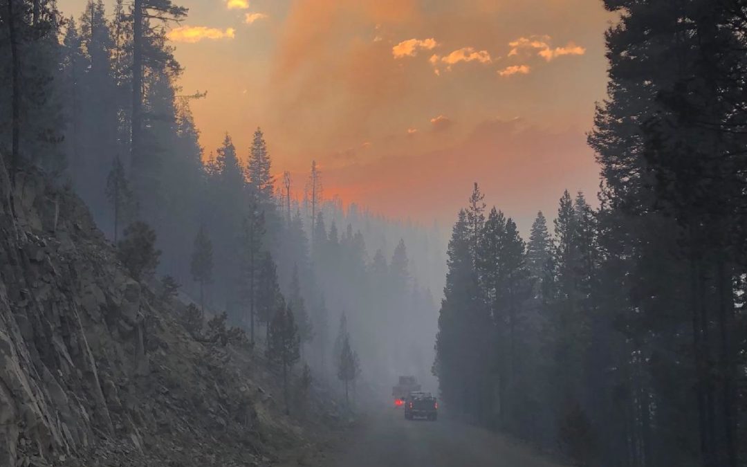
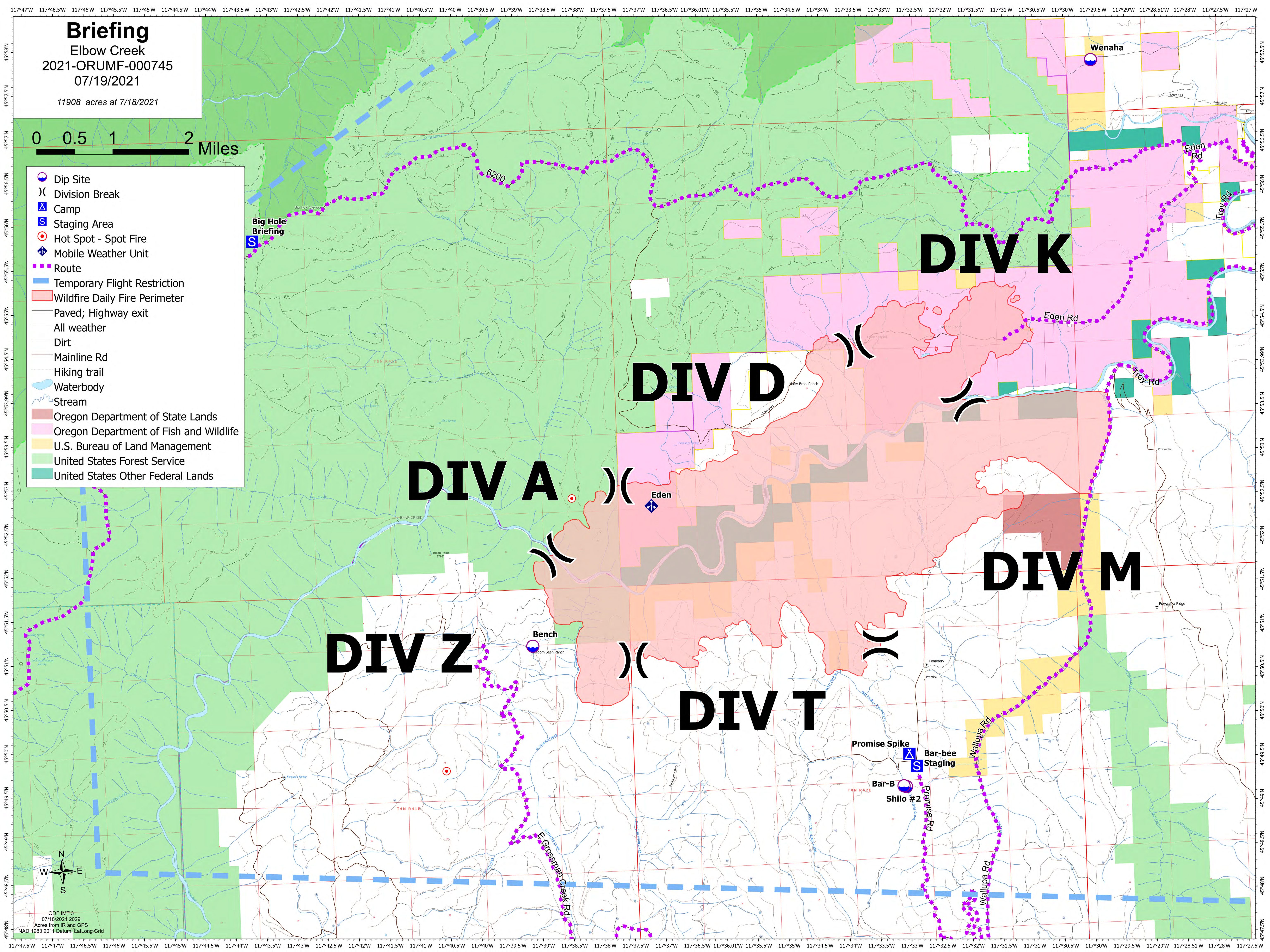
| Elbow Creek |
July 15, 2021 |
11,908 |
8,544 |
0% |
Near Troy |
Unknown |
ODF IMT3
Fire information |
| Resource shortages hampering staffing and spike camp plans. IA resources returning to local district and agencies. Fire growth on south flank is threatening structures. Red Flag Warning for evening thunderstorms. |
More information
- Red Flag Warning in effect for much of South-Central and Northeast Oregon for dry thunderstorms, above-average temperatures, low RH and locally strong wind gusts.
- Resources remain short throughout the West. Oregon fires have unfilled orders for crews, overhead positions and camp support facilities.
Resources:
July 19, 2021
Elbow Creek Fire Information: 541-805-2784 (7 a.m. – 9 p.m.)
Email: ElbowCreek.information@gmail.com
Facebook: www.facebook.com/ElbowCreekFire
Inciweb: inciweb.nwcg.gov/incident/7672/
Wallowa, ORE. – Two days of fire growth not previously captured by infrared mapping now shows the fire at 16,432 acres. Containment is estimated at 10 percent.
The arrival of Oregon Department of Forestry’s Incident Management Team brings in additional overhead capacity and firefighting resources. There is a total of 343 firefighters and overhead personnel on the incident with additional crews on order.
Crews continued to manage northside lines of the fire perimeter successfully. Growth occurred on the southwest side with winds out of the northeast pushing the fire through the canyons. Steep and rocky terrain continues to be challenging in the canyons of the Grande Ronde River. With a limited number of crews, the incident management team will focus efforts in the most challenging areas along the southwestern portions of the fire in the Grossman Creek Drainage. Dozers are also being utilized in this area along the top of canyon shelves where they can be more effective. The eastern edge of the fire is holding and has transitioned to mop-up operations.
A Red Flag Warning is in effect for the general area with the potential for abundant lightning. Thunderstorm activity could also bring erratic winds, further challenging fire suppression actions.
Another concern facing firefighters is the continued threat of COVID-19. The incident management team is doing all it can to prevent a covid outbreak by limiting the number of participants in briefings and meetings, promoting healthy hygiene, and even substituting fist bump greetings in lieu of handshakes.
Level 2 and 3 evacuation notifications by the Wallowa County Sheriff’s Office remain unchanged. Additional information regarding evacuations is available on the Wallowa County Sheriff’s Office Facebook page (www.facebook.com/Wallowa-County-Sheriffs-Office-147212815486187).
Closures are also in place surrounding the fire. Due to fire activity on both sides of the Grande Ronde River corridor, the river is closed at Minam State Park. Any rafters that arrive into the fire area will be safely evacuated in coordination with Wallowa County Search and Rescue. Due to extreme wildfire activity and the concern for the safety of the public the entirety of the Umatilla National Forest has been temporarily closed. For more information visit https://www.fs.usda.gov/umatilla.
July 19, 2021
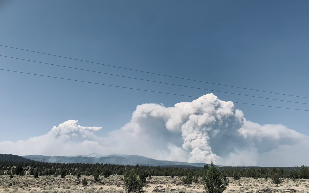
Klamath Falls, ORE. – Yesterday was the ninth day in a row with such extreme fire behavior that firefighters moved to safety zones and looked for opportunities to re-engage. Please note: the fire map issued today does not reflect the actual fire perimeter as the infrared data collection flight was not performed due to aircraft mechanical issues.
There was active fire all night on the southeastern corner. A fire slop over across the 28 Road is estimated to be over 2,500 acres in the Elder Creek area. Firefighters worked through the night to limit growth. On the north edge, firefighters disengaged when the fire aggressively moved past retardant lines three to four miles north toward Long Creek. The Nature Conservancy station at Sycan Marsh was evacuated and firefighters provided structure protection. Fire activity on the Log Fire was moderated by heavy smoke cover (shading from smoke cover results in lower fire intensity) and firefighters were successful in limiting southeast growth toward Summer Lake with dozer lines.
“We are running firefighting operations through the day and all through the night,” said Joe Hessel, Incident Commander. “This fire is a real challenge, and we are looking at sustained battle for the foreseeable future.”
Weather today will add the possibility of thunderstorms to the dry, hot, and windy conditions, with fire growth expected to the north, east, and southeast. Today, crews will work to contain the slop over the 28 Road and scout for contingency lines. Crews are also managing smaller areas of fire outside of the containment lines. The southeast flank of the fire from Preacher Flats to Mitchell Monument remains in patrol status. More firefighters have shifted to the north to support fire efforts near Silver Lake. Firefighters on the Log Fire continue line improvements to attempt to protect ranches and the Summer Lake community. Firefighters are preparing secondary firelines in all areas of fire growth. The southwestern flank of the fire continues to hold. It is imperative property owners use caution when returning; there are lingering hot spots and fire-weakened trees. The public may see smoke as fuels continue to burn within the fire perimeter. Please use an abundance of caution around these areas.
Community Meeting: July 19, 2021 at 7:00 p.m. at the Gearhart Elementary School (61100 Metler St, Bly, OR 97622).
Evacuations: Evacuations are rapidly changing due to the nature of this wildfire. Please visit tinyurl.com/bootlegevac for an interactive map of evacuation level in Lake and Klamath Counties.
Two Red Cross Evacuation Shelters are Open 24/7: Klamath County Fairgrounds at 3531 S 6th St. Klamath Falls, Oregon and Daly Middle School 906 S 3rd St. Lakeview, Oregon for information or assistance: 1-800-Red-Cross and FB @RedCrossCascades
Closures: The Fremont-Winema National Forest is closed to the public in the fire area. Map and full order available at inciweb.nwcg.gov/incident/7609/.
Smoke: Smoke impacts will be high in areas north, northeast, and east of the fire, especially in the vicinity of Silver Lake, Summer Lake, and Paisley. See: fires.airfire.org/outlooks/southcentraloregon.
Fire Information Public Phone: 541-482-1331
Fire Information Media Phone: 971-727-7255
Inciweb: inciweb.nwcg.gov/incident/7609/
Facebook: www.facebook.com/BootlegFireInfo
Twitter: twitter.com/BootlegFireInfo
Hashtags: #BootlegFire #FireYear2021
July 19, 2021
Sisters, ORE. – The Grandview fire acreage remains at 6,032 acres. Containment on the fire is now 57%.
Crews are pushing mop up from 50 feet to 100 feet or more inside the fire line. The goal over the next few days is to remove all heat at least 300 feet from the fire’s edge.
Searching for lingering heat is done by carefully searching in grid patterns, finding hot spots in the ground, cooling them, and repeating. Each grid is searched several times to ensure that all heat is gone.
Team 2 successfully conducted an incident-wide simulated Incident Within an Incident, followed by a safety stand down to allow crews to discuss and review the safety protocols for rapid response to aid an injured firefighter.
Snags are a continuing concern around the perimeter of the fire and felling crews will work to remove them to reduce risk of hazard.
Temperatures will be in the low 90’s with light winds out of the NW.
For up-to-date information on the Grandview Fire, please visit: https://inciweb.nwcg.gov/incident/7651/ or Centraloregonfire.org.
There are evacuation notices in place issued by the Jefferson County Sheriff’s Office and Deschutes County Sheriff’s Office. Please follow their guidance.
Jurisdictional agencies tied to the fire include Oregon Department of Forestry Central Oregon District and Ochoco National Forest, Crooked River National Grassland.
Grandview Fire Information: 541-633-7410 (8am – 8pm) UPDATED
Email: grandviewfire.information@gmail.com
Facebook: https://www.facebook.com/ODFCentralOregon
Twitter: @CentralORFire
Deschutes County Emergency Information Line: 541-550-4850
July 19, 2021
Special Update
Klamath Falls, ORE. – A firefighter became separated from his crew while working on the Bootleg Fire in Lake County today. The incident occurred when the fire crew was working on containing spot fires in the Happy Camp area.
Crew members reported the individual as missing at 6:30 p.m. The Zone 1 Incident Management Team immediately initiated a search mission. Incident aircraft and other resources were dispatched to help with the search. An incident helicopter spotted the firefighter at 8:20 pm but could not locate an adequate landing zone. Another firefighting crew joined in the search and located the separated firefighter. Lake County Sheriff’s personnel also responded to the area and assisted with the search operation and extraction of the individual. The Rapid Extraction Module (REM), a highly skilled and specially equipped team used to provide emergency medical services and extraction to firefighters on the line, was dispatched to the area and assisted in the transport.
The firefighter was in good spirits and was able to hike to the road to a waiting ambulance. Medical personnel transported the crew member to Lakeview Hospital for further medical evaluation.
Fire Information Public Phone: 541-482-1331
Fire Information Media Phone: 971-727-7255
Facebook: www.facebook.com/BootlegFireInfo
Twitter: twitter.com/BootlegFireInfo
Hashtags: #BootlegFire #FireYear2021
July 18, 2021
FOREST GROVE, Ore. – Saturday crews completed line construction into the elk creek canyon halting fire spread. Aircraft kept the fire activity low and the lines held through the afternoon and overnight.
Objectives today are to strengthen the line and begin mopping up. A heavy and medium helicopter are on standby at the Banks Fire station to assist if needed.