August 10, 2021
Bootleg Fire
Location: 28 miles northeast of Klamath Falls, OR Containment: 98%
Size: 413,765 acres (647 square miles) Personnel: 938
Walrus Fire
Location: 10.5 miles N of Bonanza
Size: 75 acres
Containment: 90%
Yainax Fire Location: 10 miles NE of Bonanza Size: 84 acres Containment: 70%
(Klamath Falls, OR) – At noon yesterday Klamath and Lake Counties lifted all evacuations for the Bootleg, Walrus, and
Yainax Fires. There are still fire personnel working on each of the fires and residents are asked to exercise caution when
travelling near the fire areas. Forest closures remain in effect, please check with your local ranger district before
entering national forest lands.
The Red Cross is closing the evacuation shelters but will still be working with the public during the recovery efforts.
Containment numbers continue to climb on each of the fires. The Bootleg Fire is now 98% contained and the majority of
the fire is in patrol status. Firefighters continue to grid and mop up along the last piece of uncontained line in the
northwest corner of the fire near Coyote Creek. Some critical suppression repair activities are underway on the
northeast corner of the fire and along the southern perimeter.
Firefighters made great progress yesterday mopping up the Walrus and Yainax Fires and expect to put those fires in
patrol status at the end of shift today.
A Burned Area Emergency Response (BAER) team arrived yesterday to begin the work of assessing the fire area for
erosion potential and determine if preventative measures are needed. BAER teams are staffed by specially trained
professionals: hydrologists, soil scientists, engineers, biologists, vegetation specialists, archeologists, and others who
rapidly evaluate the burned area and prescribe emergency stabilization treatments.
Closures: An emergency closure order is in effect for the Bootleg Fire on the Fremont-Winema National Forest to protect
public and firefighter safety. All travel or entry into the area is prohibited. The full closure order and map are available on the
website under Alerts and Closures at https://www.fs.usda.gov/alerts/fremont-winema/alerts-notices
Red Cross Disaster Relief: For information or assistance: 1-800-Red-Cross (www.redcrossblog.org/disaster)
Insurance Assistance: For additional information on submitting insurance claims after losing your home or property to a
wildfire, please visit https://dfr.oregon.gov/insure/home/storm/Pages/wildfires.aspx or call the state’s team of consumer
advocates at 888-877-4894 (toll-free).
Fire Information Public Phone: 541-482-1331 Fire Information Media Phone: 971-727-7255
Inciweb: inciweb.nwcg.gov/incident/7609/ Facebook: www.facebook.com/BootlegFireInfo
Twitter: twitter.com/BootlegFireInfo Hashtags: #BootlegFire #FireYear2021
August 9, 2021
CANYONVILLE, Ore. – Of the 19 fires comprising the Complex, 18 did not grow over the past couple of days, boosting overall containment to 14%. Objectives today continue with mop-up, patrol and reinforcing control line on all fires while directing more resources to contain the 2,350-acre Poole Creek Fire.
Roughly six miles southeast of the community of Days Creek, the Poole Creek Fire is a top priority for firefighters. Additional crews are helping to strengthen containment lines. Helicopters are dropping water and retardant to slow the fire’s growth. Burn-out operations continue today, which will strengthen and deepen containment lines. This will allow firefighters to safely engage the fire while protecting houses and outbuildings on the south bank of the South Umpqua River. Local residents can expect to see more fire traffic and smoke from burn-out operations.
Air operations personnel have set up a mobile retardant base. The retardant base will help facilitate quick retardant drops to reinforce control lines in front of the burnout operations.
As a precaution, the Douglas County Sheriff’s Office has issued a Green or Level 1 “Be Ready” evacuation advisory for residences in the area north of Poole Creek Fire. This includes an area south of the South Umpqua River along Tiller Trail Highway including all addresses on Ferguson Lane and Moore Ranch Road. www.dcso.com/evacuations.
ODF Team 1 hosted a virtual community meeting on Facebook Live yesterday evening. For more information on the fires, you can watch the recorded event at: https://www.facebook.com/skylineridgecomplex/videos/197339652288528
August 9, 2021
(Klamath Falls, OR) – A Virtual Public Meeting will be held tonight at 7:30 pm to update the public on the current status of the Bootleg, Walrus, and Yainax Fires. The meeting will not be live but will be recorded and posted to Facebook and Inciweb. Fire manager will answer questions from the public submitted in advance. This will be the final public meeting.
Firefighters continue to grid and mop up in the northeast corner of the Bootleg Fire near Silver Creek as they work toward achieving 100% containment. Control lines that have already been secured are being patrolled and firefighters are removing pumps and hose and other suppression supplies that are no longer needed. Some suppression repair activities are underway in the northeast corner of the fire.
The women and men of the Oregon National Guard have completed their tour on the Bootleg Fire and are packing up today and preparing to head home tomorrow, many to get ready for immediate overseas deployments. The guardsmen and women played a crucial role in containing some critical areas of the fire, and we are thankful for their service.
Ground resources on the Walrus and Yainax Fires have completed constructing containment lines and installing hose lays around both fires and are well into the mop-up phase.
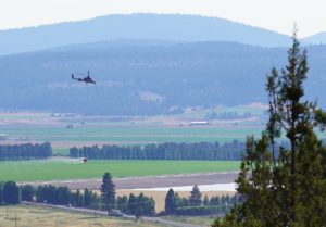
Due to the lessening need for suppression aircraft on all three fires, the Temporary Flight Restriction (TFR) was lifted from the fire area last night. Pilots should be aware that there will still be fire aircraft in the area and should exercise caution when flying near the fire. Forest closures remains in effect, please check with your local ranger district before entering national forest lands.
Closures: An emergency closure order is in effect for the Bootleg Fire on the Fremont-Winema National Forest to protect public and firefighter safety. All travel or entry into the area is prohibited. The full closure order and map are available on the website under Alerts and Closures at https://www.fs.usda.gov/alerts/fremont-winema/alerts-notices
Red Cross Evacuation Shelters: For information or assistance: 1-800-Red-Cross (www.redcrossblog.org/disaster)
Insurance Assistance: For additional information on submitting insurance claims after losing your home or property to a wildfire, please visit https://dfr.oregon.gov/insure/home/storm/Pages/wildfires.aspx or call the state’s team of consumer advocates at 888-877-4894 (toll-free).
August 8, 2021
Location: 28 miles northeast of Klamath Falls, OR
Containment: 96%
Size: 413,765 acres (647 square miles)
Personnel: 1,125
Walrus Fire
Location: 10.5 miles N of Bonanza
Size: 75 acres
Containment: 0%
Yainax Fire
Location: 10 miles NE of Bonanza
Size: 88 acres
Containment: 0%
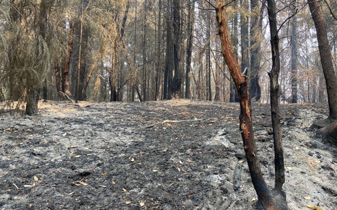
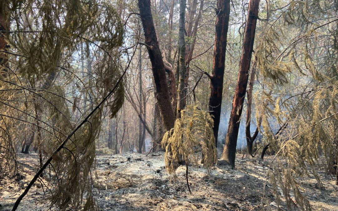
(Klamath Falls, OR) – Significant progress was made on the northeast corner of the Bootleg Fire yesterday and the official containment number grew to 96% due to hard fought effort by firefighters for nearly a month. Engine crews will continue patrolling the fire perimeter as a safety measure for the foreseeable future. Crews and equipment will continue efforts to return the fireline to a more natural state, repairing the impacts on the landscape caused during the initial and extended attack periods of the fire. Smoke will be visible in the interior of the fire perimeter until a season ending event (heavy rains or snow). The fire size remains unchanged for the tenth consecutive day despite being tested by the hot, dry, windy days over the last week.
Ground resources on the Walrus and Yainax Fires, aided by heavy helicopters, kept fire growth to a minimum and completed hose lays around both fires. Containment lines are being constructed and reinforced and have a high probability of success in the coming shifts.
Calmer weather conditions today will aid firefighter in continued suppression and mop up efforts on both fires. Forest closure remains in effect, please check with your local ranger district before entering national forest lands.
Evacuations: Evacuations are dynamic. The best way to view the evacuation designation boundaries and details is on the interactive map available at tinyurl.com/bootlegevac
Closures: An emergency closure order is in effect for the Bootleg Fire on the Fremont-Winema National Forest to protect public and firefighter safety. All travel or entry into the area is prohibited. The full closure order and map are available on the website under Alerts and Closures at https://www.fs.usda.gov/alerts/fremont-winema/alerts-notices
Red Cross Evacuation Shelters: For information or assistance: 1-800-Red-Cross (www.redcrossblog.org/disaster)
Smoke: Wildland fire smoke can adversely impact your health. Be aware of the smoke near you and learn about ways to mitigate smoke impacts. See the air quality near you at https://fire.airnow.gov and learn how to keep smoke out of your home at https://www.epa.gov/smoke-ready-toolbox-wildfires
Insurance Assistance: For additional information on submitting insurance claims after losing your home or property to a wildfire, please visit https://dfr.oregon.gov/insure/home/storm/Pages/wildfires.aspx or call the state’s team of consumer advocates at 888-877-4894 (toll-free).
August 8, 2021
CANYONVILLE, Ore.—With a dozen smaller wildfires mostly trailed, mopped up or already in patrol status, more firefighters are engaged on preventing the spread of the Poole Creek Fire. Containment on the Complex has risen to 9 percent.
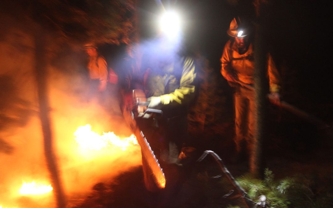
At 1,942 acres, Poole Creek is the largest fire in the Skyline Ridge Complex. It is burning roughly six miles southeast of the community of Days Creek. Firefighters plan to keep the fire within two steep drainages by building control lines on ridgetops and securing them with controlled burns at night. This will protect houses and outbuildings on the south bank of the South Umpqua River. Local residents can expect to see more fire traffic and smoke from burn-out operations.
Fire managers at the Complex are also responsible for identifying and helping suppress new fires in the area. Sunday afternoon they did just that. A pilot assigned to the Complex spotted a fire on the border of Douglas and Jackson counties, fire managers sent a 10-person hand crew to help Douglas Forest Protective Association firefighters engage the fire. The fire was kept to less than an acre. It likely started during last week’s heavy lightning strikes.
ODF Team 1 is hosting a virtual community meeting on Facebook Live Sunday at 7:30 p.m. You can find the event at https://www.facebook.com/events/540312997032963.
Incident Commander Joe Hessel said, “We’re protecting multiple values at risk including homes, communities, commercial timberlands, powerlines, recreation and cultural sites, and treasured fishing and hunting grounds. It drives our work to secure the last three active fires in the Complex as fast and as safely as we can.”
August 7, 2021
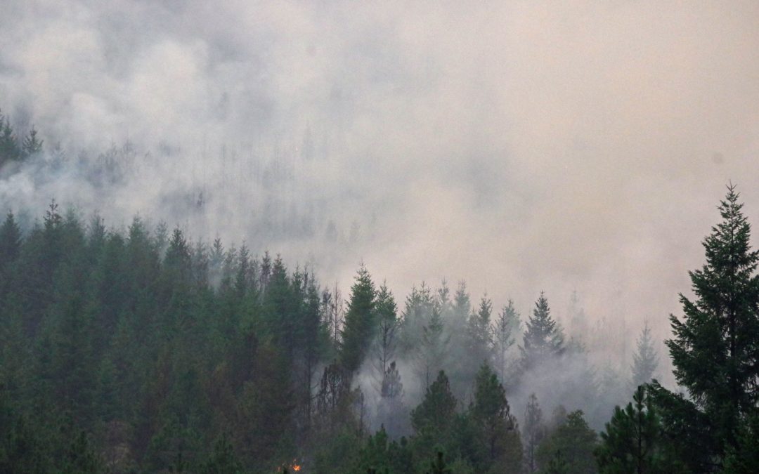
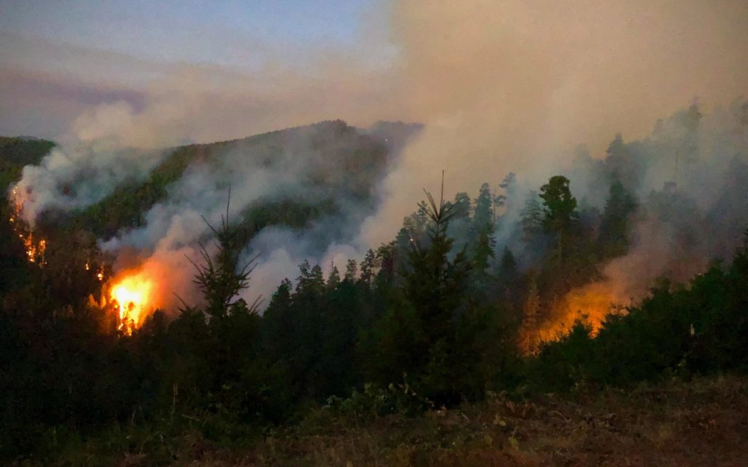
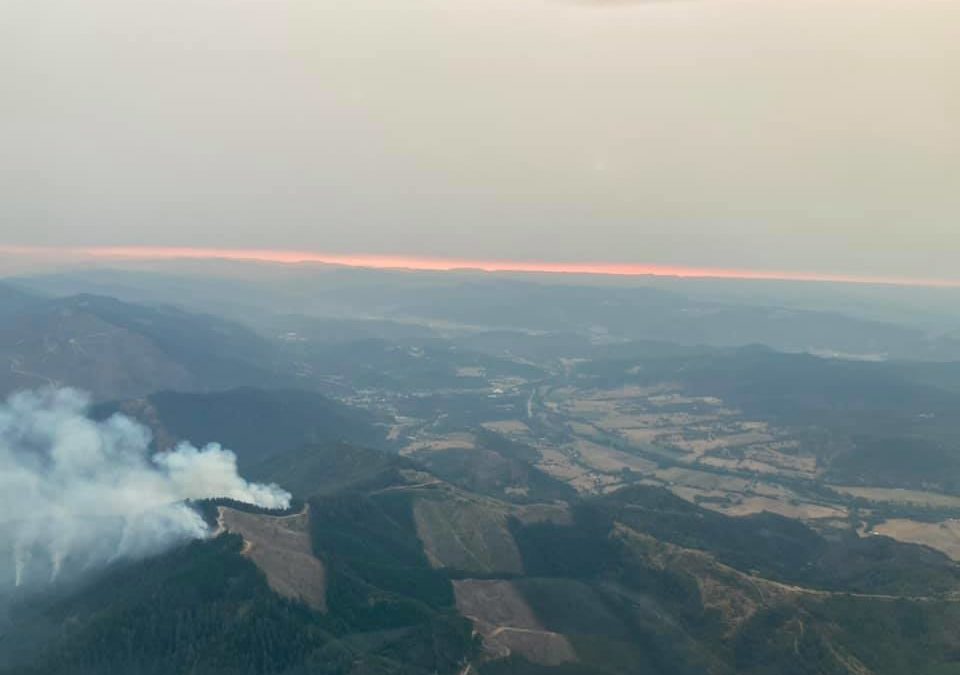
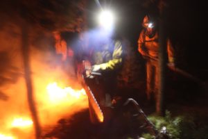
CANYONVILLE, Ore.—Firefighters are fighting all the fires in the Skyline Ridge Complex with direct action to minimize their spread. That same approach is being used on the southern edge of the largest fire in the Complex – the 1,600-acre Poole Fire, about 6 miles southeast of Days Creek. The northern edge of the fire is far more challenging – three steep ridges run north to south, split by two deep canyons. At the highest point the ridges are over 2,000 feet high, with slopes of 70 to 100 percent.
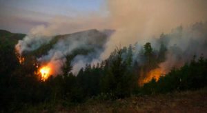
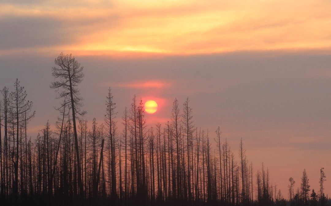
Due to the fuel conditions on the fires in the Skyline Ridge Complex, many fires are burning actively even after the sun goes down. The Poole Creek Fire is shown here burning at dusk on August 6th. Night shift crews will continue working on strengthening lines that were built during the previous day shift.
After looking at the difficult terrain, fire managers and private and public landowners have agreed that the best chance of stopping the fire is to build a control line where the ridges converge at a lower elevation.
Firefighters are building control lines along existing roads on the tops of the outer east and west ridges. Controlled burns over the next several days will help strengthen those lines to prevent the fire from spreading east or west. Newly arriving resources are being directed to this effort, including 100 more firefighters who arrived yesterday. Ten helicopters continue helping suppress fires in the Complex. The second largest fire in the Complex is the 190 acre O’Shea Fire a few miles southeast of Canyonville. Most other fires are two acres or less.
PNW Team 8 will host an in-person community meeting at Tiller Fire Station tonight at 7:30 p.m. ODF Team 1 will then host a virtual community meeting on Facebook Live Sunday at 7:30 p.m.
Incident Commander Joe Hessel said, “Our highest chance for success in stopping the Poole Creek Fire with the lowest risk to our firefighters is to bring it north along the ridges, out of the canyons, to a strong, defensible control line.”
August 7, 2021
Location: 28 miles northeast of Klamath Falls, OR
Fireline total: 326 miles
Size: 413,765 acres (647 square miles)
42 miles active fire edge, 284 miles of contained line
Personnel: 1,124
Containment: 87%
Walrus Fire
Location: 10 miles N of Bonanza
Size: 288 acres
Containment: 0%
Yainax Fire
Location: 10 miles NE of Bonanza
Size: 88 acres
Containment: 0%
Currently, the PNW2 Incident Management Team is managing the Bootleg, Walrus and Yainax Fires.
(Klamath Falls, OR) – Fire activity on the Bootleg Fire was minimal yesterday. Crews continued to monitor, patrol and mop up along the fire perimeter. As containment increases, attention now has turned to repairing dozer lines constructed in the early stages of the fire, commonly referred to as “suppression repair”. Crews have begun work to return the fireline to a more natural state, repairing the impacts on the landscape caused by fighting fire during initial and extended attack. While interior burning and smoke is expected until some kind of season-ending rain or snow event, the fire size remains unchanged for the ninth consecutive day. “Everything we do on the fire matters as we continue to put finishing touches on this landscape and focus our attention in supporting initial attack,” said Rob Allen, Incident Commander for PNW2.
Fire managers sent resources from the Bootleg Fire to the Walrus Fire and the Yainax Fire to help local agencies with suppression activities. Fire crews used a combination of handline, retardant and dozer lines to slow fire progression. Crews were able to establish dozer line around both fires and will complete water hoselays around the perimeters today. Firefighters can expect gusty winds and interior torching today. Air resources will continue to support firefighters on the ground as needed.
Evacuations: Evacuations are dynamic. The best way to view the evacuation designation boundaries and details is on the interactive map available at tinyurl.com/bootlegevac
Closures: An emergency closure order is in effect for the Bootleg Fire on the Fremont-Winema National Forest to protect public and firefighter safety. All travel or entry into the area is prohibited. The full closure order and map are available on the website under Alerts and Closures at https://www.fs.usda.gov/alerts/fremont-winema/alerts-notices
Red Cross Evacuation Shelters: For information or assistance: 1-800-Red-Cross (www.redcrossblog.org/disaster)
Smoke: Wildland fire smoke can adversely impact your health. Be aware of the smoke near you and learn about ways to mitigate smoke impacts. See the air quality near you at https://fire.airnow.gov and learn how to keep smoke out of your home at https://www.epa.gov/smoke-ready-toolbox-wildfires
Insurance Assistance: For additional information on submitting insurance claims after losing your home or property to a wildfire, please visit https://dfr.oregon.gov/insure/home/storm/Pages/wildfires.aspx or call the state’s team of consumer advocates at 888-877-4894 (toll-free).
August 6, 2021
[John Day, Ore.] No new fires were reported in the John Day Unit Thursday. Significant progress was made on mop-up and containment of fires from earlier this week.
Containment for the Cottonwood Creek Fire has reached 95% on the 159-acre fire. The fire will transition to a Type 5 incident commander Saturday. One hand crew will complete mop-up work, gridding for hot spots. These resources will pull hose and other equipment from the fire. The fire will be in patrol status at the end of shift on Saturday.
The one-acre Dissel Creek Fire, reported Tuesday evening burning five miles southeast of John Day, was fully contained late Thursday evening.
Tomorrow crews on the Cole Canyon Fire will continue mop-up work, anticipating the fire to be fully contained Saturday evening. Two crews, a water cat, and a tender will be staffing the fire. The fire burned 150 acres of private land and Prineville Bureau of Land Management ownership.
All of these fires will be placed in patrol status and monitored until determined to be dead out. It is possible interior smoke may be visible. These “smokes” will be put out if they are found to have the potential to spread fire outside the fireline.
A Regulated-Use Closure is in effect for the Central Oregon District to reduce human caused fires. The full proclamation and restrictions are available at https://gisapps.odf.oregon.gov/firerestrictions/PFR.html. Preventing human caused fires allows firefighters to focus suppression effort on fires started by lightning. These focused activities result in smaller fires with less damage to natural resources and communities and fewer impacts to air quality.
For additional information on ODF’s Central Oregon District, including contact information and unit offices, please visit www.ODFcentraloregon.com.
August 6, 2021
JACKSON & JOSEPHINE COUNTIES, Ore. (August 6, 2021) – Significant progress continues to be made on the Round Top and Buck Rock Fires, the only active incidents left on the Oregon Department of Forestry (ODF) Southwest Oregon District following thunderstorms last weekend. ODF Southwest firefighters responded to more than 65 fires in a five-day period. Following aggressive initial attacks and coverage on incidents around the clock, nearly all fires have been extinguished, the largest reaching only 23 acres.
On the Round Top Fire, located 10 miles northwest of Shady Cove, firefighters have mopped up 150-feet into the interior of the fire from its perimeter; it remains 23 acres in size. On the Buck Rock Fire, located 5 miles north of Trail, crews have mopped up past the 200-foot mark into the interior. It is also still holding at 17 acres. As progress remains steady and fire lines are holding strong, this will be the final update on these fires unless conditions significantly change.
The Rogue Valley experienced clean air on Friday; multiple fires in Douglas County and Northern California have been causing smoke to settle across Jackson and Josephine counties. Through the weekend, smoke may settle once again throughout the region. Smoke-related information and forecasts are available on https://fire.airnow.gov/ and https://airquality.weather.gov/sectors/pacnorthwest.php.
Information on the fires burning in Douglas County on Douglas Forest Protective Association (DFPA) protected land and the Umpqua National Forest can be found on https://www.facebook.com/skylineridgecomplex/, https://www.facebook.com/2021-Devils-Knob-Complex-112079071131008, https://www.facebook.com/DouglasForestProtectiveAssociation and https://www.facebook.com/UmpquaNationalForest.
Additional information about fire season is also available online on our website, www.swofire.com, our Facebook page, @ODFSouthwest and our Twitter account, @swofire.
August 6, 2021
La Grande, OR- Firefighters across the district have been busy responding to several lightning caused fires from yesterday’s thunderstorms. A total of 25 smoke reports have been reported on lands protected by Oregon Department of Forestry-Northeast Oregon District. These fires are spread around the district, however several of them have occurred in Wallowa and Union counties. The majority of the fires were stopped at less than 1 acre.
The Gimlet Fire, located in Baker County 5 miles southwest of Sumpter, burned approximately 2 acres. This fire is contained, and firefighters are on scene today to continue mopping up. Firefighters in the Pendleton Unit responded to one lighting caused fire located 16 miles southeast of Pendleton. This fire burned 1/10th of an acre and has been contained. The La Grande Unit has responded to three smoke reports. All of these fires were less than 1/10th of an acre and are contained.
In Wallowa County, 19 fires were reported. The Maxville Fire is located 12 miles northwest of Wallowa. The fire is estimated to be five acres. Firefighters are on scene today mopping up and further securing the fire line.
The Wise Fire, located near Smith Mountain Road burned 132 acres yesterday. A mix of ground and aviation resources provided a quick response and stopped the spread of this fire. Resources are on scene today securing fire lines and mopping up. The Wallowa County Sheriff’s Office issued a LEVEL 2 (GET SET) evacuation order for the Smith Mountain Road. The Saw Dust Pile Fire was reported eight miles northwest of Wallowa. The fire burned nine acres and has been contained. The Type 3 Incident Management Team that is managing the Elbow Creek Fire will also be managing these two fires. This allows for local resources to remain ready for any additional fires that may be reported.
Conditions are expected to be warmer and drier today. Resources will be patrolling areas of heavy lightning and monitoring for additional fires. Aerial resources will also be providing patrol through the weekend. Fires can be reported by calling Blue Mountain Interagency Fire Center at (541)963-7171 or by dialing 9-1-1.
ODF’s Northeast Oregon District is in Regulated Use Closure or Public Use Restrictions. Restrictions can be found at http://bmidc.org/restrictions.shtml. Fire conditions are Extreme throughout the region. Please use caution to help prevent forest fires. Fuel conditions in many areas are critical for active fire behavior and fire growth.
Contact the Oregon Department of Forestry-Northeast Oregon Fire Prevention Information Line for more information on ODF’s Public Use Restrictions: (541) 975-3027
August 6, 2021
CANYONVILLE, Ore.— Containing the wildfires closest to Canyonville is one of firefighters’ top priorities today. Once completed, more resources will be focused on the 1,104-acre Poole Fire south of Days Creek. While good progress has been made on the south end of that fire, difficult terrain on the northern edge has proven more challenging.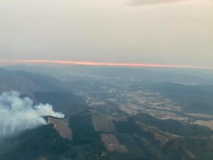
Yesterday firefighters also began engaging on the Dismal Creek 210 Fire in the Upper Cow Creek area. Crews placed hoses around much of that fire and aim to complete that today.
As the highest priority set of wildfires in the region, the Skyline Ridge Complex received more than 300 additional personnel yesterday, bringing staffing to 824. The number of hand crews doubled to 26, with more water tenders and more fire engines arriving. Ten helicopters will continue making water drops today, helping firefighters gain control of the smaller fires, many of which are now fully lined and in mop up.
Temperatures in the high 70s or low 80s today should help firefighters. However, burning debris rolling downhill and across control lines will continue to pose a hazard.
PNW Team 8 will host an in-person community meeting at Tiller Fire Station on Saturday at 7:30 p.m. ODF Team 1 will then host a virtual community meeting on Facebook Live Sunday at 7:30 p.m.
Incident Commander Joe Hessel said, “We’re pushing for steady, thorough and methodical work today to contain many of the smaller fires so we can then focus more resources on Poole Creek, our biggest and most challenging fire.”
August 6, 2021
Bootleg Fire Update, August 6, 2021
Location: 28 miles northeast of Klamath Falls, OR
Fireline total: 326 miles
Size: 413,765 acres, 647 square miles
42 miles active fire edge, 284 miles of contained line
Personnel: 1,252
Containment: 87%
 (Klamath Falls, OR) – Gusty winds and thunderstorms resulted in several new starts from lightning strikes north and south of the Bootleg Fire burn area. Initial attack resources have established perimeter to control them. The Walrus Fire and the Yanix Fire are about 75 acres each in size. The Yanix Fire has a spot about a quarter of a mile outside its perimeter and crews are working on initial attack and control of those new fires. The Pacific Northwest Team 2 resumed command of the Bootleg Fire from the Alaska Incident Management Team at 0600 today and assumed command of the Yanix Fire and Walrus Fire.
Today’s weather will not be as extreme as the previous three days. Cooler temperatures and higher humidity overnight helped slow fire progression. Skies have cleared of smoke today, which can encourage updrafts and increase fire behavior, but also provides good weather for air operations. Crews will remain vigilant today watching for new starts and responding with initial attack to suppress them.
The Bootleg perimeter has seen no significant growth in eight days. Fire crews continue to mop up and control the remaining active line, but most of the boundary is in patrol status. In some areas, chippers have started suppression repair work to help the forest heal.
“We want to return the land to as close to the natural state and natural function as possible,” said Resource Advisor Coordinator Bill Hedman. “In time, the regrowth will bring the forest back.” Crews will work with the national forest to salvage any valuable timber and will chip small-diameter limbs and return that biomass to the forest to maintain nutrients. Often vegetation isn’t completely cleared, but rather, thinned, leaving large trees to help the forest regenerate. Suppression repair gives the forest a head start to regrow.
Community Meeting: Due to the weather and power interruptions yesterday, the virtual community meeting was recorded and posted on Facebook. Check it out for the latest updates at www.facebook.com/BootlegFireInfo
Evacuations: Evacuations are dynamic. The best way to view the evacuation designation boundaries and details is on the interactive map available at tinyurl.com/bootlegevac
Closures: An emergency closure order is in effect for the Bootleg Fire on the Fremont-Winema National Forest to protect public and firefighter safety. All travel or entry into the area is prohibited. The full closure order and map are available on the website under Alerts and Closures at https://www.fs.usda.gov/alerts/fremont-winema/alerts-notices
Red Cross Evacuation Shelters: For information or assistance: 1-800-Red-Cross (www.redcrossblog.org/disaster)
Smoke: Wildland fire smoke can adversely impact your health. Be aware of the smoke near you and learn about ways to mitigate smoke impacts. See the air quality near you at https://fire.airnow.gov and learn how to keep smoke out of your home at https://www.epa.gov/smoke-ready-toolbox-wildfires
Insurance Assistance: For additional information on submitting insurance claims after losing your home or property to a wildfire, please visit https://dfr.oregon.gov/insure/home/storm/Pages/wildfires.aspx or call the state’s team of consumer advocates at 888-877-4894 (toll-free).
August 5, 2021
JACKSON & JOSEPHINE COUNTIES, Ore. (August 5, 2021) – Despite strong winds, firefighters were able to hold fires lines on the two active fires on the Oregon Department of Forestry (ODF) Southwest Oregon District. Potential thunderstorms in the forecast didn’t materialize, and smoke in the valley cleared out slightly to allow for air operations.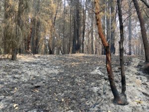
The Round Top and Buck Rock Fires are still holding at 23 and 17 acres respectively. Crews on both fires were able to strengthen lines and push forward on mop-up operations. Overnight, resources assigned to these incidents will continue checking for hot spots.
Just after 3 p.m., a grassfire was reported along Interstate-5 on the northbound side near MP 47 outside of Rogue River. Resources from ODF Southwest, Rogue River Fire District #1, Grants Pass Fire Rescue, Rural Metro Fire and Evans Valley Fire District all responded, and through an aggressive initial attack, the fire was quickly extinguished; it was caught at a quarter-acre in size. ODF investigators on scene determined the fire was caused by a catalytic converter. At the points of origin, pieces of a catalytic converter were found. It is unlikely that the vehicle those pieces came from will be identified, however, if anyone driving in the area at the time of ignition has information, please contact the Grants Pass ODF office at (541) 474-3152.
Despite the activity on our district, ODF Southwest continued to provide resources to fires burning in southern Douglas County on Douglas Forest Protective Association (DFPA) protected land and the Umpqua National Forest. Information on these specific fires can be found on https://www.facebook.com/skylineridgecomplex/, https://www.facebook.com/2021-Devils-Knob-Complex-112079071131008, https://www.facebook.com/DouglasForestProtectiveAssociation and https://www.facebook.com/UmpquaNationalForest.
As fire activity has diminished from the thunderstorms over the weekend, updates will only be given once a day starting on Friday, unless conditions significantly change, and fire behavior increases. Additional information about fire season is also available online on our website, www.swofire.com, our Facebook page, @ODFSouthwest and our Twitter account, @swofire.
August 5, 2021
Wallowa, OR- Numerous smoke reports have been received across Wallowa County this afternoon. Firefighters have been responding to multiple fires caused by the thunderstorms which passed through earlier today.
The Wise Fire, located near Smith Mountain Road was reported at 1:50 p.m. This fire is estimated to be 75 acres. Helicopters, single-engine air tankers (SEATs), and heavy air tankers are being used on this incident. Wallowa County Sheriff’s Office has issued a LEVEL 2 (GET SET) evacuation order for the Smith Mountain Road.
The Saw Dust Pile Fire is estimated to be 4 acres and is located in the Johnson Spring area, approximately 8 miles northwest of Wallowa. This fire has been contained. Crews will remain on scene to strengthen the fire line and mop-up heat close to the line. Another report was received of a 5-acre fire near Maxville. Fire crews and a bulldozer are on scene and have the forward spread of the fire stopped. Additional small fires have been reported and responded to. Fire managers anticipate receiving additional reports as storms continue to impact the area.
Tonight’s forecast calls for the potential of additional severe thunderstorms. These storms could produce frequent cloud to ground lightning and may bring gusty winds. Fires can be reported by calling Blue Mountain Interagency Fire Center at (541)963-7171 or by dialing 9-1-1.
ODF’s Northeast Oregon District is in Regulated Use Closure or Public Use Restrictions. Restrictions can be found at http://bmidc.org/restrictions.shtml. Fire conditions are Extreme throughout the region. Please use caution to help prevent forest fires. Fuel conditions in many areas are critical for active fire behavior and fire growth.
Contact the Oregon Department of Forestry-Northeast Oregon Fire Prevention Information Line for more information on ODF’s Public Use Restrictions: (541) 975-3027
August 5, 2021
[John Day, Ore.] No new fires were reported in the John Day Unit Wednesday. Extended attack on fires in the John Day Unit have been fully transitioned to mop-up. Today this work will continue as firefighters prepare for strong winds as thunderstorms pass through the area. Firefighting resources from these fires will be available to assist in initial attack of any new fire starts today.
Management of the Cottonwood Creek Fire transitioned to a Type 4 incident commander Wednesday. Crews on the fire continue to grid for smoldering fuel and extinguish hot spots as they work toward the interior of the fire from the perimeter. Two hand crews, five wildland engines, and one water tender are assigned to the fire. The remaining mop-up work is expected to last several more days.
Resources on the Dissel Creek Fire, reported Tuesday evening burning five miles southeast of John Day, will continue mop-up work today. The ~1 acre fire is staffed with four engines and a squad. The fire is anticipated to be transitioned to patrol status at the end of shift today.
Fireline construction is nearly complete on the 150-acre Cole Canyon Fire. Yesterday helicopters and Single Engine Air Tankers were used to slow the spread of the fire, allowing hand crews to build fireline adjacent to the fire’s edge. This work, along with mop-up in other area’s of the fire have increased containment to 25%. Today four 20-person hand crews, two wildland engines, two water tenders, and four skidgines will work to complete the line around the fire, strengthen the existing fireline, and work to increase the cold black area between the fire and the fireline. Aircraft is available to assist firefighters as needed.
A red flag warning has been issued by the National Weather Service for the area for abundant lightning and gusty winds. This weather in combination with severely dry fuels poses a high risk of rapid fire spread.
A Regulated-Use Closure is in effect for the Central Oregon District to reduce human caused fires. The full proclamation and restrictions are available at https://gisapps.odf.oregon.gov/firerestrictions/PFR.html. Preventing human caused fires allows firefighters to focus suppression effort on fires started by lightning. These focused activities result in smaller fires with less damage to natural resources and communities and fewer impacts to air quality.
For additional information on ODF’s Central Oregon District, including contact information and unit offices, please visit www.ODFcentraloregon.com.
August 5, 2021
JACKSON & JOSEPHINE COUNTIES, Ore. (August 5, 2021) – A significant shift in the weather pattern on Thursday could challenge fire lines and crews; this potential is the biggest focus today on active incidents on the Oregon Department of Forestry (ODF) Southwest Oregon District. The National Weather Service is predicting a slight chance of thunderstorms in the morning with strong, shifting winds throughout the day. Not only could these conditions affect the progress crews have been making, but it increases the risk of new fires starting.
 Smoke in the area from various fires surrounding southern Oregon is also affecting visibility and may impact the use of aircraft; firefighters on the ground are taking this into accou
nt, and adjusting their strategies based on the potential of losing this resource for the better part of Thursday. The smoke is also impacting the ODF Southwest Detection Center, and detection center camera views are limited from the haze. Smoke information is available on https://fire.airnow.gov/ and https://airquality.weather.gov/sectors/pacnorthwest.php.
Crews on the two remaining fires on ODF-protected land in Jackson and Josephine Counties are continuing to make progress on strengthening perimeters and general mop-up; The Round Top Fire, located 10 miles northwest of Shady Cove, is still holding at 23 acres. Firefighters have been able to mop up 50 feet into the interior of the fire, and will continue that work today. Four 10-person crews, two engines and three water tenders are assigned to the Round Top Fire today. The Buck Rock Fire, located 5 miles north of Trail, remains at 17 acres. A 10-person crew, 20-person crew, five engines and three water tenders are assigned to this fire today to continue mop-up operations. On both of these incidents, steep terrain and hazardous trees have challenged crews and caused safety concerns. Firefighters assigned to these fires will be taking these factors into account as they continue to push forward on suppression efforts.
ODF Southwest is continuing to provide resources to fires burning in southern Douglas County on Douglas Forest Protective Association (DFPA) protected land and the Umpqua National Forest. Information on these specific fires can be found on https://www.facebook.com/skylineridgecomplex/, https://www.facebook.com/2021-Devils-Knob-Complex-112079071131008, https://www.facebook.com/DouglasForestProtectiveAssociation and https://www.facebook.com/UmpquaNationalForest.
Additional information about fire season is also available online on our website, www.swofire.com, our Facebook page, @ODFSouthwest and our Twitter account, @swofire.
August 5, 2021
Bootleg Fire Update, August 5, 2021
Location: 28 miles northeast of Klamath Falls, OR
Fireline total: 326 miles
Size: 413,765 acres, 647 square miles
42 miles active fire edge, 284 miles of contained line
Personnel: 1,387
 Containment: 84%
(Klamath Falls, OR) – For the third consecutive day, a Red Flag Warning and Fire Weather Watch are in effect for this afternoon and evening. Thunderstorms associated with the edge of a cold front are forecast for today and are likely to bring gusty and erratic winds. Yesterday, smoke and ash from the Antelope Fire in northern California filled the sky, helping to somewhat moderate fire behavior. Despite the conditions over the past two days, the Bootleg Fire line is holding with no spot fires.
Fire activity has increased inside the fire perimeter, however. There remain patches of unburned fuels where the fire can spread and single- and group-tree torching has been observed. Snags and other hazard trees are common and crews and heavy equipment are still actively working the fire area.
As a reminder, the Fremont-Winema National Forest remains closed north of Oregon State Route 140. Public entry to the burn area is unsafe. U.S. Forest Service Renewable Resources Staff Officer Sean Ferrell commented: “We know you care for our firefighters and want to help in any way you can. The best thing you can do is be patient and honor the closure to give firefighters space so they can work safely.”
The Alaska Incident Management Team will transition command back to the Pacific Northwest Team 2 on Friday.
Community Meeting: Join us for a virtual community meeting tonight on Facebook live at 6:30 pm and streaming at the Paisley Community Center. Join us at www.facebook.com/BootlegFireInfo
Evacuations: Lake County expanded the Level 1 (Get Ready) evacuation boundary to include the area north of Summer Lake. The expanded area extends from Mile Post 73 on Highway 31 north to Picture Rock Pass and east of the highway to include the Ana Subdivision. A Level 2 (Be Set) evacuation remains in place from milepost 73 on Highway 31 south to Monument Rock. A Level 3 (GO NOW!) evacuation remains in place for all areas within and adjacent to the Bootleg Fire perimeter, including Yamsay Mountain, Thompson Reservoir, and the Sycan Marsh to the top of Winter Rim. The best way to view the evacuation designation boundaries and details is on the interactive map available at tinyurl.com/bootlegevac
Closures: An emergency closure order is in effect for the Bootleg Fire on the Fremont-Winema National Forest to protect public and firefighter safety. All travel or entry into the area is prohibited. The full closure order and map are available on the website under Alerts and Closures at https://www.fs.usda.gov/alerts/fremont-winema/alerts-notices
Red Cross Evacuation Shelters: For information or assistance: 1-800-Red-Cross (www.redcrossblog.org/disaster)
Smoke: Wildland fire smoke can adversely impact your health. Be aware of the smoke near you and learn about ways to mitigate smoke impacts. See the air quality near you at https://fire.airnow.gov and learn how to keep smoke out of your home at https://www.epa.gov/smoke-ready-toolbox-wildfires
Insurance Assistance: For additional information on submitting insurance claims after losing your home or property to a wildfire, please visit https://dfr.oregon.gov/insure/home/storm/Pages/wildfires.aspx or call the state’s team of consumer advocates at 888-877-4894 (toll-free).
August 5, 2021
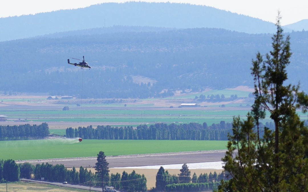
CANYONVILLE, Ore.— Two Oregon Air National Guard Black Hawk helicopters are joining eight other helicopters today in dropping water on fires in the Skyline Ridge Complex in southern Douglas County. Such drops are key given the steep terrain and heavy timber and brush facing firefighters.
Personnel on the Complex has increased to 518, with the number of hand crews almost doubling since yesterday, nine more fire engines and a tripling of heavy equipment, including dozers. Containment remains at 0 percent.
Ground crews will benefit from cooler temperatures today. Heavy fuels, though, continue to burn, sending burning debris rolling downhill and across control lines. Firefighters will be on alert to put out any new spot fires caused by such rollouts.
Infrared mapping has shown the combined acreage of the 15 fires in the Skyline Ridge Complex to be 1,516. The largest fires are:
Poole Creek – 1,104 acres; O’Shea Creek – 182 acres; Ike Butte – 124 acres (now completely encircled by control lines); Sweat Creek – 56 acres; Turkey Creek – 15 acres; McGinnis – 11 acres.
The remaining fires are less than an acre or two. Many have fire lines around them.
Incident Commander Joe Hessel told firefighters that today was a day of opportunity for making gains on the fires. “Cooler temperatures will allow us to extend control lines on our bigger fires and keep smaller ones buttoned up within their fire lines,” said Hessel.
August 4, 2021
JACKSON & JOSEPHINE COUNTIES, Ore. (August 4, 2021) – Firefighters working the Buck Rock and Round Top Fires on the Oregon Department of Forestry (ODF) Southwest Oregon District are continuing to make good progress on strengthening fire lines. The Buck Rock Fire, located 5 miles north of Trail,  remains 17 acres, and the Round Top Fire, located 10 miles northwest of Shady Cove, is still 23 acres.
Mop-up efforts continued Wednesday on both fires, as crews work from the perimeter moving inward, extinguishing smokes and smoldering areas. Overnight, this will continue to be the focus of firefighters assigned to these incidents. Hazardous trees on both fires have been a safety concern, which has slowed down crews. Steep terrain is also an added challenge on these fires.
ODF Southwest, along with the U.S. Forest Service Rogue River-Siskiyou National Forest, is continuing to provide resources to fires burning in southern Douglas County on Douglas Forest Protective Association (DFPA) protected land and the Umpqua National Forest. ODF will continue to assist on these active incidents. Information on these specific fires can be found on https://www.facebook.com/skylineridgecomplex/, https://www.facebook.com/DouglasForestProtectiveAssociation and https://www.facebook.com/UmpquaNationalForest.
Weather conditions Thursday could increase fire activity, including strong winds and a slight potential for thunderstorms. A Red Flag Warning has been issued by the National Weather Service from 12 – 10 p.m. on Thursday due to these factors. Firefighters will take this into account on the line, as it may impact fire behavior.
Smoke from multiple fires in Douglas County are causing smoke to settle across Jackson and Josephine counties; smoke information is available on https://fire.airnow.gov/ and https://airquality.weather.gov/sectors/pacnorthwest.php.
Additional information about fire season is also available online on our website, www.swofire.com, our Facebook page, @ODFSouthwest and our Twitter account, @swofire.
August 4, 2021
John Day, Ore — Late Tuesday evening two new fires were reported on private land protected by Oregon Department of Forestry’s (ODF) John Day Unit. The Dissel Creek Fire was reported just before 6:00 p.m., burning five miles southeast of John Day. While firefighters worked to stop the initial spread of the Dissel Creek Fire a report for a second fire, the Cole Canyon Fire, was received. This fire is located seven miles northeast of Monument.
The Dissel Creek Fire was 100% contained late Tuesday night with a combination of hand and dozer line around the fire’s perimeter. A small spot across the fireline was secured by firefighters this morning. Fire crews will work today to strengthen the perimeter and mop-up the interior of the fire, gridding through the fire to find flames and heat. Dozers, wildland engines, helitack, a Type 4 engine from Prairie City Rural, a helicopter with bucket, and a single engine air tanker (SEAT) were used to check the fire spread at just over one acre. An isolated lightning strike Tuesday evening ignited the Dissel Creek Fire.
This morning the Cole Canyon Fire is estimated to be 75 acres with dozer line around 50% of the fire’s edge. Dozers will continue fireline construction today. Three 20-person contract crews will arrive this morning to work with the dozers to strengthen the fireline and construct hand line in areas too steep for dozers to safely work. Additional wildland engines and overhead will also be arriving this morning. Local aircraft, a helicopter and three SEATs have been ordered for the fire this morning to assist in holding the fire in place while line is being constructed. The fire is burning on private lands and Prineville Bureau of Land Management lands protected by Oregon Department of Forestry.
Firefighters on the Cottonwood Creek Fire, five miles south of Fossil, have made significant progress mopping-up the fire’s interior. Containment has increased to 65% today, with plans for transitioning the fire to a Type 4 organization later this morning. Two hand crews and four contract wildland engines remain on the fire to complete the mop-up work.
Fire crews will be focusing work to secure fire perimeters in anticipation of a cold front moving through on Thursday. Strong wind and additional lightning is forecast for the coming days. Additional holdover fires from thunderstorms earlier this week are also a concern today as temperatures warm.
A Regulated-Use Closure is in effect for the Central Oregon District to reduce human caused fires. The full proclamation and restrictions are available at https://gisapps.odf.oregon.gov/firerestrictions/PFR.html. Preventing human caused fires allows firefighters to focus suppression effort on fires started by lightning. These focused activities result in smaller fires with less damage to natural resources and communities and fewer impacts to air quality.
For additional information on ODF’s Central Oregon District, including contact information and unit offices, please visit www.ODFcentraloregon.com.