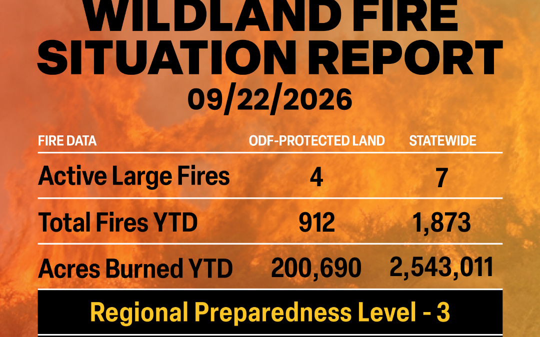
September 22, 2026
ODF Complex Incident Management Teams
- ODF CIMT 1 is in command of the Rowe Creek Complex. For incident updates, visit the incident’s Facebook page.
- ODF CIMT 2 is on standby.
- ODF CIMT 3 is on rotation.
Current Large Fires with ODF Involvement (in priority order).
| FIRE NAME |
TOTAL ACRES |
ODF ACRES |
CONTAINMENT |
LOCATION |
COMMAND |
| Austin |
12,887 |
137 |
98% |
25 miles SE of Estacada |
CA Team 2 |
| The Narrows |
305 |
0 |
98% |
15 miles SE of Estacada |
CA Team 2 |
| Grasshopper |
93,982 |
21,148 |
98% |
3 miles N of Sportsmans Park |
CA Team 2 |
| Rowe Creek Complex |
373,927 |
99,408 |
99% |
10 miles S of Fossil |
ODF CIMT 1 |
*These numbers may change as we receive more data.
There are approximately 2,432 personnel assigned to the 7 large fires across the state, not including many of the local and agency government employees, landowners, forestland operators, and members of the community who are contributing every day.
Initial attack remains ODF’s top priority.
Prevention: Stay informed this September. As fire danger levels and restrictions fluctuate, make sure to check local restrictions regularly where you live or where you plan to recreate. Brush up on your wildfire prevention knowledge and remain aware of weather conditions.
Weather: Another, weaker trough of low pressure drops down over southeast Oregon today bringing isolated showers and thunderstorms to northern Washington. This low sits over northern California Wednesday into Thursday bringing gusty east winds to areas west of the Cascades on Wednesday, although RH will remain somewhat elevated. Showers and thunderstorms are expected across south central Oregon on Wednesday, then spread to eastern Oregon on Thursday while eastern Washington remains quite dry. The low moves out for the weekend as a generally dry, mild airmass moves in.
Today’s Highlight: The Oregon Department of Forestry (ODF) wants to remind Oregonians that even with the weather shifting, Oregon is still in fire season. Remember that if you are responsible for starting a wildfire in Oregon, you are liable for suppression costs. Remain aware and informed by checking your local fire restrictions and fire danger levels.
Wildfire prevention means:
- Debris burning remains the number one cause of human-caused fires in Oregon and is prohibited during fire season. Cover your pile and wait until fire season is declared over before burning. A dry, covered pile is cleaner and safer to burn in the late fall and winter. Visit net for real-time updates on burning regulations and safe burning practices.
- Check local restrictions before lighting a camp or warming fire to see if it is allowed.
- Never leave your campfire or warming fire unattended.
- Make sure your campfire or warming fire is OUT COLD. That means drowning it with water, stirring the ashes, and repeating that process until it is cold to touch. If there is any heat coming off the embers, then it can reignite later.
- Don’t park your car over dried grass, and make sure your vehicle or ATV is regularly serviced.
- Make sure your tow chains are not dragging. The metal hitting asphalt while driving can throw sparks into dry grass on the side of the road.
Visit keeporegongreen.org for more wildfire prevention tips.
Resources:
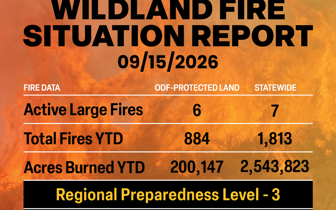
September 15, 2026
ODF Complex Incident Management Teams
- ODF CIMT 1 is in command of the Rowe Creek Complex. For incident updates, visit the incident’s Facebook page.
- ODF CIMT 2 is on rotation.
- ODF CIMT 3 is on standby.
Current Large Fires with ODF Involvement (in priority order).
| FIRE NAME |
TOTAL ACRES |
ODF ACRES |
CONTAINMENT |
LOCATION |
COMMAND |
| Austin |
12,887 |
137 |
67% |
25 miles SE of Estacada |
NW Team 10 |
| Grasshopper |
93,982 |
20,059 |
97% |
3 miles N of Sportsmans Park |
NW Team 10 |
| Paradise |
9,656 |
344 |
86% |
18 miles E of Milton-Freewater |
NW Team 8
(Local Unit TOC @ 1800 today) |
| Hagen |
61,381 |
1,847 |
87% |
26 miles E of Pendleton |
NW Team 8 |
| Rowe Creek Complex |
373,927 |
99,407 |
99% |
10 miles S of Fossil |
ODF CIMT 1 |
| McCully |
13,604 |
1,452 |
87% |
22 miles NW of Baker City |
CA Team 1
(Local Unit TOC @ 1800 today) |
*These numbers may change as we receive more data.
There are approximately 2,426 personnel assigned to the 7 large fires across the state, not including many of the local and agency government employees, landowners, forestland operators, and members of the community who are contributing every day.
Initial attack remains ODF’s top priority.
Prevention: Stay informed this September. As fire danger levels and restrictions fluctuate, make sure to check local restrictions regularly where you live or where you plan to recreate. Brush up on your wildfire prevention knowledge and remain aware of weather conditions.
Weather: Another, weaker trough of low pressure drops down over southeast Oregon today bringing isolated showers and thunderstorms to northern Washington. This low sits over northern California Wednesday into Thursday bringing gusty east winds to areas west of the Cascades on Wednesday, although RH will remain somewhat elevated. Showers and thunderstorms are expected across south central Oregon on Wednesday, then spread to eastern Oregon on Thursday while eastern Washington remains quite dry. The low moves out for the weekend as a generally dry, mild airmass moves in.
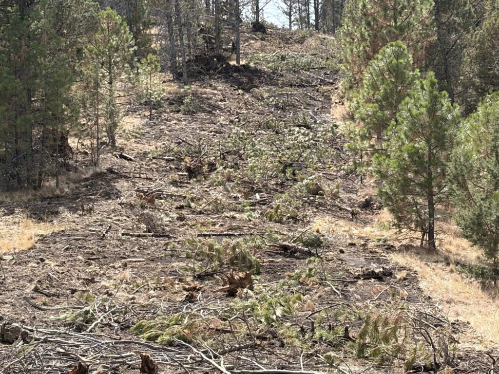
Today’s Highlight: What is Suppression Repair? As many have probably seen in large fire updates, several large fires in Oregon are now in suppression repair operations. Suppression repair is a series of immediate post-fire actions taken to repair damage and minimize potential soil erosion and impacts resulting from fire suppression activities. This work repairs the hand and dozer lines, roads, trails, staging areas, safety zones, and drop points used during fire suppression efforts.
Resources:
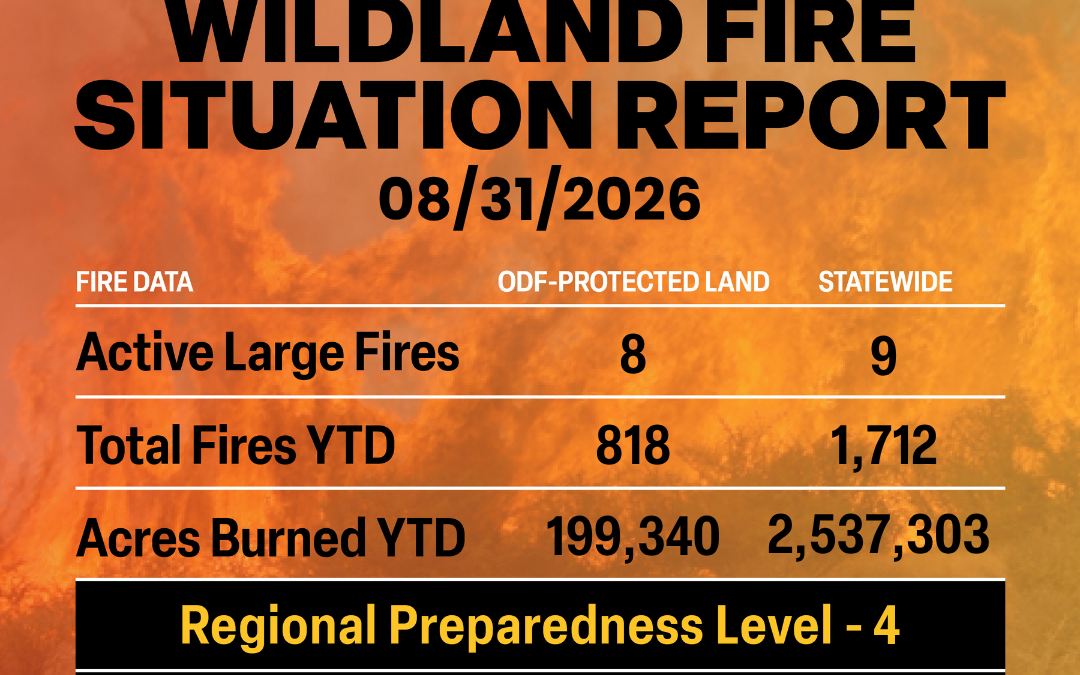
August 31, 2026
ODF Complex Incident Management Teams
- ODF CIMT 1 is on standby.
- ODF CIMT 2 is on rest.
- ODF CIMT 3 is on rotation.
Current Large Fires with ODF Involvement (in priority order).
| FIRE NAME |
TOTAL ACRES |
ODF ACRES |
CONTAINMENT |
LOCATION |
COMMAND |
| Austin |
11,682 |
0 |
0% |
25 miles SE of Estacada |
GB Team 4 |
| Grasshopper |
93,961 |
19,508 |
83% |
3 miles N of Sportsmans Park |
GB Team 4 |
| The Narrows |
301 |
0 |
11% |
15 miles SE of Estacada |
GB Team 4 |
| Paradise |
9,329 |
307 |
15% |
18 miles E of Milton-Freewater |
SA Team 3 |
| Hagen |
60,975 |
1,845 |
45% |
26 miles E of Pendleton |
SA Team 3 |
| Rowe Creek Complex |
373,927 |
97,429 |
92% |
10 miles S of Fossil |
CA Team 4 |
| McCully |
11,231 |
783 |
2% |
22 miles NW of Baker City |
NW Team 3 |
| Wrights Spring |
55,134 |
13,188 |
90% |
2 miles SE of Sprague River |
NW Team 7 |
*These numbers may change as we receive more data.
There are approximately 5,307 personnel assigned to the 9 large fires across the state, not including many of the local and agency government employees, landowners, forestland operators, and members of the community who are contributing every day.
Initial attack remains ODF’s top priority.
Prevention: As we already know, fire behavior this season is extremely active and continuously changing. Even with rain on the forecast, now is NOT the time to become complacent.
Help your wildland firefighters by preventing the next human-caused wildfire. The easiest way to do this is by checking your local fire restrictions and brushing up on your wildfire prevention knowledge. Remain aware of weather conditions and any red flag warnings in your area. Sign up for emergency alerts at ORalert.gov.
Weather: Expect dry weather, light winds and seasonal temperatures through Monday. On Tuesday, west southwest winds will increase east of the Cascades with a slight chance of thunderstorms across southern and central Oregon. Wednesday through Friday, a strong cold front will bring wetting rains, especially from the coast through the Cascades, northern Washington and northeast Oregon.
Today’s Highlight: Five firefighting crews from South Fork Forest Camp (SFFC) responded to the Wolf Creek Fire in Tillamook State Forest last week to help with the initial attack on the fire. The combination of air attack, heavy equipment, and the Adults-in-Custody hand crews contained the fire to 18 acres. Four crews returned the following day to help with mop-up operations.
SFFC is jointly run by the Department of Corrections and Department of Forestry. This year marks the 75th anniversary of the jointly run camp. ODF trains and supervises adults-in-custody crews to perform a variety of key forest management and protection projects.
This interagency partnership allows adults-in-custody to gain valuable work skills while providing economic, social, and environmental benefits for Oregonians.
Resources

August 26, 2026
ODF Complex Incident Management Teams
- ODF CIMT 1 is on rotation
- ODF CIMT 2 is in command of the Rowe Creek Complex. Visit the incident Facebook page for updates.
- ODF CIMT 3 is on standby.
Current Large Fires with ODF Involvement (in priority order).
| FIRE NAME |
TOTAL ACRES |
ODF ACRES |
CONTAINMENT |
LOCATION |
COMMAND |
| Grasshopper |
93,806 |
21,372 |
76% |
3 miles N of Sportsmans Park |
GB Team 4 |
| Austin |
8,183 |
TBD |
0% |
25 miles SE of Estacada |
GB Team 4 |
| The Narrows |
281 |
0 |
0% |
15 miles SE of Estacada |
GB Team 4 |
| Paradise |
9,027 |
287 |
0% |
18 miles E of Milton-Freewater |
SA Team 3 |
| Hagen |
60,372 |
1,823 |
33% |
26 miles E of Pendleton |
SA Team 3 |
| Rowe Creek Complex |
373,981 |
97,469 |
92% |
10 miles S of Fossil |
ODF CIMT 2 |
| McCully |
5,458 |
391 |
0% |
22 miles NW of Baker City |
NW Team 3 |
| North Pole |
513 |
119 |
0% |
18 miles NW of Baker City |
NW Team 3 |
| Wrights Spring |
55,131 |
13,185 |
65% |
2 miles SE of Sprague River |
NW Team 7 |
*These numbers may change as we receive more data.
There are approximately 5,652 personnel assigned to the 14 large fires across the state, not including many of the local and agency government employees, landowners, forestland operators, and members of the community who are contributing every day.
Initial attack remains ODF’s top priority.
Prevention: As we already know, fire behavior this season is extremely active and continuously changing. Even as containment is rising on large wildfires, the region is still experiencing critical fire weather. Now is NOT the time to become complacent.
Help your wildland firefighters by preventing the next human-caused wildfire. The easiest way to do this is by checking your local fire restrictions and brushing up on your wildfire prevention knowledge. Remain aware of weather conditions and any red flag warnings in your area. Sign up for emergency alerts at ORalert.gov.
Weather: Warm to hot and dry conditions will persist east of the Cascades and southwest Oregon. Areas west of the Cascades remain cooler under marine influence. A slight chance of mainly dry thunderstorms will occur across Northern Washington, Eastern and Southeast Oregon today. A thermal trough will linger east of the Cascades, enhancing low level instability and ventilation, especially across eastern Oregon. A dry cold front will cross Thursday, producing strong, gusty winds in very dry conditions across most areas east of the crest, with the highest speeds through the Cascade gaps and across the Columbia and Harney Basins. The upper trough will move across the region Saturday, bringing another round of dry, gusty winds mainly on the eastside, while western Washington has better wetting rain potential with thunderstorms.
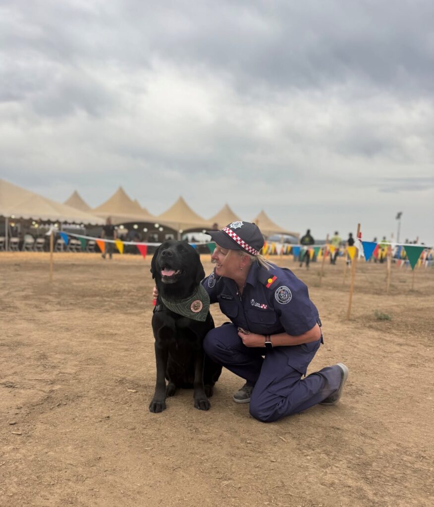 Today’s Highlight: It’s National Dog Day! As the season continues, our furry friends help to give a bit of relief to our firefighters when they return home, and even some relief on a fire when the support dogs come to visit.
Puppy pets and dog kisses help to heal the fatigue of the season, even just a little.
Resources
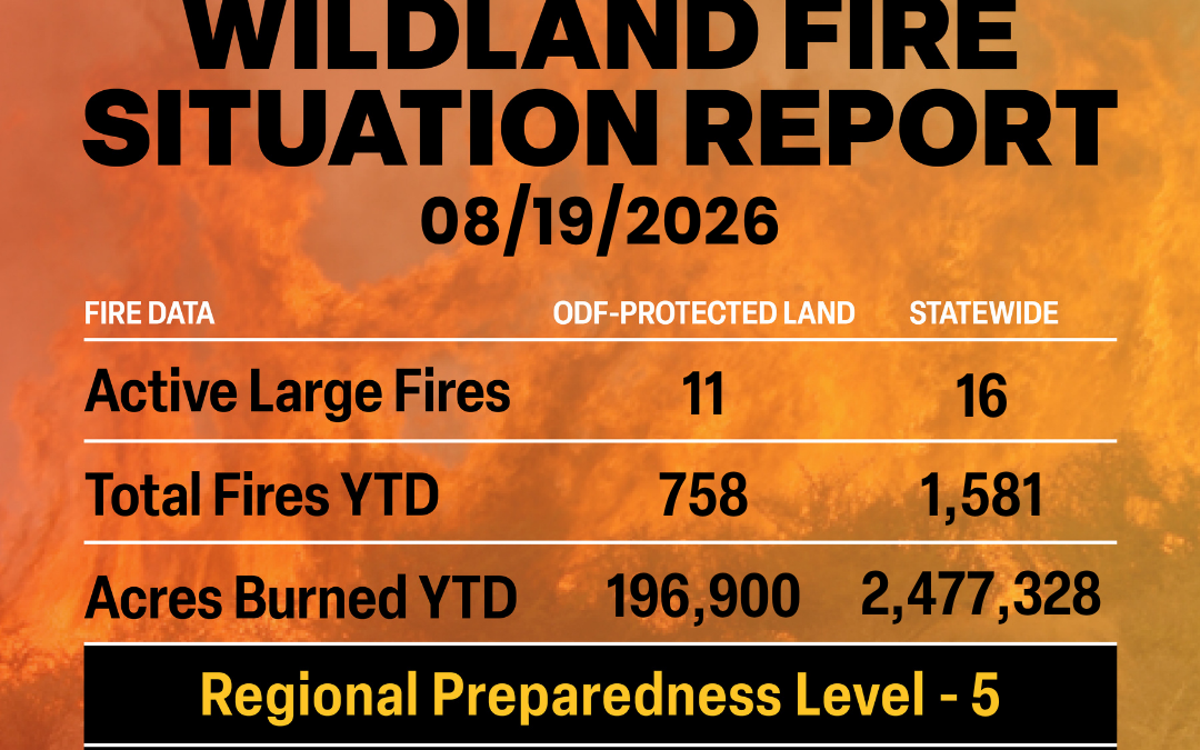
August 19, 2026
ODF Complex Incident Management Teams
Current Large Fires with ODF Involvement (in priority order).
| FIRE NAME |
TOTAL ACRES |
ODF ACRES |
CONTAINMENT |
LOCATION |
COMMAND |
| Grasshopper |
91,555 |
19,650 |
57% |
3 miles N of Sportsmans Park |
SA Team 2 | OSFM Blue Team |
| Austin |
3,244 |
TBD |
0% |
25 miles SE of Estacada |
SA Team 2 | OSFM Blue Team |
| The Narrows |
167 |
TBD |
0% |
15 miles SE of Estacada |
SA Team 2 | OSFM Blue Team |
| Paradise |
5,423 |
25 |
0% |
18 miles E of Milton-Freewater |
SA Team 3 |
| Hagen |
57,678 |
1,615 |
19% |
26 miles E of Pendleton |
SA Team 3 |
| Cottonwood |
722 |
722 |
95% |
15 miles SW of Long Creek |
ODF CIMT 3 |
| Little Bear |
67 |
67 |
55% |
7 miles N of John Day |
ODF CIMT 3 |
| Bologna |
4,509 |
1,607 |
89% |
7 miles NE of Kimberly |
ODF CIMT 3 |
| Rosenbaum |
483 |
483 |
54% |
4 miles NW of Service Creek |
ODF CIMT 3 |
| Rowe Creek Complex |
373,785 |
97,065 |
89% |
10 miles S of Fossil |
ODF CIMT 2 |
| Fielder Mountain |
573 |
573 |
53% |
4 miles SE of Grants Pass |
ODF CIMT 1 |
| Wrights Spring |
54,016 |
12,873 |
55% |
2 miles SE of Sprague River |
NW Team 8 |
*These numbers may change as we receive more data.
There are approximately 7,880 personnel assigned to the 16 large fires across the state, not including many of the local and agency government employees, landowners, forestland operators, and members of the community who are contributing every day.
Initial attack remains ODF’s top priority.
Prevention: As we already know, fire behavior this season is extremely active and continuously changing. Even as containment is rising on large wildfires, the region is still experiencing critical fire weather. Firefighters continue to work diligently and will do so until all fires are completely out. Now is NOT the time to become complacent.
Help your wildland firefighters by preventing the next human-caused wildfire. The easiest way to do this is by checking your local fire restrictions and brushing up on your wildfire prevention knowledge. Remain aware of weather conditions and any red flag warnings in your area. Sign up for emergency alerts at ORalert.gov.
Weather: Drier and warmer conditions, along with building instability will produce an elevated burn environment much of this week. Heading into the weekend, southwest winds will increase and bring back a lightning threat as a stronger Pacific trough approaches the west coast. The best potential for faster moving thunderstorms Friday is along the Cascades and Olympics, with thunderstorms shifting north and east into the northern Cascades and eastern Washington on Saturday. A cold front will likely move across the region late Friday and Saturday bringing gusty west winds following the lightning.
However, confidence is still low on exact details, and overall timing may change as the event nears. Temperatures will cool 8-12 degrees over the weekend behind the front. A weak trough will remain along the coast with continued southwest flow into next week.
Today’s Highlight: Incident management teams on large fires don’t just manage those fires but also support the local district in initial attack as needed, sometimes preventing the next large fire.
This is true for ODF’s Complex Incident Management Team 3, who were originally assigned to manage the Bologna and Cottonwood fires. While in the area, the team helped with initial attack on both the Little Bear and Rosenbaum fires and quickly assumed command of both for the district.
Due to critical fire weather, the Rosenbaum Fire grew quickly from steep forestland towards Hwy. 19 creating complexity for initial attack resources to get around it. With ODF CIMT 3 already in place, additional ground and air resources were mobilized to the Rosenbaum Fire to support the ODF Central Oregon District in their suppression efforts. The team took command of the fire the following morning to alleviate resources in the local district. The Rosenbaum Fire is now 54% contained and 483 acres.
This fire had the potential to become thousands of acres due to hot, dry and windy conditions driving it through difficult terrain and dried fuels, but now it is well on its way to containment due to the partnership between ODF Central Oregon District and ODF CIMT 3.
Resources
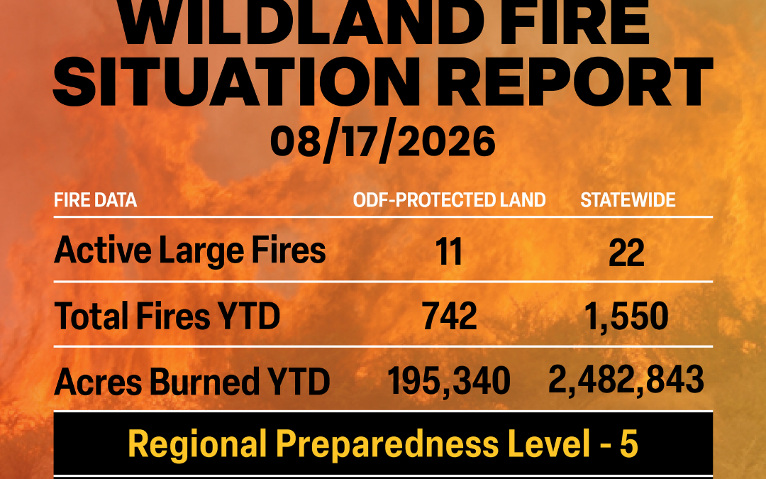
August 17, 2026
ODF Complex Incident Management Teams
ODF Priority Fires
| FIRE NAME |
TOTAL ACRES |
ODF ACRES |
CONTAINMENT |
LOCATION |
COMMAND |
| Fielder Mountain |
573 |
573 |
29% |
4 miles SE of Grants Pass |
ODF CIMT 1 |
| Cottonwood |
722 |
722 |
95% |
15 miles SW of Long Creek |
ODF CIMT 3 |
| Little Bear |
86 |
86 |
55% |
7 miles N of John Day |
ODF CIMT 3 |
| Bologna |
4,509 |
1,746 |
78% |
7 miles NE of Kimberly |
ODF CIMT 3 |
| Rosenbaum |
483 |
230 |
16% |
4 miles NW of Service Creek |
ODF CIMT 3 |
| Rowe Creek Complex |
373,784 |
96,989 |
89% |
10 miles S of Fossil |
ODF CIMT 2 | OSFM Red Team |
| Grasshopper |
90,130 |
17,695 |
47% |
3 miles N of Sportsmans Park |
SA Team 2 |
OSFM Blue Team |
| Paradise |
5,195 |
12 |
0% |
18 miles E of Milton-Freewater |
NR Team 6 |
| Hagen |
56,419 |
1,486 |
14% |
26 miles E of Pendleton |
NR Team 6 |
| Wrights Spring |
53,628 |
12,285 |
51% |
2 miles SE of Sprague River |
NW Team 8 |
| Shingle |
73,179 |
20,411 |
89% |
14 miles SE of Mitchell |
GA Type 3 Team |
*These numbers may change as we receive more data.
There are approximately 8,439 personnel assigned to the 22 large fires across the state, not including many of the local and agency government employees, landowners, forestland operators, and members of the community who are contributing every day.
Initial attack remains ODF’s top priority.
Prevention: As we already know, fire behavior this season is extremely active and continuously changing. Even as containment has risen on several fires, they are still experiencing fire growth, established spot fires and slopover on the containment lines. Firefighters continue to work diligently to contain these fires and will do so until it is completely out. Now is NOT the time to become complacent.
Help your wildland firefighters by preventing the next human-caused wildfire. The easiest way to do this is by checking your local fire restrictions and brushing up on your wildfire prevention knowledge. Remain aware of weather conditions and any red flag warnings in your area. Sign up for emergency alerts at ORalert.gov.
Weather: An upper-level disturbance may trigger lightning today, mainly in Oregon. Drier southwest flow aloft develops afterward, reducing the lightning threat through much of the week. Gusty west wind develops over eastside PSAs today and Tuesday, especially through the Cascade gaps and into the western
 Columbia Basin. A warming and drying trend is expected mid to late week as a ridge builds. Heading into the weekend, low pressure will increase southerly winds and bring back a lightning threat as a stronger Pacific trough approaches. Many areas could see lightning, though details remain uncertain.
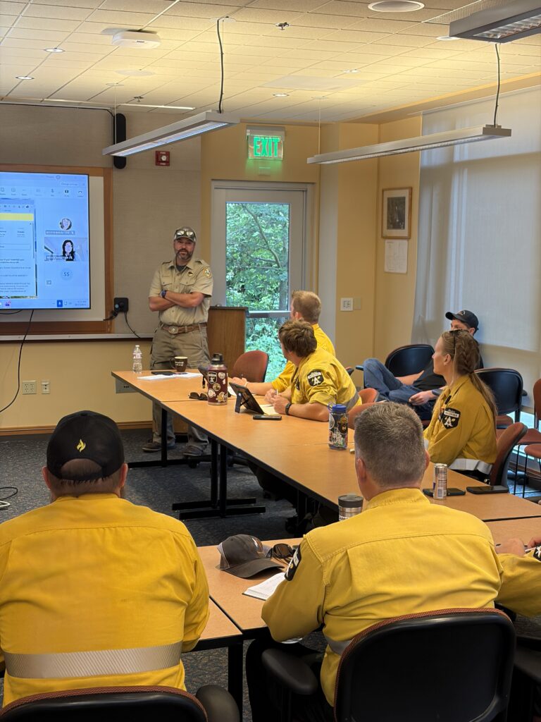
Today’s Highlight: Through the NW Compact, a mutual aid agreement with western states, provinces and territories, the Oregon Department of Forestry has brought in 19 firefighters from Alberta, the Yukon Territory and Saskatchewan.
These firefighters range from heavy equipment bosses to aviation managers to Type 3 incident commanders and safety officers. These management positions will help the state mobilize more resources and give reprieve to those that have been on assignment. The firefighters will be spread out amongst several fires in Oregon including the Grasshopper Fire, the Wrights Spring Fire, the Rowe Creek Complex and others this week.
Resources
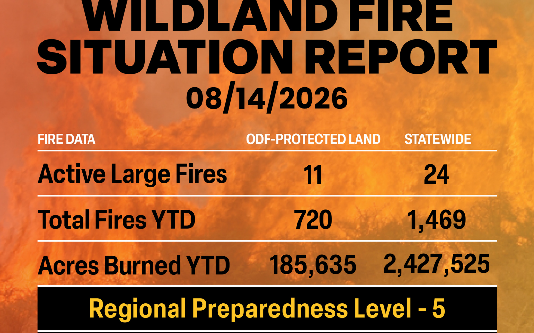
August 14, 2026
ODF Complex Incident Management Teams
- ODF CIMT 1 has been mobilized to the Fielder Mountain Fire and will take command at 6 p.m. tonight. Visit the ODF Southwest Oregon District Facebook page for updates.
- ODF CIMT 2 has been mobilized to the Rowe Creek Complex and will take command Sunday, August 16. Visit the incident Facebook page for updates.
- ODF CIMT 3 is in command of the Cottonwood, Little Bear, Rosenbaum and Bologna Fire. Visit the incident Facebook page for updates.
ODF Priority Fires
| FIRE NAME |
TOTAL ACRES |
ODF ACRES |
CONTAINMENT |
LOCATION |
COMMAND |
| Fielder Mountain |
550 |
225 |
0% |
4 miles SE of Grants Pass |
ODF CIMT 1
(TOC @ 1800) |
| Cottonwood |
722 |
722 |
88% |
15 miles SW of Long Creek |
ODF CIMT 3 |
| Little Bear |
86 |
0 |
55% |
7 miles N of John Day |
ODF CIMT 3 |
| Bologna |
4,743 |
1,803 |
53% |
7 miles NE of Kimberly |
ODF CIMT 3 |
| Rosenbaum |
200 |
TBD |
0% |
4 miles NW of Service Creek |
ODF CIMT 3 |
| Rowe Creek Complex |
373,777 |
96,945 |
84% |
10 miles S of Fossil |
SW Team 2 | OSFM Red Team |
| Grasshopper |
85,114 |
11,187 |
20% |
3 miles N of Sportsmans Park |
SA Team 2 |
OSFM Blue Team |
| Paradise |
4,433 |
0 |
0% |
18 miles E of Milton-Freewater |
NR Team 6 |
| Hagen |
54,484 |
1,486 |
11% |
26 miles E of Pendleton |
NR Team 6 |
| Wrights Spring |
53,061 |
11,786 |
6% |
2 miles SE of Sprague River |
NW Team 8 |
OSFM Green Team |
| Shingle |
73,179 |
20,411 |
82% |
14 miles SE of Mitchell |
GA Type 3 Team |
*These numbers may change as we receive more data.
There are approximately 8,925 personnel assigned to the 24 large fires across the state, not including many of the local and agency government employees, landowners, forestland operators, and members of the community who are contributing every day.
Initial attack remains ODF’s top priority.
Prevention: As we already know, fire behavior this season is extremely active and continuously changing. Even as containment has risen on several fires, they are still experiencing fire growth, established spot fires and slopover on the containment lines. Firefighters continue to work diligently to contain these fires and will do so until it is completely out. Now is NOT the time to become complacent.
Help your wildland firefighters by preventing the next human-caused wildfire. The easiest way to do this is by checking your local fire restrictions and brushing up on your wildfire prevention knowledge. Remain aware of weather conditions and any red flag warnings in your area. Sign up for emergency alerts at ORalert.gov.
Weather: Low pressure moving south from Canada will keep thunderstorms over northern Washington and the northern Cascades through Friday, producing gusty outflow winds and localized wetting rain. Northeast winds behind a cold front will continue today across eastern Washington, with 25–35 mph gusts over higher terrain and aligned valleys and may push smoke west of the Cascades. A coastal trough will hold in place through the weekend and maintain thunder potential over northern Washington, the northern Cascades, and the Olympics. Monsoonal moisture will spread into eastern Oregon through Sunday, starting with mixed wet and dry thunderstorms and gusty outflows that shift north and gradually produce localized rainfall. Isolated thunderstorms are possible along the Oregon Cascades and the Siskiyous through Saturday, with lightning coverage potentially peaking Saturday. Weak upper waves may also trigger isolated early‑morning lightning in eastern Washington and Oregon.
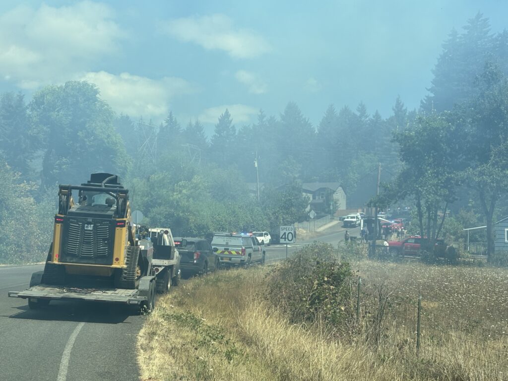 Today’s Highlight: This past Wednesday, ODF’s South Cascade District responded to a vegetation fire within the Springfield city limits. In coordination with the local fire department, ODF supported suppression efforts by providing firefighters, engines and a dozer through mutual aid agreements.
ODF alongside structural firefighters was able to help quickly extinguish the fire before it reached nearby residences.
Resources
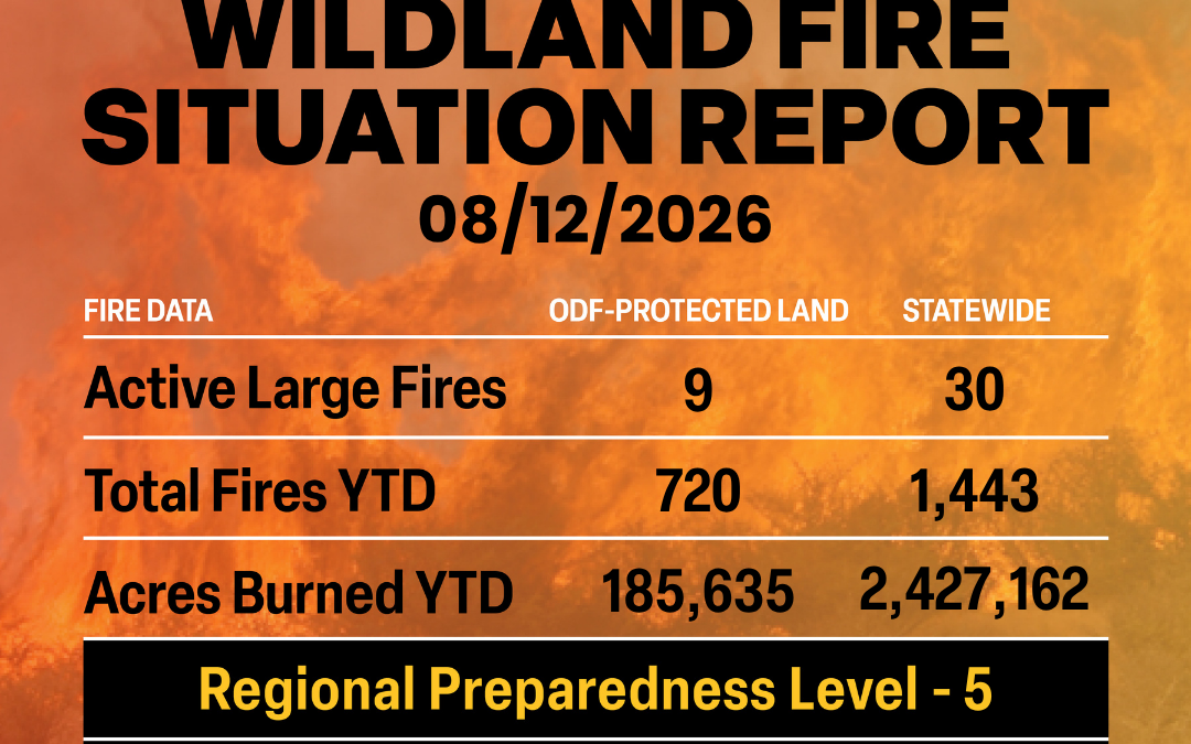
August 12, 2026
ODF Complex Incident Management Teams
- ODF CIMT 1 is on rotation.
- ODF CIMT 2 has sent a partial team to the Rowe Creek Complex. Remainder of the team will arrive and take over command of the complex Sunday, August 16. Visit the incident Facebook page for updates.
- ODF CIMT 3 is in command of the Cottonwood and Bologna Fire. Visit the incident Facebook page for updates.
ODF Priority Fires
| FIRE NAME |
TOTAL ACRES |
ODF ACRES |
CONTAINMENT |
LOCATION |
COMMAND |
| Wrights Spring |
51,687 |
11,786 |
5% |
2 miles SE of Sprague River |
NW Team 8 |
OSFM Green Team |
| Bologna |
4,743 |
1,803 |
36% |
7 miles NE of Kimberly |
ODF CIMT 3 |
| Grasshopper |
77,311 |
11,187 |
20% |
3 miles N of Sportsmans Park |
SA Team 2 |
OSFM Blue Team |
| Paradise |
3,531 |
0 |
0% |
18 miles E of Milton-Freewater |
NR Team 6 |
| Hagen |
51,061 |
1,486 |
11% |
26 miles E of Pendleton |
NR Team 6 |
| Rowe Creek Complex |
373,169 |
96,945 |
79% |
10 miles S of Fossil |
SW Team 2 | OSFM Red Team |
| Second Flat |
105,501 |
5,013 |
90% |
6 miles NE of Riley |
CA Team 4 |
| Shingle |
73,016 |
20,411 |
86% |
14 miles SE of Mitchell |
GA Type 3 Team |
*These numbers may change as we receive more data.
There are approximately 11,798 personnel assigned to the 30 large fires across the state, not including many of the local and agency government employees, landowners, forestland operators, and members of the community who are contributing every day.
Initial attack remains ODF’s top priority.
Prevention: As we already know, fire behavior this season is extremely active and continuously changing. Even as containment has risen on several fires, they are still experiencing fire growth, established spot fires and slopover on the containment lines. Firefighters continue to work diligently to contain these fires and will do so until it is completely out. Now is NOT the time to become complacent.
Help your wildland firefighters by preventing the next human-caused wildfire. The easiest way to do this is by checking your local fire restrictions and brushing up on your wildfire prevention knowledge. Remain aware of weather conditions and any red flag warnings in your area. Sign up for emergency alerts at ORalert.gov.
Weather: Gusty gap winds begin decreasing today. Low pressure crossing southern British Columbia Wednesday and Thursday will keep scattered thunderstorms in northern Washington, which may linger overnight. Thunderstorms will bring gusty outflow winds and localized wetting rains. Winds will shift to the north across the Okanogan Valley and northern Columbia Basin mid-week. A low-pressure trough remains along the coast through the weekend and will maintain thunder potential over northern Washington Friday. Monsoonal moisture will spread into eastern Oregon from Thursday through Sunday, starting with drier thunderstorms and gusty outflow winds that move north and gradually produce localized rainfall. Thunderstorms may develop west toward the Cascades and Siskiyou Mountains Friday and continue in the Cascades through the weekend.

Today’s Highlight: In collaboration with local fire departments and the Oregon Dept. of Corrections, Keep Oregon Green (KOG) collected a bunch of spent fire hose to use for an important purpose—wildfire prevention messaging: “Dragging chains spark flames” on one side and “Keep Oregon Green” on the other.
KOG will be handing these out at the state fair for free (one per customer) until they run out. Help us send a message to boat, trailer, and camper haulers to tie up those sagging, dragging tow chains and help us prevent wildfires!
Resources
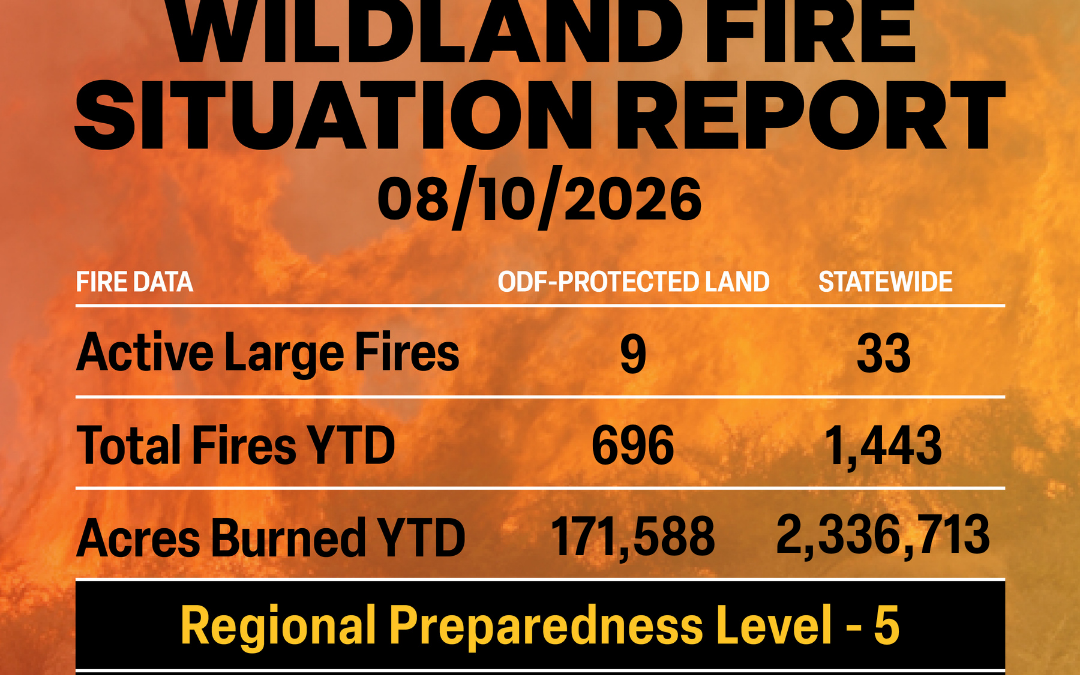
August 10, 2026
ODF Complex Incident Management Teams
- ODF CIMT 1 is on rotation.
- ODF CIMT 2 has sent a partial team to the Rowe Creek Complex. Remainder of the team will arrive and take over command of the complex at the end of the week. Visit the incident Facebook page for updates.
- ODF CIMT 3 has been deployed to the Cottonwood and Bologna Fire.
ODF Priority Fires
| FIRE NAME |
TOTAL ACRES |
ODF ACRES |
CONTAINMENT |
LOCATION |
COMMAND |
| Bologna |
4,300 |
161 |
30% |
7 miles NE of Kimberly |
ICT 3
(ODF CIMT 3 mobilized, TOC @ 0600 tomorrow) |
| Wrights Spring |
33,970 |
9,856 |
0% |
2 miles SE of Chiloquin |
NW Team 8 |
OSFM Green Team |
| Grasshopper |
57,087 |
1,550 |
23% |
7 miles W of Wamic |
CA Team 6 |
| Rowe Creek Complex |
366,617 |
96,162 |
79% |
10 miles S of Fossil |
SW Team 2 | OSFM Red Team |
| Paradise |
3,155 |
0 |
0% |
15 miles S of Pendleton |
NR Team 6 |
| Hagen |
46,527 |
1,482 |
11% |
26 miles E of Pendleton |
NR Team 6 |
| Second Flat |
105,501 |
5,013 |
88% |
6 miles NE of Riley |
CA Team 4 |
| Shingle |
73,101 |
20,411 |
86% |
14 miles SE of Mitchell |
GB Team 5 |
*These numbers may change as we receive more data.
There are approximately 10,165 personnel assigned to the 33 large fires across the state, not including many of the local and agency government employees, landowners, forestland operators, and members of the community who are contributing every day.
Initial attack remains ODF’s top priority.
Prevention: As we already know, fire behavior this season is extremely active and continuously changing. Even as containment has risen on several fires, they are still experiencing fire growth, established spot fires and slopover on the containment lines. Firefighters continue to work diligently to contain these fires and will do so until it is completely out. Now is NOT the time to become complacent.
Help your wildland firefighters by preventing the next human-caused wildfire. The easiest way to do this is by checking your local fire restrictions and brushing up on your wildfire prevention knowledge. Remain aware of weather conditions and any red flag warnings in your area. Sign up for emergency alerts at ORalert.gov.
Weather: Gusty gap winds will continue through Tuesday, though any westside humidity increases will not last far from the Cascades. Low pressure moving across southern British Columbia Wednesday and Thursday will bring scattered thunderstorms near the Canadian border Wednesday and into far northeast Washington Thursday. Winds shift to be from the northwest and north through the Okanogan Valley and the northern Columbia Basin. Monsoonal moisture will move into central, south central, and southeast Oregon from Thursday through Sunday with initially dry thunderstorms moving northward from the Sierra Nevada Mountains and Great Basin. Rainfall from the storms increases Saturday and Sunday, but so does the lightning potential.
In Memoriam: The Oregon Department of Forestry extends its deepest condolences to the family and loved ones of Jason Ensign, who passed away while fighting the Wrights Spring Fire for Green Diamond Resource Company.
Every life lost on a fire hits hard for all of us in the wildland fire community, especially when it’s this close to home.
ODF will continue to work closely with our federal, state, and local agency partners and support wherever is needed through the next steps of this process.
And to every firefighter out on the line this season: stay safe, stay aware and take care of yourself. We appreciate everything you are doing to protect Oregon.
For more information, visit Klamath County Sheriff’s Office.
Resources
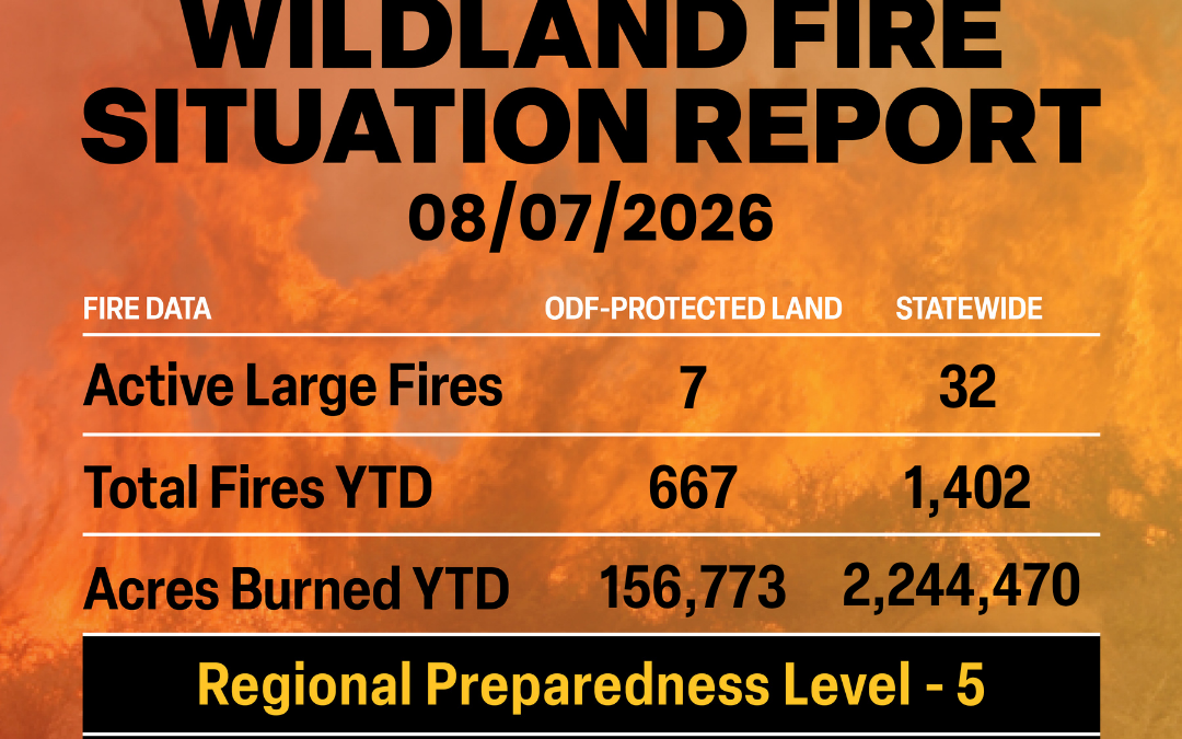
August 7, 2026
ODF Complex Incident Management Teams
- FL Team 1 is in command of the East Evans Creek and I-5 MM 57 NB Fire. For fire updates, visit the Southwest Oregon District’s Facebook page.
- ODF CIMT 1 is on rest.
- ODF CIMT 2 is on rotation.
- ODF CIMT 3 is on standby.
ODF Priority Fires
| FIRE NAME |
TOTAL ACRES |
ODF ACRES |
CONTAINMENT |
LOCATION |
COMMAND |
| Wrights Spring |
8,722 |
6 |
0% |
2 miles SE of Chiloquin |
ICT 3
(NW Team 8 and OSFM Green Team
TOC tomorrow) |
| Grasshopper |
48,344 |
2,390 |
23% |
7 miles W of Wamic |
CA Team 6 |
| Paradise |
2,560 |
0 |
0% |
15 miles S of Pendleton |
NR Team 6 |
| Hagen |
40,803 |
1,441 |
11% |
26 miles E of Pendleton |
NR Team 6 |
| Rowe Creek Complex |
357,895 |
90,532 |
73% |
10 miles S of Fossil |
SW Team 2 |
| Shingle |
70,806 |
20,414 |
53% |
14 miles SE of Mitchell |
GB Team 5 |
| Second Flat |
105,464 |
5,013 |
85% |
6 miles NE of Riley |
CA Team 4 |
| East Evans Creek |
15,580 |
15,580 |
98% |
14 miles NE of
Rogue River |
FL Team 1 |
*These numbers may change as we receive more data.
There are approximately 10,508 personnel assigned to the 32 large fires across the state, not including many of the local and agency government employees, landowners, forestland operators, and members of the community who are contributing every day.
Initial attack remains ODF’s top priority.
Prevention: As fire weather and extreme fire behavior persists, the Oregon Department of Forestry, along with other fire managers across Oregon, are urging Oregonians and those visiting our state to exercise caution and help prevent wildfires. Check local restrictions, avoid activities that could cause a spark, stay clear of firefighting operation areas and follow local evacuation and emergency alerts.
Help your wildland firefighters by preventing the next human-caused wildfire. The easiest way to do this is by checking your local fire restrictions and brushing up on your wildfire prevention knowledge.
Weather: Gusty westerly winds will increase east of Cascades today and Saturday, especially through the Cascade gaps and Columbia Basin. It will also be hot with very low RHs each day. Areas in the east will see their lowest RHs in the single digit to mid-teens. Early next week, westerly onshore flow will return typical westside conditions, while central and eastern areas stay warm, dry, and periodically breezy.
Today’s Highlight: Four South Fork Forest Camp (SFFC) crews are returning after deploying for 14 days to help battle the 15,580-acre East Evans Creek Fire in southern Oregon. The 10-person adults in custody crews, who are led and trained by ODF staff, have been preforming labor-intensive mop-up operations. The wildland firefighters extinguish residual fire and prevent rekindling near control lines by cooling ash pits to maintain a fireline during mop-up. They also do cold-trailing where firefighters use the back of their hands to feel the ground for any remaining heat near the fireline and put out those hot spots.
SFFC, a minimum-security facility in the middle of the Tillamook State Forest, is jointly run by the Oregon Department of Forestry and the Oregon Department of Corrections. During fire season the SFFC crews are typically prepositioned in northwest Oregon; however, with size, number and intensity of wildfires this year they are deploying outside the region. DOC staff provide security and administrative support while the AICs are in camp. The life and job skills and practical experience they learn at SFFC while on fires can lead to some making careers in firefighting afterwards with contactors or ODF.
Resources
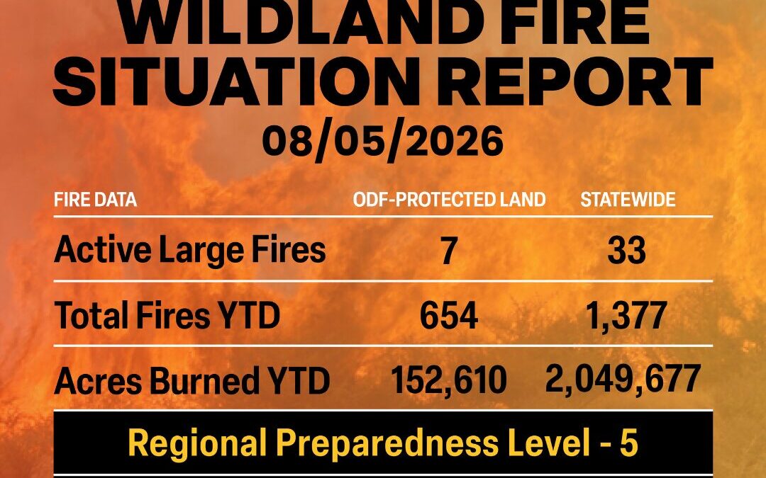
August 5, 2026
ODF Complex Incident Management Teams
- FL Team 1 is in command of the East Evans Creek Fire. For fire updates, visit the Southwest Oregon District’s Facebook page.
- ODF CIMT 1 is on rest.
- ODF CIMT 2 is on rotation.
- ODF CIMT 3 is on standby.
ODF Priority Fires
| FIRE NAME |
TOTAL ACRES |
ODF ACRES |
CONTAINMENT |
LOCATION |
COMMAND |
| Grasshopper |
34,659 |
2,392 |
19% |
7 miles W of Wamic |
CA Team 6 | OSFM Gray |
| Paradise |
1,505 |
0 |
0% |
15 miles S of Pendleton |
CIMT NW Team 7 |
| Hagen |
40,391 |
1,441 |
11% |
26 miles E of Pendleton |
CIMT NW Team 7 |
| Shingle |
70,551 |
19,369 |
50% |
14 miles SE of Mitchell |
GB Team 5 |
| Second Flat |
105,464 |
5,017 |
55% |
6 miles NE of Riley |
CIMT CA Team 4 |
| Rowe Creek Complex |
325,265 |
88,401 |
57% |
10 miles S of Fossil |
CIMT SW Team 2 OSFM Blue Team |
| East Evans Creek |
15,580 |
15,580 |
95% |
14 miles NE of
Rogue River |
CIMT FL Team 1 |
*These numbers may change as we receive more data.
There are approximately 11,304 personnel assigned to the 33 large fires across the state, not including many of the local and agency government employees, landowners, forestland operators, and members of the community who are contributing every day.
Initial attack remains ODF’s top priority.
Prevention: As fire weather and extreme fire behavior persists, the Oregon Department of Forestry, along with other fire managers across Oregon, are urging Oregonians and those visiting our state to exercise caution and help prevent wildfires. Check local restrictions, avoid activities that could cause a spark, stay clear of firefighting operation areas and follow local evacuation and emergency alerts.
Help your wildland firefighters by preventing the next human-caused wildfire. The easiest way to do this is by checking your local fire restrictions and brushing up on your wildfire prevention knowledge.
Weather: High pressure over the Northwest today through Friday will bring hot and very dry conditions, poor humidity recoveries with north to northeast wind in the Willamette valley and the Columbia Gorge. A thermal trough over southern and central Oregon Cascades establishes itself today and Wednesday increasing instability and some easterly winds. High pressure over the Northwest will begin to weaken and move well east of the region late this week into the weekend. Low pressure and associated front will enter British Columbia resulting in a flattening of the ridge and increased winds in the Columbia Basin and Cascade gaps Friday through Sunday. Slightly cooler temperatures by Sunday.
Today’s Highlight: Through mutual aid agreements, the Oregon Department of Forestry has been able to bring in qualified middle management supervisors from out of state to support our firefighting efforts. Nationally, there is a shortage of qualified middle managers, which are needed to be able to safely mobilize assets like aircraft, hand crews, strike teams and more.
Most recently, ODF brought in four Military Helicopter Managers from California, through the NW Compact, which enabled the state to activate Oregon National Guard resources to support wildfire suppression efforts in Northeast Oregon. Without these key manager positions from California, Oregon would have been unable to fill the positions and subsequently unable to activate the needed assets supplied and staffed by the Oregon National Guard – Oregon Military Department.
These agreements with our partners and neighboring states help us to protect the state we love.
Resources
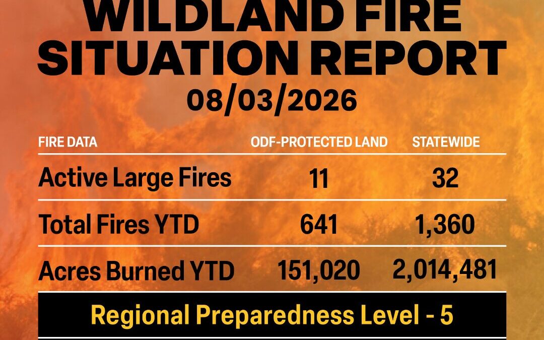
August 3, 2026
ODF Complex Incident Management Teams
- FL Team 1 is in command of the East Evans Creek Fire. For fire updates, visit the Southwest Oregon District’s Facebook page.
- ODF CIMT 1 is on rotation.
- ODF CIMT 2 is on rest.
- ODF CIMT 3 is on rest.
ODF Priority Fires
| FIRE NAME |
TOTAL ACRES |
ODF ACRES |
CONTAINMENT |
LOCATION |
COMMAND |
| Grasshopper |
30,729 |
2,119 |
0% |
7 miles W of Wamic |
CA Team 6 | OSFM Gray |
| Shingle |
70,372 |
19,317 |
16% |
14 miles SE of Mitchell |
GB Team 5 |
| Second Flat |
105,461 |
4,932 |
55% |
6 miles NE of Riley |
CIMT CA Team 4 |
| Paradise |
1,318 |
0 |
0% |
15 miles S of Pendleton |
CIMT NW Team 7 |
| Hagen |
39,777 |
1,374 |
11% |
26 miles E of Pendleton |
CIMT NW Team 7 |
| Rowe Creek Complex |
323,951 |
87,437 |
60% |
10 miles S of Fossil |
CIMT SW Team 2 OSFM Blue Team |
| Akawa Butte |
27,435 |
11,850 |
85% |
13 miles NE of Sisters |
NM Type 3 IMT |
| Burnt Creek |
4,169 |
366 |
52% |
23 miles N of Enterprise |
CIMT NW Team 13 |
| Bench |
67,238 |
0 |
66% |
4 miles S of Warm Springs |
SW Team 4 |
| East Evans Creek |
15,580 |
15,580 |
90% |
14 miles NE of
Rogue River |
CIMT FL Team 1 |
*These numbers may change as we receive more data.
There are approximately 11,774 personnel assigned to the 32 large fires across the state, not including many of the local and agency government employees, landowners, forestland operators, and members of the community who are contributing every day.
Initial attack remains ODF’s top priority.
Prevention: As fire weather and extreme fire behavior persists, the Oregon Department of Forestry, along with other fire managers across Oregon, are urging Oregonians and those visiting our state to exercise caution and help prevent wildfires. Check local restrictions, avoid activities that could cause a spark, stay clear of firefighting operation areas and follow local evacuation and emergency alerts.
Help your wildland firefighters by preventing the next human-caused wildfire. The easiest way to do this is by checking your local fire restrictions and brushing up on your wildfire prevention knowledge.
Weather: Strong high pressure develops over the Northeast Pacific Monday and then covers the Geographic Area Tuesday through at least Friday. This will result in hot and very dry conditions, with poor humidity recovery beginning Monday night over the eastside PSAs. Poor humidity recovery can be expected over the eastside and westside higher terrain Tuesday night through Friday. North to northeast wind develops Monday and continues through early Tuesday east of the Cascades and in the Columbia Gorge enhancing fire weather concerns. A thermal trough will develop across the southern and central Oregon Cascades Monday and Tuesday resulting in favorable conditions for increasing instability. The thermal trough shifts to the east Cascade slopes and into the Okanogan Valley Wednesday. Models indicate the possibility of another dry cold frontal passage next weekend.
Today’s Highlight: The Oregon Department of Forestry’s (ODF) Southwest Oregon District worked hard over the weekend and through their dedication helped protect two separate communities from wildfire.
Saturday afternoon, ODF Southwest Oregon firefighters, alongside local fire districts, responded to a wildland fire off I-5, near mile marker 57. The agency quickly went full throttle when it came to initial attack on the fast-moving fire, bringing in several different types of aircraft to limit the fire’s growth and impact on communities.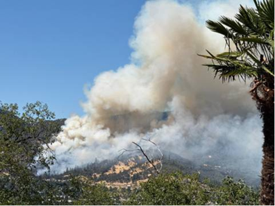
Within 45 minutes of that fire starting, there was a three-alarm fire in White City and the local fire district requested assistance from ODF. ODF Southwest Oregon firefighters responded and were stationed to protect the local VA medical center.
By Sunday morning, both fires were contained and in mop-up operations.
These two fires show the great successes of not only aggressive initial attack but partnering with our local fire districts. Together, we can support each other and protect Oregonians.
Resources
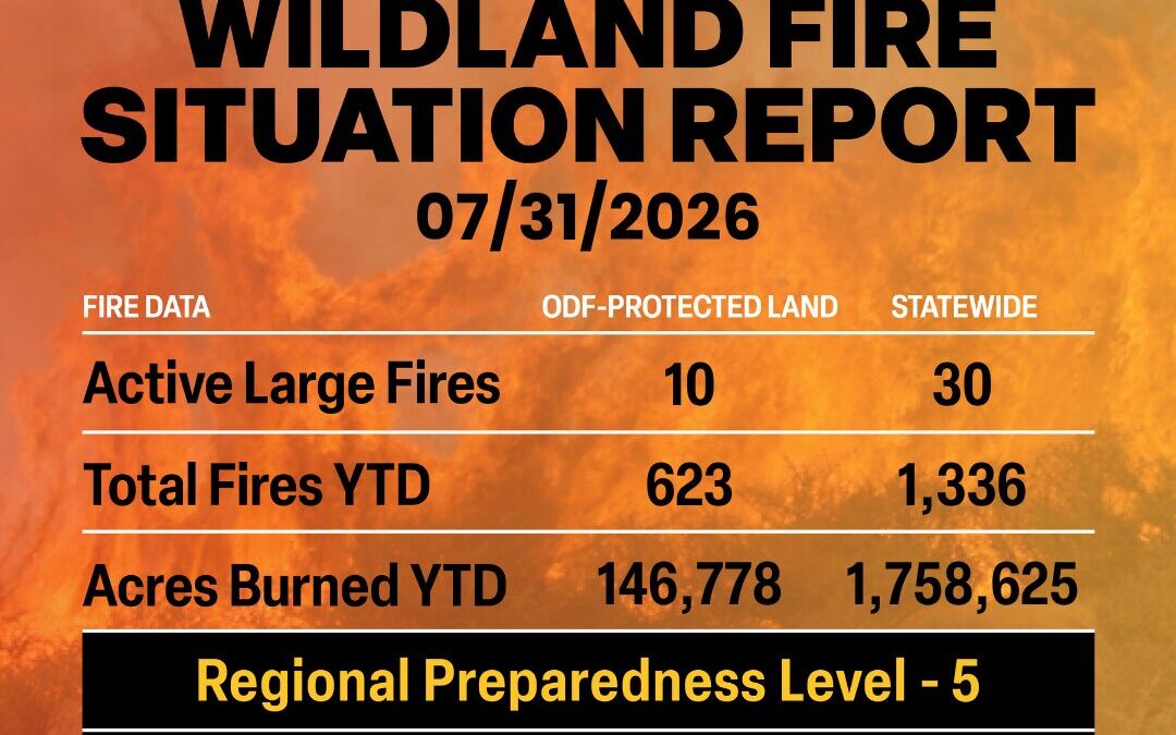
July 31, 2026
Significant Fire Potential This Weekend in Eastern Oregon
A dry cold front will arrive on Saturday that will bring strong winds to most of eastern Oregon east side, driving fire growth Saturday into Sunday. Forecasts are showing sustained winds 20-30 mph with gusts up to 50 mph. Winds over 30 mph can cause spot fires more than a mile away from the main fire. These conditions have the potential to produce fire behavior beyond what we’ve already seen this season. It’s critical that people pay close attention to weather forecasts and public safety information over the next several days. If you haven’t already, sign up for local emergency alerts at ORAlert.gov.
*ODF acres burned from the July 29, 2026 Sit Report contained duplicates. The above is the correct ODF acres burned.
ODF Complex Incident Management Teams
- FL Team 1 is in command of the East Evans Creek Fire. For fire updates, visit the Southwest Oregon District’s Facebook page.
- ODF CIMT 2 is in command of the Akawa Butte Fire. For fire updates, visit the incident’s Facebook page.
- ODF CIMT 3 is in unified command with OSFM Red Team on the Rowe Creek Complex – West Zone. For fire updates, visit the incident’s Facebook page.
- ODF CIMT 1 is on rotation.
ODF Priority Fires
| FIRE NAME |
TOTAL ACRES |
ODF ACRES |
CONTAINMENT |
LOCATION |
COMMAND |
| Grasshopper |
21,576 |
2,119 |
0% |
7 miles W of Wamic |
CA Team 6 | OSFM Gray |
| Shingle |
66,299 |
19,317 |
10% |
14 miles SE of Mitchell |
OSFM Blue Team
GB Team 5 |
| Second Flat |
103,459 |
4,932 |
18% |
6 miles NE of Riley |
CIMT CA Team 4 |
| Paradise |
768 |
0 |
0% |
15 miles S of Pendleton |
CIMT NW Team 7 |
| Hagen |
35,427 |
1,374 |
8% |
26 miles E of Pendleton |
CIMT NW Team 7 |
| Rowe Creek Complex |
309,765 |
87,437 |
52% |
10 miles S of Fossil |
CIMT NW Team 2 | ODF CIMT 3 | OSFM Red Team |
| Akawa Butte |
27,429 |
11,850 |
43% |
13 miles NE of Sisters |
ODF CIMT 2 |
| Burnt Creek |
4,169 |
366 |
22% |
23 miles N of Enterprise |
CIMT NW Team 13 |
| Bench |
65,130 |
0 |
32% |
4 miles S of Warm Springs |
SW Team 4 |
OSFM Blue Team |
| East Evans Creek |
15,580 |
15,580 |
87% |
14 miles NE of
Rogue River |
CIMT FL Team 1 |
*These numbers may change as we receive more data.
There are approximately 12,498 personnel assigned to the 30 large fires across the state, not including many of the local and agency government employees, landowners, forestland operators, and members of the community who are contributing every day.
Initial attack remains ODF’s top priority.
Prevention: As fire weather and extreme fire behavior persists, the Oregon Department of Forestry, along with other fire managers across Oregon, are urging Oregonians and those visiting our state to exercise extreme caution and help prevent wildfires. Check local restrictions, avoid activities that could cause a spark, stay clear of firefighting operation areas and follow local evacuation and emergency alerts.
Help your wildland firefighters by preventing the next human-caused wildfire. The easiest way to do this is by checking your local fire restrictions and brushing up on your wildfire prevention knowledge.
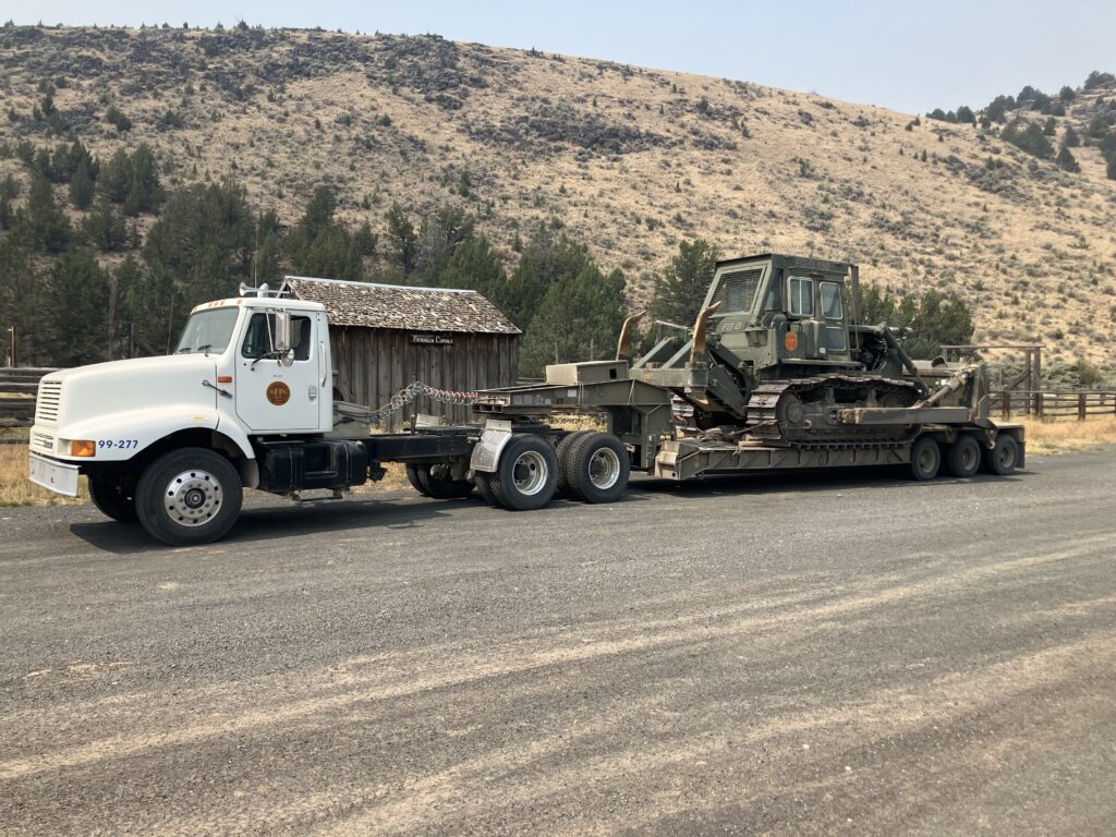
Today’s Highlight: As fires in Central and Eastern Oregon continue, Oregon’s Rangeland Fire Protection Associations (RFPA) remain a vital local resource in our wildfire suppression efforts. For example, the Frenchglen RFPA estimates that they have put in 50 miles of dozer line, along with loading and unloading the dozer multiple times to move it.
ODF supports Oregon’s RFPAs through training, equipment acquisition and administrative support.
Through ODF, Oregon’s RFPAs have received over 20 individual assets ranging from slip-on units, Type 6 brush engines, Humvees, converted military 5-ton cargo trucks, and more. These totals do not include the dozens of federal excess assets re-allocated to the various RFPAs (through ODF) when declared excess from other holding agencies across the state.
This level of assistance has expanded through HB 3349, which established the Rangeland Protection Association Fund and authorized ODF to transfer used vehicles and other firefighting equipment to RFPAs through sale or donation.
Resources
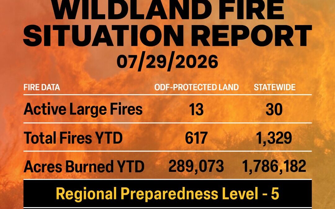
July 29, 2026
ODF Complex Incident Management Teams
- FL Team 1 is in command of the East Evans Creek Fire. For fire updates, visit the Southwest Oregon District’s Facebook page.
- ODF CIMT 2 is in unified command with OSFM Red Team of the Akawa Butte Fire. For fire updates, visit the incident’s Facebook page.
- ODF CIMT 3 is in unified command with OSFM Red Team on the Rowe Creek Complex – West Zone. For fire updates, visit the incident’s Facebook page.
- ODF CIMT 1 is on rest.
ODF Priority Fires
| FIRE NAME |
TOTAL ACRES |
ODF ACRES |
CONTAINMENT |
LOCATION |
COMMAND |
| Grasshopper |
15,000 |
1,332 |
0% |
7 miles W of Wamic |
CA Team 6 |
| Egypt |
4,553 |
9 |
80% |
15 miles N of Riley |
Type 3 IMT |
| Second Flat |
100,673 |
4,932 |
6% |
6 miles NE of Riley |
CIMT CA Team 4
OSFM Blue Team |
| Shingle |
64,493 |
19,211 |
6% |
14 miles SE of Mitchell |
OSFM Blue Team
GB Team 5 |
| Horse Ridge |
838 |
50 |
76% |
25 miles E of Pendleton |
CIMT NW Team 7 |
| Paradise |
763 |
0 |
0% |
15 miles S of Pendleton |
CIMT NW Team 7 |
| Hagen |
31,862 |
1,325 |
3% |
26 miles E of Pendleton |
CIMT NW Team 7 |
| Rowe Creek Complex |
295,132 |
85,333 |
42% |
10 miles S of Fossil |
CIMT NW Team 2 | ODF CIMT 3 | OSFM Red Team |
| Akawa Butte |
27,433 |
11,824 |
10% |
13 miles NE of Sisters |
ODF CIMT 2 |OSFM Red Team |
| Anthony |
2,563 |
0 |
89% |
34 miles N of Baker City |
CIMT NW Team 13 |
| Burnt Creek |
3,336 |
366 |
0% |
23 miles N of Enterprise |
CIMT NW Team 13 |
| Bench / Beachcomb |
60,295 |
0 |
3% |
4 miles S of Warm Springs |
SW Team 4 |
OSFM Red Team |
| East Evans Creek |
15,580 |
15,580 |
68% |
14 miles NE of
Rogue River |
FL Team 1 |
*These numbers may change as we receive more data.
There are approximately 11,619 personnel assigned to the 30 large fires across the state, not including many of the local and agency government employees, landowners, forestland operators, and members of the community who are contributing every day.
Initial attack remains ODF’s top priority.
Prevention: With extreme fire weather conditions across the state, the Oregon Department of Forestry, along with other fire managers across Oregon, are urging Oregonians and those visiting our state to exercise extreme caution and help prevent wildfires. Check local restrictions, avoid activities that could cause a spark, stay clear of firefighting operation areas and follow local evacuation and emergency alerts.
Help your wildland firefighters by preventing the next human-caused wildfire. The easiest way to do this is by checking your local fire restrictions and brushing up on your wildfire prevention knowledge.
Weather: A persistent pattern will keep the Northwest between Great Basin high pressure and low pressure near British Columbia through Friday. Marine air will continue moving onshore west of the Cascades. Eastern PSAs will see daily dry, breezy conditions with continued low humidity, especially across southeast Oregon. There will be a slight chance of mainly dry thunderstorms across central and northeast Oregon on Wednesday and Thursday. A dry cold front on Saturday will produce strong and gusty winds resulting in widespread fire weather concerns, especially in eastern Washington. Expect increasing instability Monday as a high-pressure ridge and associated surface thermal trough develop across southwest Oregon. Overnight humidity recovery east of the Cascades will remain limited over the next several days.
Today’s Highlight: When wildfire evacuation notices are issued, every minute matters.
If you or someone in your household may need extra time to evacuate, the Oregon Department of Emergency Management asks you to consider leaving one evacuation level earlier. This can help you avoid traffic, reduce stress, and get to safety before conditions change.
You may want to leave early if your household includes:
- Someone who relies on medical equipment or oxygen
- Young children
- Pets
- Livestock
- Someone with mobility or access and functional needs
Planning ahead today can make all the difference during an emergency.
- Sign up for local emergency alerts at gov
- Stay informed about fires, evacuations, shelters, and resources at oregon.gov
- Please follow evacuation instructions from local officials and don’t wait until conditions become dangerous.
Resources
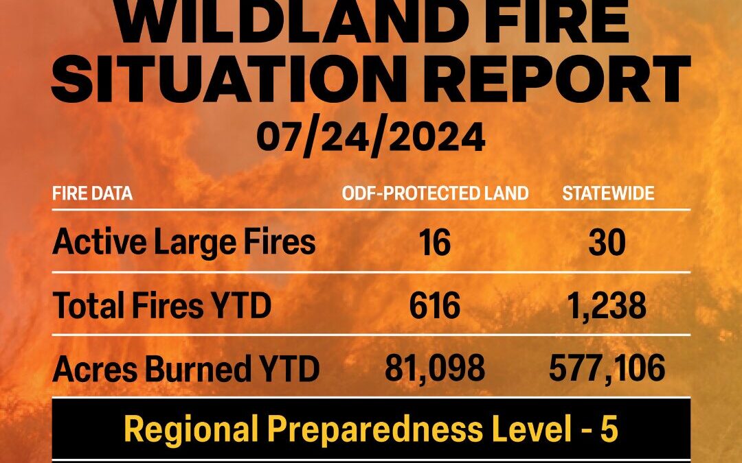
July 24, 2026
ODF Complex Incident Management Teams
- Team 1 is in command of the East Evans Creek Fire. For fire updates, visit the Southwest Oregon District’s Facebook page.
- Team 2 is in unified command with OSFM Red Team of the Akawa Butte Fire. For fire updates, visit the incident’s Facebook page.
- Team 3 is in unified command with OSFM Red Team on the Brewer and Crosswhite West Fires. For fire updates, visit the incident’s Facebook page.
ODF Priority Fires
| FIRE NAME |
TOTAL ACRES |
ODF ACRES |
CONTAINMENT |
LOCATION |
COMMAND |
| Akawa Butte |
27,287 |
13,283 |
5% |
13 miles NE of Sisters |
ODF CIMT 2 |OSFM Red Team |
| Horse Ridge |
293 |
50 |
10% |
25 miles E of Pendleton |
CIMT NW Team 7 |
| Paradise |
707 |
0 |
0% |
15 miles S of Pendleton |
CIMT NW Team 7 |
| Hagen |
15,799 |
565 |
0% |
26 miles E of Pendleton |
CIMT NW Team 7 |
| Brewer |
32,707 |
29,895 |
5% |
15 miles E of Madras |
ODF CIMT 3 | OSFM Red Team |
Box Springs
(Crosswhite West after today) |
15,203 |
13,550 |
0% |
18 miles W of Mitchell |
ODF CIMT 3 | OSFM Red Team |
| Rowe Creek Complex |
192,681 |
4,155 |
31% |
10 miles S of Fossil |
CIMT NW Team 2 |OSFM Green Team |
| Anthony |
2,445 |
0 |
57% |
34 miles N of Baker City |
CIMT NW Team 13 |
| Burnt Creek |
2,678 |
312 |
0% |
23 miles N of Enterprise |
CIMT NW Team 13 |
| Coyote |
17,406 |
4,263 |
47% |
5 miles S of Post |
CIMT CA Team 1 |
| East Evans Creek |
15,705 |
15,705 |
38% |
14 miles NE of
Rogue River |
ODF CIMT 1 |
| Egypt |
4, 594 |
40 |
68% |
15 miles N of Riley |
CIMT SA Team 2 |
| Bologna |
2,269 |
198 |
8% |
7 miles NE of Kimberly |
IMT 3 |
| Olive Butte |
3,011 |
18 |
60% |
34 miles SW of Baker City |
CIMT NW Team 12 |
| Salmon |
1,434 |
32 |
60% |
34 miles SW of Baker City |
CIMT NW Team 12 |
| Powder River |
21,030 |
0 |
41% |
4 miles SW of Richland |
CIMT SW Team 4 |
*These numbers may change as we receive more data.
There are approximately 10,333 personnel assigned to the 30 large fires across the state, not including many of the local and agency government employees, landowners, forestland operators, and members of the community who are contributing every day.
Initial attack remains ODF’s top priority.
Prevention: Over the last 72 hours, the state of Oregon has received thousands of lightning strikes. As new fires continue to pop up, firefighters will be working around the clock to catch them early and keep them small. A preventable, human-caused fire will take resources away from a new lightning start. We can’t control lightning, but we can control our actions.
Help your wildland firefighters by preventing the next human-caused wildfire. The easiest way to do this is by checking your local fire restrictions and brushing up on your wildfire prevention knowledge.
Weather: Monsoonal moisture will get pushed out of the Pacific Northwest today as an offshore low moves up the Oregon Coast. This will limit thunderstorm potential to a slight afternoon threat over extreme northeast Oregon and southeast Washington. This approaching low will also intensify onshore flow, bringing cooling and increased moisture to western Washington and Oregon, while generating gusty west winds and low humidity that create critical fire weather across southeast Oregon and central Washington. A cold front will sweep through the region on Saturday bringing light rain to northwest Washington and deepening the marine layer west of the Cascades. It will also deliver some cooling east of the Cascades alongside 30 to 40 mph wind gusts and single digit to teen humidity levels leading to critical fire weather conditions. The winds are expected to moderate through mid-week, although dry humidity levels will remain east of the Cascades.
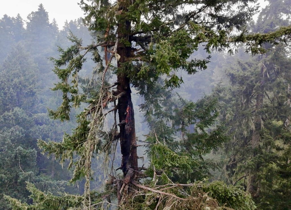
ODF Highlight: This week, Oregon Department of Forestry’s West Oregon District firefighters, alongside local landowners and operators, responded to 20 new fire starts across the district following the lightning event. To give perspective, the 10-year average of fires for an entire season in this district is 35 fires.
The majority of the fires were fully extinguished by the early morning while some were in mop-up through the rest of the day. Through the dedication of these firefighters and our state, local, and contract wildfire response partners, none became a large wildfire.
Resources
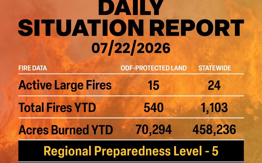
July 22, 2026
ODF Complex Incident Management Teams
- Team 1 is in unified command with OSFM Blue Team on the East Evans Creek Fire. For fire updates, visit the Southwest Oregon District’s Facebook page.
- Team 2 is in unified command with OSFM Red Team of the Akawa Butte Fire. For fire updates, visit the incident’s Facebook page.
- Team 3 is in unified command with OSFM Red Team on the Brewer and Box Springs Fires. For fire updates, visit the incident’s Facebook page.
ODF Priority Fires
| FIRE NAME |
TOTAL ACRES |
ODF ACRES |
CONTAINMENT |
LOCATION |
COMMAND |
| Akawa Butte |
19,034 |
5,331 |
3% |
13 miles NE of Sisters |
ODF CIMT 2 |OSFM Red Team |
| Brewer |
27,932 |
24,705 |
5% |
15 miles E of Madras |
ODF CIMT 3 | OSFM Red Team |
| Box Springs |
12,343 |
12,343 |
0% |
18 miles W of Mitchell |
ODF CIMT 3 | OSFM Red Team |
| Horse Ridge |
675 |
50 |
10% |
25 miles E of Pendleton |
CIMT NW Team 7 |
| Paradise |
590 |
50 |
0% |
15 miles S of Pendleton |
CIMT NW Team 7 |
| Hagen |
7,417 |
546 |
0% |
26 miles E of Pendleton |
CIMT NW Team 7 |
| Rowe Creek Complex |
148,563 |
3, 889 |
21% |
10 miles S of Fossil |
CIMT NW Team 2 |OSFM Green Team |
| Anthony |
2,445 |
0 |
26% |
34 miles N of Baker City |
CIMT NW Team 13 |
| Burnt Creek |
2,109 |
311 |
0% |
23 miles N of Enterprise |
CIMT NW Team 13 |
| Coyote |
17,343 |
4,357 |
21% |
5 miles S of Post |
CIMT CA Team 1 |
| East Evans Creek |
15,705 |
15,614 |
26% |
14 miles NE of
Rogue River |
ODF CIMT 1 | OSFM Blue Team |
| Egypt |
4,692 |
40 |
39% |
15 miles N of Riley |
CIMT SA Team 2 |
| Olive Butte |
3,010 |
12 |
30% |
34 miles SW of Baker City |
CIMT NW Team 12 |
| Salmon |
1,433 |
14 |
35% |
34 miles SW of Baker City |
CIMT NW Team 12 |
| Powder River |
20,773 |
0 |
24% |
4 miles SW of Richland |
CIMT SW Team 3 |
*These numbers may change as we receive more data.
There are approximately 9,885 personnel assigned to the 24 large fires across the state, not including many of the local and agency government employees, landowners, forestland operators, and members of the community who are contributing every day.
Initial attack remains ODF’s top priority.
Prevention: The Northwest Region is in Preparedness Level 5 meaning that resources are extremely strained throughout Oregon and Washington. Moving forward throughout the week, ODF protection districts will be focused on aggressive initial attack to new fire starts, while ODF CIMTs will be working to suppress large fires in the state. Even just one preventable, human-caused fire will add stress to an already strained system.
Help your wildland firefighters by preventing the next human-caused wildfire. The easiest way to do this is by checking your local fire restrictions and brushing up on your wildfire prevention knowledge.
Weather: The surge of monsoonal moisture will continue to push into Oregon today as an upper-level low approaches the coast. This will result in a significant increase in thunderstorms across Oregon with the most numerous thunderstorms expected near the Oregon Cascades into northwest Oregon. Although widespread wetting rains are not expected, some locally heavy rains are possible over the central Oregon Cascades. The scattered thunderstorm threat will continue to spread north and east tomorrow night into Thursday across Washington into northeast Oregon with an even lesser chance of wetting rains. Before the thunderstorms arrive expect hot and dry conditions to continue, especially over eastern Washington with triple digit temperatures and relative humidity values in the teens. Drier air will filter into the area late Thursday afternoon east of the Cascades resulting in hot, dry and windy conditions. These conditions will likely persist at times through Saturday, although there will be gradual cooling. Meanwhile west of the Cascades expect the return of cooler onshore flow with much higher relative humidity values.
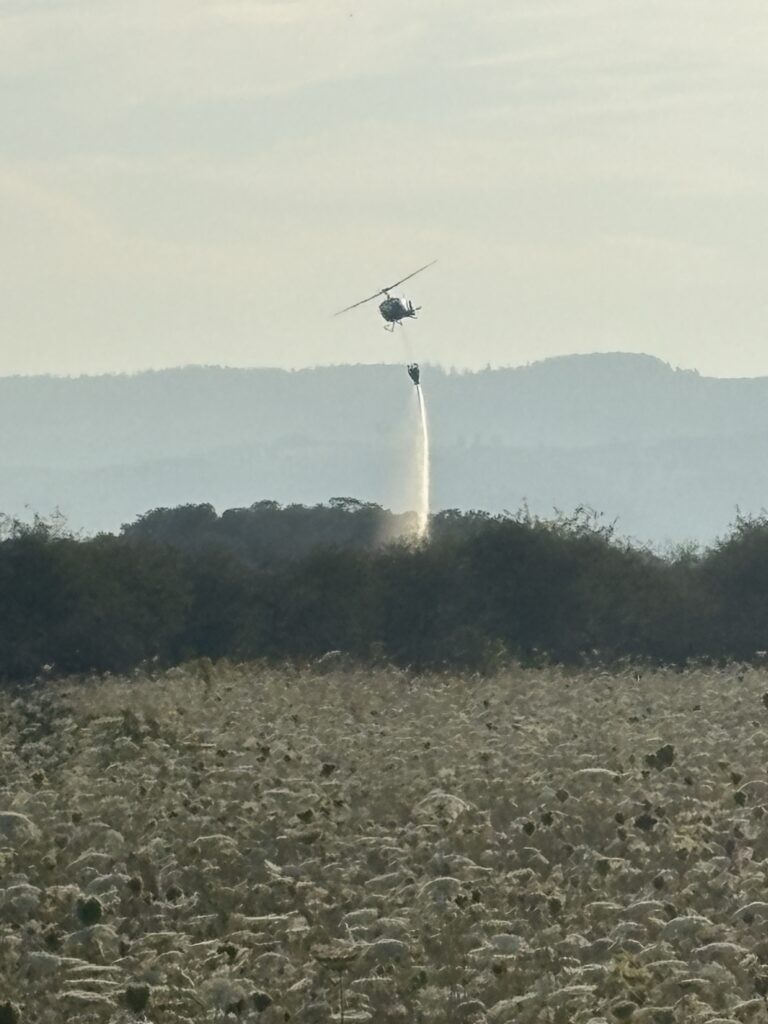
ODF Highlight: Yesterday, Oregon Department of Forestry firefighters from the Dallas Unit responded to a three-alarm grass fire just a little bit south of their office. Though the fire was not on ODF-protected land, the proximity to the ODF office made them some of the closest resources. The ODF Dallas Unit sent several engines to assist and ordered a helicopter to assist ground operations. Alongside SW Polk Fire and Dallas Fire, wildland and structural firefighters were able to respond quickly and protect the surrounding community.
Resources
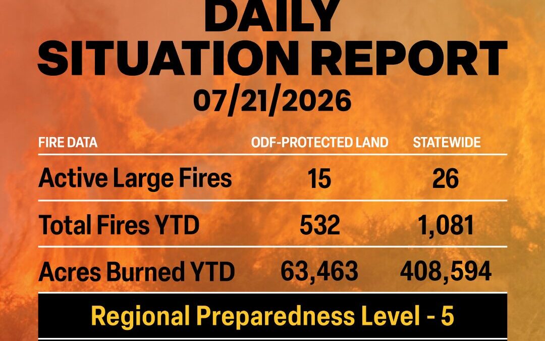
July 21, 2026
ODF Complex Incident Management Teams
- Team 1 is in unified command with OSFM Blue Team on the East Evans Creek Fire. For fire updates, visit the Southwest Oregon District’s Facebook page.
- Team 2 is in unified command with OSFM Red Team of the Akawa Butte Fire. For fire updates, visit the incident’s Facebook page.
- Team 3 is in unified command with OSFM Red Team on the Brewer and Box Springs Fires. For fire update, visit the incident’s Facebook page.
ODF Priority Fires
| FIRE NAME |
TOTAL ACRES |
ODF ACRES |
CONTAINMENT |
LOCATION |
COMMAND |
| Akawa Butte |
13,605 |
3,870 |
3% |
13 miles NE of Sisters |
ODF CIMT 2 |OSFM Red Team |
| Brewer |
24,460 |
24,701 |
1% |
15 miles E of Madras |
ODF CIMT 3 | OSFM Red Team |
| Box Springs |
4,239 |
1,350 |
0% |
18 miles W of Mitchell |
ODF CIMT 3 | OSFM Red Team |
| Horse Ridge |
602 |
50 |
10% |
25 miles E of Pendleton |
CIMT NW Team 7 |
| Paradise |
511 |
50 |
0 |
15 miles S of Pendleton |
CIMT NW Team 7 |
| Hagen |
5,121 |
456 |
0 |
26 miles E of Pendleton |
CIMT NW Team 7 |
| Rowe Creek Complex |
142,936 |
TBD |
5 |
10 miles S of Fossil |
CIMT NW Team 2 |OSFM Green Team |
| Anthony |
2,435 |
0 |
20 |
34 miles N of Baker City |
CIMT NW Team 13 |
| Burnt Creek |
1,944 |
276 |
0 |
23 miles N of Enterprise |
CIMT NW Team 13 |
| Coyote |
16,688 |
4,262 |
15 |
5 miles S of Post |
CIMT CA Team 1 |
| East Evans Creek |
15,705 |
15,705 |
17% |
14 miles NE of
Rogue River |
ODF CIM
T 1 | OSFM Blue Team |
| Egypt |
4,686 |
40 |
0 |
15 miles N of Riley |
CIMT SA Team 2 |
| Olive Butte |
2,987 |
12 |
25 |
34 miles SW of Baker City |
CIMT NW Team 12 |
| Salmon |
1,439 |
18 |
30 |
34 miles SW of Baker City |
CIMT NW Team 12 |
| Powder River |
20,727 |
TBD |
10 |
4 miles SW of Richland |
CIMT SW Team 3 |
*These numbers may change as we receive more data.
There are approximately 8,906 personnel assigned to the 26 large fires across the state, not including many of the local and agency government employees, landowners, forestland operators, and members of the community who are contributing every day.
Initial attack remains ODF’s top priority.
Prevention: The Northwest Region is in Preparedness Level 5 meaning that resources are extremely strained throughout Oregon and Washington. Moving forward throughout the week, ODF protection districts will be focused on aggressive initial attack to new fire starts, while ODF CIMTs will be working to suppress large fires in the state. Even just one preventable, human-caused fire will add stress to an already strained system.
Help your wildland firefighters by preventing the next human-caused wildfire. The easiest way to do this is by checking your local fire restrictions and brushing up on your wildfire prevention knowledge.
Weather: Upper-level ridging will continue to push monsoonal moisture north across Oregon today, with potential thunderstorms primarily over south-central into southeast Oregon. Elsewhere expect warming conditions with the hottest and driest conditions forecast for the Columbia Basin with highs around 100 and relative humidity values in the teens. The chance of thunderstorms will increase significantly on Wednesday with the best chances again over the Oregon Cascades into southeast Oregon. Meanwhile the heat will continue to intensify across most of the region with highs in the lower 100s over a large portion of the Columbia Basin and relative humidity in the teens. Thursday will bring the hottest and driest conditions of the stretch to eastern Washington, followed by afternoon thunderstorms and then critical windy, dry conditions that should persist at least through Friday.
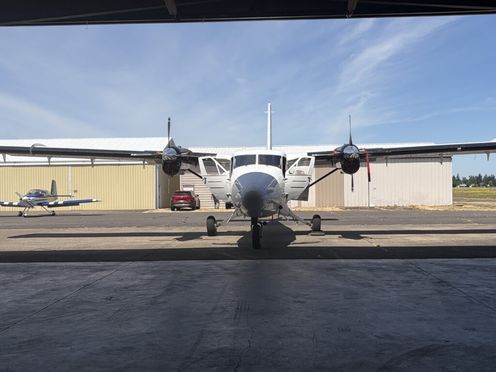
ODF Highlight: As technology evolves, so does the Oregon Department of Forestry (ODF). ODF continues to adapt and integrate technological advancements into their work. During fire season, the agency uses several different types of tech for early detection, prevention, data collection and to support suppression efforts. Read more at ODFFire.com.
Resources
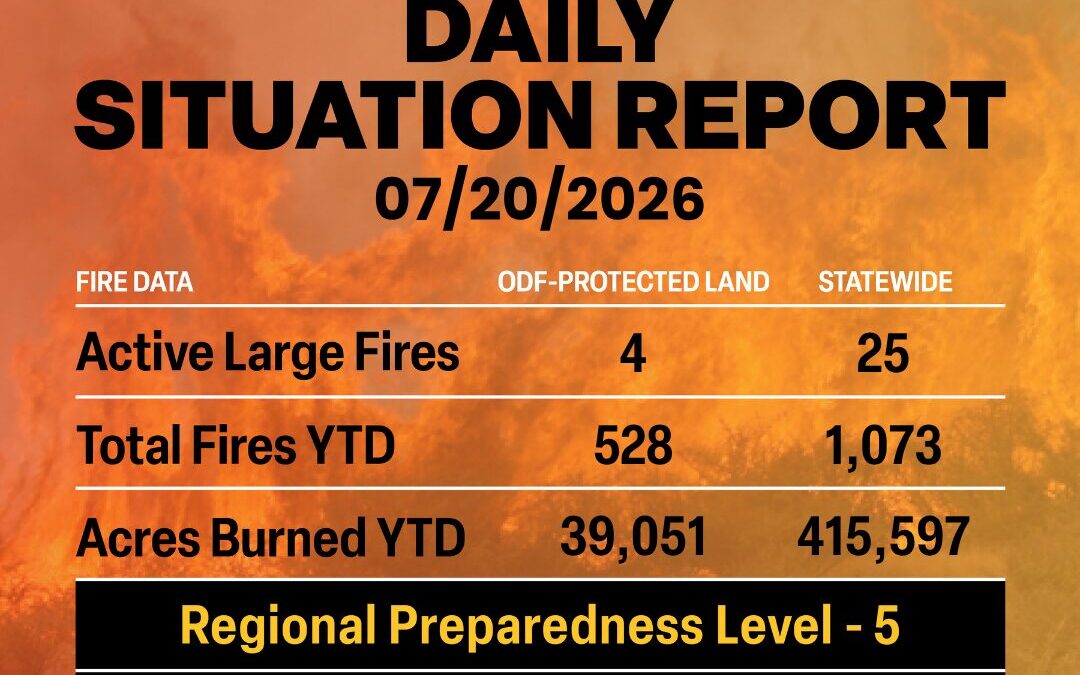
July 20, 2026
ODF Complex Incident Management Teams
ODF Priority Fires
| FIRE NAME |
TOTAL ACRES |
ODF ACRES |
CONTAINMENT |
LOCATION |
COMMAND |
| Akawa Butte |
10,326 |
2,560 |
3% |
13 miles NE of Sisters |
ODF CIMT 2 |OSFM Red Team |
| Brewer |
24,459 |
14,945 |
1% |
15 miles E of Madras |
ODF CIMT 3 | OSFM Red Team |
| Box Springs |
4,200 |
1,350 |
0% |
18 miles W of Mitchell |
ODF CIMT 3 | OSFM Red Team |
| East Evans Creek |
15,015 |
14,945 |
8% |
14 miles NE of
Rogue River |
ODF CIMT 1 | OSFM Blue Team |
*These numbers may change as we receive more data.
** More priority fires will be added starting tomorrow, July 21, 2026.
There are approximately 7,257 personnel assigned to the 25 large fires across the state, not including many of the local and agency government employees, landowners, forestland operators, and members of the community who are contributing every day.
Initial attack remains ODF’s top priority.
Prevention: The Northwest Region is now in Preparedness Level 5 meaning that resources are extremely strained throughout Oregon and Washington. Moving forward throughout the week, ODF protection districts will be focused on aggressive initial attack to new fire starts, while ODF CIMTs will be working to suppress large fires in the state. Even just one preventable, human-caused fire will add stress on an already strained system.
Help your wildland firefighters by preventing the next human-caused wildfire. The easiest way to do this is by checking your local fire restrictions and brushing up on your wildfire prevention knowledge.
Weather: High pressure centered over the Great Basin continues to expand northwest through mid-week. This will result in generally hot and dry conditions. Monsoon moisture spreads into south-central and southeast Oregon Tuesday for potential lightning. The lightning threat Wednesday expands to all areas east of the Cascades, possibly into southwest Oregon and the Washington Olympics as well. A weak upper-level trough is expected to settle off the Pacific Northwest coast late in the week. This brings enhanced wind to eastside PSAs, with Friday being of most concern.
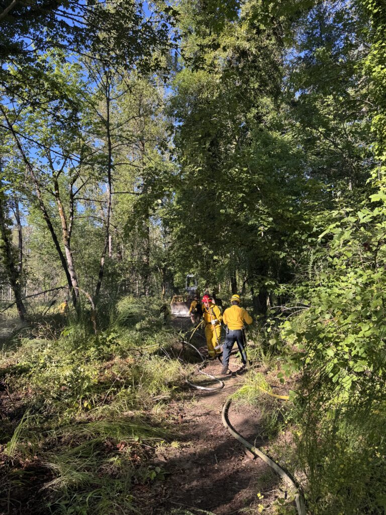
Photo from Lebanon Fire District
ODF Highlight: Last week, Oregon Department of Forestry wildland firefighters alongside Lebanon Fire and Albany Fire responded to a brush fire near the Santiam River. Due to the rapid response of local resources, the fire burned just over an acre and was fully suppressed within just a few hours.
This is an excellent example of how the complete and coordinated fire system in Oregon works at all levels, from local to statewide response. The relationship between ODF protection districts and local fire departments is vital to keeping fires small and protecting Oregon’s communities.
Resources
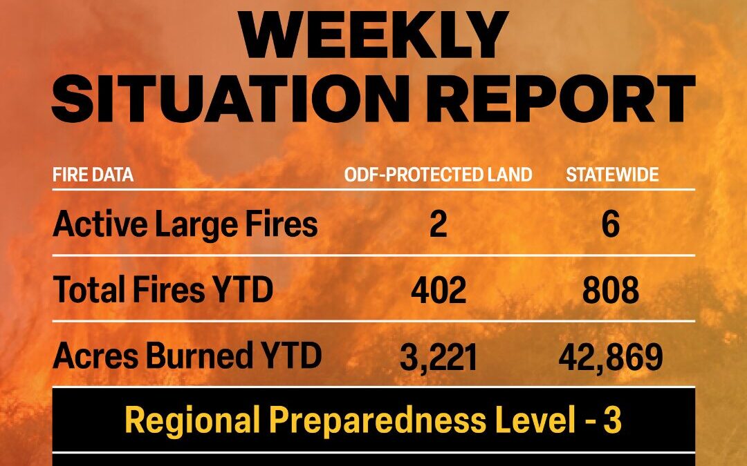
July 13, 2026
ODF Complex Incident Management Teams
- Team 1 is in unified command with OSFM Blue Team on the East Evans Creek Fire. For fire updates, visit the Southwest Oregon District’s Facebook page.
- Team 2 is on rotation.
- Team 3 is on standby.
ODF Priority Fires
| FIRE NAME |
TOTAL ACRES |
ODF ACRES |
CONTAINMENT |
LOCATION |
COMMAND |
| East Evans Creek |
3,628 |
2,059 |
5% |
14 miles NE of
Rogue River |
ODF CIMT 1 | OSFM Blue Team |
| Salmon |
1,304 |
20 |
0% |
34 miles SW of
Baker City |
NW Team 12 | OSFM Green Team |
| Olive Butte |
1,720 |
14 |
0% |
34 miles SW of
Baker City |
NW Team 12 | OSFM Green Team |
| North Cayuse |
4,887 |
462 |
91% |
15 miles E of Pendleton |
NW Team 3 |
*These numbers may change as we receive more data.
There are approximately 2,309 personnel assigned to the 6 large fires across the state, not including many of the local and agency government employees, landowners, forestland operators, and members of the community who are contributing every day.
Initial attack remains ODF’s top priority.
Prevention: By taking a few extra steps, you can help prevent the next wildfire in Oregon.
Wildfire prevention means:
- Debris burning remains the number one cause of human-caused fires in Oregon. Cover your pile and wait until fire season is declared over before burning. A dry, covered pile is cleaner and safer to burn in the late fall and winter.
- Check local restrictions before lighting a camp or warming fire to see if it is allowed.
- Never leave your campfire or warming fire unattended.
- Make sure your campfire or warming fire is OUT COLD. That means drowning it with water, stirring the ashes, and repeating that process until it is cold to touch. If there is any heat coming off the embers, then it can reignite later.
- Don’t park your car over dried grass, and make sure your vehicle or ATV is regularly serviced.
- Make sure your tow chains are not dragging. The metal hitting asphalt while driving can throw sparks into dry grass on the side of the road.
Visit Oregon.gov/odf to find local fire restrictions and keeporegongreen.org for more wildfire prevention tips.
Weather: High pressure will build over the region today and tomorrow. This will deliver very warm and dry conditions to the east side public service announcements with locally breezy conditions over south central Oregon. Additionally, monsoonal moisture and increased instability will begin to creep into the southeast quarter of Oregon by afternoon resulting in a small chance of thunderstorms as well as pyrocumulus development over existing fires. This threat will increase over all eastern Oregon on Tuesday. Any storms which form on Monday will initially be dry, however they will transition to wet storms on Tuesday. The forecast for late Wednesday to the end of the workweek is uncertain, however it appears the ridge will briefly break down as an offshore low heads inland. If this comes to fruition, expect a significant cooldown west of the Cascades as well as a good chance of thunderstorms from the Cascade Crest eastward.
ODF Highlight: The Oregon Department of Forestry (ODF) Southwest Oregon District’s aggressive initial attack played a critical role in protecting nearby communities during the East Evans Creek Fire’s first operational period.
Reported Friday afternoon, the fire quickly grew under hot, dry and windy conditions in steep, challenging terrain. The first ODF engine arrived on scene in just 30 seconds after witnessing the incident, allowing firefighters to immediately begin suppression efforts.
Additional resources quickly followed, including five helicopters and three air tankers. Working in coordination with partner agencies, firefighters established an anchor point and made a stand along East Evans Creek Road, holding the fire along that corridor despite difficult topography and hazardous snags.
Those early suppression efforts helped keep the fire from making a significant push toward the Shady Cove and Eagle Point communities and prevented it from becoming much larger during its initial hours.
As firefighters continue working to suppress the East Evans Creek Fire, the line established during initial attack continues to help protect neighboring communities.
Resources
July 13, 2026
SAMS VALLEY, Ore. (July 13, 2026) – Firefighters worked all night continuing to build on progress across the East Evans Creek Fire, located approximately seven miles west of Shady Cove. Overnight, the fire continued to burn fuels within an area with difficult access and steep terrain on the northwestern edge in the Spignet Butte area, moving the fire perimeter toward the indirect fireline that firefighters have been constructing. Crews worked throughout the night to strengthen fireline and solidify the temporary retardant lines dropped by multiple air tankers yesterday and construct line around a ~20-acre slopover.
An overnight infrared (IR) flight found the acreage of the fire increased to 3,628. This change is due to the added fire activity yesterday within the established control lines.
Resources were able to hold lines and connect those sections with new line on the northeastern edge, as well as on the southern side, where the majority of homes are located. Overnight, Oregon State Fire Marshal (OSFM) structural resources patrolled the areas near houses and today, structural resources will continue to mop up 100 feet adjacent to homes within the fire.
Wildland resources continue to work along the south and eastern parts of the perimeter, where up to 25 feet of mop-up is complete across the perimeter. This work creates a cold, black control line that is difficult for fire to cross again. As this work continues, containment will begin to increase.
Weather conditions will continue to challenge firefighters today; instability in the forecast slightly increases the chance for thunderstorms across southern Oregon, which could create erratic wind on the fire, as well as the potential for sparking new fires in the area. East Evans Creek Fire Unified Command is aware and planning for these challenges, and can provide added resources should new fire starts be reported.
While safety remains a top priority on this incident, firefighters are committed to holding the fire in the smallest footprint possible and will continue to aggressively push forward on this progress.
The fire started on Friday afternoon at 2:41 p.m. after a car crashed into a power pole, sparking dry vegetation in the area. The Jackson County Sheriff’s Office is currently investigating the cause of the crash.
Evacuations: The Jackson County Sheriff’s Office and Emergency Management have issued the following evacuations by level:
Evacuation Level 3 Go Now: JAC-148A All residences located adjacent to E. Evans Creek Road, from address 19385 through 21899, are included in the evacuation area. Additionally, residences located at 21612 Antioch Road and 21615 Antioch Road are included.
Evacuation Level 2 Be Set:
JAC-016 / JAC-124 / JAC-147 / JAC-148B
Evacuation Level 1 Be Ready:
JAC-003 / JAC-004 / JAC-017 / JAC-026 / JAC-036 / JAC-109 / JAC-126 / JAC-149B
An evacuation shelter for residents and domestic pets has been established at Hanby Middle School, 806 6th Avenue, Gold Hill. Horses can be taken to the Expo at 21 Penninger Road, Central Point, Ore. For more information on evacuation levels or to find your evacuation zone, visit https://tinyurl.com/EastEvansCreekFireEvacMap. Expo staff and volunteers are prepared to receive horses; however, please call 541‑776‑7206 first to confirm space is available, as additional shelter locations may be activated. Owners should bring feed, water containers, and any necessary medications when possible.
For livestock sheltering assistance, call 541‑776‑7206.
Road Closures: Traffic is closed to the public on East Evans Creek Road at Meadows Road. Please avoid the fire area to allow firefighters and heavy equipment to operate safely.
Temporary Flight Restriction (TFR): A “TFR” is in place for the fire area daily (24 hours) until further notice. Complete information is available at https://tfr.faa.gov/tfr3/?page=detail_6_4915. Flying a drone near or around a wildfire is illegal and compromises the safety of both pilots and firefighters, and interferes with firefighting efforts.
# # #
