ODF Incident Management Teams
- Team 1 is in command of the Lane 1 Fire (ODF South Cascade District). Updates available on the incident’s Facebook page.
- Team 2 is in command of the Dixon Fire (Douglas Forest Protective Association). Updates available on the incident’s Facebook page.
- Team 3 is on rotation.
ODF Priority Fires
| FIRE NAME | TOTAL ACRES | ODF ACRES | CONTAINMENT | LOCATION | COMMAND |
| Lane 1 | 24,592 | 9,112 | 37% | East of Cottage Grove | ODF IMT 1 |
| Dixon | 1,997 | 1,123 | 11% | 2 miles SE of Tiller | ODF IMT 2 |
| Town Gulch | 18,215 | 1,665 | 79% | 24 miles E of Baker City | SA Team 2 |
| Crazy Creek | 85,893 | 7,372 | 79% | 16 miles E of Paulina | CA Team 1 |
| Battle Mountain Complex | 183,026 | 71,999 | 94% | West of Ukiah | SW Team 3 |
| Falls | 151,680 | 6,273 | 95% | 20 miles NW of Burns | NW Team 2 |
| Telephone | 54,034 | 4,218 | 89% | 16 miles N of Burns | NW Team 2 |
| Sandstone | 696 | 0 | 10% | 9 miles SE of Ripplebrook | NR Team 2 |
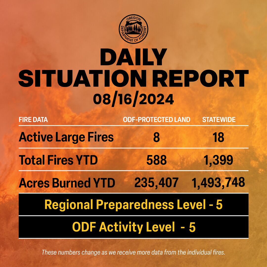
There are approximately 9,000 personnel assigned to the 18 large fires across the state, not including many of the local and agency government employees, landowners, forestland operators, and members of the community who are contributing every day.

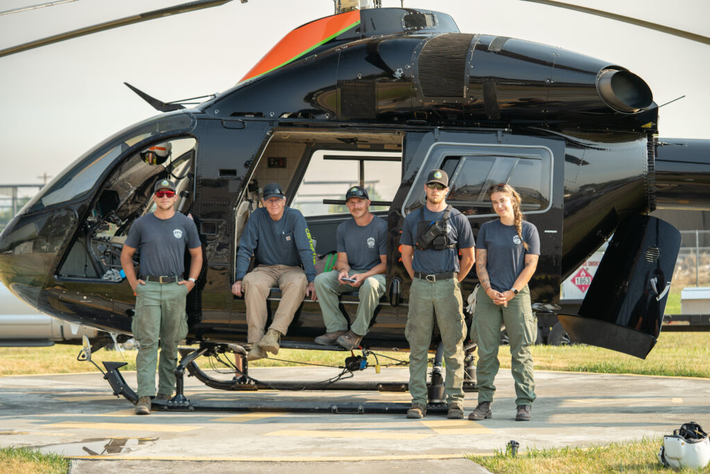
ODF Highlight: Helitack crews are made up of seven or more aerially delivered firefighters whose primary mission is responding to new fires quickly, suppressing fires, and using the helicopter to support fireline operations. The helicopter and specialized crew can insert firefighters into the fire area quickly, especially in areas where vehicle access is limited. Helicopter transport can also reduce the time needed to hike into remote areas.
Helitack crews play an important role – not only being able to respond quickly and insert firefighters on the ground, but to manage and support the helicopter with water delivery via a “bucket” to extinguish the fire. They also aid in the delivery of additional firefighters, tools, equipment, and other supplies to the fire area in support of the firefighters on the ground.
The Oregon Department of Forestry has a Statewide Severity Helitack crew based in John Day and district crews in the Klamath-Lake District, Coos Forest Protective Association and Southwest Oregon District.
The department also runs a detailer program where ODF employees from across the state can detail into a crew to learn more about aviation and become a Helicopter Crew Member Trainee (a steppingstone to Helicopter Manager). This program is so that we can help train and build the next generation of helicopter managers.
Weather: Scattered thunderstorms will return along the eastern Washington Canadian border this afternoon. These storms have potential for frequent lightning, very heavy rain, and strong outflow winds. Isolated but weaker storms affect northeast Oregon. Saturday, low pressure will swing a strong cold front from south to north across areas east of the Cascades. Peak wind speeds range from 20-30 mph with gusts to 40 mph and locally 50 mph. Main area of concern will be southeast Oregon where humidity falls to the lower teens. Thunderstorms will also move from south to north from the Cascades westward. These storms bring frequent lightning, heavy rain with potential for flash floods, and strong outflow winds. Showers continue moving north Saturday night and into Washington Sunday morning. Cooler weather remains early next week westside while conditions return close to average eastside.
Prevention: Thunderstorms and lightning are expected across the state over the weekend. With firefighters patrolling over the weekend to detect new starts, do your part by actively practicing wildfire prevention. By taking extra steps, you can prevent the next human-caused wildfire in Oregon and reduce strain on resources.
Know the fire danger level of the areas where you live, work and play, and follow all local restrictions on burning, equipment use, campfires and other activities that can start wildfires. Find danger levels and restrictions across the state here.
Resources
- ODF wildfire blog and Public Fire Restrictions/Danger Levels map
- Regional situation report and national situation report
- Inciweb (information, photos, videos, and maps from specific incidents)

