
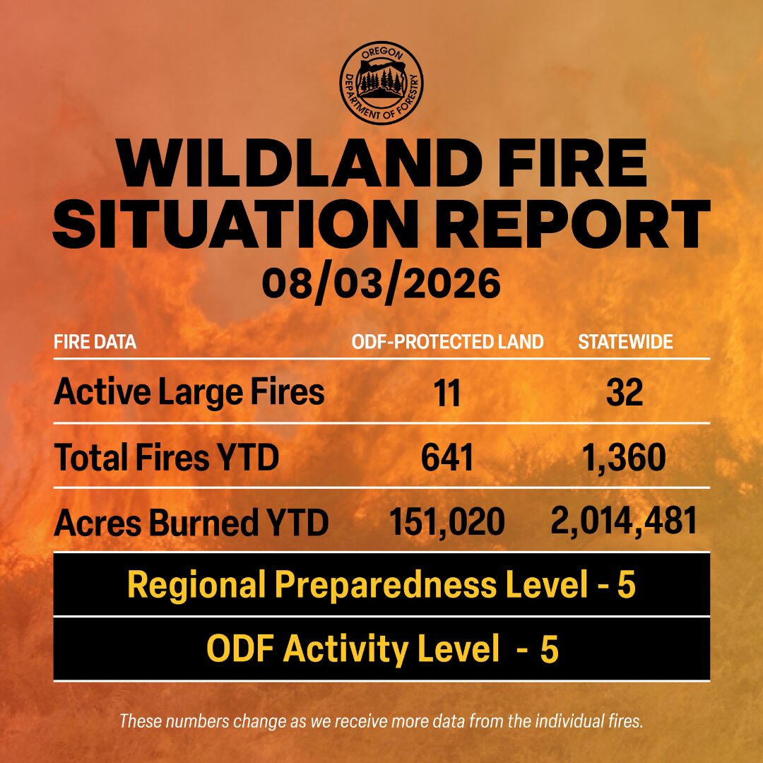
ODF Complex Incident Management Teams
- FL Team 1 is in command of the East Evans Creek Fire. For fire updates, visit the Southwest Oregon District’s Facebook page.
- ODF CIMT 1 is on rotation.
- ODF CIMT 2 is on rest.
- ODF CIMT 3 is on rest.
ODF Priority Fires
| FIRE NAME | TOTAL ACRES | ODF ACRES | CONTAINMENT | LOCATION | COMMAND |
| Grasshopper | 30,729 | 2,119 | 0% | 7 miles W of Wamic | CA Team 6 | OSFM Gray |
| Shingle | 70,372 | 19,317 | 16% | 14 miles SE of Mitchell | GB Team 5 |
| Second Flat | 105,461 | 4,932 | 55% | 6 miles NE of Riley | CIMT CA Team 4 |
| Paradise | 1,318 | 0 | 0% | 15 miles S of Pendleton | CIMT NW Team 7 |
| Hagen | 39,777 | 1,374 | 11% | 26 miles E of Pendleton | CIMT NW Team 7 |
| Rowe Creek Complex | 323,951 | 87,437 | 60% | 10 miles S of Fossil | CIMT SW Team 2 OSFM Blue Team |
| Akawa Butte | 27,435 | 11,850 | 85% | 13 miles NE of Sisters | NM Type 3 IMT |
| Burnt Creek | 4,169 | 366 | 52% | 23 miles N of Enterprise | CIMT NW Team 13 |
| Bench | 67,238 | 0 | 66% | 4 miles S of Warm Springs | SW Team 4 |
| East Evans Creek | 15,580 | 15,580 | 90% | 14 miles NE of Rogue River |
CIMT FL Team 1 |
*These numbers may change as we receive more data.
There are approximately 11,774 personnel assigned to the 32 large fires across the state, not including many of the local and agency government employees, landowners, forestland operators, and members of the community who are contributing every day.
Initial attack remains ODF’s top priority.
Prevention: As fire weather and extreme fire behavior persists, the Oregon Department of Forestry, along with other fire managers across Oregon, are urging Oregonians and those visiting our state to exercise caution and help prevent wildfires. Check local restrictions, avoid activities that could cause a spark, stay clear of firefighting operation areas and follow local evacuation and emergency alerts.
Help your wildland firefighters by preventing the next human-caused wildfire. The easiest way to do this is by checking your local fire restrictions and brushing up on your wildfire prevention knowledge.
Weather: Strong high pressure develops over the Northeast Pacific Monday and then covers the Geographic Area Tuesday through at least Friday. This will result in hot and very dry conditions, with poor humidity recovery beginning Monday night over the eastside PSAs. Poor humidity recovery can be expected over the eastside and westside higher terrain Tuesday night through Friday. North to northeast wind develops Monday and continues through early Tuesday east of the Cascades and in the Columbia Gorge enhancing fire weather concerns. A thermal trough will develop across the southern and central Oregon Cascades Monday and Tuesday resulting in favorable conditions for increasing instability. The thermal trough shifts to the east Cascade slopes and into the Okanogan Valley Wednesday. Models indicate the possibility of another dry cold frontal passage next weekend.
Today’s Highlight: The Oregon Department of Forestry’s (ODF) Southwest Oregon District worked hard over the weekend and through their dedication helped protect two separate communities from wildfire.
Saturday afternoon, ODF Southwest Oregon firefighters, alongside local fire districts, responded to a wildland fire off I-5, near mile marker 57. The agency quickly went full throttle when it came to initial attack on the fast-moving fire, bringing in several different types of aircraft to limit the fire’s growth and impact on communities.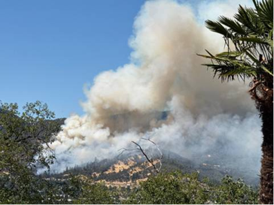
Within 45 minutes of that fire starting, there was a three-alarm fire in White City and the local fire district requested assistance from ODF. ODF Southwest Oregon firefighters responded and were stationed to protect the local VA medical center.
By Sunday morning, both fires were contained and in mop-up operations.
These two fires show the great successes of not only aggressive initial attack but partnering with our local fire districts. Together, we can support each other and protect Oregonians.
Resources
- ODF wildfire blog and Public Fire Restrictions/Danger Levels map
- Regional situation report and national situation report
- Inciweb (information, photos, videos, and maps from specific incidents)