
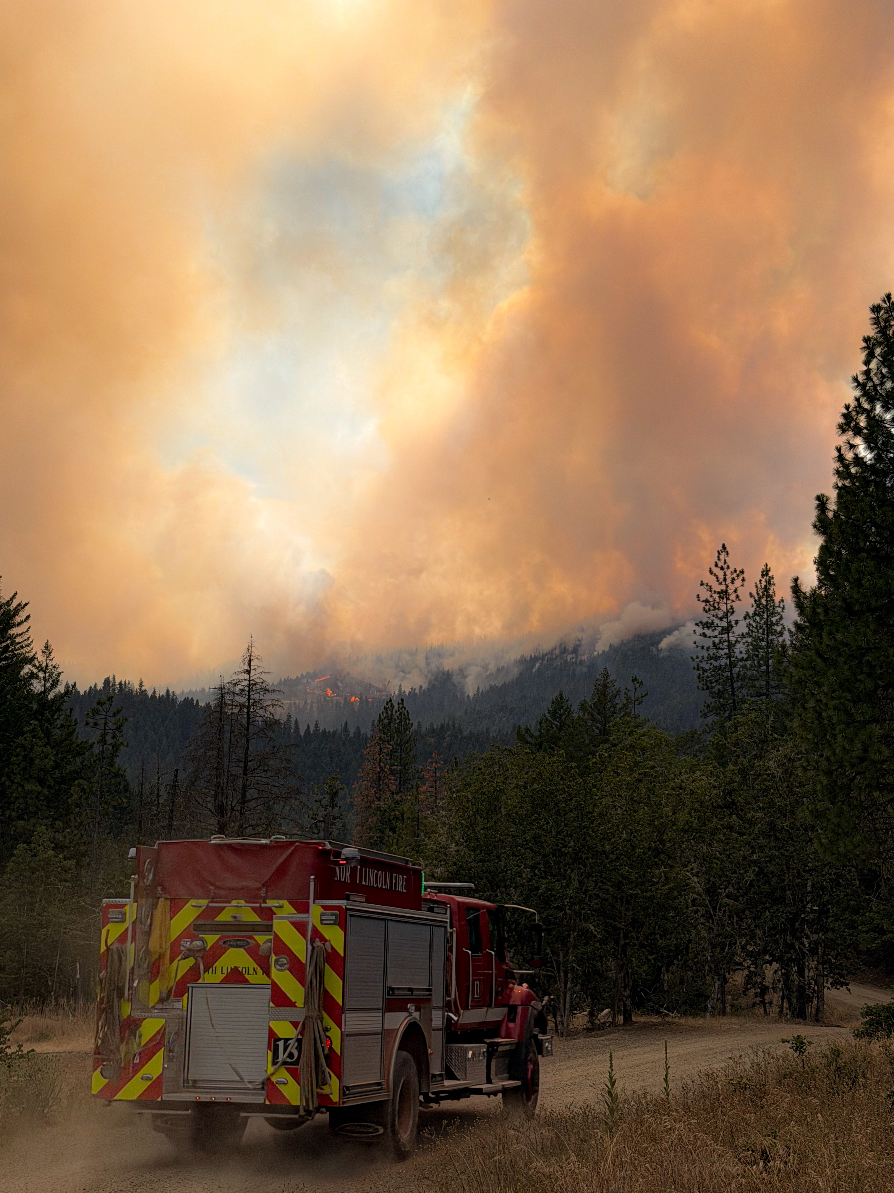
SAMS VALLEY, Ore. (July 14, 2026) – Firefighters are preparing for another demanding day on the East Evans Creek Fire as hot, dry conditions combine with the potential for gusty, erratic winds and isolated thunderstorms. Additional resources arrived overnight and will continue arriving throughout the day, increasing suppression capacity and ensuring firefighters are positioned to respond quickly as conditions change.
The fire remained active through the evening, with extreme fire behavior and spotting creating challenging conditions across the north, northwest, and northeast areas of the incident. Working alongside wildland firefighters, Oregon State Fire Marshal (OSFM) structural resources provided point protection where fire activity threatened homes along East Evans Creek Road and Morrison Creek as the fire advanced to the edge of several properties. Crews quickly suppressed spot fires, extinguished ember-caused ignitions, and successfully defended these structures.
As fire activity moderated overnight, firefighters took advantage of improved conditions to cool hot areas, slow fire growth, and strengthen suppression efforts. Crews aggressively engaged multiple spot fires while heavy equipment improved access and constructed fireline. Aviation resources supported suppression well into the evening, assisting ground crews by cooling active fire and utilizing retardant to assist the firefight where possible.
An overnight infrared flight reflected growth of 1,742 acres, bringing the total acreage of the fire to 5,370, providing critical intelligence for today’s operations. Multiple spot fires were identified outside the fire’s northeastern perimeter. Crews are actively working to access and address those areas.
Today, poor overnight humidity recovery, high temperatures, isolated dry thunderstorms, and gusty, erratic outflow winds are expected to contribute to active fire behavior and the potential for another well-developed smoke column. Firefighters will continue engaging the fire aggressively where conditions allow while adapting tactics to steep terrain, limited access, and rapidly changing weather. Aircraft will support suppression efforts by slowing fire spread, cooling active areas, and reinforcing containment lines. Structural resources will continue working alongside wildland firefighters to assess and protect homes, monitor for ember casts, and rapidly suppress any new spot fires that threaten structures.
The arrival of additional hand crews, engines, heavy equipment, overhead personnel, and aviation resources ordered by the Oregon Department of Forestry (ODF) and Oregon State Fire Marshal (OSFM) reflects the increasing complexity of the incident and the commitment to keeping pressure on the fire. Every available resource is being strategically assigned to areas where they can have the greatest impact, whether strengthening containment lines, improving access, protecting homes, or responding to new fire activity.
Firefighter and public safety remain the highest priorities. As weather conditions become more unstable, suppression tactics may shift throughout the day to ensure crews can continue operating safely while taking advantage of opportunities to contain the fire.
Community members should expect to see increased fire resources throughout the area today as they arrive and are assigned. Residents are encouraged to monitor official updates and continue giving firefighters the space they need to work safely. Avoid entering closed areas or stopping along roadways near the fire, as heavy equipment and emergency vehicles will be operating throughout the incident.
The fire started on Friday afternoon at 2:41 p.m. after a car crashed into a power pole, sparking dry vegetation in the area. The Jackson County Sheriff’s Office is currently investigating the cause of the crash.
Smoke Impacts: Smoke from the East Evans Creek Fire may settle into valleys and other low-lying areas, reducing visibility and impacting air quality in nearby communities. Smoke conditions can change throughout the day as winds shift. Individuals sensitive to smoke should take appropriate precautions. For current air quality information and smoke forecasts, visit: https://fire.airnow.gov/
Evacuations: The Jackson County Sheriff’s Office and Emergency Management have issued the following evacuations by level:
Evacuation Level 3 Go Now: The Jackson County Sheriff’s Office and Emergency Management have upgraded JAC-124 to a Level 3 evacuation zone. JAC-148A All residences located adjacent to E. Evans Creek Road, from address 19385 through 21899, are included in the evacuation area. Additionally, residences located at 21612 Antioch Road and 21615 Antioch Road are included.
Evacuation Level 2 Be Set: JAC-016 / JAC-147 / JAC-148B
Evacuation Level 1 Be Ready: JAC-003 / JAC-004 / JAC-017 / JAC-026 / JAC-036 / JAC-109 / JAC-126 / JAC-149B
An evacuation shelter for residents and domestic pets has been established at Hanby Middle School, 806 6th Avenue, Gold Hill. Horses can be taken to the Expo at 21 Penninger Road, Central Point, Ore. For more information on evacuation levels or to find your evacuation zone, visit https://tinyurl.com/EastEvansCreekFireEvacMap. Expo staff and volunteers are prepared to receive horses; however, please call 541-776-7206 first to confirm space is available, as additional shelter locations may be activated. Owners should bring feed, water containers, and any necessary medications when possible.
For livestock sheltering assistance, call 541-776-7206.
Road Closures: Traffic is closed to the public on East Evans Creek Road at Meadows Road. Please avoid the fire area to allow firefighters and heavy equipment to operate safely.
Temporary Flight Restriction (TFR): A “TFR” is in place for the fire area daily (24 hours) until further notice. Complete information is available at https://tfr.faa.gov/tfr3/?page=detail_6_4915. Flying a drone near or around a wildfire is illegal and compromises the safety of both pilots and firefighters, and interferes with firefighting efforts.