ODF Incident Management Teams
- Team 2 is on rotation.
- Team 3 is on call.
- Team 1 is on rest.
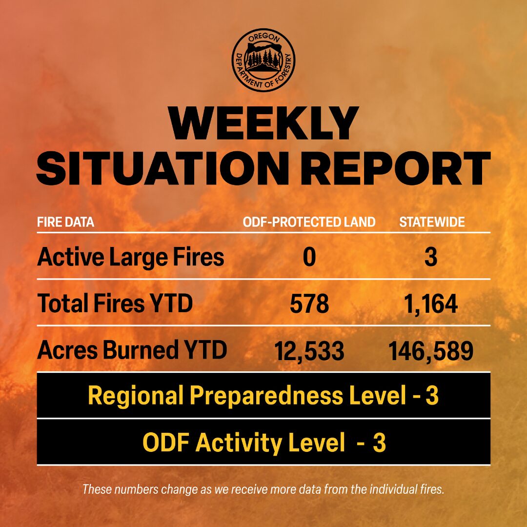
There are approximately 416 personnel assigned to the 3 large fires across the state, not including many of the local and agency government employees, landowners, forestland operators, and members of the community who are contributing every day.
Initial attack remains ODF’s top priority to keep wildfires small.

ODF Highlight: Ever curious about the difference between a fire watch and a red flag warning? Enjoy this easy analogy as we move into several red flag warnings and fire weather watches this week across Oregon. For up-to-date fire weather alerts, follow your regional National Weather Service Facebook page.
Weather: High pressure centered over the Intermountain Region will expand west during the first half of the week. This will result in a warming trend and increasing thunderstorm activity from the Cascade crest eastward. Locally, heavy showers can be expected with some storms Wednesday and Thursday, especially over central and south central Oregon. Some storms Tuesday and Wednesday could drift over the west slopes of the Cascades. Onshore flow strengthens late in the week, gradually reducing the thunderstorm threat. General winds are expected to be near normal over the next few days, but gusty erratic winds can be expected near thunderstorms. Breezy to windy conditions are likely to develop in the central Gorge, Columbia Basin and through the Cascade gaps late in the week and continue through the weekend.
Prevention: Check the fire regulations of the areas where you live, work and play, and follow all local restrictions on burning, equipment use, campfires and other activities that can start wildfires. Find danger levels and restrictions across the state here.
Resources
- ODF wildfire blog and Public Fire Restrictions/Danger Levels map
- Regional situation report and national situation report
- Inciweb (information, photos, videos, and maps from specific incidents)

