ODF Incident Management Teams
- Team 1 is in command of the Lane 1 Fire (ODF South Cascade District). Updates available on the incident’s Facebook page.
- Team 2 is in unified command of the Dixon Fire (Douglas Forest Protective Association) with OSFM Green Team. Updates available on the incident’s Facebook page.
- Team 3 is on rotation.
ODF Priority Fires
| FIRE NAME | TOTAL ACRES | ODF ACRES | CONTAINMENT | LOCATION | COMMAND |
| Lane 1 | 24,103 | 8,630 | 26% | East of Cottage Grove | ODF IMT 1 |
| Dixon | 1,997 | 1,180 | 0% | 2 miles SE of Tiller | ODF IMT 2/ OSFM Green Team |
| Town Gulch | 18,188 | 1,811 | 42% | 24 miles E of Baker City | SA Team 2 |
| Crazy Creek | 85,870 | 7,372 | 71% | 16 miles E of Paulina | CA Team 1 |
| Battle Mountain Complex | 182,870 | 71,988 | 82% | West of Ukiah | SW Team 3 |
| Falls | 151,166 | 7, 330 | 89% | 20 miles NW of Burns | NW Team 2 |
| Telephone | 53,989 | 4,861 | 65% | 16 miles N of Burns | NW Team 2 |
| Microwave Tower | 1,313 | 927 | 95% | 5 miles SW of Mosier | NR Team 2 |
| Sandstone | 625 | 0 | 0% | 9 miles SE of Ripplebrook | NR Team 2 |
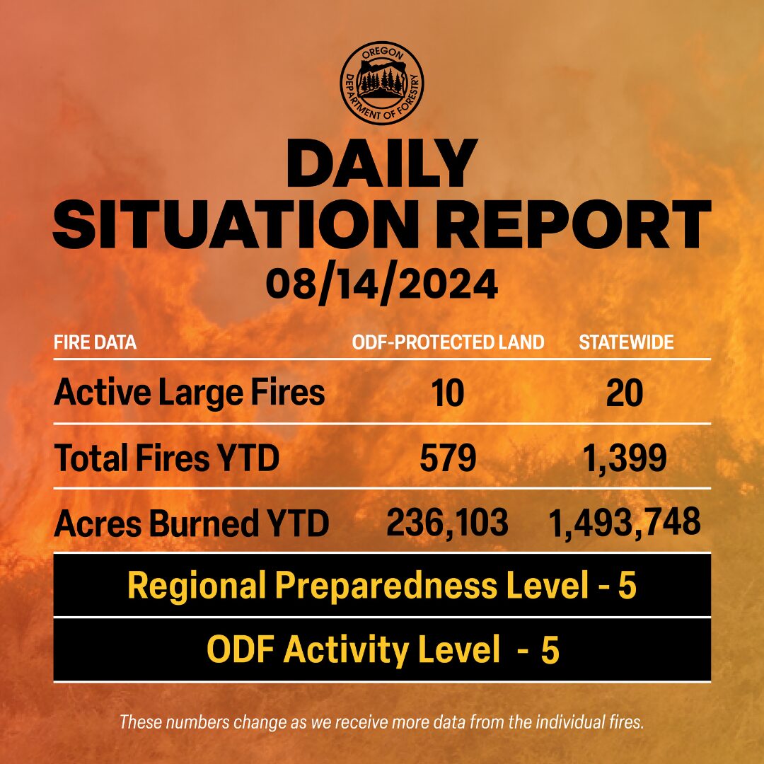
There are approximately 9,300 personnel assigned to the 20 large fires across the state, not including many of the local and agency government employees, landowners, forestland operators, and members of the community who are contributing every day.

ODF Highlight: The Salem Coordination Center (SCC) is a statewide dispatch center based in Salem that plays a key role in maintaining the complete and coordinated statewide fire protection system in Oregon. The dispatchers track every resource dispatched from the Oregon Department of Forestry and work with other dispatch centers to order new resources as needed.
Over the last several weeks, their primary duty has been to mobilize resources from other states and countries to relieve the strain on the agency’s firefighters. They are also tasked with mobilizing ODF’s incident management teams when the time comes.
Weather: Today brings a break in convection and winds. Thursday and Friday have another low-pressure trough developing along the coast. Thunderstorms return tonight across south-central Oregon then expand north and east through early Thursday morning. Storms begin drier and then evolve Thursday afternoon through Friday to bring moderate or heavy rain plus moderately strong outflow wind. Additionally, general winds become gusty each afternoon. Cooler temperatures and breezy winds continue through the weekend. Saturday appears more showery than Sunday. Western PSAs have the best chance for wetting rain on Sunday.
Prevention: Even with the moderating weather, Oregon is still incredibly dry. Know the fire danger level of the areas where you live, work and play, and follow all local restrictions on burning, equipment use, campfires and other activities that can start wildfires. Find danger levels and restrictions across the state here.
Resources
- ODF wildfire blog and Public Fire Restrictions/Danger Levels map
- Regional situation report and national situation report
- Inciweb (information, photos, videos, and maps from specific incidents)

