Location: 28 miles northeast of Klamath Falls, OR Size: 413,545 acres
Personnel: 1,928 Containment: 53%
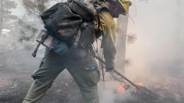
WALLOWA, Ore. – The water is flowing across all divisions of the Elbow Creek Fire 17 miles northwest of Wallowa. Fire crews have fully transitioned to mop-up and an increase in the number of water tenders will keep the water flowing to help firefighters soak the remains of the fire over the next several days.
The fire is 22,955 acres and 57% contained.
A 10-person crew made it halfway down over the rim yesterday towards the bottom of the Grande Ronde River Canyon in the Elbow Creek drainage. They will continue to the bottom of the canyon today to seek and destroy hot spots along the river.
The depth of mop-up, or how far crews should go in from the fire’s edge, is based on the fuels and the heat they hold. Grass for instance, doesn’t hold heat for very long, and poses less of a threat of tossing embers over containment lines in coming weeks. Whereas heavier fuels, such as downed logs and stumps, can hold heat for weeks and even months. Areas covered with heavier fuels may require up to 300 feet to assure no burning embers carried by winds over the line.
Contingency work continues on the north side of the fire with crews improving roads and removing roadside vegetation in the event a backup fire break be needed.
Today’s weather is expected to be mostly sunny, hot, and dry with areas of smoke and haze. The high will be 94-99 degrees, relative humidity 11-20 percent, and northeasterly afternoon winds from 8-12 mph with gusts to 18.
Evacuation levels within Wallowa County remain unchanged for now. Additional information on evacuation levels is available on the Wallowa County Sheriff’s Office Facebook page (www.facebook.com/Wallowa-County-Sheriffs-Office-147212815486187).
Evacuations: Evacuations are dynamic. Klamath County has dropped all evacuation notices; however, the Fremont-Winema National Forest remains closed. Evacuation levels were lowered in Lake County. The best way to view the evacuation designation boundaries and details is on the interactive map available at tinyurl.com/bootlegevac
Red Cross Evacuation Shelters: For information or assistance: 1-800-Red-Cross (www.redcrossblog.org/disaster)
Insurance Assistance: For additional information on submitting insurance claims after losing your home or property to a wildfire, please visit https://dfr.oregon.gov/insure/home/storm/Pages/wildfires.aspx or call the state’s team of consumer advocates at 888-877-4894 (toll-free).
Closures: The Fremont-Winema National Forest is closed to the public in the fire area. The full closure order and map are available at https://www.fs.usda.gov/alerts/fremont-winema/alerts-notices
Smoke: Smoke from the Dixie Fire in Northern California could once again affect the southern part of the region today. The Bootleg and other nearby fires, including the Jack Fire just to the northwest of the region, continue to impact air quality on our region. Today, we will see another good to moderate day of air quality. Periods of moderate air quality will be brief. See: fires.airfire.org/outlooks/southcentraloregon
Fire Information Public Phone: 541-482-1331 Fire Information Media Phone: 971-727-7255
Inciweb: inciweb.nwcg.gov/incident/7609/ Facebook: www.facebook.com/BootlegFireInfo
Twitter: twitter.com/BootlegFireInfo Hashtags: #BootlegFire #FireYear2021

